Micro. For when good is good enough
Client: Fathom Pacific
Describing underwater ecosystems requires detailed information that can be accurately tied to specific locations. The impact of marine pests, litter, marine industries and other issues needs to be tracked over time with confidence. What’s more, the changeable nature of the sea and weather systems in coastal areas means equipment used for the assessment and monitoring of marine life, reef systems and sea fauna must be quick to deploy and simple to set up.
The Challenge
Port Phillip Bay is home to a host of unique and iconic marine life and is one of the most diverse places on the planet for seaweeds and reef systems that support a diverse array of sponges and other invertebrates. It’s also shadowed by the city of Melbourne which has a growing population of nearly 5 million people and experiences particularly challenging conditions – the large embayment is exposed to strong winds and has periods of low underwater visibility.
To protect the Bay, the Victorian Department of Environment, Land, Water and Planning (DELWP) is implementing the Port Phillip Bay Environmental Management Plan 2017-2027 (EMP). The team at Fathom Pacific Pty Ltd have been tasked with carrying out studies and surveys in Port Phillip Bay to inform the decisions and recommendations made by the EMP.
To do this they need to create reliable models and maps, along with reports detailing the bay’s marine biotopes – areas that provide habitats for specific species – for the protection of the Bay to be effective. The data gathered has to be quantitative and accurately geo-referenced, and it must be gathered in increasingly cost-efficient ways.
Featured in this story
Micro-Ranger 2 USBL
The solution
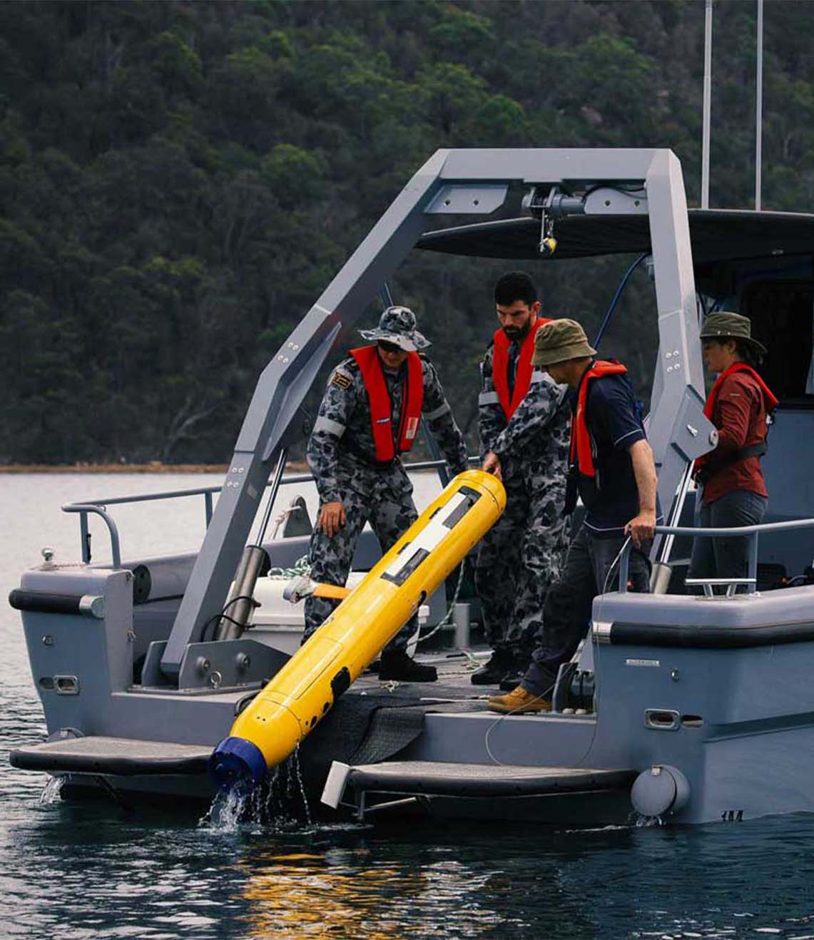
Firsthand ecological research and environmental monitoring are key building blocks of the models and maps needed for supporting the EMP decisions. The BlueROV2 remotely operated vehicle (ROV) from Blue Robotics and a Micro-Ranger 2 USBL from Sonardyne have enabled Fathom Pacific Ltd to capture incredibly detailed HD imagery from the camera they’ve mounted on it. Importantly, the USBL tells them exactly where it was recorded. If divers and other assets are in the water, it can track them as well.
The Micro-Ranger 2 is extremely portable and easy to mobilise making it the ideal solution for small-boat coastal operations and short-notice surveys.
The MRT – the part of the system that communicates with transponders fitted to underwater targets – is so small and light, it has been mounted to the bottom of the stern diver ladder. The range and coverage of the transponder is impressive. Equally impressive are the Nano transponders, these can be strapped to the frame of the ROV or a diver’s tank without affecting balance or freedom of movement. The rechargeable battery lasts for a full day of operations.
Thanks to the instructional videos available on YouTube, the whole system was simple to install and calibrate. Once the software was set up and tested on the laptop, it was put straight to work supporting surveys throughout last winter and spring. The whole set up was often mobilised at very short notice, due to the unpredictable weather windows experienced in Port Phillip Bay.
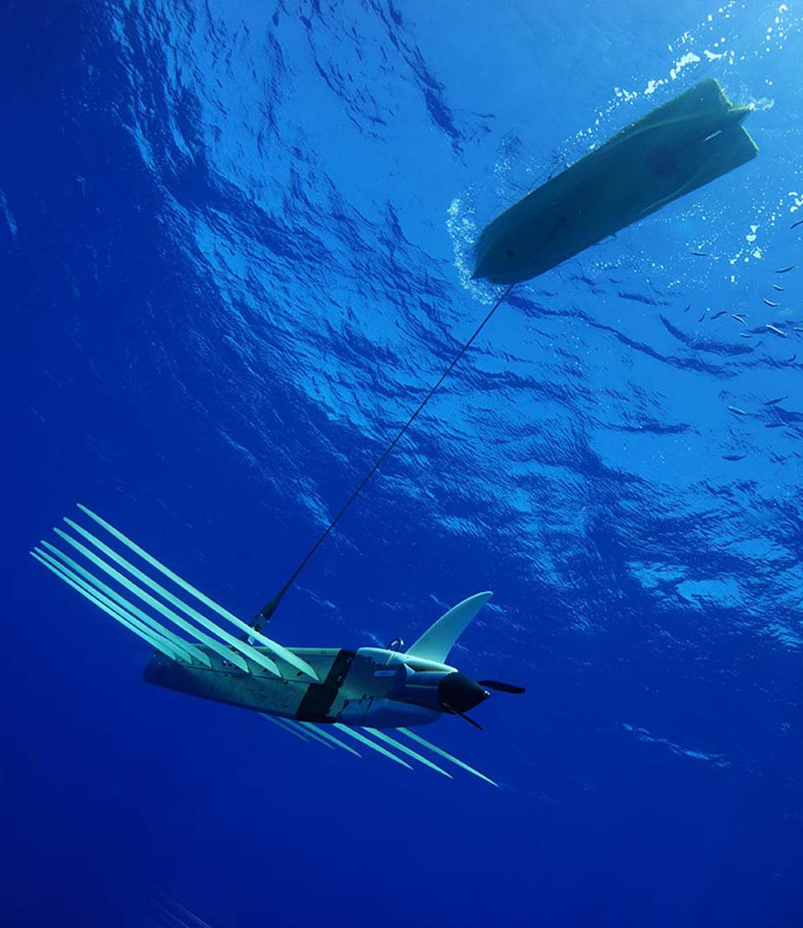
The Micro-Ranger 2 system has accurately and consistently tracked the BlueROV2 in the bay’s shallow waters, even when it has been transecting some 50-100 m from the small MRT transceiver. This is important for the assessment of the bay’s biotopes during which images of the key structural and functional components of temperate reef and sediment biotopes are taken using the ROV mounted HD camera.
ROV transects typically operate in two modes. The first is a ‘video inspection mode’, detailing the canopy, sub-canopy, lower strata and turfing components and identifying the associated macrofaunal biodiversity. The second is a ‘still image mosaicking mode’, where fixed-altitude planar stills are taken to create biotope mosaics.
Using Micro-Ranger 2, Fathom Pacific Ltd were also able to place their analyses of reef biodiversity and biotopes into a spatial context by correlating the imagery data with real world coordinates. This means ground-truth data for biotope modelling can be provided, while also establishing biotope conditions and informing ecosystem models. Exactly the same locations can be visited time and again for future surveys.
The results
The investment in Sonardyne’s USBL technology is paying enormous dividends. Better monitoring of the Bay is enabling targeted and faster responses to issues like the spread of marine pests, loss of canopy-forming algae to urchin grazing, biodiversity loss, eutrophication, litter and impacts from marine industries. These are just some of the threats facing Port Phillip Bay’s marine systems that are now being curtailed.
Speak with one of our experts to learn how you can protect coastal environments with Sonardyne’s technology.
Have you got a similar project?
Challenge us to solve your problem