Sonardyne
Support Centre

A new world of multi-robot ocean exploration

The OECI’s Technology Integration Challenge made major strides in multi-robot operations, on the surface and underwater, unlocking ways to explore our ocean – and far more efficiently. Find out how and the role our acoustics played.

The challenge

Ocean exploration is costly. Operations involving single underwater platforms, such as remotely operated vehicles (ROVs) or autonomous underwater vehicles (AUVs), often take up an entire cruise. Even when multiple underwater robots can be accommodated on a vessel, only one tends to be deployed at any one time, due to the complexity involved in its deployment, operations and recovery. It makes ocean exploration expensive and limits how much science can be conducted on any one cruise. But what if uncrewed surface vessels (USVs) could be used, not just as force multipliers for mapping operations, but as a remote shepherd, coordinating multiple underwater vehicles, they would be able to operate entirely freely from a mother ship.

This was a key objective of the US’ Ocean Exploration Cooperative Institute (OECI) 2022 Technology Integration expedition NA139 on the Exploration Vessel (EV) Nautilus.

Enhancing ocean exploration through the use of remote and autonomous operations is a key objective of the OECI, a partnership between The University of Rhode IslandThe Ocean Exploration Trust (OET), The University of Southern Mississippi, the University of New Hampshire (UNH), Woods Hole Oceanographic Institution (WHOI) and primary funding partner National Oceanic and Atmospheric Administration (NOAA) Ocean Exploration.

The expedition brought together OECI partner robots together with OET’s EV Nautilus for a ground-breaking technology demonstration in the Pacific Ocean during May 2022. These were:

Mesbot – WHOI’s mid-water robot that is designed to image and sample plankton layers.

NUI – WHOI’s hybrid ROV-AUV, designed initially to work under ice, that can operate out to about 20km on a fibre optic cable for high data rate data, but can also continue to operate without the fibre link.

DriX – UNH’s 7 m-long USV capable of supporting a variety of payloads such as multibeam echo sounders, acoustic communications and tracking and surface communications.

Their goal was to have all three platforms operating together, sharing information and situational awareness and relaying their information, via the DriX, back to the EV Nautilus, enabling scientists onboard to remotely control subsurface operations up to 20 km away from the ship.

Key to meeting their goal was inter-vehicle communications, tracking and positioning.

The solution

The DriX used a marine broadband radio link to communicate with the RV Nautilus (and our HPT 3000) to track, position and communicate with (including providing navigation data) the Mesobot and NUI as part of our Mini-Ranger 2 Ultra-Short BaseLine USBL system.

The underwater vehicles Mesobot and NUI were fitted with our AvTrak 6 combined tracking, telemetry and control transponders. The EV Nautilus was also fitted with our Ranger 2 Gyro USBL system, which would have also be able to track, position and communicate with the Mesobot and NUI, if this had been required.

Mini-Ranger 2 is our mid-level USBL tracking system that’s also able to support communications with underwater vehicles. It can track up to 10 targets at a time, at ranges of up to 4,000 m (with an extended range option) and, with our Robotics Pack, enables command and control untethered underwater vehicles.

For the OECI team, it was this combination of communications and positioning – acomms and USBL – that offered the broadest possibilities to the mission, from a single system.

AvTrak 6 is our tracking, communications and relocation transceiver. It allows USBL aiding for your AUV from a surface vessel and robust telemetry for AUV to vessel and AUV-to-AUV communications.

Ranger 2’s Gyro USBL comes pre-calibrated, thanks to its perfectly aligned acoustic transceiver and built-in attitude and heading reference sensor (AHRS), so you don’t need to take the measurements otherwise needed to determine the alignment of the ship’s motion sensors to the acoustic transceiver.

This makes it a very a portable system that the OET can use on vessels of opportunity. On the EV Nautilus, it was fitted through the vessel’s moon pool.

0

robots

0

dives

Communications

0

km

range

The results

“This was a real first for us,” – Professor Larry Mayer, Director of the Center for Coastal and Ocean Mapping, University of New Hampshire.

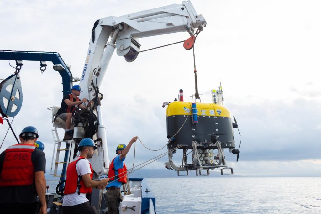
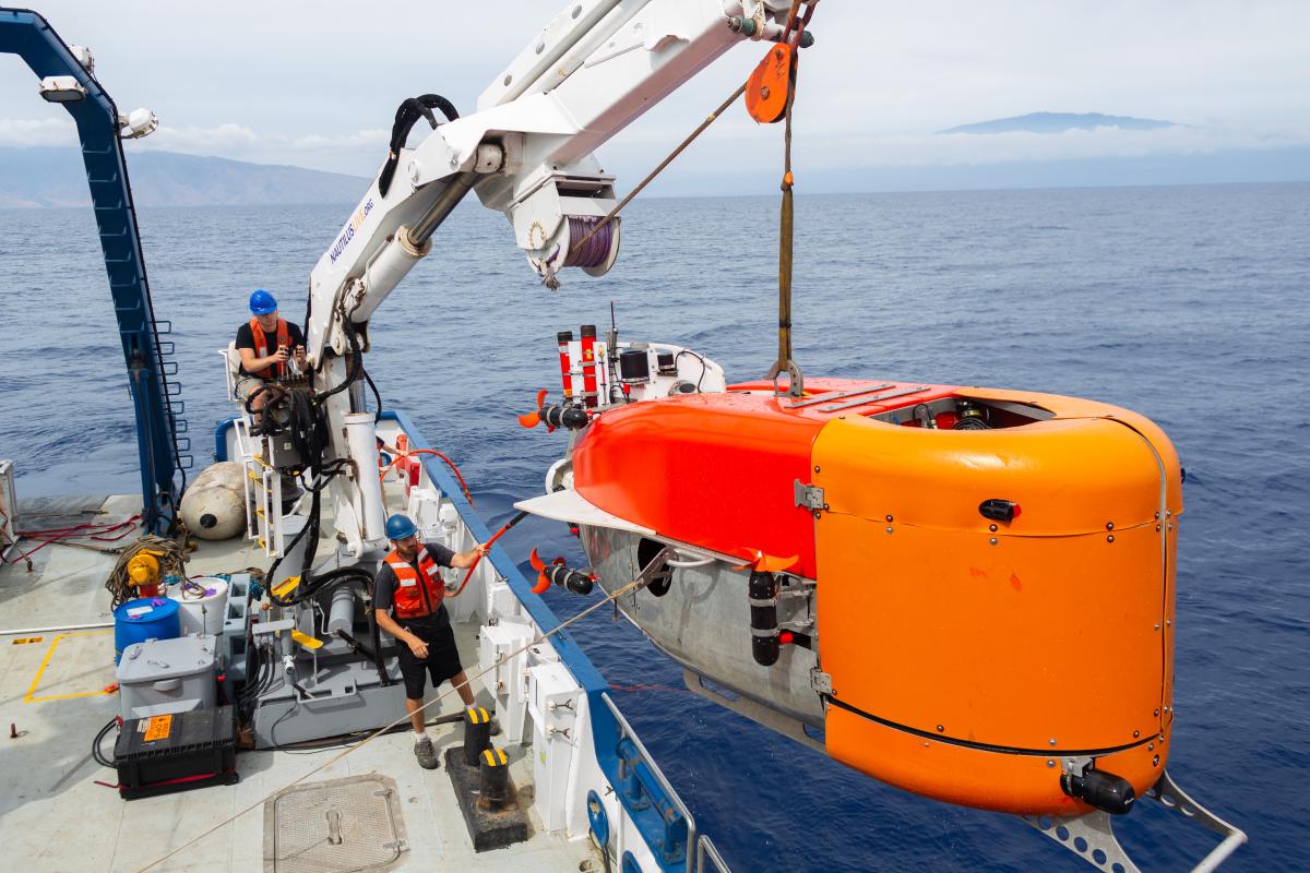
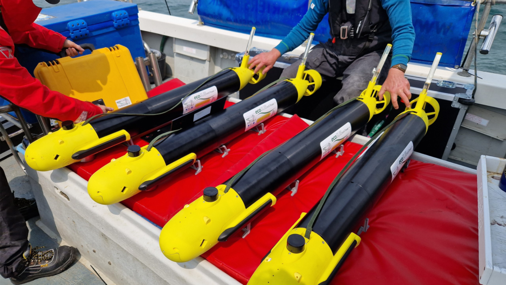
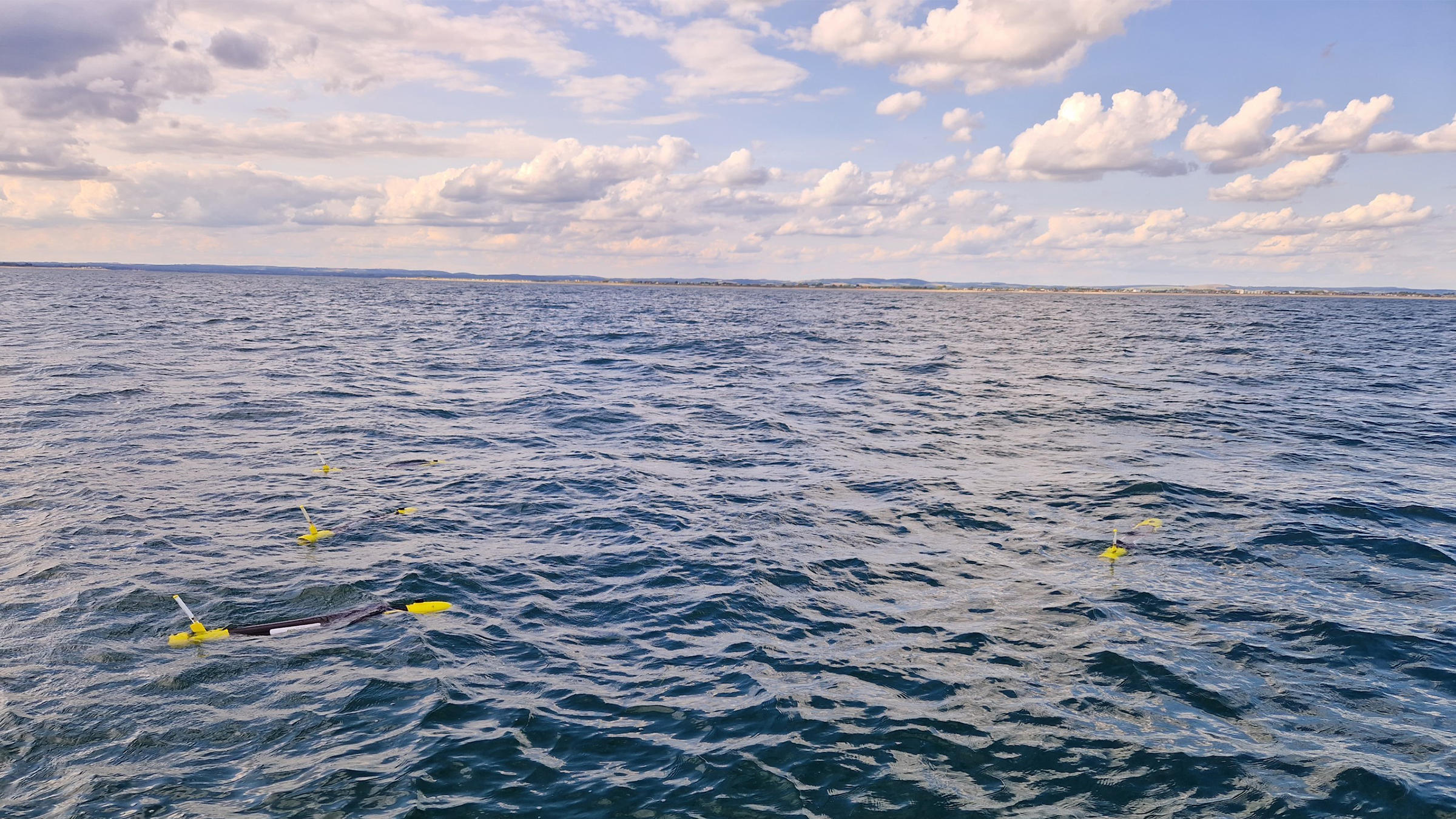
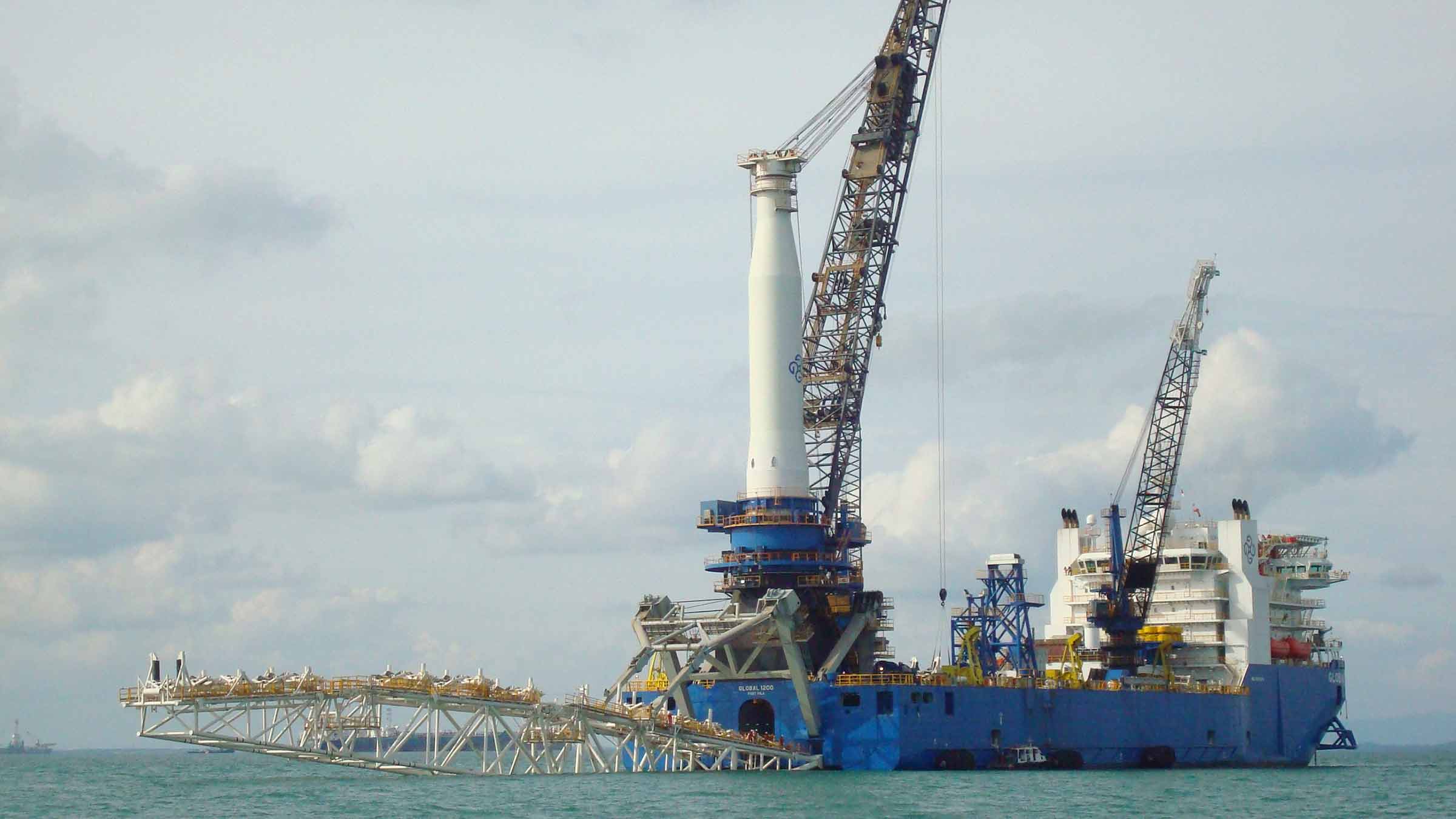
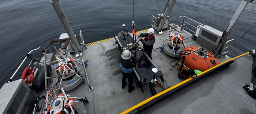
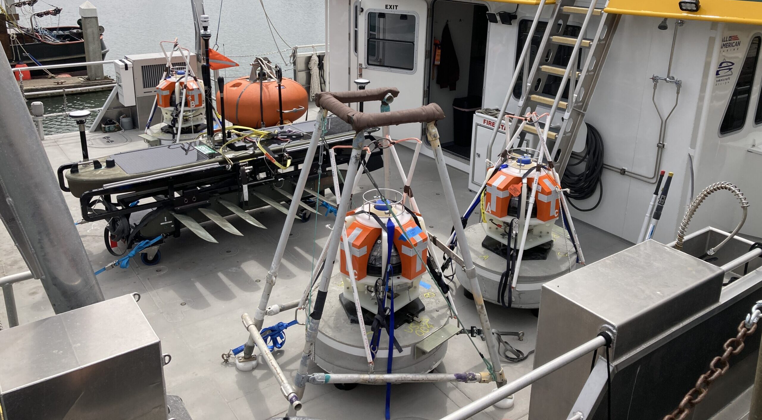
Over the course of the 16-day expedition near the island of Oahu, off Hawaii, the team tested and demonstrated operational capabilities. Over 30 dives were performed, totaling 210 hours in the water.

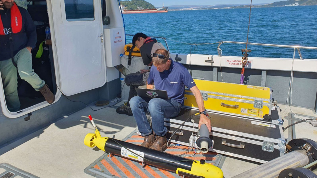
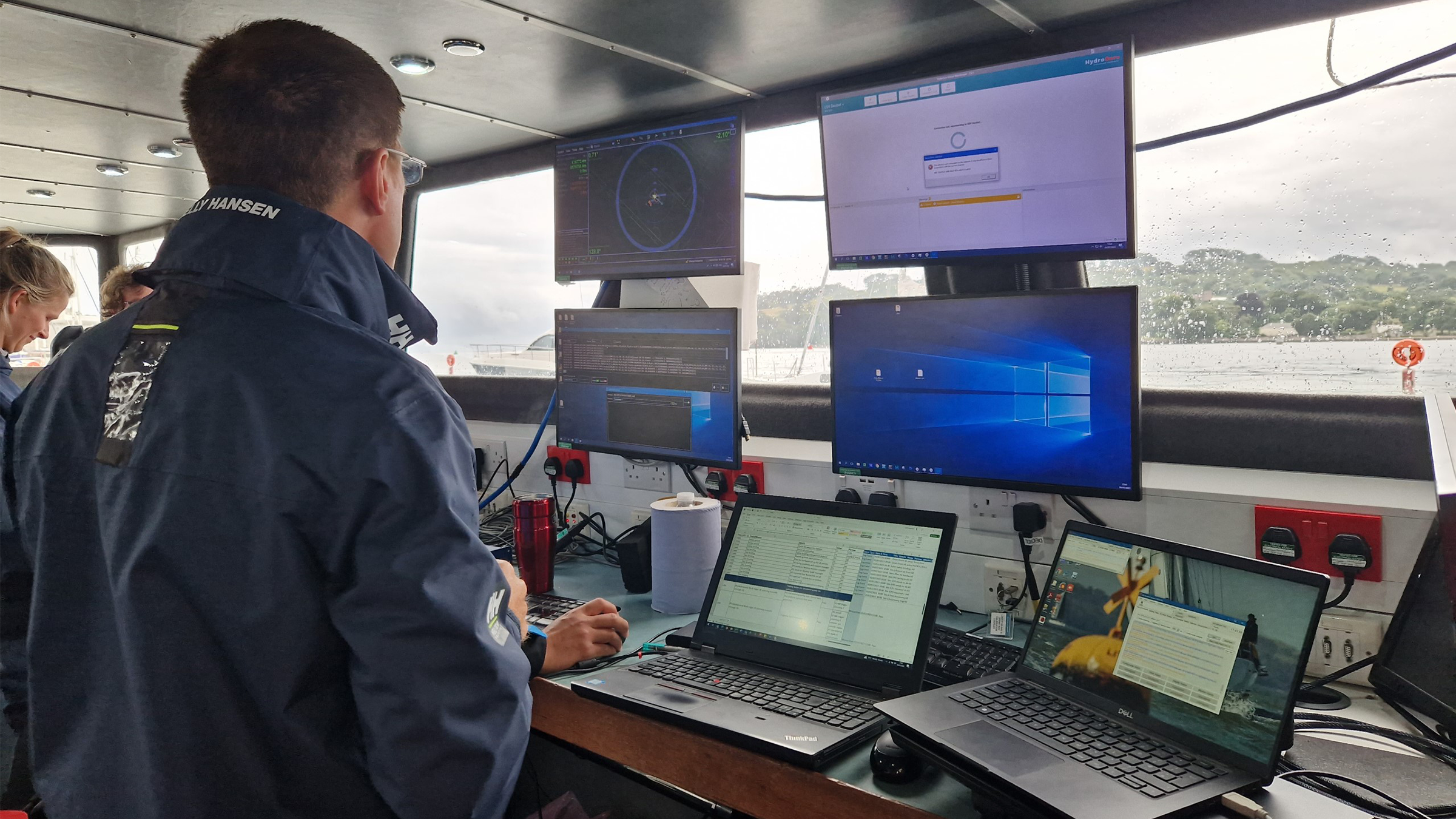
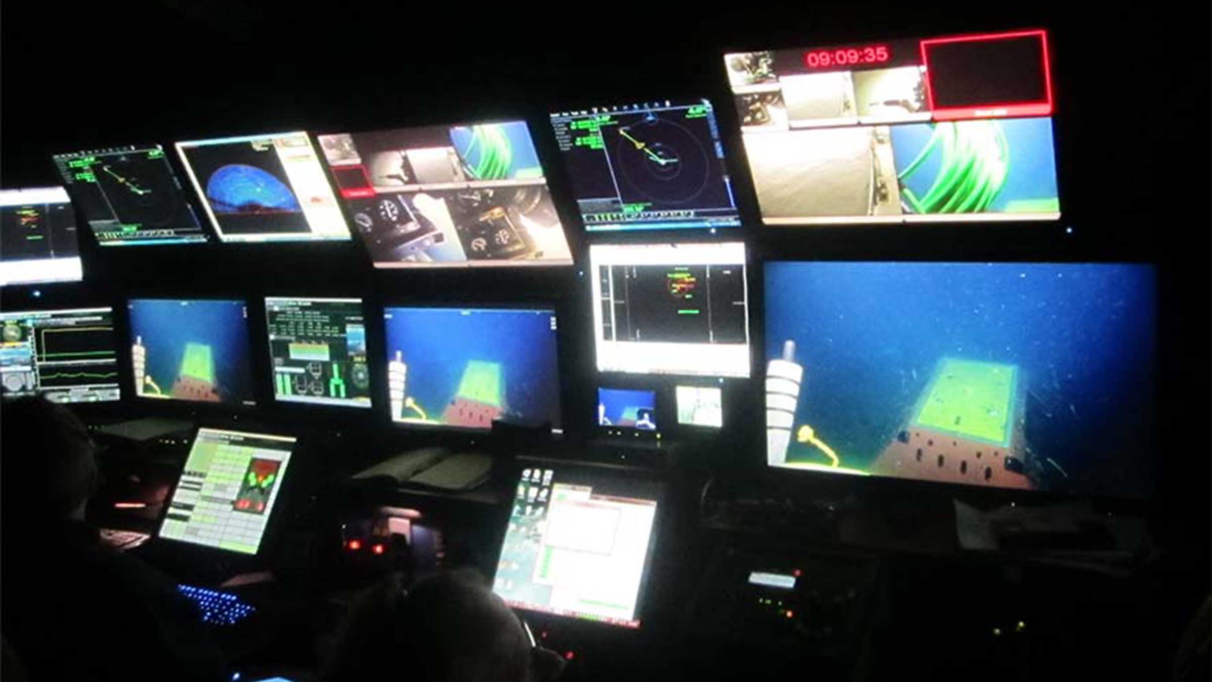
The team established a common control system, based on the robot operating system (ROS) for the vehicles and then set out, each time proving out more and more capabilities.

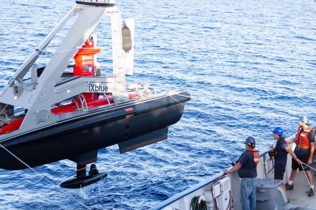
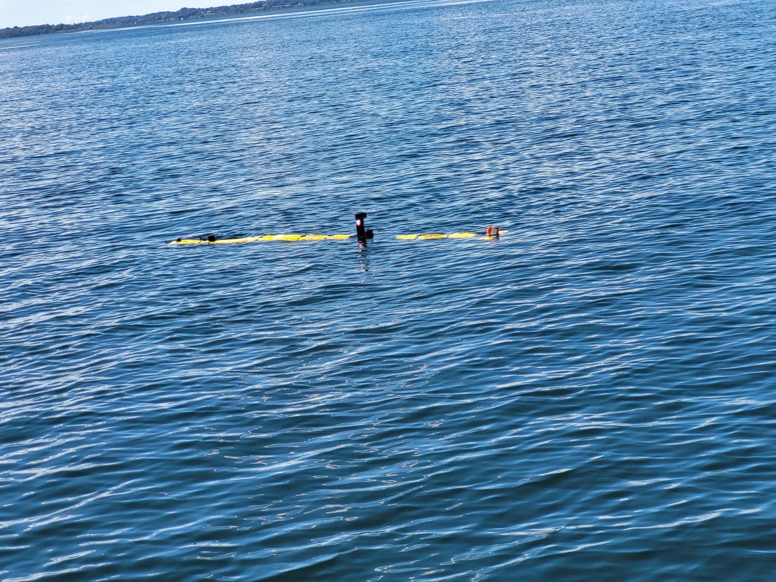
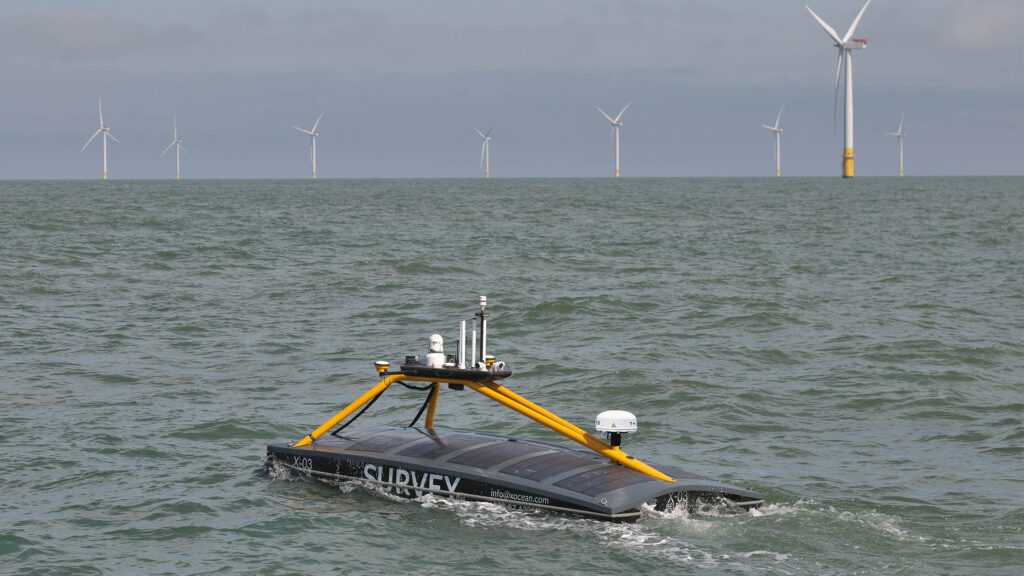
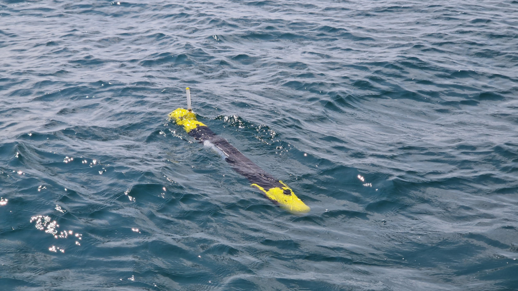
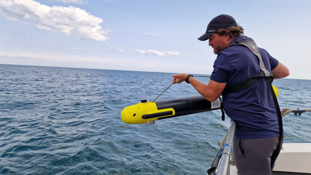
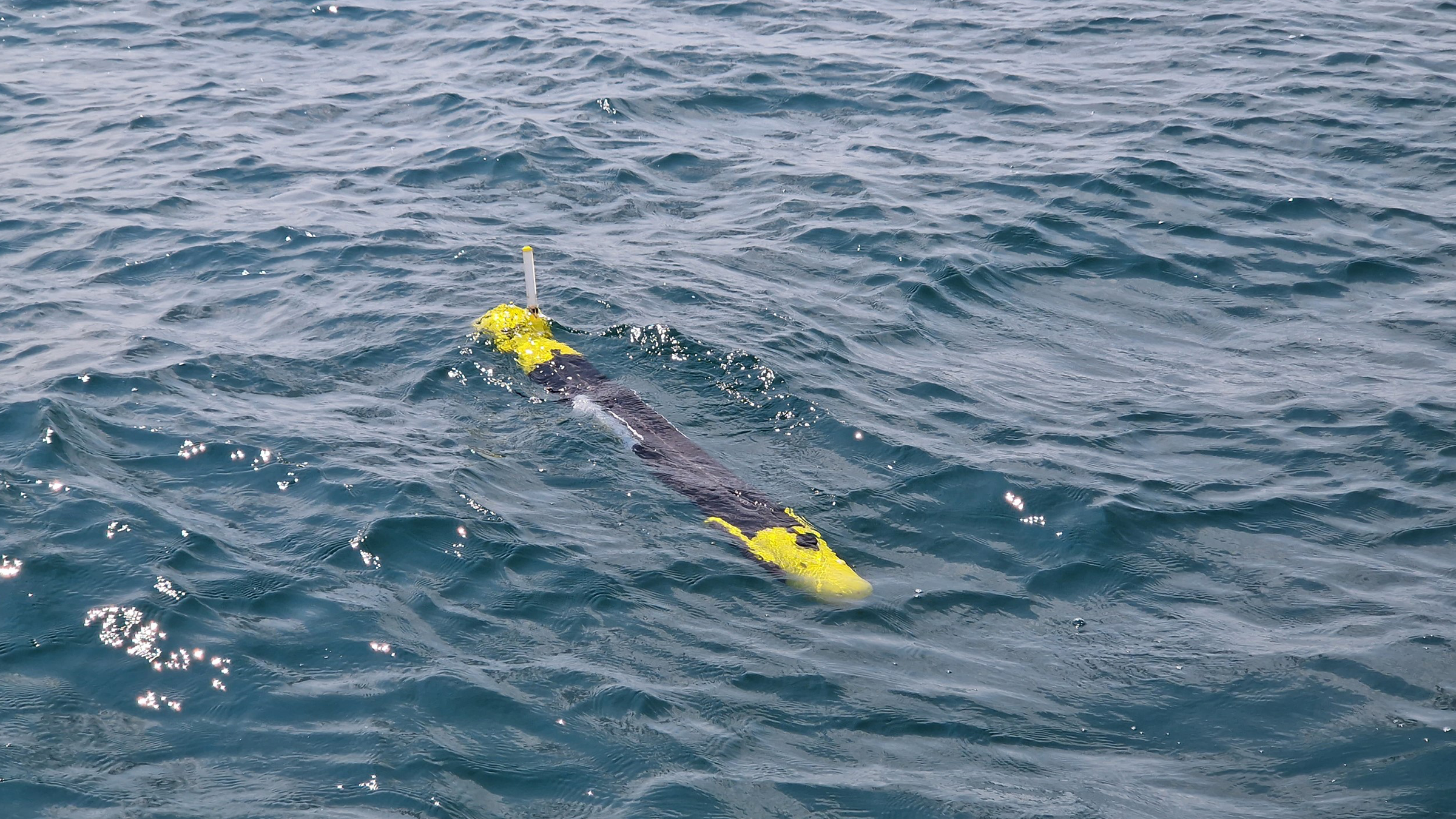
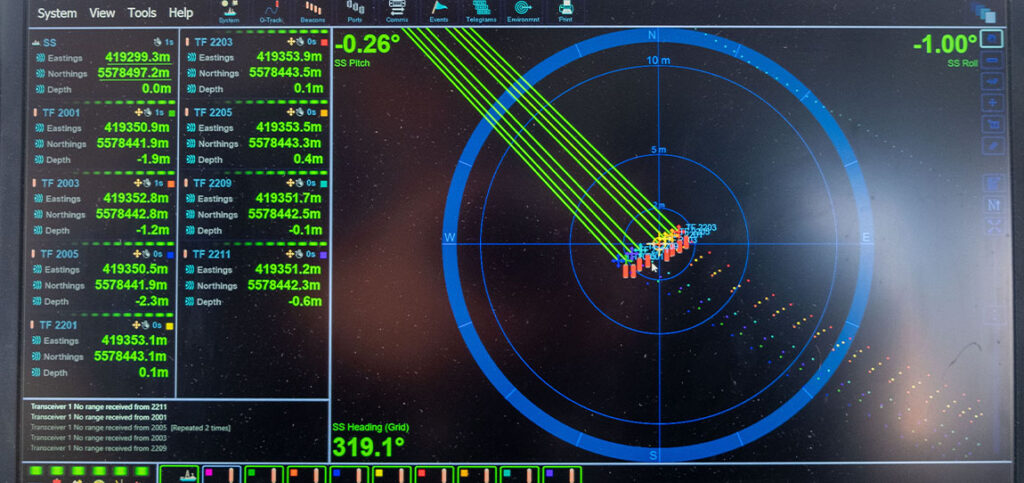
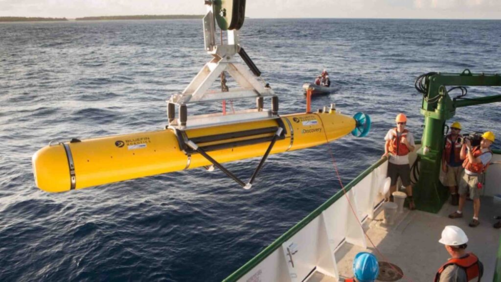
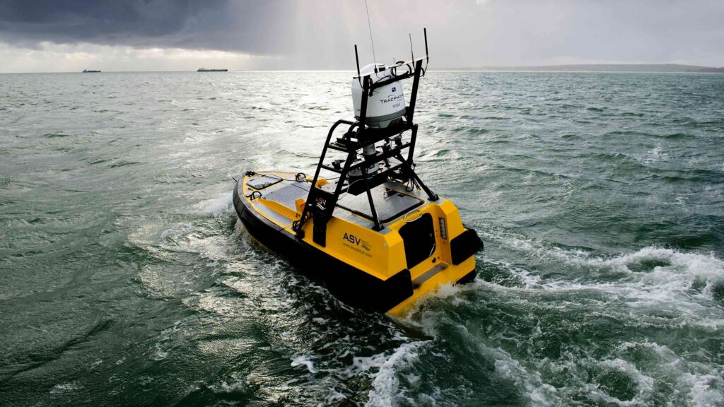
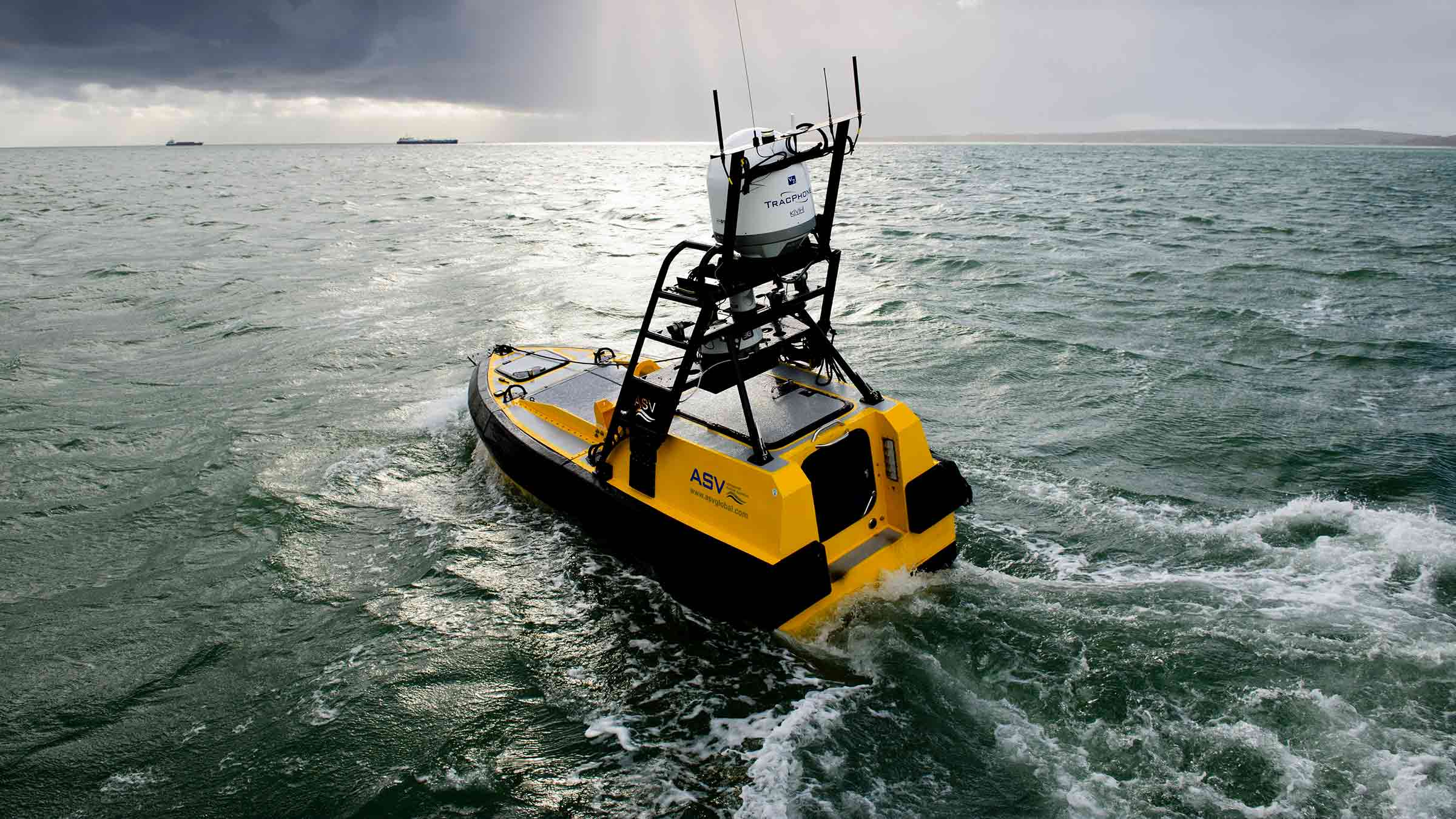
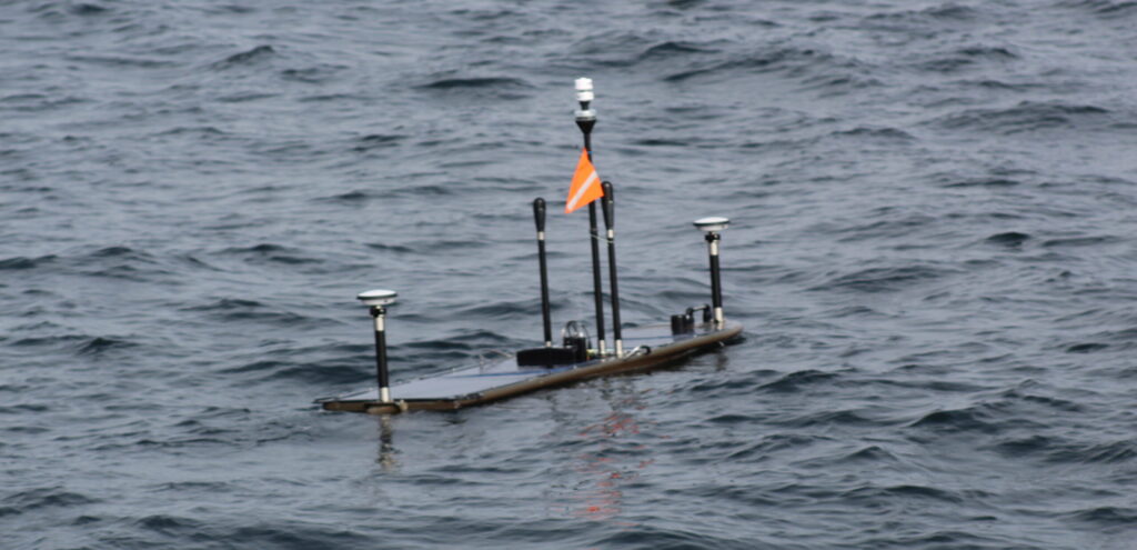
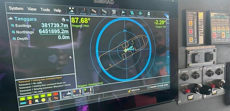
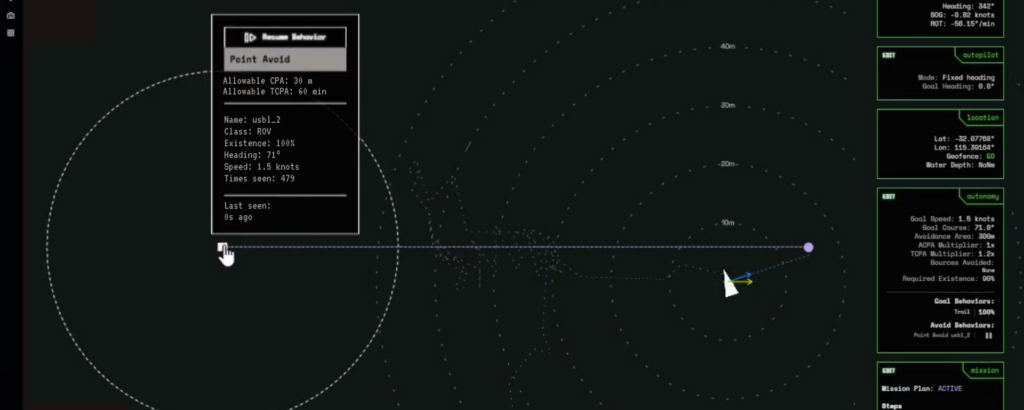
First, they had DriX track and communicate with Mesobot, using Mini-Ranger 2. Because the DriX has GNSS data at the surface, this meant it could position the Mesobot in the real-world and relay this data back to the RV Nautilus.

Next, they sent commands, via the DriX to Mesobot, from EV Nautilus to open and close its samplers, as well as to move up or down or to the right or left as well as change speed through the water column.

But then the most exciting thing happened, explains Professor Mayer:

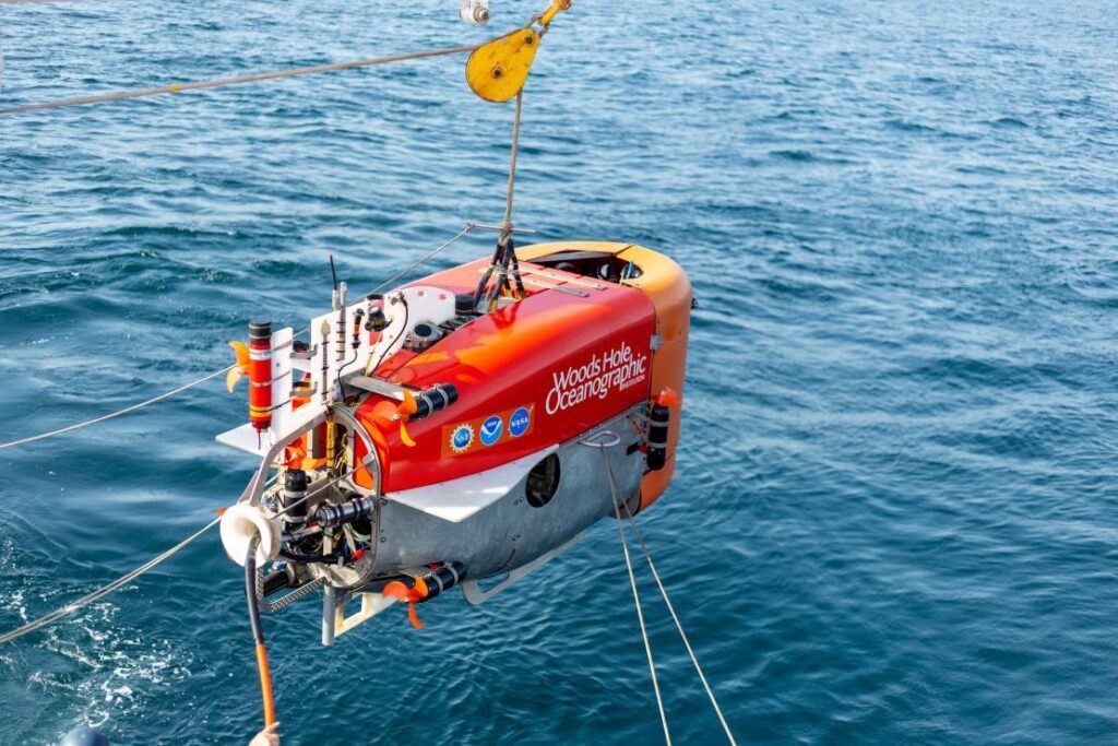
“Mesobot is designed to sample layers in the water column. But it doesn’t know where they are. DriX has a sonar (EK-80) that could see those layers. So we could get DriX sonar data back on the ship and in real-time see what’s called the scattering layer of plankton and command the Mesobot to go to that layer to sample it.

“Because Drix is circling above, it can actually see the Mesobot in the layer. This was a whole new world. Normally, Mesobot is sampling blindly. We could now direct it into the layer, know it’s in the layer and see if its entrance causes the layer to scatter. All these were unknowns before.”

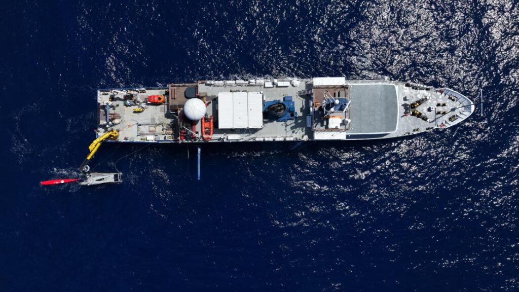
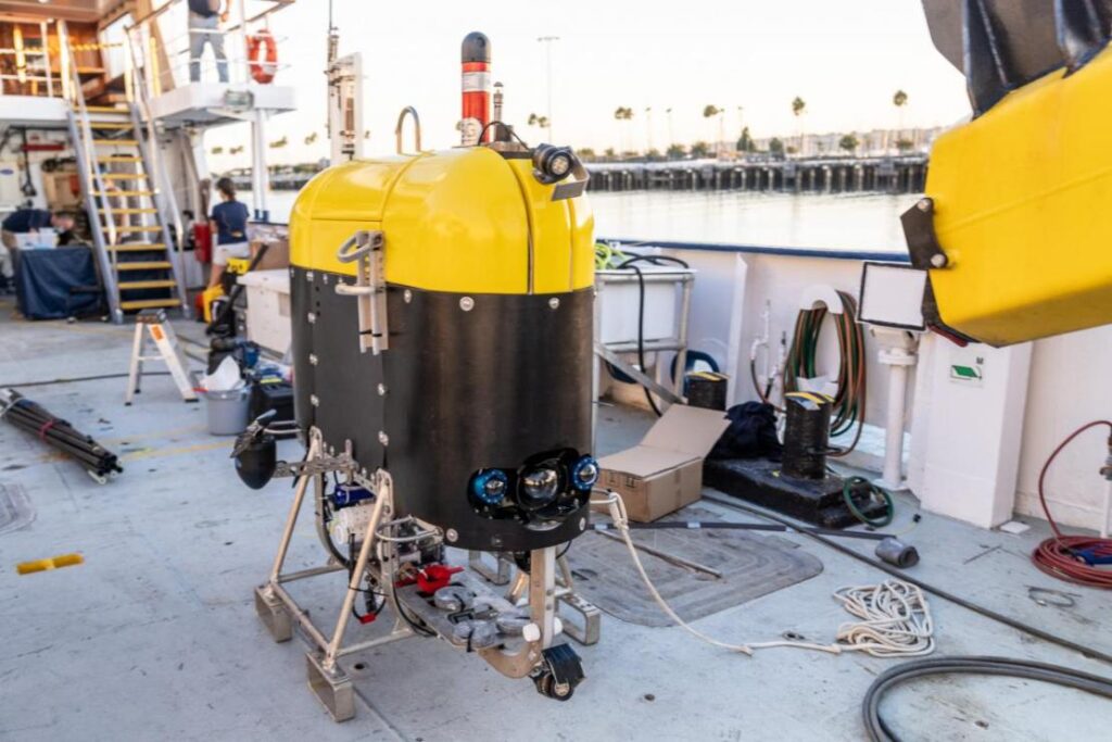
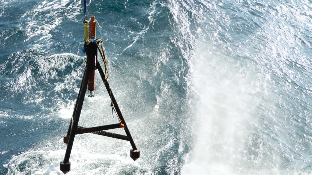
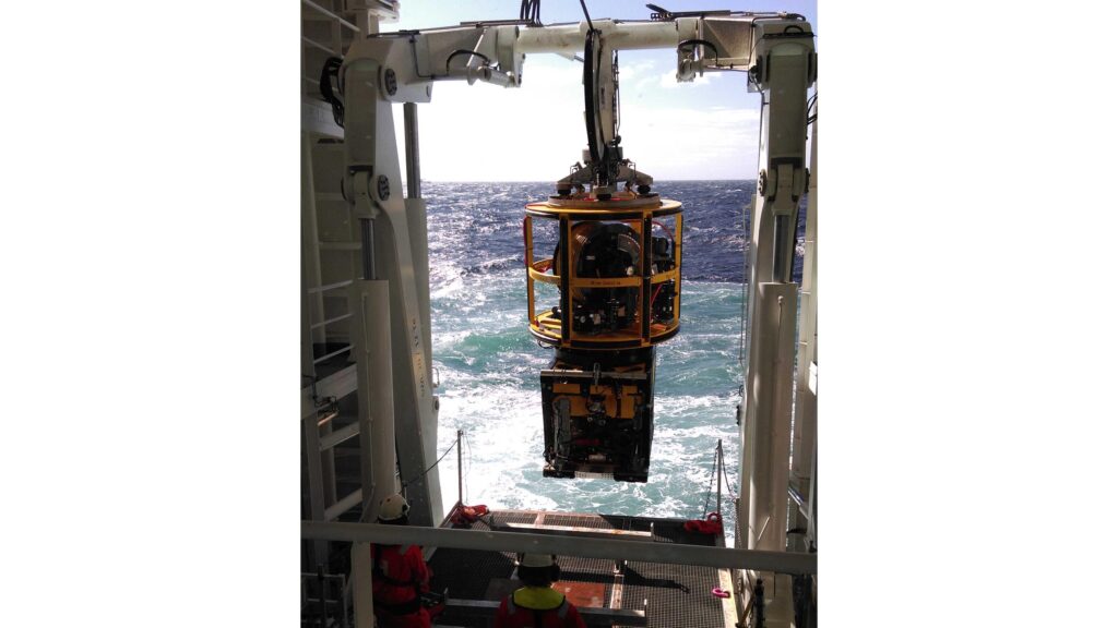
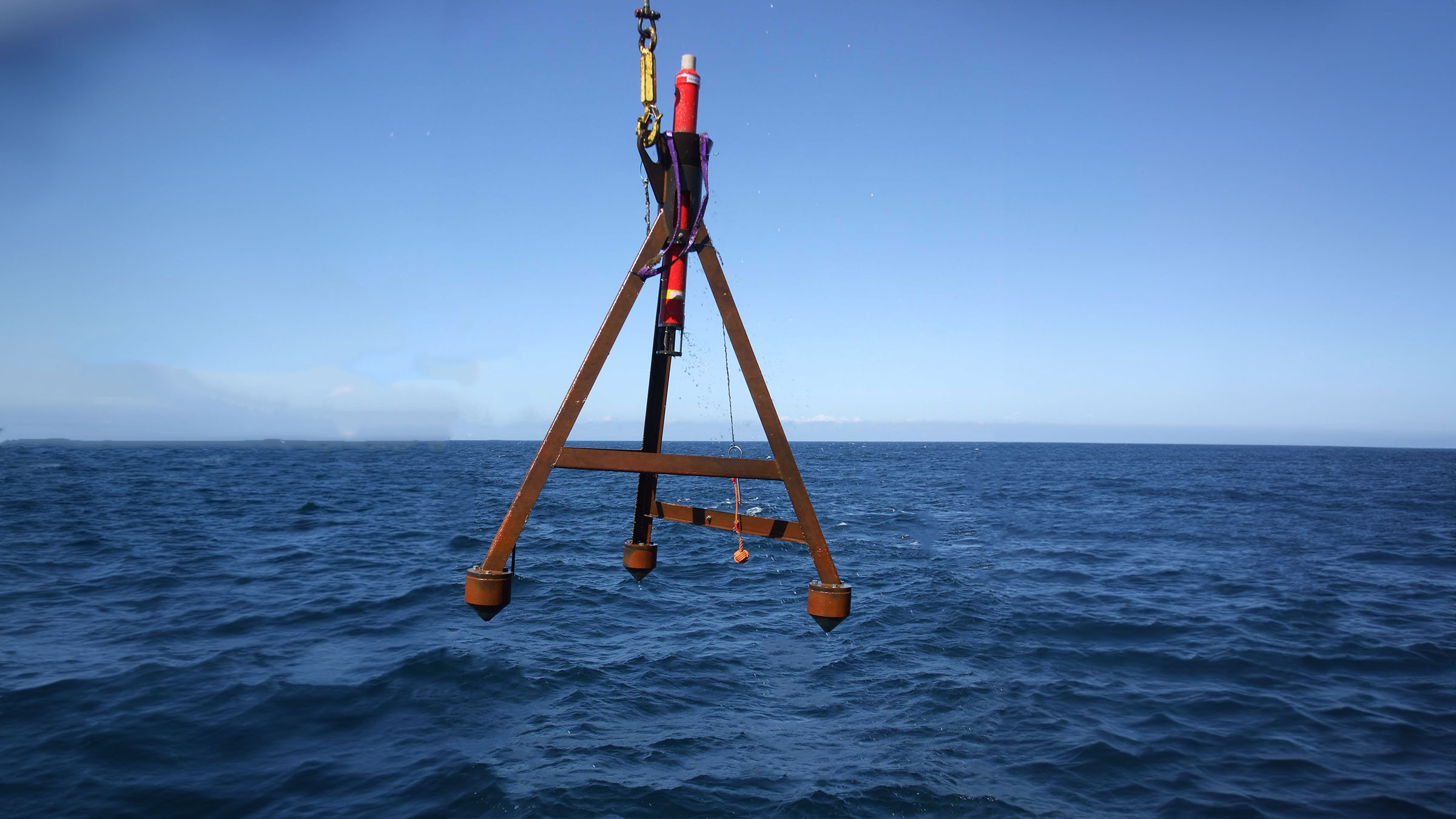
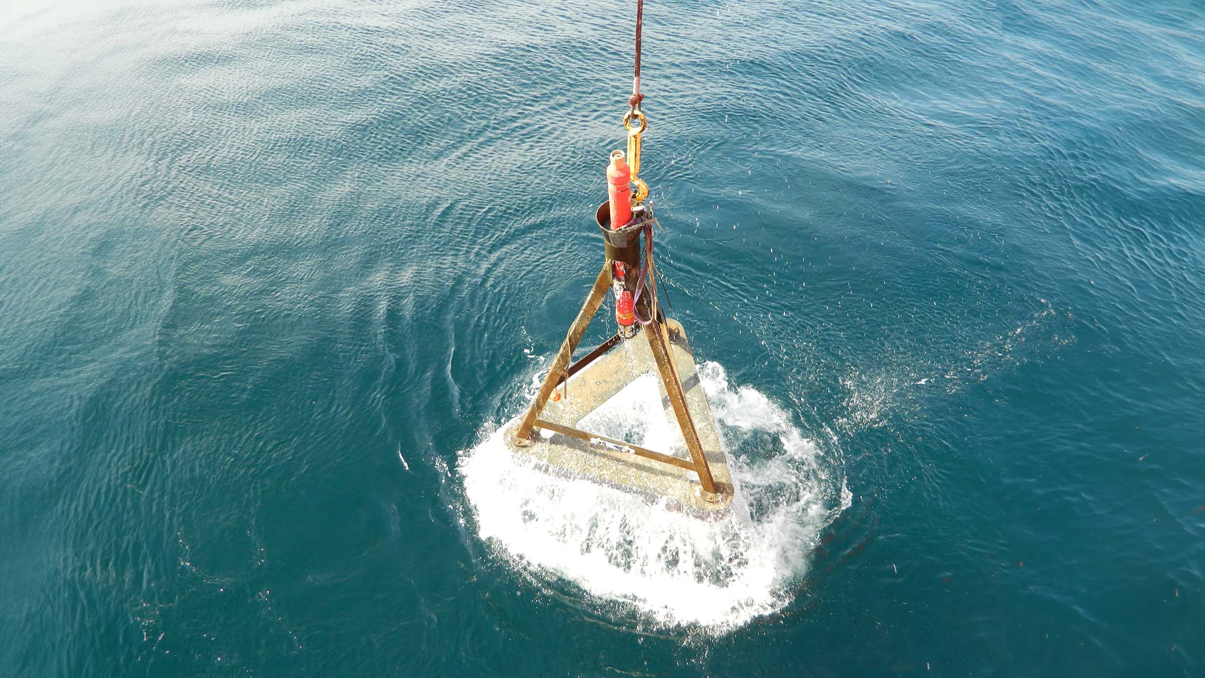
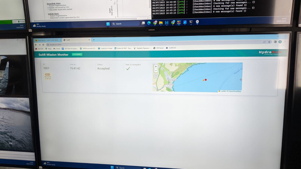
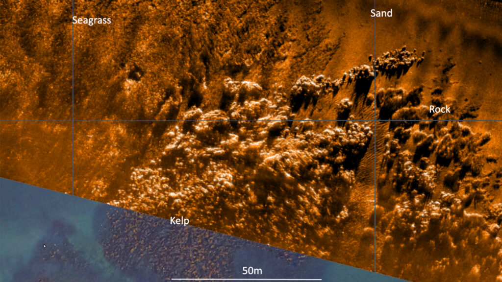
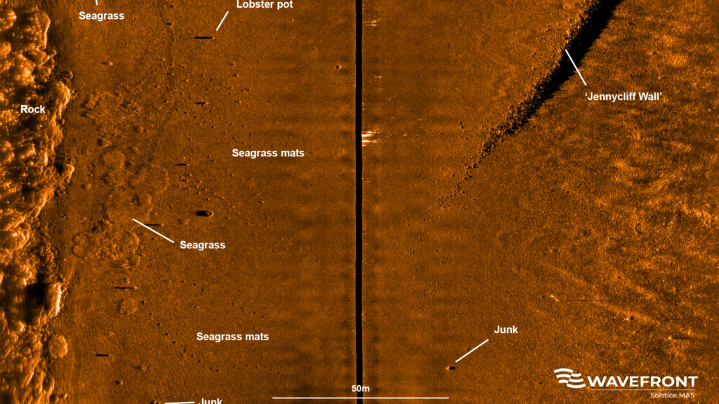
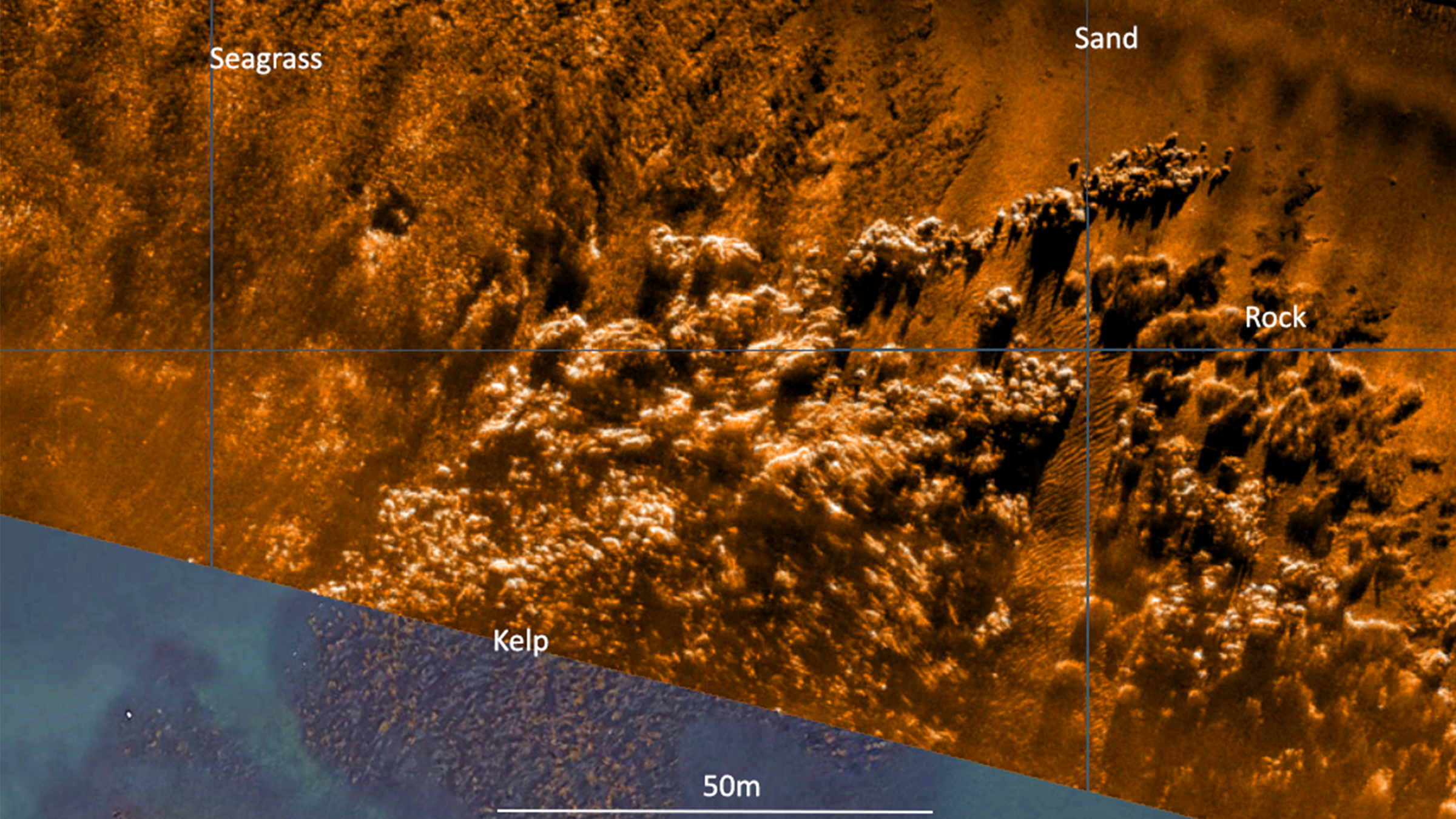
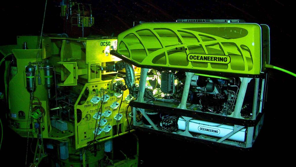
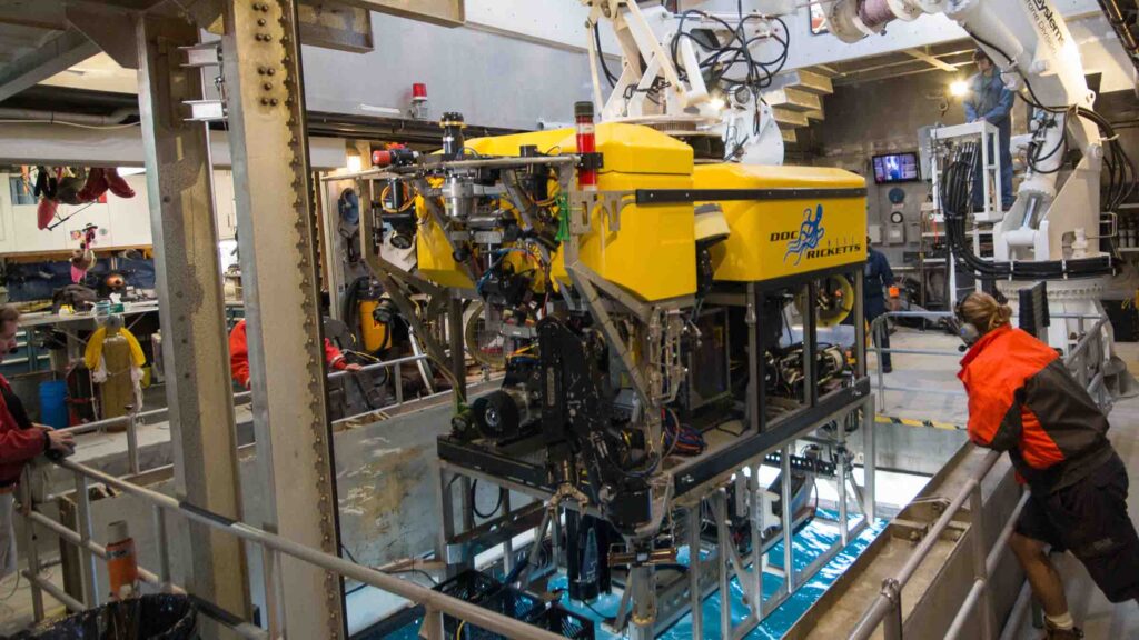
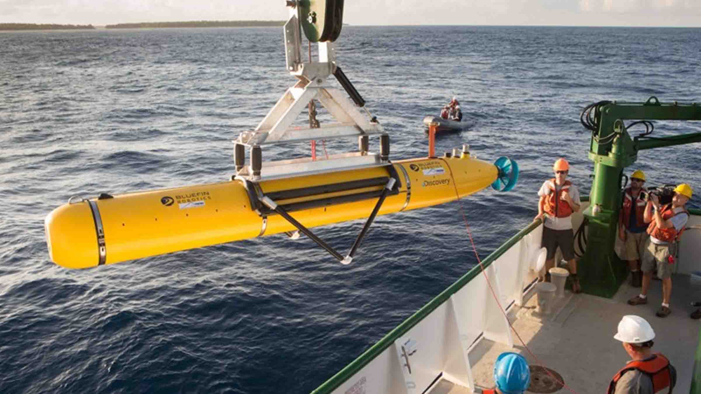
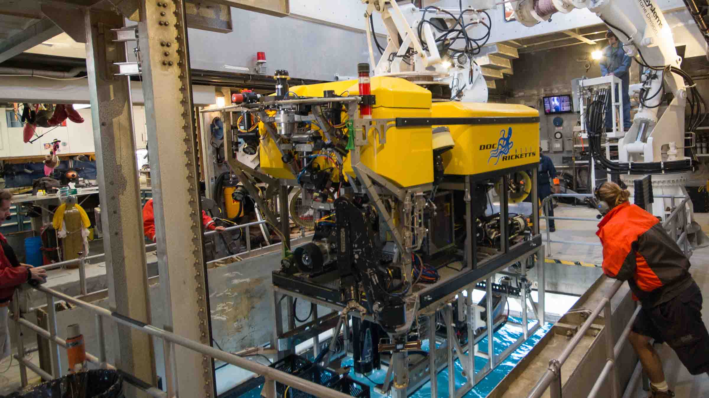
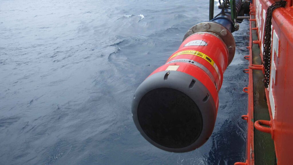
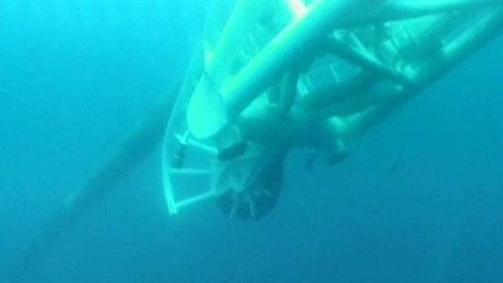
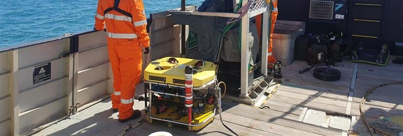
The team were then able to repeat these activities with NUI, including using DriX to map the seafloor east of Maui and then relay a mission to NUI for further investigation. In addition, CTD data, as well as snippets of imagery and bathymetry were transmitted acoustically up to the DriX, using Mini-Ranger 2, and then via the radio link back to the Nautilus.

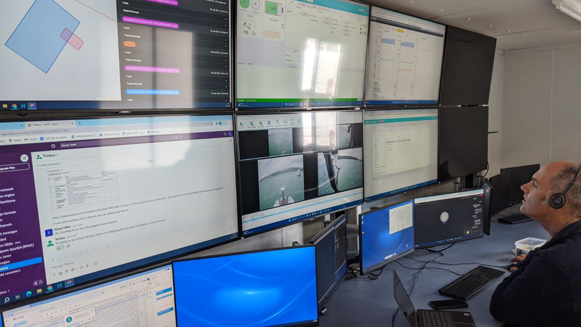
“By the end of the cruise we were able to have both vehicles in the water with the DriX circulating above, communicating with each of the vehicles, giving each other situational awareness, and the mothership, it was off do its own thing. I couldn’t have asked for a more successful cruise,” says Larry.

“We are really opening up a new world of multi-vehicle operations. In the old days, we would schedule a cruise and just use the Mesobot or schedule a cruise and just the NUI or an ROV. Even if they would all fit on one ship at the same time, you only use one at a time, so the $60,000 a day would be clicking away and you’re only doing a single science operation.

“Now we can do 2-3 science operations, the efficiencies are tremendous and it allows us to explore the seafloor, water column and surface all at once.

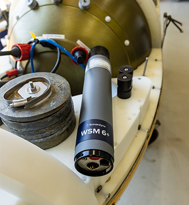
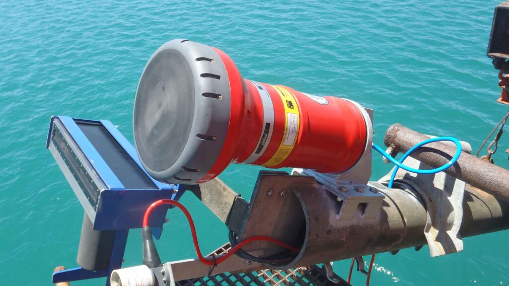
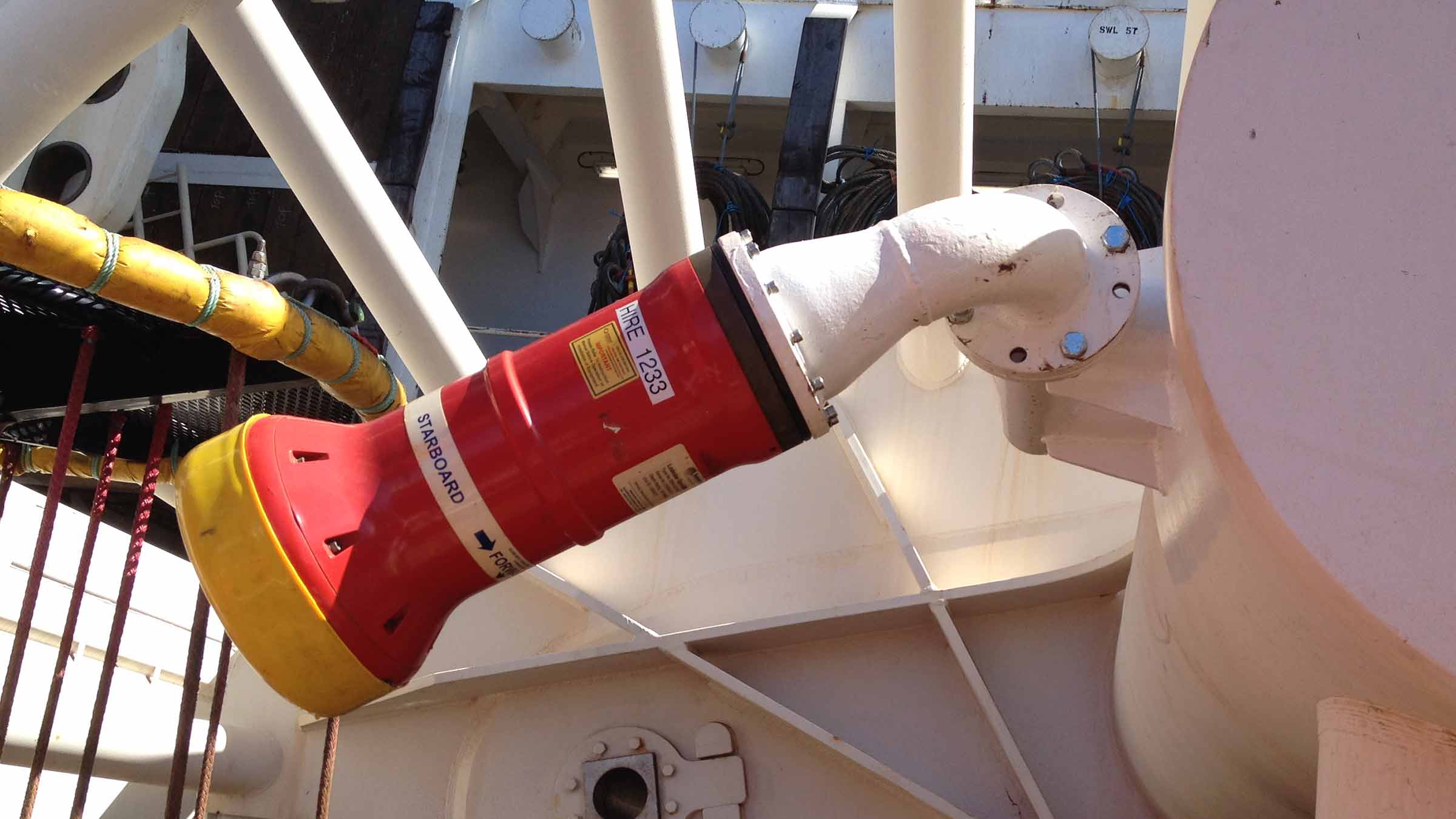
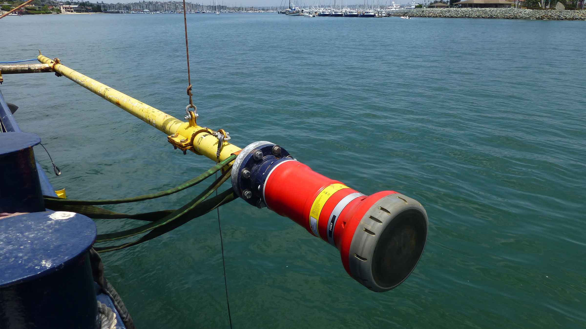
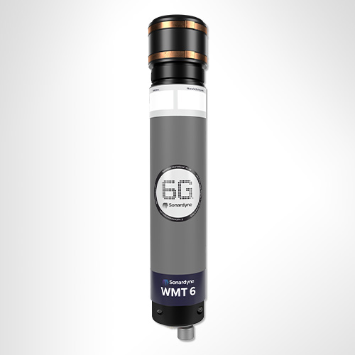
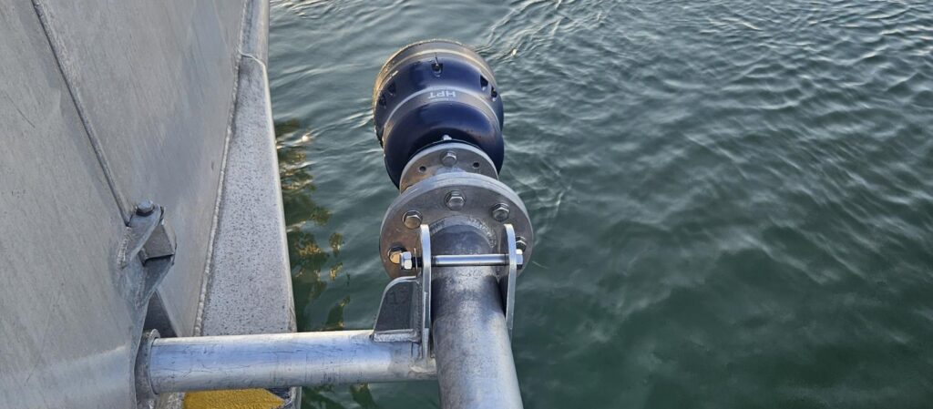
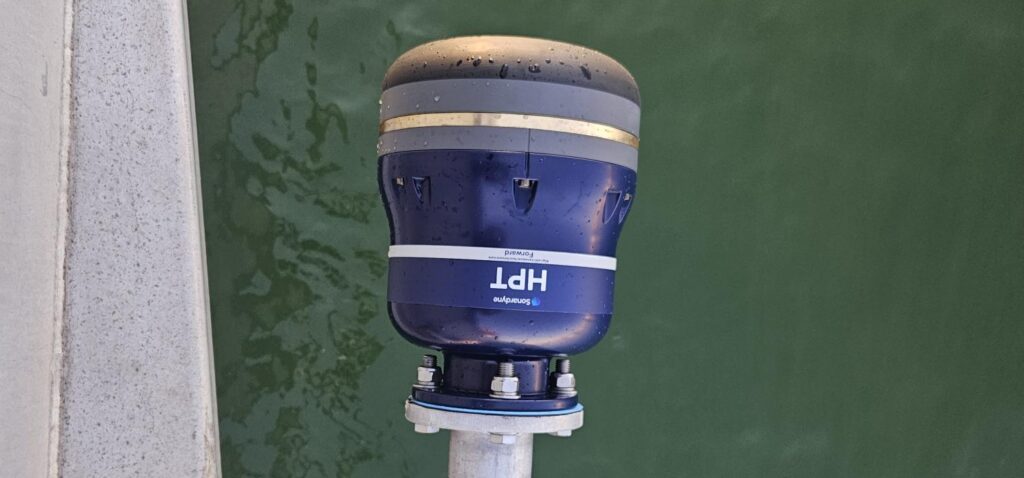
“The Mini-Ranger 2 system gave us the broadest base of possibilities with having both the acoustic communications and the positioning, USBL and acoustic communications, from the same system and that combined set of capabilities was so important to us.

“The standardization and ease at which we were able to send messages across from our programmers made it easy to use. The cooperativeness and responsiveness of the team at Sonardyne was also really helpful. They didn’t see it as disruption, they saw the possibilities.”

The expedition was funded by NOAA Ocean Exploration via the Ocean Exploration Cooperative Institute.

For more information and to watch other videos from Nautilus, click here.

Bringing special order accuracy to small diameter AUVs

L3Harris has armed its Iver3 AUV with Special Order survey navigation capability – thanks to our Mini-Ranger 2 Ultra-Short BaseLine (USBL) system and AvTrak 6. Find out how – and how it will help cut offshore wind farm survey costs.

The challenge

Demand for underwater surveys in coastal waters as part of the offshore wind life cycle is at an all-time high. There’s little sign of that demand falling, thanks to a global shift to renewable energy. But surveys come at a cost.

To keep costs down, surveyors are looking at innovative ways to survey more seabed more efficiently using smaller AUVs that reduce operational costs by requiring smaller vessels and fewer people and reducing their overall carbon footprint.

This includes International Hydrographic Organization (IHO) classified Special Order standard surveys, which are often specified for pre- and post-surveys underwater power cables and UXO surveys.

To meet navigation requirements, Special Order surveys in shallower waters tend to require ship-mounted sensors, to achieve the absolute positional accuracy required (using the vessel’s RTK/GNSS position).

In deeper waters, heavier, larger diameter AUVs are used. Because they rely on a DVL and an inertial navigation system (INS) for their navigation, they also must be supported by large vessels.

But what if you could perform Special Order surveys in shallower coastal waters with smaller low-cost AUVs, reducing your reliance on large vessels, reducing logistics, emissions and operational costs?

This was the challenge set by customers of L3Harris who were keen to find ways to use their Iver3 AUV for Special Order surveys.

Specifically, they set out to test if USBL-aiding at high enough accuracy for Special Order surveys could be achieved within the size, weight and power limitations of a smaller, light weight AUV platform, such as the 5.8 in-diameter Iver3.

If it could, it would allow underwater run-times of more than eight hours, and a new paradigm in lower operational cost coastal surveys.

The solution

L3Harris had already used our Mini-Ranger 2 for USBL aiding an iXblue Phins INS, via one of our AvTrak 6 OEM Nanos, on one of its Iver3s on a separate customer project. Read more here.

Mini-Ranger 2 is the ideal USBL system for coastal operations, supporting high-elevation tracking of up to 10 targets simultaneously down to 995 m water depth (extendable to 4,000 m), as well as data harvesting. It offers performance without the cost and complexity of a larger deep water USBL system.

At the heart of the system our HPT 3000, a highly capable surface deployed USBL transceiver which is optimized for performance in shallow water, high elevation and long lay back operating scenarios, as well data telemetry.

To provide INS aiding, L3Harris’ customer chose to integrate our AvTrak 6 OEM Nano, with a remote transducer, into their Iver3.

AvTrak 6 OEM Nano is the smallest variant of our AvTrak transceiver, designed for ease of integration on smaller underwater vehicles. It combines the functions of a transponder, transceiver and telemetry link, enabling communications, tracking and USBL aiding for subsea robotics. It’s also based on our 6G hardware platform, which means it’s interoperable with all our USBL, LBL and INS systems. This provides flexibility, but also performance enhancement, for example when combined with a Sonardyne INS.

As in the earlier project, the AvTrak 6 was programmed to speak the right language to the third-party IXBLUE Phins INS, by sending out an APOS PSIM SSB telegram, instead of our proprietary SPOS. The AvTrak 6 transducer was also supplied on a special Iver3 mounting post design, to make it easy to plug and play into the AUV – and any other Iver3, for that matter.

Mini Ranger 2 was pole-mounted to the support vessel with hemisphere GPS for topside absolute positioning.

The results

L3Harris ran a <5 km-long survey, with six 800 m legs, in challenging <20 m water depth in Narraganset Bay on the north side of Rhode Island Sound.

Real-time USBL-aiding improved the survey accuracy by upwards of 7 m on far end of survey legs through the turns. During the survey, real-time survey performance ranges up to 800m were tested with USBL position standard deviations ranging from 1 – 3 m.

In addition, using Mini-Ranger 2’s robotics pack, the L3Harris team were able to provide the vehicle with information of the acoustic environment, so its autonomy could make decisions to adjust the AvTrak 6 OEM Nano’s power and gain settings to improve acoustics without a human in the loop.

“The standard deviation on the USBL position fixes were accurate allowing real-time position updates to the INS. The ease of operation using the Mini-Ranger 2 topside to track and monitor environmental influences throughout the survey also added a layer of safety for monitoring the UUV.”

“This set up allows surveyors to meet Special Order navigation standards, which is a big deal for small unmanned underwater vehicles (UUVs),” says John Sloat, Application Engineering Lead, L3Harris. “The problem before has been that there’s not a lot of real estate inside smaller UUVs to house the onboard technology required for Special Order navigation capability in. But now they can.

“This capability adds a high level of survey efficiency by reducing the need to frequently surface for a position fix which increases the vehicles endurance, reduces the risk of vehicle entanglement or loss, and allows for larger areas to be surveyed. It also means they have real-time data vehicle positioning, which, when post-processed, could be improved even more. That’s really valuable to survey customers and we do see this as the cusp of a new UUV survey era,” adds John.

What was also hugely valuable to the L3Harris team was the support from Sonardyne’s experts.

“The level of support and service from Sonardyne has been exceptional,” says John. “We are very pleased. It’s been a fantastic experience at every phase of the integration we have done and that’s a big de-risk for us, having a partnership like this.”

“The real-time improvements on the survey navigational position accuracy were nothing short of exceptional, offering a powerful capability to improve survey accuracy using small UUVs,”

Morgan Eash Applications Engineering Manager, L3Harris AUV Systems

A 'custom-off-the-shelf' product provides a timely solution for Dana Petroleum

Our experience and expertise allowed us to rapidly adapt our off-the-shelf technology for Dana Petroleum. This delivered a cost-efficient, low environmental impact, and timely solution for them to monitor their suspended wells in the North Sea.

The challenge

As they reach the end of their productive life, oil and gas well heads still need to be monitored whilst suspended – for up to five years, before they become fully abandoned / decommissioned. A regime must be in place to monitor the assets ‘in perpetuity’ to meet government regulations. As this is ‘abandonment expenditure’, rather than capital expenditure, any monitoring schedule must be conducted as cost effectively as possible.

Dana Petroleum (Netherlands) was faced with one such challenge in early 2023 when they needed to plan and implement a well annulus monitoring schedule for suspended wells at their Van Ghent and Van Nes subsea wells, situated in the North Sea approximately 60km West of The Hague. The wells were situated alongside others still in operation and although the topside platform remained, communication links with the sensors on the suspended subsea wells had been lost. There was an additional challenge of the system needing to be in place within 12 weeks.

The solution

The ’simple’ solution would have been to lay new communication cables from the suspended well heads to the topside platform to enable the monitoring. But this would have been lengthy, expensive and carbon intensive, involving bringing in large vessels to lay long stretches of subsea cables. A quicker, cost effective and lower carbon solution was needed. Having heard about Sonardyne’s experience and expertise in long-term subsea asset monitoring, Dana Petroleum approached us for a solution.

We have many years’ experience in providing subsea pressure and temperature data directly from well downhole gauges, mostly during the appraisal phase in a field development, providing essential data to the reservoir engineers before connection is made to the offshore or onshore facility.

Although Dana Petroleum’s requirement was well within our capabilities, there were some initial unknowns such as; field layout, pressure gauge model and manufacturer and how the equipment would be mounted to the subsea manifold. Also, which topside would be most suitable for data harvest? Something which is typically dictated by the vessel size, noise profile and water depth. The timeframe was also very challenging.

In the following weeks, Dana Petroleum provided information on the field layout, drawings of the subsea infrastructure and a strong specification for a system capable of monitoring the annulus pressures at both locations. Having received this, we were able to provide illustrations of previously designed bracketry, 3D CAD images of our potential offering and expert advice to work out the optimum placement to enable best line of site for data harvesting. With a firm specification and known time constraints we looked to our off-the-shelf products with a view to creating a semi-custom solution with our projects team.

The obvious choice was to make custom alterations to our Autonomous monitoring transponder (AMT). The AMT has been used in a wide variety of different applications including overburden monitoring and pipeline movement monitoring, all utilising and autonomously logging pressure sensor data. These solutions can operate autonomously over long periods of time, over five years – depending on deployment – logging data and making it accessible for wireless upload.

The topside platform of choice was a Nano topside equipped with a ruggedised laptop running Sonardyne’s Monitor software fitted to a small crew transfer vessel that would pass by the wells at regular intervals, delivering workers to the platforms. The size of the vessel dictated a small portable solution but other options are available for all sizes of vessels.

Once the seabed and topside products were selected, custom modifications were made by the projects team to the AMT, allowing the pressure sensor to be connected to the annulus via a flange – rather than inside the AMT –to give flexibility in the location of the AMT and achieve best line of communication with the Nano transceiver when it passed overhead.

A factory acceptance test was witnessed by Dana Petroleum where our projects team provided documentation and coordinated the testing. Following this the equipment was shipped and ready for installation – all within a few months!

The results

The AMTs were installed by N-Sea using the diving support vessel EDT Protea and acoustic connection was established to test the pressure gauges. Readings came back as expected and the system was set logging. Following several days of logging the vessel returned to each well head to harvest the data and prove the system.

Significant cost savings were made by removing the need for new cable infrastructure and utilising a crew transfer vessel for data collection. This also dramatically reduced the carbon footprint of the monitoring schedule.

To fully verify the installation, valve settings were changed at the De Ruyter platform and this was visible in the data. The graph above shows a steady increase in pressure after the valve was opened on 13/07/23. The notable drop in pressure between 14:10 (UTC) and 20:10 (UTC) on 17/07/23 shows when the valve was closed.

“With energy transition currently very high on most Governments agendas, there is a high volume of suspended wells globally that require a form of long-term monitoring. The current high demand for vessels and drive towards a carbon neutral planet means that traditional methods of monitoring are not always going to viable.

However, regardless of the political and economic environment, assets still need monitoring in a safe and responsible way and that’s where Sonardyne comes in. We have a flexible approach to projects where we can provide exactly what the client needs. Whether it’s equipment to monitor a single well or provision of the raw data for a full multi-well campaign, we have the in-house experience.

When I received the initial enquiry from Dana Petroleum, as a previous member of the technical team it was actually quite exciting as I had been looking for an opportunity to drive a low-cost robust solution that fits well within abandonment expenditure budgets.

We have shown all of this is possible to do and provided the system in a very short timeframe.”

Colin Sutherland Sales Manager, Sonardyne

“Subsea issues like communication or power loss are one of the most difficult items to deal with. With existing systems, normally the only option is to do a complete reinstallation, resulting in huge costs and environmental impact. The solution offered by Sonardyne not only bypasses the communication and power loss, but also offered a cost-effective means of reinstating the pressure monitoring, all within a couple of months’ time.”

Richard Bus Senior C/E/I Engineer, Dana-Petroleum

Over the horizon robotic data harvest aids Shell's net zero ambition

Sonardyne, working with XOCEAN’s uncrewed surface vehicles (USV), deliver a lower cost, lower risk and lower carbon, remote acoustic data harvesting service to Shell from their Ormen Lange gas field in the Norwegian Sea.

Shell’s Ormen Lange gas field is a deep-sea site 120 km / 75 miles off the coast of Norway. As Norway’s second largest gas producer, it plays a key role delivering stable gas supplies to Europe. Built on the site close to Storegga, a major landslide which occurred some 8000 years ago, about 5 million tonnes of rock was used to prepare the seabed for subsea equipment back in 2005. The field has been operational since 2007. Ormen Lange is distinctive in that it doesn’t have conventional surface operation platforms.

Close monitoring of any seabed movement is key to prevent any potential impact to the pipe system. Monitoring of the ocean floor around the well heads is conducted by seabed sensors. The first monitoring array at the site saw 203 Acoustic Monitoring Transponders (AMTs) installed in 2011. These sensors enabled monitoring of changes in pressure and tilt to provide an understanding of seabed movement.

This array was recovered in 2016 due to battery limitations and uncertainty in drift. Today the monitoring is undertaken by an array of 75 Sonardyne seabed Pressure Monitoring Transponders (PMTs). Shell took the decision to install 30 PMTs in 2019 with a further 45 installed in 2020.

The challenge

Without surface platforms, acoustic data from the subsea sensors had to be harvested by crewed vessels in the early years of the field’s operation. This was costly, carbon heavy and posed a risk to personnel in often challenging sea conditions.

With a company ‘Powering Progress’ strategy to achieve net-zero emissions by 2050, Shell was looking for an alternative data harvest method that would reduce cost and risk as well as its carbon footprint.

The solution

Marine robotic platforms provide the opportunity to remove carbon and personnel risk. Working with the customer and XOCEAN as a sub-contractor we developed a solution that would save time, costs. and carbon, while also eliminating the human risk element, using a USV to conduct the data harvest.

The proposal was to use our HPT 3000 transceiver mounted to an XOCEAN USV to remotely harvest data from the 75 seabed PMTs. The HPT 3000 is perfect in terms of size, weight and power for deployment from a USV and can communicate with seabed transponders at depths up to 995 m (or 4,000 m with an extended range version).

XOCEAN USVs are perfect for the data harvesting mission at Ormen Lange. They enable full over-the-horizon 24/7 operations. This means that operators and data analysts can remain safely onshore whilst the operation takes place and data can be sent ashore and verified in near real-time using the USV’s satellite communications.

This satisfied Shell’s commitment to accelerate the transition of their business to net-zero emissions and to integrate sustainability within their business strategy. Following the successful PMT installation in 2019, a five year project was agreed where Sonardyne are responsible for the data delivery to Shell and XOCEAN are responsible for delivering the transceiver to the field for data collection via their USV.

The results

The project began in January 2020 and this was the first time a remote USV data harvest was completed offshore in Norwegian waters by any operator.

Whilst the USV and HPT 3000 were in Norwegian waters surveying the Ormen Lange site, the Sonardyne and XOCEAN personnel never left their bases in England and Ireland.

The data harvest was monitored in real time, 24/7 and the two teams were in contact with each other as well as the remote equipment. This mean that data was being monitored by our team as it was collected and there was no risk of the USV returning with missing or irrelevant data. Had there been any missed or partially collected data the Sonardyne team could ask the XOCEAN team to return to recollect from a particular PMT whilst still in the field, rather than waiting until the vessel returned and having to send it out again.

Successful data harvests have been conducted yearly since 2020 and continue to be a cost effective, low impact operation. This year we collected data from the Ormen Lange site twice, in Spring and Autumn.

If you think you have a similar challenge for us, contact us today.

XOCEAN says

“Through the successful PMT data harvest campaigns at the Ormen Lange Field, XOCEAN has demonstrated reliability by leveraging our cutting-edge USV technology in partnership with Sonardyne. Our uncrewed survey vessel platform offers a safe, reliable and low carbon solution for the delivery of ocean data. As we continue developing our remote operations, we recognize its pivotal role in steering the world towards the realization of the UN Sustainable Development Goals.”

Tomas Frafjord Norway Country Manager, XOCEAN

Sonardyne says

“Transforming how data is harvested at the Ormen Lange site and the on-going success of this project demonstrates the current and future potential of marine robotics in offshore operations. Moving from crewed to uncrewed vessels for such operations enables the drive to reduce carbon emissions in marine industries. Similar remote data collection solutions can be realised in any marine operation that requires long-term data collection. Where Sonardyne communications are built into seabed sensors we can communicate with them using instruments fitted to marine robotic platforms.”

Aidan Thorn Business Development Manager – Marine Robotics, Sonardyne

Norske Shell says

“In Shell we are always looking for new, innovative ways of working that can reduce risk to both people, assets and the environment. Uncrewed surface vessels have proven a highly suitable vessel for downloading PMTs. Carbon emissions are reduced to almost zero, and we don’t need to send people offshore anymore for the downloads. Considering the long distance from shore to field and the often unstable weather conditions in the area, solid planning and vessel management is essential.”

Egil Syre Project Manager, Norske Shell

Autonomous robots prepare to storm the ocean depths

Sonardyne were delighted to be part of the trials of a fleet of marine robots able to tackle complex offshore tasks as part of a ground-breaking project funded by Innovate UK, which is poised to change approaches to ocean exploration. Autonomous marine systems are being developed and deployed in increasing numbers. However, as maritime operations become ever more complex and expensive, and installed energy infrastructure increases in scale and distance from shore, there is a rapidly emerging need for more sophisticated multi-platform capabilities in the offshore renewable energy (ORE) market.

Squads of Adaptive Robots (SoAR) is a two-year collaborative research project, led by the developer of ecoSUB autonomous underwater vehicles (AUVs), Planet Ocean. The project kicked off in September 2021 and culminated this summer with full system testing at Smart Sound Plymouth on England’s south coast.

The SoAR team’s aim was to demonstrate how large-scale survey and exploration missions can be achieved by going beyond the limitations of individual AUVs. We worked alongside industry and academic partners; Planet Ocean, HydroSurv, the National Oceanography Centre (NOC)Royal Holloway University and the Offshore Renewable Energy (ORE) Catapult to develop advanced AI-driven mission planning, communications protocols for fleet coordination and significant improvements in underwater navigation and communications technology.

The trials simulated an offshore windfarm concession survey mission informed by a comprehensive business case analysis by the team at ORE Catapult.

The technology

The fleet-level autonomy engine developed by Royal Holloway, University of London served as the mission’s central nervous system, making real-time decisions and replanning when necessary due to factors such as inaccurate mission execution, vehicle faults, changes in the operating environment or the addition and removal of stations. The division of labour enabled by this approach showed significant promise in productivity gains made possible by robotics and AI.

The SoAR Communications Backbone, developed and released by the team at the NOC, acted as a central messaging system which enabled interoperability between the fleet-level autonomy engine, each vehicle-specific command and control system and any other sub-system requiring bi-directional communication. This was key to allowing the seamless introduction of different platforms and sub-systems in diverse combinations to suit a wide range of mission objectives.

We provided inter-medium communications via our AvTrak 6 Nano acoustic transceivers fitted to each AUV. This enabled simultaneous USBL tracking via a surface vessel and robust telemetry for AUV-to-vessel and AUV-to-AUV communications.

A small swarm of four ecoSUB AUVs, each fitted with an AvTrak 6 Nano acoustic transceiver, played a crucial role in rapidly assessing the underwater environment and conducting preliminary evaluations to identify targets of interest.

An Auto-Hover 1 (AH1) AUV, owned and operated by NOC, capable of exceptional precision in maintaining station and navigating vertically within the water column, and fitted with an AvTrak transceiver, was dedicated to close inspection tasks, enabling intricate and comprehensive examination of identified targets.

Our HydroSurv REAV-60 uncrewed surface vessel ‘Decibel’ assumed a pivotal role, serving as a crucial communications gateway to and from the AUV swarm. It was fitted with an HPT 3000 transceiver and ran our well-established Ranger-2 software on its topside, facilitating inter-medium communication and providing navigation support to the AUVs. Decibel was also equipped with various communications devices including 4G/LTE and Iridium satellite communication systems to enable communications between subsea, surface and the Autonomy Engine.

The deployed SoAR fleet was managed and controlled from HydroSurv’s shore-based Remote Operations Centre in Exeter, using 4G/LTE and Iridium communications.

The results

The open-water trials successfully showcased co-ordinated missions designed, monitored and adapted in real-time by an intelligent “Autonomy Engine”. The trials involved several surface and underwater autonomous systems, with mission management conducted from a remote shore-based command and control facility.

SoAR has led to the introduction of several technological innovations, including advanced AI-driven mission planning, open-source communications protocols for heterogenous fleet coordination and a range of new and enhanced platform capabilities for both surface and sub-surface systems. The variety of small form factor robotic platforms involved in the project represented some of the best innovation in UK ocean robotics to date.

The SoAR concept is adaptable to various applications but strategically tailored to address the specific needs of the offshore wind sector, developing an approach that will offer new operating paradigms and substantial long term cost savings for offshore asset construction and maintenance compared to conventional methods.

SoAR received funding from the ‘Next Generation Subsea Technologies’ competition, a joint initiative supported by Innovate UK, the Net Zero Technology Centre and the Royal Navy.

Mapping the future for seagrass beds in Plymouth Sound

Seagrass beds are incredibly important ecosystems that offer a range of ecological benefits. Not only do they provide crucial habitats for a diverse array of marine wildlife, especially in coastal areas like Plymouth Sound, they can also store carbon, helping to mitigate the effects of climate change. These underwater meadows serve as nurseries for many species of fish in the early stages of their life, offering them protection and abundant food sources. Additionally, seagrass beds help to stabilise the seabed with their root systems, preventing coastal erosion and maintaining water quality by trapping sediments and nutrients.

Drake seabed
Seagrass
Seagrass seeding
Seagrass map
Drake seabed
Seagrass
Seagrass seeding
Seagrass map

However, despite their importance, locating and monitoring seagrass beds using traditional methods, such as survey boats, presents significant challenges. Seagrass typically grows in shallow waters, which can make it difficult for boats to navigate close enough to the shore to obtain accurate data. Traditional survey boats are often large and cumbersome, making them hard to manoeuvre in shallow or rocky areas. This limitation can result in incomplete or inaccurate assessments of seagrass distribution and health.

Furthermore, the process of using boats for surveying can be time-consuming and labour-intensive. It often requires multiple trips and extensive manual labour to map out the seagrass beds accurately. The visibility in shallow waters can also be poor due to water turbidity, further complicating the survey efforts and leading to potential underestimation of seagrass coverage.

Finding a solution…

This is where Sonardyne and Wavefront Systems come in. The solution, which combines Sonardyne and Wavefront technology, is a survey boat carrying Solstice MAS™ (Multi-Aperture Sonar) as well as a SPRINT-Nav Mini mounted to a pole, deployed over the side of the boat; this maps the chosen area in 200 m wide strips. Once this survey has been completed, the sonar data that has been captured is then processed to create a map of the seagrass in a GIS. A Remotely Operated Vehicle (ROV) is then sent to the same area to ground truth features on the seabed to check that they are how they have been interpreted by Solstice MAS. The ROV is fitted with SPRINT-Nav Mini, allowing us to track its position underwater and guide it, using the map, to the features identified by Solstice; the ROV is also fitted with a camera and the recorded video can be used to create 3D models of the seabed.

Wavefront Systems’ Solstice MAS uses sound signals to produce high-quality images of the seabed, capable of creating images 200 metres wide at high resolution even in shallow water environments, all while consuming very little power. The Solstice family of sonars are built on unique MAS technology and are designed to fill the gap between standard side scan sonars, which are typically simple in design but give low image resolution, and Synthetic Aperture Sonars (SAS), which are expensive, more susceptible to complete data loss due to platform movement and also produce vast amounts of data. In order to execute more detailed mapping, Solstice MAS requires a high quality navigation sensor, which in this case is SPRINT-Nav Mini.

SPRINT-Nav Mini is an all-in-one vehicle guidance and navigation instrument, which combines AHRS data, Doppler Velocity Logger (DVL), Inertial Navigation System (INS) and depth sensor into a single housing. Having SPRINT-Nav Mini fitted onto the ROV provides positioning input, as well as attitude and heading data.

Creates images

0

m

at high resolution

ROV fitted with

0

D

camera

Solstice creates images

0

m

each side of the vessel

Adopting these technologies on such small versatile platforms opens the possibility of high-grade survey data in shallow waters. As a result of the cross Covelya Group collaboration between Sonardyne and Wavefront Systems, a high-definition map of seagrass beds can be created with a greater degree of accuracy than was previously possible with more traditional methods.

A seagrass restoration project conducted by the Ocean Conservation Trust (OCT) in Plymouth Sound, which involves monitoring, conserving and expanding the existing seagrass beds can be enhanced with the use of an ROV which has SPRINT-Nav Mini fitted to it. To help grow the existing seagrass beds, the OCT are placing seagrass mats on the seabed in Plymouth Sound. A survey boat fitted with Solstice and SPRINT-Nav Mini followed by an ROV fitted with SPRINT-Nav Mini can then be used to monitor and create a map of where these mats have been placed so that they have a better understanding of the success of the restoration and expansion project.

“Collaboration is key to our success as a business as we strive to offer integrated solutions to key markets and applications. Our operating companies run independently. However, the overall value when they come together can be significantly more than the sum of their parts. Coupling Wavefront’s Solstice multi-aperture sonar with high performance inertial navigation solutions from Sonardyne and applying it to significant sustainability initiatives such as mapping and monitoring the extent of seagrass beds on the South coast of the UK, makes the effort all the more worthwhile. Great job by the team, continuously innovating to realise increased efficiency and higher value datasets for such worthwhile causes.”

Phil Hart, VP of Integrated Technology, Covelya Group

“We use Wavefront’s Solstice multi-aperture sonar to map seagrass because it provides high-resolution images out to 100m on each side of the vessel even in shallow water. The sonar images give us both a broad and detailed view of marine habitats which is hard to create using other methods. Solstice produces reliable and repeatable results so is ideal for measuring and monitoring changes to the seabed. Solstice also requires very little processing and is compatible with standard side scan processing software, so we find it an efficient solution for habitat mapping over large areas.”

Peter Holt Marine habitat monitoring applications specialist, Sonardyne

Jump to

Overview

Ranger 2 – it's anything but standard

Ranger 2 is your complete subsea USBL workshop. Trace, track, command or position everything, in any depth, from any vessel, anything that your underwater operations may demand. Track a towfish, position an ROV, dynamically position your vessel, communicate with an AUV – or do all of this simultaneously.

What is possible

Ranger 2 comes with an impressive list of features including our award-winning 6G (sixth generation) acoustic hardware platform and Sonardyne Wideband 2 digital signal architecture. It provides stable and repeatable acoustic position referencing for your ship’s DP system, including those from GE, Kongsberg, MT, Navis, Thrustmaster and Wärtsilä.

As your needs grow and become more complex, bolt-on software packs unlock additional capability and protect your investment. Take the DP pack and enable your acoustic ranging to be aided by our inertial navigation technology (DP-INS). Add the robotics pack and commanding a swarm of up to 99 AUVs is at your fingertips.

Ranger 2 can do even more, it also supports robust two-way data telemetry, allowing you to control our range of seafloor deployed, long-endurance sensors and recover your all-important data.

Track everything, in any depth, from any vessel

Why choose it?

  • Tracks multiple targets to 11 km;
  • Compatible with all makes of DP system – GE, Kongsberg, MT
  • System accuracy: when fully optimised it will deliver 0.04% of slant range
  • Works with a global inventory of pre-deployed Sonardyne 6G hardware
  • Configurations available for USV and temporary vessel installations
  • Valuable features included as standard
  • Bolt-on packs available for growth with your operations and ambitions
  • Developed and supported by a company with over 50 years of experience in innovative underwater technology

Learn more about Ranger 2 USBL

The kit

Transceivers

Our High Performance Transceiver (HPT), is available in a range of different designs to suit your operations whether they are in deep or shallow water or over a long layback.

HPT 5000 / 7000 are acoustic and telemetry transceivers designed for use with Ranger 2 USBL system. HPT 5000 enables targets to be tracked over a wide range of water depths; HPT 7000 is optimised for noisy DP drilling or construction vessels and in deep water.

HPT 5000 offers full hemispherical acoustic coverage so is a popular choice for tracking multiple targets (ROVs, AUVs, towfish, seafloor sensors) over a wide range of depths and elevations. The unit is also suitable for dynamic positioning reference on survey, research and offshore support vessels.

HPT 7000 is engineered for ultra-deepwater operations, tracking targets far below (rather than to the side of) a vessel, and for high vessel noise operating environments such as those typical of DP, drilling and construction where activity from thrusters is liable to cause signal interference.

If you need a solution for a vessel of opportunity, our pre-calibrated, all-in-one Gyro USBL transceiver is perfect. Lighter, smaller and just as capable, our second-generation Gyro USBL transceiver works seamlessly with Ranger 2 to track the position of your subsea targets from a USV, vessel of opportunity or from a pipelay vessel’s stinger over extreme ranges.

  • All-in-one instrument; combined 6G acoustic transceiver and AHRS
  • Choose between standard or ‘plus’ variants to suit your project’s specifications
  • Optimises the performance of Ranger 2; eliminates lever arm offsets, pole bending and ship flexing errors
  • Calibrated in-water before delivery – saving you time; install it and go to work

Transponders

The flexibility of the Ranger 2 family is further extended by our range of transponders to support a wide variety of your operations. WMT is a high-power transponder capable of operations to 7,000 m, while AvTrak 6 is our most capable acoustic vehicle instrument, combining the functions of a USBL transponder, LBL transceiver and modem for demanding applications such as AUV command and control.

Performance

• Up to 0.04% of slant range system accuracy
• Up 99 targets tracked, simultaneously
• Up to 11,000 m tracking range (LMF)
• 1 Hz position update rate
• Supports all industry standard DP telegrams
• Supports acoustically aided INS

Acoustics

• MF frequency (20–34 kHz) or LMF (14-19.5 kHz)
• Compatible with a wide range of 6G transponders
• Supports Sonardyne Messaging Service for data exchange up to 9,000 bps
• Sonardyne Wideband 2 acoustics for reliable performance in both shallow and deep-water environments

Ownership

• ITAR Controlled: No
• Warranty: 1 year return to Sonardyne service centre
• UK Export Licence: Required
• What’s in the box: HPT 5000 / 7000 / Gyro USBL, deck cables, software, manual

Overview

• Can be used for both survey and construction phases
• Configurable to work in the LMF band enabling you to track targets to beyond 11 km
• Supports complex tracking scenarios such as structures and vehicles with multiple transponders and multiple remote offsets

Specifications table

Feature Specification
Design The most powerful USBL system on the market
Incorporates 30 years of USBL innovation and know-how
Recommended for installation on large vessels and USVs
Global vessel track record; offshore, research, cable-lay, salvage and naval
Shares common platform with other Sonardyne USBLs
Performance Up to 0.04% of slant range system accuracy
Up to 99 targets tracked, simultaneously
Up to 11,000 m tracking range (LMF)
1 Hz position update rate
Support all industry standard DP telegrams
Supports acoustically-aided INS
Acoustics MF frequency (20-34 kHz) or LMF (14-19.5 kHz)
Sonardyne Wideband 2 digital acoustics for reliable performance in both shallow and deep environments
Supports Sonardyne Messaging Service for data exchange up to 9,000 bps
Compatible with a wide range of 6G transponders

Frequently asked questions

How to view DJF using XML Notepad for Ranger 2

Planning 6G beacon deployments

CASIUS calibration recommendations

What is a USBL and how does it work?

How to use Auto Discover to scan the water for unknown transponder addresses

How to format the sound speed profile for Marksman and Ranger 2

How to use HPR418BCD telegrams for DP

How to mount and extract an ISO image

How to track an underwater locator beacon

How to Compensate for Responder Latency

How to set up an SSB_LBP Telegram

Marksman/Ranger 2 DP INS indicator sequence explained

How to create an alarm to warn that the transceiver deployment pole has been left deployed

How to import waypoints into Ranger 2

How to enter Transceiver & Lodestar Offsets for Optimised USBL

Frequency management is obsolete. Here’s why.

How to set up Responder Mode

How to Skip Telemetry Options in Rangers 2 and Marksman LUSBL

What should I do if my Sonardyne security dongle expires or reports a problem?

How to Capture a cef in Marksman and Ranger 2

How to download or upload files using Filezilla

Why am I getting old / incorrect data from my GyroCompatt 6+?

How to turn on a Lodestar Gyro Compatt using Ranger 2 or Fusion 2

I’m outputting a GGA from Fusion 2 / Ranger 2 to NaviPac but the position isn’t appearing in the correct location?

Health check for your acoustic system

How do I mark where my RT 6-1000 is deployed?

Will Compatt 6+ work with Ranger 2 and Marksman?

The transponder isn’t replying to interrogation or commands

Can I get USBL position updates from my AUV with Ranger 2/ Mini-Ranger 2?

How quickly can I start tracking beacons with Ranger 2?

Has anyone ever installed an echosounder and Ranger 2 USBL transceiver directly beside each other? Would this work?

Can I perform a USBL verification in shallow water without an ROV to deploy or recover the beacon?

How do USBLs work?

Which USBL Deployment Machine is most suitable for my vessel?

Advantages of using Ranger 2 for ROV tracking

When to use Depth Aiding

What’s new in Micro Ranger 2?

What to consider when mounting acoustic transducers

What acoustic address should I use for my USBL transponder

What do my CASIUS results tell me about my USBL calibration

Calibration tips for Ranger 2 USBL systems

How to align Gyro USBL to the vessel frame of reference

How to interface Ranger 2 into a 3rd party survey system

How can an uncrewed system interact with Ranger 2 software?

How can I synchronise a clock on my AUV to a GNSS reference using Ranger 2?

What is Telemetry Tracking, and why would I need it?

How to release an RT 6 acoustic release transponder using Ranger 2

How to set up an update rate in Ranger 2

How to set the operating range in Ranger 2

How to configure sound speed in Ranger 2

Ranger 2 – How to release an RT6 acoustic release transponder

Manuals and quick start guides

Jump to

Overview

Gyro USBL: Precision and efficiency redefined

Introducing your next-generation Gyro USBL transceiver. Smaller, lighter, and packed with advanced features, it’s the ultimate solution for your precise subsea tracking operations. It works seamlessly with Ranger 2 to track the position of a subsea target from a USV, vessel of opportunity or from a pipelay vessel’s stinger over extreme ranges. Gyro USBL delivers the highest precision available and is now pre-calibrated direct from us, saving you precious operational time.

Accelerate your operations with our compact powerhouse

Key benefits

Saves you time and money: pre-calibrated for immediate deployment, eliminating setup delays.

Enhanced accuracy: delivers unparalleled precision through a combined acoustic transceiver and AHRS.

Versatility: ideal for a variety of applications, including subsea structure installation, pipeline positioning and USV operations.

Compact design: up to 20% shorter and 19 kg lighter than previous versions. It’s perfect for use in space-constrained environments such as on over-the-side poles and pipelay vessel stingers.

Optimised performance: seamless integration with Ranger 2 for superior tracking accuracy.

Experience the difference

Gyro USBL is more than just a tool – it's a game-changer. Whether you're in energy, defence, or science, our advanced technology will elevate your operations with:


  • Faster deployment on vessels of opportunity or from a pipelay vessel’s stinger.
  • Reliable and accurate target tracking for enhanced mission success.
  • Expanded exploration capabilities with extended range and precision.

How it works

Combining our cutting-edge 6G acoustic transceiver with a high-performance AHRS, Gyro USBL eliminates the lever arm offsets, pole bending and ship flexing errors common in traditional USBL systems. Its compact, corrosion-resistant design ensures durability in any marine environment.

Upgrade your operations today

Discover how Gyro USBL can revolutionise your subsea projects. Contact us to learn more about this groundbreaking technology.

Performance

• Calibration free offering rapid mobilisation
• 7000 tested to better than 0.07% of slant range 1 DRMS
• Pitch and roll accuracy 0.01°
• Heave accuracy (real time) 5 cm or 5% (whichever the greater)

Design

• Works with Ranger 2 USBL and Marksman LUSBL systems
• 439 x 225 mm (5000 variant); 508 x 310 mm (7000 variant)
• 9 to 19 kg weight saving in air; 15 to 40% lighter than previous models
• Aluminium-bronze and plastic construction. ROHS compliant
• Calibration free offering rapid mobilisation

Acoustic and AHRS

• Heading accuracy 0.1° for ‘plus’ variant
• 7000 expected system slant range accuracy 1 DRMS (20 dB) 0.04°
• Pitch and roll accuracy 0.01°
• Heave accuracy (real time) 5 cm or 5% (whichever the greater

Ownership

• What’s in the box: Gyro USBL and manual
• Warranty: 1 year return to Sonardyne service centre
• ITAR Controlled: No
• UK Export License: required; US Export License: covered under de minimis

Specifications

Feature Gyro USBL 5000 Type 8084-0425 & Gyro USBL 5000+ Type 8084-0455 Gyro USBL 7000 Type 8084-0427 & Gyro USBL 7000+ Type 8084-0457
Operational frequency MF (20–34 kHz) MF (20–34 kHz)
Transceiver
performance
Operating range Up to 7,000 m Up to 7,000 m
Acoustic coverage Up to ± 90° Up to ±90° optimised for deepwater (dependant on frequency of operation)
Range accuracy Better than 15 mm Better than 15 mm
Expected system slant range accuracy 1 drms
(20 dB)
0.07% 0.04%
Transmit source level (dB re 1 µPa @ 1 m) 200 dB 200 dB
Tone Equivalent Energy (TEE) 206 dB 206 dB
Heading Accuracy – Plus variant 0.1° secant latitude 0.1° secant latitude
Accuracy – Standard variant 0.2° secant latitude 0.2° secant latitude
Settle time <5 minutes in dynamic conditions <5 minutes in dynamic conditions
Pitch & roll (accuracy) 0.01° 0.01°
Heave Range ±99 m ±99 m
Accuracy (real time) 5 cm or 5% (whichever the greater) 5 cm or 5% (whichever the greater)
Electrical +48 V dc maximum
160 W
+48 V dc maximum
160 W
Connector AGP-2716 AGP-2716
Communication RS485, baud rate switchable, Ethernet 100 Mbps RS485, baud rate switchable, Ethernet 100 Mbps
Operating temperature -5 to 40°C -5 to 40°C
Storage temperature -20 to 45°C -20 to 45°C
Dimensions (length x diameter) 400 x 225 mm 469 x 310 mm
Weight in air/water 35.7/21.6 kg 55.9/35.3 kg
Note: The absolute accuracy of the system is dependent upon the beacon source level, vessel noise, water depth, mechanical rigidity of the transceiver deployment machine, SV knowledge and proper calibration of the total system using CASIUS

Monitoring the restless earth for the next “big one”

When the 8.2 magnitude Chignik earthquake hit off the coast of Alaska in 2021, it was a big warning signal.

The largest earthquake in the US since 1965 and one of the largest globally in recent years; it was a reminder of the geohazards lurking, out of sight, off our coastlines.

Offshore events like these could trigger a tsunami, putting major coastal cities and regions at risk.

But, until recently, the geological activity that leads to an earthquake like Chignik was a significant blind spot to scientists, lying hidden and inaccessible beneath the waves.

Now, thanks to ongoing collaboration and development between underwater technology company Sonardyne, Scripps Institution of Oceanography and the U.S. Geological Survey (USGS), the ability to remotely monitor our restless earth is not just possible but also becoming standard practise.

Using a technique called GNSS-A, an increasing amount of coastline most vulnerable to earthquake and tsunami hazards, including the US Pacific Coast, is being monitored.

What is GNSS-A?

GNSS-A works by combining satellite positioning with underwater acoustics to track seafloor movement with centimetre-level accuracy. An uncrewed surface vessel (USV) with Sonardyne’s GNSS-A payload patrols above an array of Sonardyne Fetch transponders on the seabed.

Combining its known surface position with acoustic pulses down to each Fetch transponder allows it to calculate the precise position of each transponder – and therefore the position of the seabed it’s sitting on.

By repeating these measurements over time, scientists can track the movement of tectonic plates across faults to better understand and estimate earthquake and tsunami hazard.

One of the organisations using this technique to monitor subduction zones, where one plate is sliding under another, is the USGS.

They first started exploring its use in 2017, working in collaboration with the University of Hawaii and Scripps, and using a Wave Glider and seabed sensors, in order to measure how friction between two tectonic plates restricts sliding and causes a build-up of stress – essentially measuring “how stuck are the plates”.

Since then, they’ve continued to contribute to the development of GNSS-A using Sonardyne GNSS-A modules and Fetch transponders.

Expanding GNSS-A monitoring along the Cascadia Subduction Zone

A big focus for USGS is the Cascadia Subduction Zone, a 1,000 km long fault off the Pacific Northwest coast that runs from Vancouver Island in Canada to northern California.

Between 2021 and 2025, USGS has installed four monitoring sites on the seabed off the US Pacific coast at the southernmost extent of this zone.

They are part of a wider network along the Cascadia Subduction Zone where subduction involves three plates, the Explorer, Juan de Fuca and the Gorda, sliding beneath the North American Plate, creating the potential for magnitude 9+ earthquakes and large tsunamis.

The USGS GNSS-A sites, each with three Fetch transponders, are on the southernmost Gorda plate where the uncertainty of the Gorda plate motion relative to the North American plate motion has implications on the size and recurrence of earthquakes in the region.

“Before we had this capability, we were only able to use GPS networks on land to estimate, to a sub-millimetre level, the slow movements of the seafloor 50 plus miles offshore,” says Todd Ericksen, Geodetic Engineer at the USGS’ Earthquake Science Center in California.

“But the seafloor was a blind spot; a major missing piece of the global tectonic jigsaw puzzle which meant the true scale of the hazard beneath the ocean was largely unknown. Our instruments stopped at the shoreline.”

“For somewhere like the Cascadia subduction zone, where oceanic plates are being subducted beneath the North American plate, seafloor geodetic sites are filling a major gap, helping us to better understand earthquake and tsunami hazard. If plates ‘lock’ in this zone, building up stress, that whole coastline, and cities like Vancouver, Victoria and Seattle, face significant tsunami risk.”

Critical insights from the Aleutian subduction zone

One of the tectonic sources of large earthquakes that USGS has been monitoring is the Aleutian Subduction Zone. It was here that the Chignik earthquake struck – and USGS was ready for a post-earthquake response mission.

Just a couple of years before, three GNSS-A monitoring sites had been set up on the seafloor off Alaska, in the Aleutian subduction zone, by a team of scientists funded by US National Science Foundation (NSF).

Several Wave Glider surveys had been carried by the USGS and Scripps prior to the M8.2 Chignik earthquake, monitoring the position of the sites in about 1,200 m water depth.

Within weeks of the earthquake, USGS had their Wave Glider back out to measure what movement there had been during and shortly after the earthquake.

Despite challenging weather conditions, the mission collected high-fidelity GNSS and acoustic data with eye-opening results.

“The tsunami was modest, but the seismic event was the largest in the US for nearly six decades,” says Ericksen, “so we expected a large movement. But it was incredible to know exactly how much – and that was 1.4 m.” This was a critical insight into the co- and post-seismic movement, helping to understand subduction zone dynamics.”

The big question was, did the Chignik earthquake increase the state of stress and tsunami potential on the up-dip portion of the fault or not?

“The measurements showed that the fault moved 2 – 3 m horizontally in a shallow part of the fault, less than 20 km below the seabed, helping us to understand how stress builds up along the fault and is released in an earthquake,” he says

“These results suggested that the cumulative slip had relieved stress on the shallow portion of the fault and therefore, the Chignik earthquake likely did not increase tsunami potential of the shallow fault.

“It also showed the effectiveness of the GNSS-A technique and the utility of rapid response GNSS-A measurements to better assess tsunami and earthquake hazards in the region.”

Read more about the Chignik data here.

The origins of GNSS-A

The ability to measure the movement of plates on the seabed is not that new. It’s based on what was originally called the GNSS-A technique, first developed by Scripps, specifically David Chadwell and Fred Spiess.

“Combining GNSS positioning and acoustic measurements to track seabed movement was a clever idea – and it worked,” says Michelle Barnett, Ocean Science Business Development Manager, at Sonardyne.

“But the cost of using crewed ships to do the positioning made it cost prohibitive. It was also technically challenging.”

“So, working with Scripps, in the early 2010s, we developed a combination of our Fetch long-life sensors and an off-the-shelf GNSS-A payload for Wave Gliders that can go out and do the survey work at a much lower cost than using a crewed ship.”

Worth the wait, even when waiting on weather

The technique is not without its challenges, however. After gathering the positions of the Aleutian subduction zone transponders, Ericksen and his team were naturally keen to see the data.

Due to the significant amounts of data involved – we’re talking 25-30 GB per site (comprising three Fetch) – only sub-samples are sent back to shore from the USV, primarily for quality control.

So, they have to wait until the USV comes back – or is brought back – to shore. Low levels of daylight in the Alaskan winter (when the Chignik survey was carried out) meant limited power availability for the USV.

Combined with bad weather, coordinating its recovery proved challenging, resulting in it taking four-months to recover the Wave Glider and offload the data.

Still, the wait was worthwhile and the results are providing greater insights than we’ve ever had before.

Read more

Sonardyne technology chosen for new Canadian seabed observatory.

TL;DR:

Scientists can now monitor underwater earthquake zones using GNSS-A technology—combining satellite positioning with acoustic sensors on the seabed. This breakthrough, developed through collaboration between Sonardyne, Scripps Institution of Oceanography, and the USGS, allows them to track how tectonic plates move and where stress is building up, which was previously a “blind spot” beneath the ocean.

The technology: Sonardyne’s Fetch transponders sit on the seabed in arrays, while Wave Glider robots equipped with Sonardyne’s GNSS-A payload circle above them, using acoustic signals to precisely measure their positions over time. This makes continuous offshore monitoring both feasible and cost-effective for the first time.

It’s DP, but not as you know it: DP and ROV-follow credentials for work class boats

Traditional pipelay and pipeline inspection operations involve the use of dedicated, often large, crewed DP-class vessels. But does a requirement for DP-level control and ROV-follow capability need to be met with a DP class vessel?

Australian vessel operator Tenggara Explorer wanted to find out. Together, Greenroom Robotics, Unique Group and Sonardyne, took on their challenge. The result is a fast, economical upgrade to DP and ROV-follow capability for non-DP-class workboats, making a wider range of vessels available for work. The next step? Hybrid autonomy.

The Challenge

Many offshore and nearshore operations, from inspection to hydrographic surveys, require precise station-keeping.

Pipeline inspection is particularly demanding: vessels must follow a remotely operated vehicle (ROV) or autonomous underwater vehicle (AUV) as it tracks pipeline systems with centimetre-level accuracy.

This requires integrating an underwater positioning system—such as Ultra-Short BaseLine (USBL)—with a dynamic positioning (DP) system to enable accurate, controlled ROV-follow capability.

Until now, this has typically meant using a fully DP-classed vessel. The alternative—relying on skilled crew to make constant thruster corrections—is prone to human error under sustained operational demands.

The MV Tenggara Explorer.

The MV Tenggara Explorer.

Australian vessel operator Tenggara Explorer wanted to see if there was another way. Could DP-level control for ROV-follow capability be achieved on a non-DP class workboat?

Together, maritime autonomy and AI specialist Greenroom Robotics, ourselves and Unique Group equipped the 34 m-long Tenggara Explorer multipurpose vessel with integrated DP-level control and USBL for ROV-follow capability for their client’s medium-size inspection-class ROVs (with the capability to attach the Sonardyne transponder to any unit).

The Solution

The core of the solution was the integration of two key systems, Greenroom Robotics’ autonomy software, GAMA and our Mini-Ranger 2 USBL system.


Greenroom Robotics’ GAMA

GAMA is advanced autonomy software that is hardware agnostic and can be retrofitted to existing vessels to enable remote, hybrid and autonomous control.

GAMA’s Dynamic Predictive Control (DP-C) independently controls thrusters, propellers and rudders using sensor feedback and control algorithms to counter wind, waves and current. This provides DP-level control to smaller more agile workboats, like Tenggara Explorer enabling precision positioning.

As a result, survey teams on smaller vessels can execute complex manoeuvres and survey patterns with high precision, at day rates around 80% less than a DP-class vessel, and with lower risk than manual precision control.

Mini-Ranger 2 USBL

Our industry-leading Mini-Ranger 2 USBL system is engineered for high-performance tracking of underwater targets from surface vessels in shallow waters and coastal environments, providing stable and reliable tracking, even in challenging sea conditions.

It’s lightweight and portable, making it easy to integrate into smaller vessels, even including smaller uncrewed surface vessels (USVs). Installed on the Tenggara Explorer, Mini-Ranger 2 provides the high-accuracy positioning data required to track the ROV during inspection tasks and survey work.

Crucial to successfully integrating these systems onto the Tenggara Explorer was:

  • Robust platform integration: direct interfacing with helm, propulsion and auxiliary thruster systems to enable smooth, coordinated actuation.
  • Sensor fusion and target tracking: combining GPS, IMU, wind, and USBL subsea positioning data to maintain stable lock on both fixed coordinates and moving underwater assets.

Unique Groups’ team was the crucial integration partner, ensuring the vessel’s complex systems worked together, enabling its transformation to DP-level control and ROV-follow capability.

The Mini-Ranger 2 was expertly integrated into the vessel along with human machine interfaces and GAMA and Sonardyne displays into pre-existing Simrad units on the Bridge. This was followed with extensive in-water testing and performance verification and calibration.

Through this work, Unique Group enabled GAMA to perform critical autonomous functions, including precise ROV following, station-keeping and survey line tracking off Australia’s West Coast.

The Results

Our collaboration with Tenggara Explorer demonstrates how high-precision station-keeping and target-following can be done without the DP price tag. With the integration of GAMA and Mini-Ranger 2, the vessel is proving its ability to deliver DP-level capability, including ROV-follow operations.

Kai Lebens, Director and Operations Manager, at Tenggara Explorer:

“What stood out most was the stability during ROV/AUV following. We consistently held position and heading within DP-equivalent tolerances, even in variable wind and swell, while following a moving subsea target through USBL updates. The feel is ‘DP-like’ – the helm simply stayed where it needed to be, without the constant micro-corrections they were used to.

With GAMA managing fine vessel motion, bridge teams can maintain higher vigilance and focus on project oversight, data quality and safety. It’s also an advancement on the autonomy roadmap – helping to unlock the benefits of autonomy, alongside DP-level control.”

Peter Baker, General Manager of Growth, at Greenroom Robotics:

“Mini-Ranger 2 provided the reliability and fidelity needed for predictive tracking. It provides high update rates, dependable accuracy and stable performance in the shallow-to-midwater environments typical of survey and inspection work.

“That consistency is essential as the autonomy needs trustworthy subsea positioning to predict vessel motion relative to the ROV/AUV. Sonardyne effectively gave us the ‘subsea truth source’ that GAMA’s Dynamic Predictive Control depends on.”

Aidan Thorn, Marine Robotics Business Development Manager at Sonardyne:

“For vessel operators like Tenggara Explorer, it means new mission types – allowing them to use their existing workboat to take on tasks that historically required a DP-class vessel, unlocking a broader variety, and potentially higher-value, jobs.”

“Unique Groups’ integration work was the linchpin that allowed the Tenggara Explorer to fully leverage the GAMA package and Mini-Ranger 2’s capabilities, enhancing operational efficiency and safety while reducing environmental risk,” adds Lebens (at Tenggara Explorer). “Their contribution was fundamental to the success of this project.”

The road to maritime autonomy

Greenroom Robotics has its sight set on expanding this capability, not just rolling it out to more work boats, but also building in and enabling more autonomy.

This includes scaling from single-vessel deployments to fleet-level collaborative capability, using Dynamic Predictive Control to support multiple vessels coordinating station-keeping, target following, launch/recovery and survey tasks.

They’ll also be building in more of their AI perception to directly inform the control loop, enabling vision-informed station-keeping and obstacle-aware positioning.

“The power of hybrid autonomy is that it unlocks autonomous functionality for ROV-follow type operations while enabling the vessel to operate with a leaner crew. This represents the next logical step in the evolution of maritime operations and a huge opportunity for innovative operators like Tenggara Explorer,” says Baker at Greenroom. “It also aligns with current regulatory frameworks that still require human oversight, while demonstrating the real-world value of autonomy in commercial service.

“As autonomy is proven under human supervision, confidence will build with classification societies and regulators, enabling a gradual transition to fully autonomous operations.”

“Through collaborations like this one with Greenroom Robotics, Tenggara Explorer, and Unique Group, we’re helping to build the safety case for autonomous operations,” adds Thorn.

“The key to future autonomy is demonstrating that these systems can complete missions successfully without requiring any human intervention. Helping to prove this capability builds the evidence base needed to move toward fully autonomous operations with confidence.”

TL;DR

Sonardyne, Greenroom Robotics and Unique Group showed that a non-DP workboat can still achieve DP-level station-keeping and ROV-follow using Sonardyne’s USBL positioning tech. The case study’s key point is that this lets operators use smaller vessels for precision inspection and survey work that would normally need a full DP-class boat.

Case studies