Support Centre
Jump to

Overview

Low power, high resolution sonar imaging

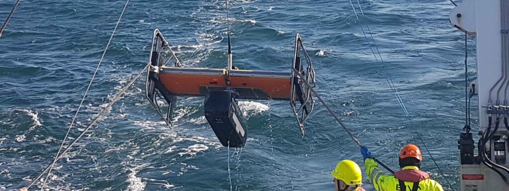
Solstice multi-aperture side-scan sonar (MAS) significantly increases the operational envelope of your underwater vehicle by providing wide swath coverage, at high resolution – all while consuming very low power.

Solstice side scan sonar

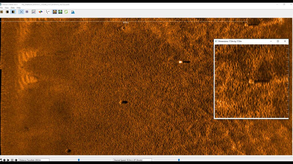
Capture every feature and every detail in ultra-high resolution.

Key benefits

  • Mission ready; designed to support search, classify and map (SCM) and hydrographic operations
  • Small and compact arrays; optimised for low-logistic AUVs and towed bodies
  • Survey more ground in a single pass; 200 m-wide swath ensures high coverage rates
  • Along track resolution of 0.15°; best in class delivering maximum detection rates
  • Collocated side scan image and bathy improves your situational awareness
  • Consumes only 18 W power: budget friendly and increases your AUV’s endurance
  • Depth rated to 300 or 600 m

Solstice offers enhanced underwater detection capabilities for various missions, including mine countermeasures, archaeological, search, and salvage operations. The system provides high-performance coverage with large 200m swaths on each side, enabling efficient site characterisation without sacrificing detail. Its class-leading imagery allows you to make confident classification decisions more quickly, with the added versatility of deployment on both autonomous underwater vehicles (AUVs) and towfish platforms. By improving probability of detection and decreasing false alarms, Solstice significantly increases the overall efficiency and reliability of underwater exploration and survey missions. It is suitable for:


  • Autonomous underwater vehicles (AUV)
  • Site survey and characterisation
  • Mine countermeasures (MCM)
  • Remotely operated vehicles (ROV)
  • Delivering pixel perfect imaging

Exceptional high-contrast seafloor imagery across diverse water depths

How it works

Solstice, designed by Wavefront Systems and commercialised by Sonardyne, is a world-leading side scan sonar for autonomous underwater vehicles (AUVs) and towed bodies. Its advanced technology delivers exceptional seafloor imagery through multiple aperture arrays with 32 multibeam elements, enabling superior signal-to-noise ratio performance and stunning imagery at extended ranges. The sonar’s unique back-projection beam-forming technique ensures focused imaging for every pixel, eliminating distortions caused by platform motion and guaranteeing 100% ground coverage across diverse water depths.

Designed for a wide range of marine missions including hydrographic, archaeological, search, salvage, and mine countermeasure operations, Solstice stands out through its innovative features. Its real-time array calibration dynamically recalibrates hydrophone elements multiple times per second, compensating for dynamic strains and maintaining linear element alignment. The system produces high-contrast imagery in environments ranging from 600-metre depths to very shallow littoral waters, utilising a specialised array technology that provides wide swath coverage with exceptional shadow contrast.

Jump to

Overview

Huge capability, small form-factor; perfect for man-portable and micro-AUVs

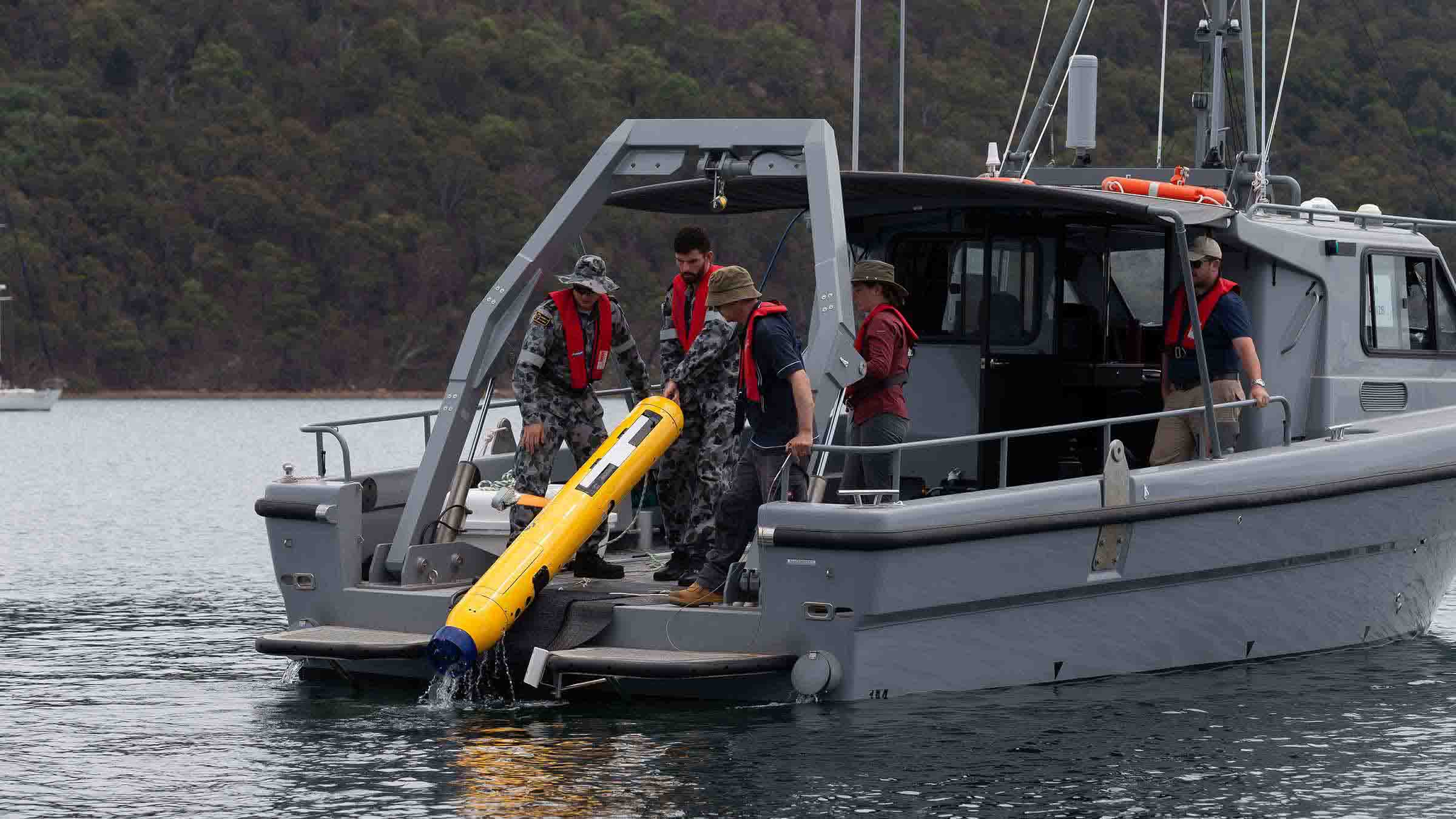
AvTrak 6 Nano provides navigation aiding, tracking, communication and mission planning – all in an incredibly small form factor. Fit it, and your micro or small AUV will be equipped to undertake simultaneous USBL tracking via a surface vessel and robust telemetry for AUV-to-vessel and AUV-to-AUV communications.

Small in size, big in performance

AvTrak 6 Nano may be our smallest acoustic transceiver, but its features and performance are anything but.

It’s built on the same 6G hardware and Wideband 2 digital signal architecture found in its larger cousin, AvTrak 6, all packed into the smallest possible form factor.

Use it with our popular MF USBL Ranger 2 family to track your AUVs or seafloor nodes. Then use the Sonardyne Messaging Service (SMS) to exchange status messages with the USBL or other AvTrak 6 Nanos in your vicinity. With hundreds of units in the field, AvTrak 6 Nano is ideal for AUV swarms.

Like its larger cousin, AvTrak 6 Nano has been developed to meet the requirements of a wide variety of AUV mission scenarios, vehicle types and the operational demands for different industries.

For energy – it’s not just for AUVs. Integrate AvTrak 6 Nano with your seabed nodes and you have a network of sensors that can position and communicate with each other.

For defence – its small form factor and ability to enable surface to AUV or AUV-to-AUV communications, makes it a prime option for swarm or squad robotics operations.

For science – AvTrak 6 Nano enables an AUV to undertake simultaneous USBL tracking and telemetry with a research vessel, as well as AUV-to-AUV communications making your projects more cost and time efficient.

At a glance

  • Tracking, communications, and emergency relocation in one instrument
  • Use with Ranger 2 to track every move your AUV makes
  • Bi-directional acoustic modem with user selectable data rates; 200-9,000 bps
  • Wide voltage input range and multiple communication methods for robotics integration
  • Optimised for Ranger 2 Robotics pack for aiding navigation systems with remote position outputs
  • Housed variant or OEM for integration into vehicles

Mini but mighty

AvTrak 6 Nano measures just 192 x 55 mm, you won’t find a smaller AUV transceiver with this much capability. It has an operating range of 3,000 m, a depth rating of 500 m and full SMS and Modem functionality.

Going smaller still, AvTrak 6 OEM Nano redefines nano, measuring at just 95 mm x 43 mm. You won’t find a smaller OEM AUV transceiver with this much capability. Its omni-directional transducer is small too, at 49 mm diameter and 72 mm long.

Equipped with AvTrak 6 Nano, your AUV will receive unlimited data and share messages every navigation cycle when used with Ranger 2. By supporting the integration of a data payload inside every navigation signal, this allows more data to be transferred to and from AUVs with fewer transmissions which ultimately reduces power consumption and increases mission endurance.

A common configuration enables the USBL system to communicate with a squad of AUVs equipped with AvTrak 6 Nanos, broadcasting to all the position of each member of the squad to aid the navigation solution and improve their situational awareness. Each AUV then replies in sequence with status information.

AvTrak 6 Nano can also be used to enable AUV-to-AUV communications and choose from seven telemetry schemes ranging from 200 bps to 9,000 bps of effective user bandwidth. Either for short burst communications or full large quantity data upload from seabed monuments.

General

• Our smallest combined transponder, transceiver, and telemetry link
• Open interfaces and protocol
• Supports AUV swarm operations

Ownership

• AvTrak 6 Nano: Transceiver, 0.5m cable tail, integration guide, manual
• AvTrak 6 OEM Nano: PCB, remote transducer, integration guide, manual
• Warranty: 1 year return to Sonardyne service centre

Performance

• Depth rated to 500 m
• Effective data transfer rates between 200 and 9000 bps
• Emergency battery life >90 days
• Range precision better than 15 mm
• 3000m tracking and communication range

Design

• OEM Board set measures just 95 mm x 43 mm
• Omni-directional transducers
• Integrated depth sensor supports horizontal tracking
• Low power and compact for ease of integration

Specifications table

Feature Type 8262 AvTrak 6 Nano Type 8262 AvTrak Nano OEM
Operating range >3,000 m >3,000 m
Depth rating 500 m 500 m (standard),
3,000 m (optional)
Operating frequency MF 20–34 kHz MF 20–34 kHz
Transducer beam shape Omni-directional ±130º Omni-directional ±130º
Source level 
(re 1 µPa @ 1 m) Modem 175 dB 175 dB
Tracking & telemetry 184/175 dB 184/175 dB
Range precision Better than 15 mm Better than 15 mm
Communication interface RS232, 3V3 TTL RS232, 3V3 TTL
Depth sensor 50 bar abs +/-0.7% FS 50 bar abs +/-0.7% FS
Power supply 12–28 V dc 12–28 V dc
Power consumption Wideband Listening (Battery) 5 mW 5 mW
Wideband Listening (Ext. Power) 20 mW (including trickle charge) 20 mW (including trickle charge)
Battery Charging 60 mW to 2.5 W (depending on battery charge state) 60 mW to 2.5 W (depending on battery charge state)
Peak (During Transmission) <30 W SMS, <20 W Modem <30 W SMS, <20 W Modem
Battery life Quiescent Listening >90 days >90 days
1 Sec Ping Rate >12 hours >12 hours
Battery charge time 12 hours 12 hours
External connections Subconn MCIL8M Molex Microfit
Mechanical construction Polymer n/a
Transducer wire length n/a 150 mm (6”)
Operating temperature -10 to 45°C -10 to 45°C
Storage temperature -20 to 55°C -20 to 55°C
Dimensions Length x diameter 192 x
55 mm
n/a
Transducer (length x diameter) n/a 72 x 49 mm
PCB board assembly (length x width x height) n/a 95 x 43 x 42.5 mm
Hole centres (M2 clearance – length x diameter) n/a 71.5 x 35 mm
Weight in air/water 584/162 g n/a
Weight (OEM) PCB in air n/a 138 g PCB + 12 g cable
Transducer in air/water (estimated) n/a 200/150 g

Manuals and quick start guides

Software and firmware

Jump to

Overview

Reliable AUV tracking

The most versatile instrument you can fit to your AUV. Built for simple integration on medium to large AUV platforms, all-in-one functionality comes as standard with AvTrak 6. The system enables your AUV to perform simultaneous LBL ranging, USBL tracking, and AUV to vessel/AUV to AUV communication.

Add AvTrak, add capability to your AUV

AvTrak 6 has been designed to form part of your integrated AUV tracking and navigation system.

Built on our 6G hardware platform running secure Wideband 2 spread-spectrum signal processing, AvTrak 6 combines the functions of transponder, transceiver and telemetry link in one low power unit that meets the requirements of a wide variety of AUV mission scenarios, vehicle types and the operational demands for different industries.

For energy – whether you’re operating a resident vehicle over-the-horizon or deploying an AUV for a pipeline inspection, AvTrak 6 is a key enabler for your oilfield and renewable energy projects.

For defence – AvTrak 6 technology provides amazing flexibility bringing together tracking, navigation aiding and secure battlespace communications into one low logistics payload that’s perfect for unmanned covert and swarm missions.

For science – AvTrak 6 is an excellent choice for your long-endurance ocean observation platforms, with the added ability to communicate and download data from seafloor sensor arrays.

The unit is fully compatible with our family of survey quality LBL and USBL navigation systems. It supports Sonardyne Messaging Service (SMS) allowing USBL position fixes to be sent to your vehicle or for status messages to be retrieved from the topside system.

At a glance

  • Combines tracking, communications, and emergency pinger functionality in one instrument
  • Track your AUV in USBL mode, localise it in LBL transponder mode
  • Bi-directional acoustic modem with user selectable data rates; 200-9,000 bps
  • Integrated outputs enable control of a release, burn-wire or drop-weight functions
  • Worried about onboard power interruption? AvTrak’s internal battery provides days of emergency vehicle relocation tracking
  • Choice of hardware configurations to simplify vehicle installation

Are you ready to add the AvTrak advantage?

AvTrak 6 is available in a variety of configurations to meet your mission profiles.

A popular option is an omni-directional unit with integral or remote transducer options. For operations at depth, an integral directional transducer option is common.

A flexible configuration assists the AUV manufacturer with the mounting of AvTrak 6 within the AUV and ensures the highest levels of acoustic performance. Low-medium frequency (LMF) and high-power (HP) versions of AvTrak 6 are also available.

An AUV equipped with AvTrak 6 can receive navigation updates from any 6G compatible USBL or LBL system, send status updates to multiple 6G instruments including other AUVs and synchronise clocks with other 6G instruments to better than 50 microseconds as standard.

That’s not all, there is an option to include an HPR400 Series tone for compatibility with a variety of other acoustic systems and transponders and another option to enable a RSPSK Modem upgrade for large volume data transfers.

It’s simple to integrate to your AUV using our rich 6G protocols and command language and RS232 serial interface. Choose from over 600 independent acoustic addresses and AvTrak 6 enables your AUV to work as part of a swarm if required.

General

• Emergency burn-wire, drop-weight, or release options
• Open interfaces and protocols
• Supports AUV swarm operations
• Combined transponder, transceiver, and telemetry link in one low power unit

Ownership

• What’s in the box: AvTrak 6 and manual
• Warranty: 1 year return to Sonardyne service centre

Performance

• Depth rated to 3,000 m and 7,000 m
• Effective data transfer rates between 200 and 9000 bps
• Emergency battery life 30 days
• Range precision better than 15 mm
• LMF (14-19 kHz) and MF (19-34 kHz)

Design

• Different configurations including omni-directional and directional transducers
• Integrated depth sensor supports horizontal tracking
• Low power and compact for ease of integration
• OEM option also available

Specifications table

Featured Type 8220-3111 Type 8220-7212
Depth Rating 3,000 m 7,000 m
Operating Frequency MF (20–34 kHz) MF (20–34 kHz)
Transducer Beam Shape Omni-directional Directional
Transmit Source Level
(re 1 µPa @ 1 m)
High Power 187 dB 193 dB
Low Power 181 dB 187 dB
Tone Equivalent Energy
(TEE) WBv2+
High Power 193 dB 199 dB
Low Power 187 dB 193 dB
Range Precision Better than 15 mm Better than 15 mm
Depth Sensor ± 0.5% full scale ± 0.5% full scale
Communications Interface RS232 (9,600–115,200 baud) RS232 (9,600–115,200 baud)
External Supply Voltage 24 or 48 V dc (± 10%) 24 or 48 V dc (± 10%)
External Power Sleep ~650 mW ~650 mW
Wideband Listening ~1 W ~1 W
Battery Charging 6 W 6 W
Peak (During Transmission) <50 W <50 W
Battery Life (Li-ion 15 V) Listening 30 days 30 days
Continuous 5 Sec Interrogation Approx. 6 days at low power Approx. 6 days at low power
Operating Temperature -5 to 40ºC -5 to 40ºC
Storage Temperature -20 to 55ºC -20 to 55ºC
Mechanical Construction Anodised aluminium alloy and plastic Anodised aluminium alloy and plastic
Dimensions (Diameter x Length) 93 x 500 mm 97 x 513 mm
Weights in Air/Water 5.1/2.2 kg 7.0/3.5 kg
Options Remote, cable
connected transducer
Right-angle connector
Jump to

Overview

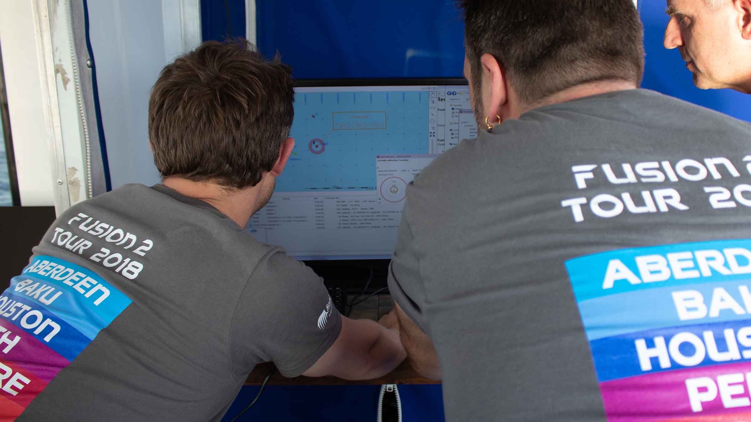
Revolutionise your underwater operations with Fusion 2

It’s not just software; it’s a game-changer for your underwater operations, streamlining workflows, maximising efficiency and empowering your operations with our 6G+ and Wideband 3 technology.

Control all your subsea Long Baseline (LBL), Sparse LBL, and SPRINT Inertial Navigation System (INS) projects from a single software suite. That’s the power of Fusion 2.

Unite your navigation and positioning for seamless efficiency

Fuse your workflow and control all your Long BaseLine (LBL), Sparse LBL, and SPRINT Inertial Navigation System (INS) projects from one intuitive interface. No more juggling multiple programmes – Fusion 2 simplifies your operations.

From subsea structure installation, metrology, pipeline and spool piece monitoring to pipeline positioning and more, Fusion 2 streamlines your subsea navigation and positioning. It connects LBL, Sparse LBL, and SPRINT INS for smooth workflows, real-time calibration and efficient deployments. This future-proof technology unlocks the potential of 6G+ and Wideband 3 instruments.

Real-Time Calibration: For faster, more efficient Sparse LBL operations, Fusion 2 allows real-time calibration of seabed transponders using Simultaneous Localisation and Mapping (SLAM). Eliminating delays and ensuring you collect accurate data from the start.

Enhanced efficiency through optimising hardware mobilisation. By consolidating control under one program, you require less equipment offshore, reducing costs and simplifying logistics, as well as saving you valuable setup time.

Built for our latest 6G+ instruments, Fusion 2 unlocks the full potential of Wideband 3 signal technology, ensuring your operations are at the forefront of subsea navigation.

Fusion 2 – fuse your systems for optimal performance

Why Fusion 2 is perfect for your operations

Do more with less – no need to operate two independent software and hardware systems to control your 6G LBL and SPRINT INS – Fusion 2 does it all in a single interface.

Fusion 2 LBL allows you to run calibrations in real time. Meaning you spend less time calibrating and more time collecting the right data, first time.

Lower your start-up costs: for practical, reliable LBL INS, Fusion 2 supports use of our SPRINT 300 with fewer transponders.

Backed by over 40 years of LBL system experience, Fusion 2 is the obvious choice for your offshore installation projects. Its 6G+ technology allows centimetric subsea positioning in all water depths. Highly robust and accurate instruments, professionally supported by our in-house engineers and surveyors, have made it the system of choice for subsea structure installations for decades.

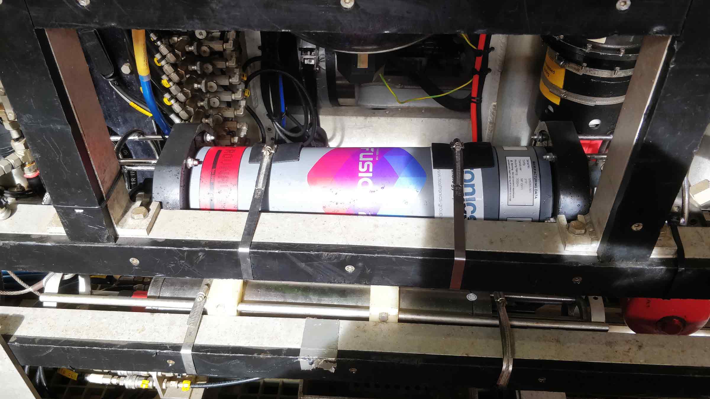
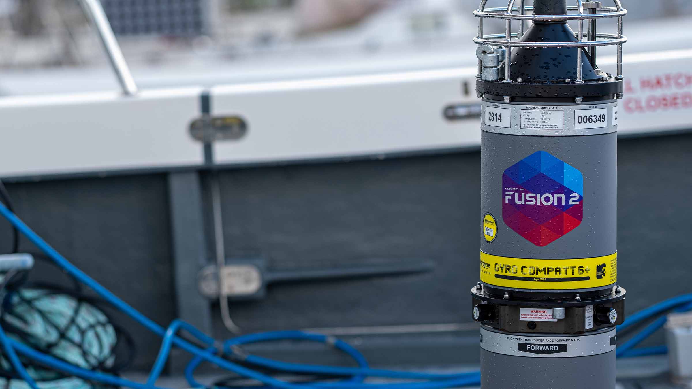
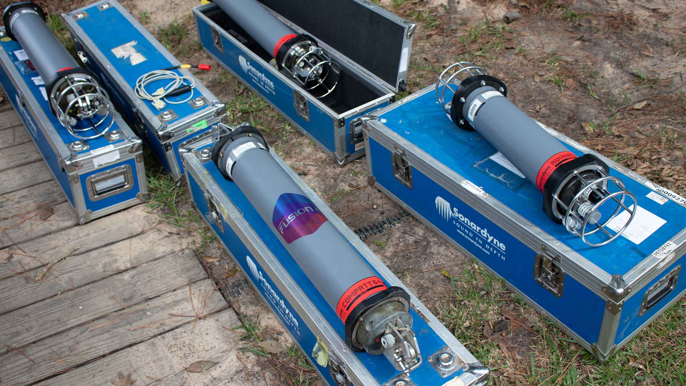
Used with products such as GyroCompatt 6+, it provides you with centimetric positioning along with class leading Lodestar gyroscopes for heading, pitch and roll measurements all in a single, easy to deploy instrument.

If your underwater operations require precise measurements, an acoustic metrology system using several Compatt 6+ transponders can be placed in a network on the seabed / structures / hubs. The depths of the Compatts can then be accurately measured and 6G+ Wideband acoustic ranges collected between them.

Fusion 2 enables your seabed transponders to be SLAM calibrated in real-time for easier and faster Sparse LBL operations. And by embedding sensor data with high-update navigation ranging data, there’s no more interruptions to positioning updates at critical moments.

You’ll begin to see the benefits even before your project teams head offshore. Acoustic and INS projects can be configured and checked onshore prior to vessel mobilisation – saving you time, streamlining procedures and helping you to further de-risk operations.

If you need to tailor your operations, Fusion 2 enables multiple computations, comparing different set-ups, allowing you to pick the one you want. Sparse LBL might suit one operation more than LBL and vice versa. Now it’s easy to check, on-site, which works best for you.

For optimal performance, Fusion 2 can be used with a number of our products – including Gyro Compatt 6+, Compatt 6+, SPRINT-Nav, ROVNav 6+ / mini ROVNav.

To further increase operational efficiency, digital signal processing protocol, Fusion 2 is best paired with Wideband 3, which you’ll find inside our trusted 6G platforms, Compatt 6+ and ROVNav 6+.

Wideband 3 gives you sensor data alongside navigation ranging data, providing your operators with real-time positions and sensor data at the same time. This allows the acceleration of update rates by a factor of ten, eliminating latency issues.

Support

• Work side-by-side with our Projects Group from concept to deployment
• Systems are manufactured and tested at our world-class in-house facilities before delivery
• Talk to our experienced team about our USV data harvesting service
• 24-hour support, wherever you are in the world

Design

• Optimised for 6G+ and Wideband 3
• Combined acoustic LBL and INS navigation
• Intelligent troubleshooting built-in
• Reduced hardware requirements
• Subsea hardware options
• High precision Compatt 6+
• High power, long-range ROVNav 6+ transceiver
• Combined LBL transponder and Lodestar AHRS Gyro Compatt 6+

Specifications

Feature Specification
Design The most powerful INS and LBL system on the market
Seamlessly combines INS and LBL positioning techniques
Incorporates 50 years of subsea navigation innovation and know-how
Positioning for all phases of construction survey
Full range of real-time array calibration options: SLAM, Baseline and Box-In
Comprehensive EPSG geodesy database
Calibration and positioning calculations in scale-free reference frame
Performance Better than 4 times precision improvement over USBL with SPRINT INS
Up to 3 cm Range-aided positioning accuracy with SPRINT INS
Up to 3 cm LBL positioning accuracy
Simultaneous LBL tracking of ROVs and structures with heading computation at up to 1 Hz
Acoustics Sonardyne Wideband 3 digital acoustics for reliable performance in all environments
Support for Multiuser Compatt 6+
Embedded Wideband 3 sensor data retrieval from Compatt 6+ for seamless tracking and faster calibration

Frequently asked questions

Sparse LBL (range-aiding) FAQs

What are the pros and cons of different positioning methods?  

Why is Sparse LBL array planning important and what are the key considerations? 

What is a Sparse LBL (range-aiding) set up?  

What is Sparse LBL (range-aiding) used for?  

What is LBL (Long BaseLine) underwater positioning? 

Planning 6G beacon deployments

How to mount and extract an ISO image

SPRINT, SPRINT-Nav, Lodestar and Lodestar-Nav troubleshooting

How to use Fusion 2 LBL and INS dongles

Frequency management is obsolete. Here’s why.

What should I do if my Sonardyne security dongle expires or reports a problem?

How to download or upload files using Filezilla

Why am I getting old / incorrect data from my GyroCompatt 6+?

How to turn on a Lodestar Gyro Compatt using Ranger 2 or Fusion 2

I’m outputting a GGA from Fusion 2 / Ranger 2 to NaviPac but the position isn’t appearing in the correct location?

Will Compatt 6+ work with Ranger 2 and Marksman?

Can Compatt 6+ be used in the same LBL array as standard Compatt 6?

What is the difference between Compatt 6 and Compatt 6+?

If I’m using Fusion 2, can I choose to use Wideband 2 or Wideband 3 telemetry?

Will my ROVNav 6 work with Compatt 6+?

Will my ROVNav 6 work with Fusion 2?

How sparse is a sparse LBL array?

What software and firmware is compatible with SPRINT and Fusion 2 Systems?

Do I need to upgrade to Compatt 6+ and ROVNav 6+?

How to QC a Sound Velocity (SV) in Fusion 2

How far can my Compatt 6+ be above the seabed?

How to plan my sparse LBL array (guidance note)

How do I calibrate my sparse LBL array?

How do I set up structure deflection monitoring (SDM) in Fusion 2?

Do I need to use a scale factor in Fusion 2?

Can I use Compatt 6+ Multiuser in Fusion 2?

How do I perform a SLAM calibration in Fusion 2?

How to input or output time in Fusion 2

How do I perform an LBL calibration in Fusion 2?

How do I set up SPRINT-Nav in Fusion 2?

How do I set up sound speed collection and pressure to depth conversion in Fusion 2?

How to connect a SPRINT-Nav in Fusion 2

Manuals and quick start guides

Jump to

Overview

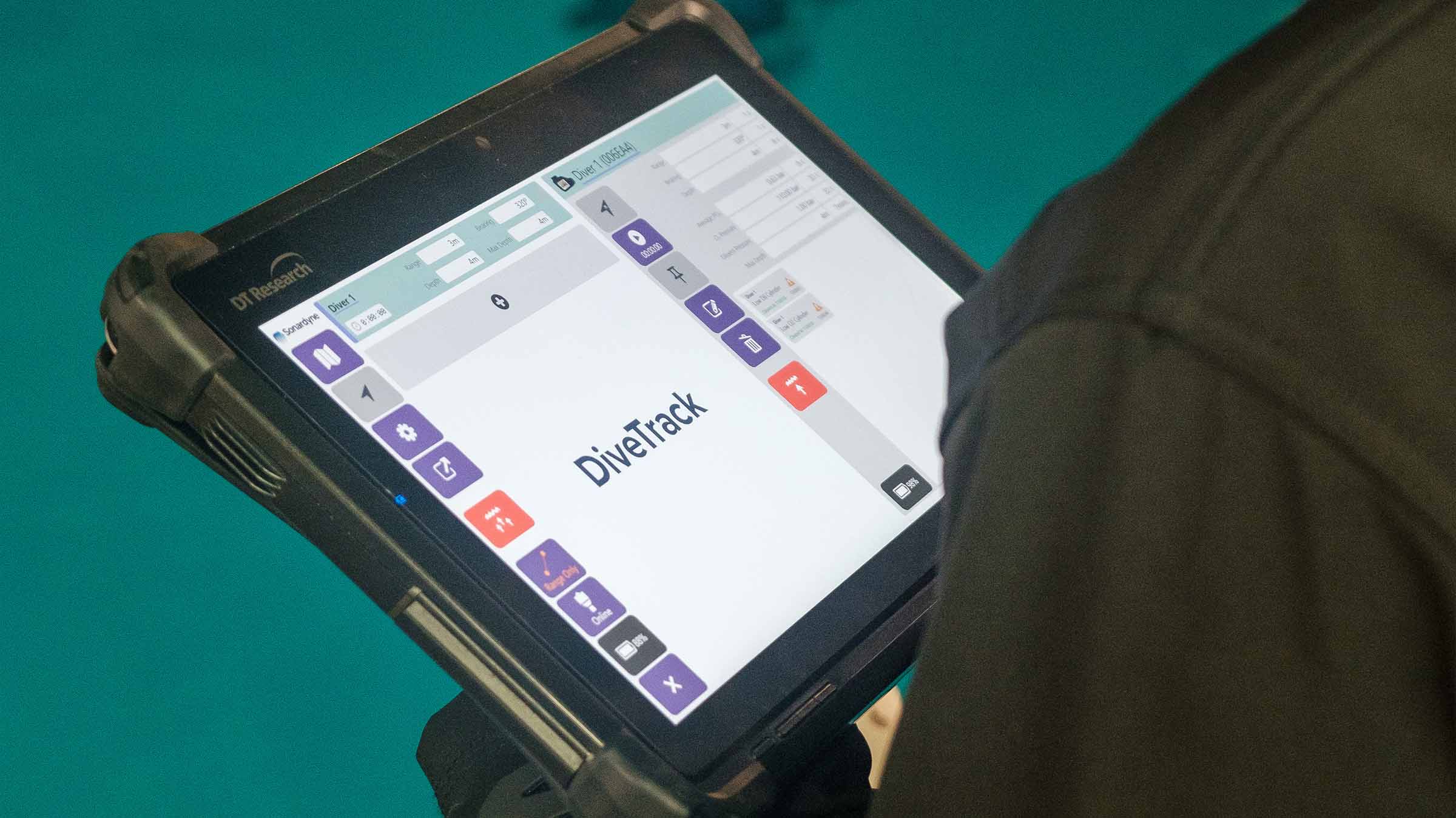
Keep Your Divers Safe and Connected with DiveTrack

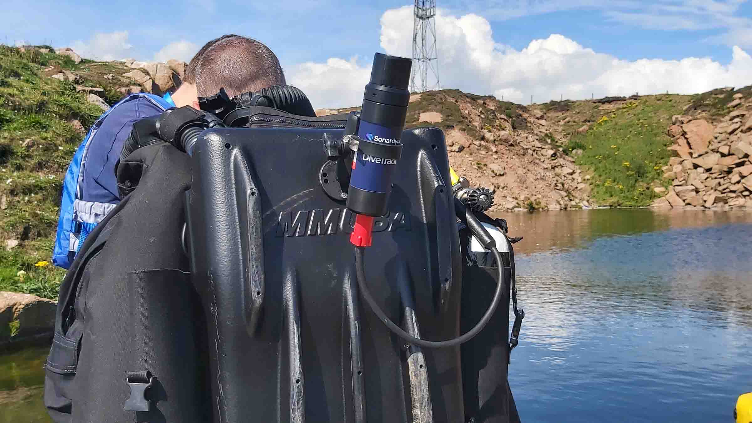
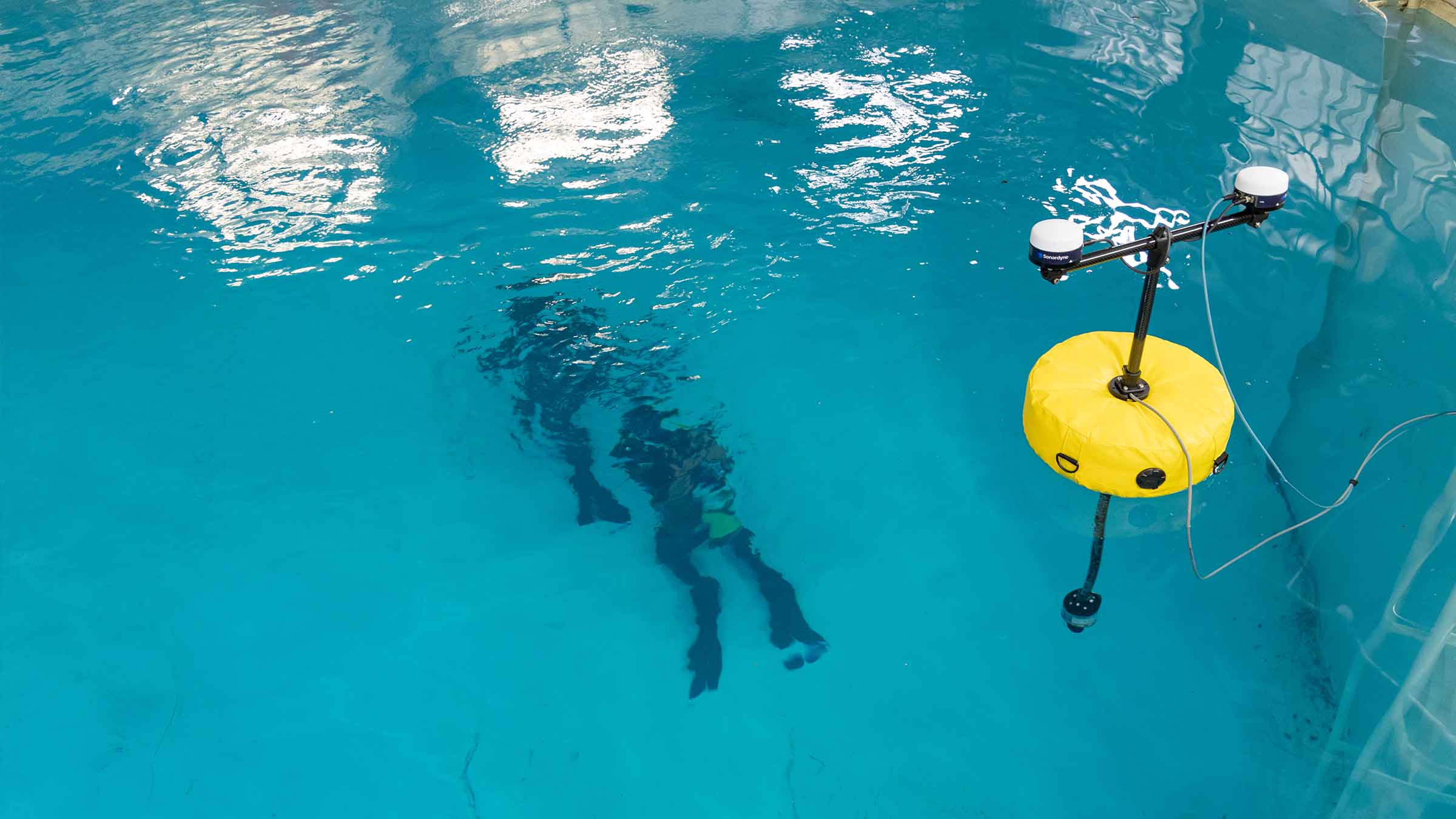
Transform your dive operations with our pioneering portable diver tracking and safety system. Designed with your team in mind – DiveTrack delivers the performance and reliability you need with the simplicity you want.

Do you want to know where your divers are and how they are performing? DiveTrack has got you covered! Designed with simplicity and ease of use in mind, DiveTrack’s excellent performance and reliability will enable your dive team to stay safe and informed.

Revolutionary technology at your service

Key advantages for your operations


  • Real-time tracking and communication with your dive teams
  • Intuitive operation – no acoustic expertise needed
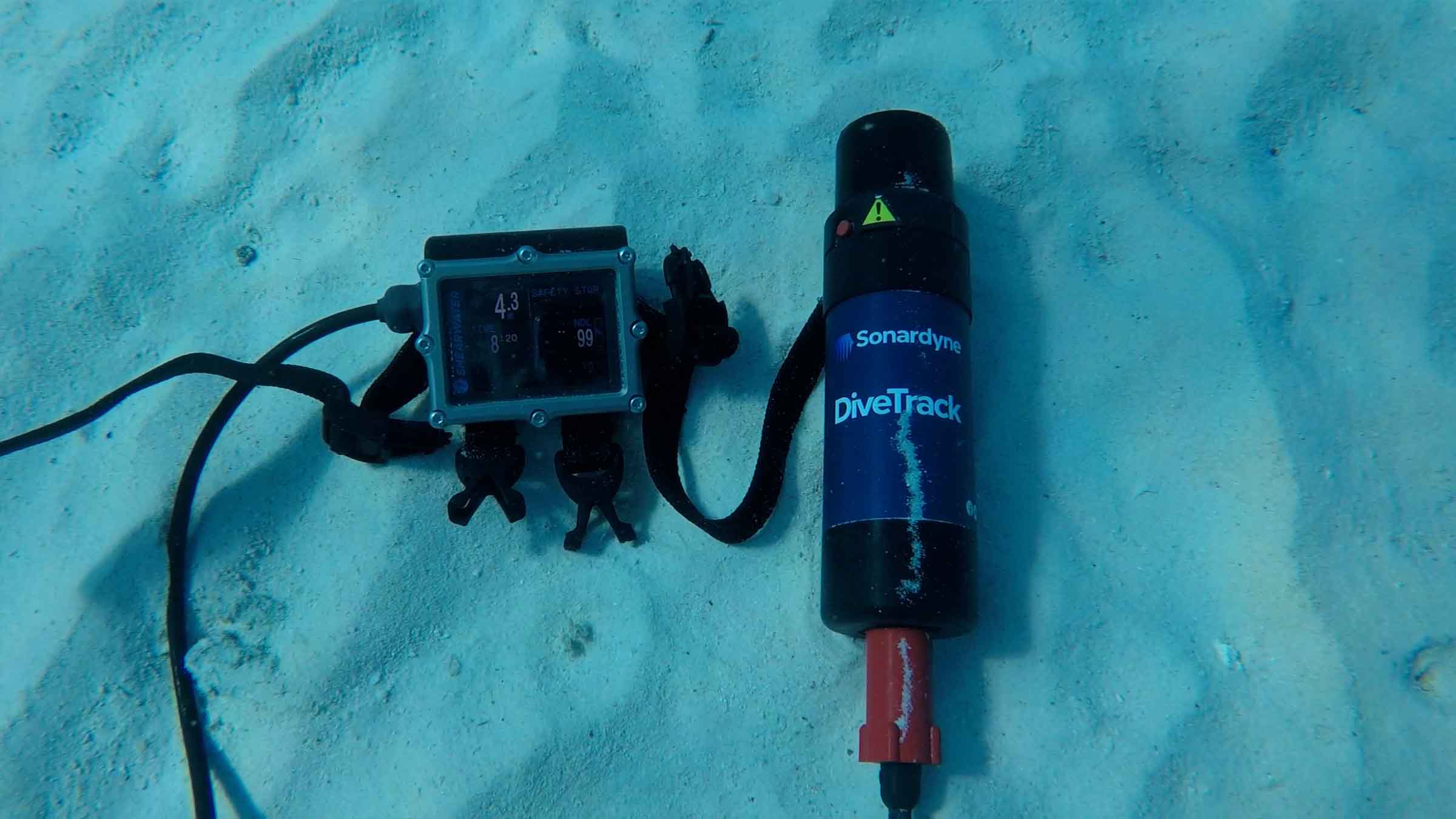
  • Seamless integration with industry-leading dive computers and rebreathers from Shearwater Research and JFD
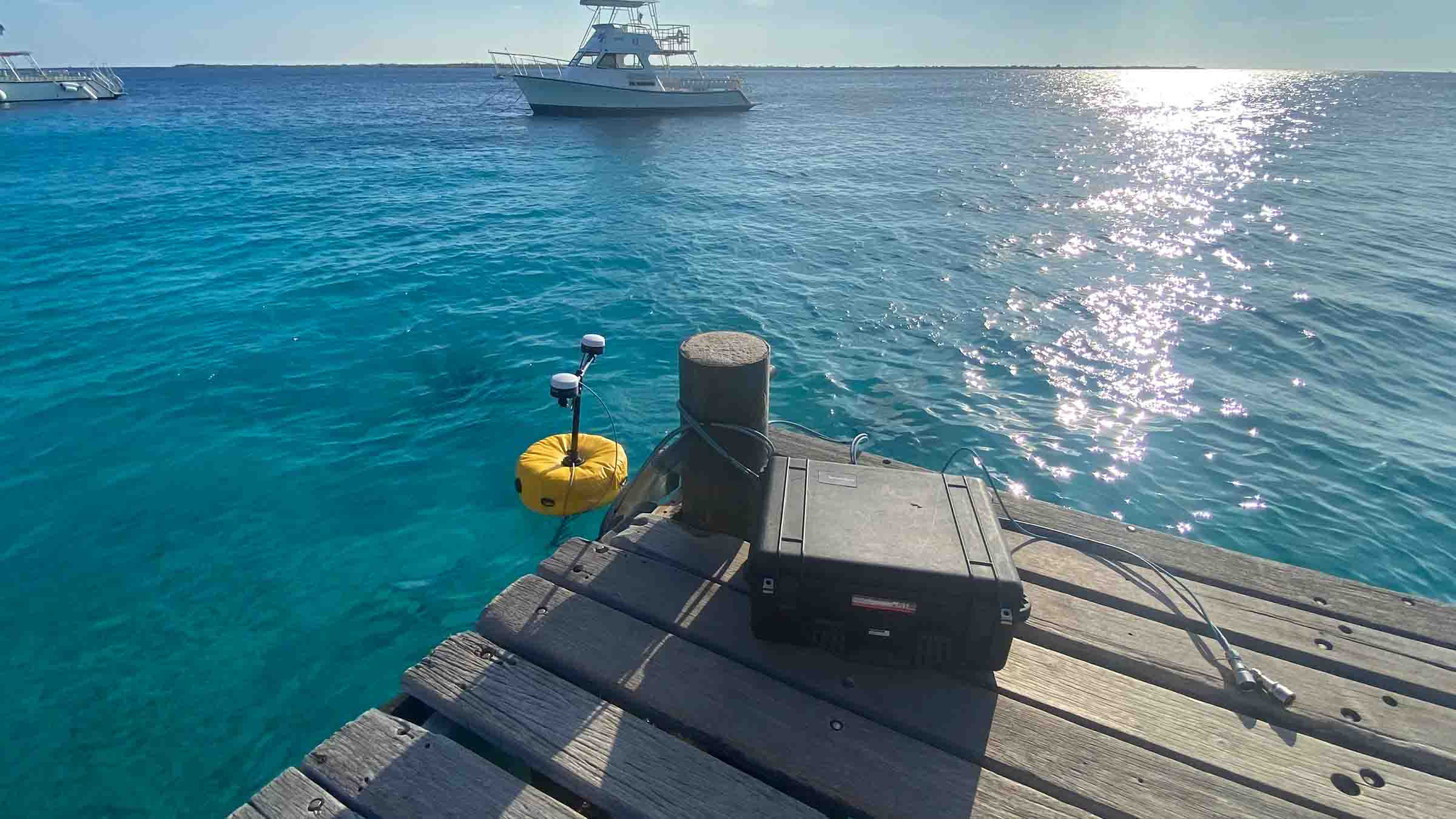
  • Quick deployment from dockside or RHIB with our simple deployment kit
  • Unrestricted by export controls

Our breakthrough digital signal architecture delivers you:


  • Superior performance in challenging shallow water environments
  • Extended range capability for long-distance dive profiles
  • Simultaneous tracking of all divers
  • Intelligent acoustic management
  • Real-time updates through our intuitive interface

DiveTrack testing with Shearwater

Built for real-world performance

DiveTrack gives you complete visibility of your dive operations. Building on our expertise in USBL and telemetry systems, we’re helping you push the boundaries of what’s possible in diver training and operations – all from just two rugged, easily portable, Peli cases.

Your complete solution includes:

Compact command unit housed in an IP-67 rated Peli case featuring:

  • Up to 10 hours of battery life
  • Integrated USBL positioning
  • 10-metre cable
  • Wi-Fi connectivity
  • GNSS heading for calibration-free setup
  • Space for your laptop or tablet

Intelligent charging station in a second Peli case:

  • Charges up to 8 DiveTrack transponders
  • Secure transport configuration
  • Automatic ‘safe flight mode’ when stored
  • 10+ hours of operational endurance per transponder
  • Universal connector system for various dive computers

Working with industry leaders for the perfect setup

Enhancing capabilities and extending missions
  • The Sonardyne solution
  • Shearwater integration
  • JFD compatibility

Performance

• Up to 5% slant range
• 8 targets tracked simultaneously
• >1500 m max tracking range
• >10 hours battery life

Design

• Portable, rugged
• Simple to connect and deploy
• Easy to use, training available if required
• Developed with divers, for divers

Ownership

• Warranty: 1 year return to Sonardyne service centre
• ITAR Controlled: No
• UK Export License: Not required
• Configure a system including DiveTrack command unit, transponder transport box with 4/8 transponders, buoy/vessel deployment kit, tablet

Acoustic

• MF frequency (20-28 kHz)
• Uniquely addressed transponders for ease of use
• Digital signal architecture for high-level shallow water performance
• Omni-directional tracking and data exchange

Specifications

Feature DiveTrack Transceiver DiveTrack Transponder
Operating range >1,500 m >1,500 m
Depth rating n/a 100 m
Frequency band MF (20-28 kHz) MF (20-28 kHz)
Transducer beam shape Omni-directional ±130º Omni-directional ±130º
Source level (re 1 µPa @ 1 m) 181 dB 181 dB
Range precision Better than 15 mm Better than 15 mm
Position accuracy 3-5% slant range n/a
Communication interface Ethernet/Wi-Fi RS232/CANbus
Depth sensor n/a 10 bar abs ±0.7% full scale
Power supply 12/24 V dc & 115/230 V ac 12/24 V dc
Power consumption – charging ~30 W ~6 W
Battery life – Quiescent listening n/a >3 days
Battery life – at DiveTrack ping rate >10 hours >10 hours
External connections Bulgin 6000 series Subconn MCIL8M
Mechanical construction Polymer & Stainless Steel Polymer
Operating temperature -15 to 50°C -30 to 50°C
Storage temperature -30 to 55°C 30 to 55°C
Dimensions (length x width x depth) 177 x 106 x 106 mm 192 x 55 x 55 mm
Weight in air/water 1.84/0.99 kg 584/162 g
Peli case dimensions (length x width x depth) 524 x 428 x 206 mm 524 x 428 x 206 mm
Peli case weight in air 13 kg 13 kg

Software and firmware

Jump to

When you need to transfer large amounts of subsea data over short distances – you need BlueComm 200 UV

Transform your underwater operations with BlueComm 200 UV, our pioneering wireless optical communication system. You’ll experience game-changing data transfer speeds enabling true wireless subsea operations, with rates up to 10 Mbps at distances reaching 75 m – even in bright conditions.

Innovation at work

We’ve engineered BlueComm 200 UV to push the boundaries of your underwater communication. Using advanced LED technology and sensitive photomultiplier tubes, you’ll achieve communication ranges up to 75 m. Its design houses the emitter separately from the receiver, ensuring optimal performance and reliability.

Fast and flexible – key features to power your mission

  • Lightning-fast data transfer: 2.5 to 10 Mbps at ranges up to 75 m
  • Optimal performance: Perfect for moderate to low turbidity dark water (>200 m depth or at night)
  • Flexible deployment: Connect with your AUV, ROV, USV or surface dunker system
  • Deep-rated capability: Ready for operations up to 4,000 m
  • Speed of light technology: Experience unprecedented data transmission rates

Perfect for your platform

Perfect for your:

  • Autonomous Underwater Vehicles
  • Extra-large uncrewed underwater vehicles (XLUUV)
  • Uncrewed Surface Vehicles
  • Remotely Operated Vehicles
  • Tracking and communications systems

Working with lights on? BlueComm 200 UV maintains reliable communication even with artificial lighting present. Operating at ranges up to 75 metres, it’s your go-to solution for ROV and AUV applications requiring illumination, such as video recording missions.

Both systems offer incredible energy efficiency – transfer more than nine gigabytes of data using just one Lithium D cell battery.

Specifications table

Feature Type 8361 BlueComm 200 UV
Depth rating Up to 4,000 m operation
Data rate 2.5–10 Mbps
Optical communication range Up to 75 m
Mechanical construction Anodised aluminium or titanium
Supply voltage 24–36 V dc
Communications interface 10/100 Base-T Ethernet (static IP address)
Command interface Graphical user interface or Ethernet UDP command set
Receiver unit
Receive wavelength UV (band pass filter blocking visible light)
Receive angle 180° (omni-directional)
Receiver weight in air/water 7.3/3.1 kg
Power consumption 10 W
Emitter unit
Optical transmit power 6 W (radiated light)
Optical wavelength options 405 nm (ultra violet)
Emitter beam shape 180° (omni-directional)
Emitter weight in air/water 3.6/2.6 kg
Power consumption 30 W (bandwidth allocation dependant)
Environmental and dimensions
Operating temperature range -5 to 40°C
Storage temperature -20 to 55°C
Dimensions (length x diameter) Receiver 384 x 136 mm
Emitter 199 x 136 mm


Manuals and quick start guides

Optics

• 405 nm (UV) optical wavelength
• 180° (omni-directional) beam pattern
• 10 W / 15 W receiver / transmitter optical transmit power

Design

• Titanium and glass construction
• Subconn connectors
• 5.7 kg weight in water, emitter and receiver

Performance

• 2.5 – 10 Mbps data rate
• 4000 m depth rating
• Up to 75 m optical communication range

Ownership

What’s in the box?
• Manual, 2 test cables and 2 sets of one emitter and receiver
• Warranty: 1 year return to Sonardyne service centre
• ITAR controlled: No
• UK export licence: Not required

Pioneering new era in deepwater seismic monitoring: OD OBN 

Shell Brasil, Petrobras, Sonardyne, and SENAI CIMATEC are pioneering autonomous technology that transforms how Brazil's challenging pre-salt fields are monitored. Now entering a major pilot array phase, the ground breaking On-Demand Ocean Bottom Node programme promises more efficient, cost-effective 4D seismic surveillance—with fewer people and lower environmental impact. This critical milestone brings us a step closer to a fundamental shift in deepwater reservoir management.

The challenge

Brazil’s pre-salt reservoirs lie in more than 2,000 m water depth, plus another 3,000 m beneath the seabed, making seismic imaging particularly challenging.

Traditional seismic surveys using ocean bottom nodes (OBNs) provide high-quality seismic data, but are often expensive and logistically complex, involving the repeated deployment and recovery of nodes using remotely operated vehicles (ROVs).

These factors can limit the frequency and economic viability of frequent 4D seismic campaigns, which are essential for understanding reservoir dynamics over time.

This is particularly challenging for monitoring large pre-salt carbonate fields where production by alternating water and gas injection (WAG) generates subtle and complex 4D signals that are difficult to measure.

These signals require on-demand monitoring with sufficient fidelity and repeatability to overcome the high levels of survey noise prevalent in conventional node-based surveys.

Saipem's FlatFish

The solution

Launched in 2018, the OD OBN programme is a research and development collaboration between partners Shell, Petrobras, SENAI CIMATEC and Sonardyne, supported under the Research Development and Innovation funding clause of the Brazilian National Agency for Petroleum, Natural Gas and Biofuels (ANP).The On-Demand Ocean Bottom Node (OD OBN) programme marks a pivotal step in addressing these challenges, providing a disruptive approach to time-lapse seismic data acquisition.

It is a pioneering new system for acquiring 4D seismic data, which delivers more efficient and cost-effective surveillance of complex pre-salt fields. At its core is a long-term OBN system that can remain on the seabed for several years, capturing seismic data that can be recorded and harvested “on-demand” using autonomous underwater vehicles (AUVs), without the need for repeated deployment and retrieval cycles.

Vast quantities of seismic data are harvested wirelessly using an AUV such as Saipem’s ‘Flatfish’, that implements the through-water optical interface to interrogate the OD OBNs, as developed under a separate ANP programme sponsored by Shell.

This AUV data harvesting approach eliminates the need for node recovery, dramatically reducing vessel time, operational complexity and associated costs.

Key Sonardyne technologies include wireless acoustic communications, required for long range recording control and node clock time offset measurement, and Sonardyne’s BlueComm extremely high-speed optical communications for short range data harvesting to a nearby AUV or remotely operated vehicle (ROV).

The results

Over 2,000 days of trials of pre-production nodes have been conducted across various pre-salt fields including Sapinhoá, Itapu and Buzios. These have successfully demonstrated acoustic control, high-fidelity data acquisition and optical data harvesting using BlueComm, as well as comparing OD OBN data with that of other commercial nodes.

The final round of tests concluded successfully in 2025, with results presented at the IMAGE ‘25 conference in Houston and SBGf Rio’25 conference in Rio de Janeiro.

Next steps

A pilot array of 660 pre-production nodes is currently being produced at a brand-new manufacturing facility in Camaçari, near Salvador, Brazil. Hundreds of these nodes will soon be deployed at the Mero field operated by Petrobras for extended testing and performance evaluation.

The long-term vision is to use autonomy and state of the art communications technologies to enable operators to conduct more frequent ‘on demand’ seismic surveys, with higher fidelity data, at a fraction of the cost of conventional seismic survey methods.

This capability will provide clearer insights into fluid movements and pressure changes within the reservoir, helping to optimise production strategies, improve decision making and enhance recovery rates in one of the world’s most challenging offshore provinces.

OD OBN is not just an incremental improvement, but a fundamental shift in how the industry approaches deepwater reservoir management.

Your challenges. Our solutions

Learn how our custom engineering team can support your project, no matter how big or small, from the shallows to the deep.

Mapping the future for seagrass beds in Plymouth Sound

Seagrass beds are incredibly important ecosystems that offer a range of ecological benefits. Not only do they provide crucial habitats for a diverse array of marine wildlife, especially in coastal areas like Plymouth Sound, they can also store carbon, helping to mitigate the effects of climate change. These underwater meadows serve as nurseries for many species of fish in the early stages of their life, offering them protection and abundant food sources. Additionally, seagrass beds help to stabilise the seabed with their root systems, preventing coastal erosion and maintaining water quality by trapping sediments and nutrients.

Drake seabed
Seagrass
Seagrass seeding
Seagrass map
Drake seabed
Seagrass
Seagrass seeding
Seagrass map

However, despite their importance, locating and monitoring seagrass beds using traditional methods, such as survey boats, presents significant challenges. Seagrass typically grows in shallow waters, which can make it difficult for boats to navigate close enough to the shore to obtain accurate data. Traditional survey boats are often large and cumbersome, making them hard to manoeuvre in shallow or rocky areas. This limitation can result in incomplete or inaccurate assessments of seagrass distribution and health.

Furthermore, the process of using boats for surveying can be time-consuming and labour-intensive. It often requires multiple trips and extensive manual labour to map out the seagrass beds accurately. The visibility in shallow waters can also be poor due to water turbidity, further complicating the survey efforts and leading to potential underestimation of seagrass coverage.

Finding a solution…

This is where Sonardyne and Wavefront Systems come in. The solution, which combines Sonardyne and Wavefront technology, is a survey boat carrying Solstice MAS™ (Multi-Aperture Sonar) as well as a SPRINT-Nav Mini mounted to a pole, deployed over the side of the boat; this maps the chosen area in 200 m wide strips. Once this survey has been completed, the sonar data that has been captured is then processed to create a map of the seagrass in a GIS. A Remotely Operated Vehicle (ROV) is then sent to the same area to ground truth features on the seabed to check that they are how they have been interpreted by Solstice MAS. The ROV is fitted with SPRINT-Nav Mini, allowing us to track its position underwater and guide it, using the map, to the features identified by Solstice; the ROV is also fitted with a camera and the recorded video can be used to create 3D models of the seabed.

Wavefront Systems’ Solstice MAS uses sound signals to produce high-quality images of the seabed, capable of creating images 200 metres wide at high resolution even in shallow water environments, all while consuming very little power. The Solstice family of sonars are built on unique MAS technology and are designed to fill the gap between standard side scan sonars, which are typically simple in design but give low image resolution, and Synthetic Aperture Sonars (SAS), which are expensive, more susceptible to complete data loss due to platform movement and also produce vast amounts of data. In order to execute more detailed mapping, Solstice MAS requires a high quality navigation sensor, which in this case is SPRINT-Nav Mini.

SPRINT-Nav Mini is an all-in-one vehicle guidance and navigation instrument, which combines AHRS data, Doppler Velocity Logger (DVL), Inertial Navigation System (INS) and depth sensor into a single housing. Having SPRINT-Nav Mini fitted onto the ROV provides positioning input, as well as attitude and heading data.

Creates images

0

m

at high resolution

ROV fitted with

0

D

camera

Solstice creates images

0

m

each side of the vessel

Adopting these technologies on such small versatile platforms opens the possibility of high-grade survey data in shallow waters. As a result of the cross Covelya Group collaboration between Sonardyne and Wavefront Systems, a high-definition map of seagrass beds can be created with a greater degree of accuracy than was previously possible with more traditional methods.

A seagrass restoration project conducted by the Ocean Conservation Trust (OCT) in Plymouth Sound, which involves monitoring, conserving and expanding the existing seagrass beds can be enhanced with the use of an ROV which has SPRINT-Nav Mini fitted to it. To help grow the existing seagrass beds, the OCT are placing seagrass mats on the seabed in Plymouth Sound. A survey boat fitted with Solstice and SPRINT-Nav Mini followed by an ROV fitted with SPRINT-Nav Mini can then be used to monitor and create a map of where these mats have been placed so that they have a better understanding of the success of the restoration and expansion project.

“Collaboration is key to our success as a business as we strive to offer integrated solutions to key markets and applications. Our operating companies run independently. However, the overall value when they come together can be significantly more than the sum of their parts. Coupling Wavefront’s Solstice multi-aperture sonar with high performance inertial navigation solutions from Sonardyne and applying it to significant sustainability initiatives such as mapping and monitoring the extent of seagrass beds on the South coast of the UK, makes the effort all the more worthwhile. Great job by the team, continuously innovating to realise increased efficiency and higher value datasets for such worthwhile causes.”

Phil Hart, VP of Integrated Technology, Covelya Group

“We use Wavefront’s Solstice multi-aperture sonar to map seagrass because it provides high-resolution images out to 100m on each side of the vessel even in shallow water. The sonar images give us both a broad and detailed view of marine habitats which is hard to create using other methods. Solstice produces reliable and repeatable results so is ideal for measuring and monitoring changes to the seabed. Solstice also requires very little processing and is compatible with standard side scan processing software, so we find it an efficient solution for habitat mapping over large areas.”

Peter Holt Marine habitat monitoring applications specialist, Sonardyne

Robotic inspections ensure fish nets are securely anchored

With precise positioning a priority in fish farm mooring maintenance, Aquasky Ltd needed a reliable tracking system for their remotely operated inspection vehicle (ROV). Find out how Micro-Ranger 2 proved equal to their challenge.

The challenge

In aquaculture, second only to the welfare of the fish, the maintenance and exact positioning of the nets and their moorings is critical. With specific areas set aside for fish farms, it’s important that the nets don’t drift out of place or into shipping lanes. To maximise production, fish farmers need to moor as many nets as possible within their area whilst ensuring the moorings don’t damage each other. All of this requires careful and precise placement and inspection, which is where Aquasky Ltd excel.

Aquasky Ltd first operated as a small diving company servicing local fish farms along the west coast of Scotland. During 2011/13 it branched out into moorings inspections using a Videoray Pro 5 ROV. They continued to grow and now provide their services to all the major fish farm companies operating in Scotland plus some others abroad.

As the aquaculture industry has grown so has the size and complexity of its subsea equipment. Aquasky Ltd use an ROV to inspect mooring lines and anchors is to verify their integrity and location. The number of anchors can vary from 26 to over 60 for each site depending on the size of the farm.

Accurate identification of anchor positions is essential. Farmers must ensure assets remain within their lease areas as moving outside can lead to suspension of the lease, with significant financial impact.

It is also essential to maintain separation between moorings to prevent any damage. Anchors being incorrectly positioned can result in the following causes of mooring failure: –

  1. Anchor chains rubbing through the mooring ropes.
  2. Mooring ropes contacting rocky reefs and rubbing through.
  3. Moorings being positioned where the anchors cannot locate firmly into the seafloor, for example on clean rock.

In the event of mooring failure, movement of the cages can initially result in the nets coming into contact with the submerged farm grid system. The nets are then squashed, and the fish are forced into a very small area with reduced oxygen available, resulting in them becoming stressed and dying.
In the event of catastrophic failure, cages can break away and drift ashore or out to sea, resulting in the fish escaping into the wild population.

As part of the inspection process, Aquasky provide their clients with detailed reports confirming the location and condition of the moorings.

In order to meet their requirements, Aquasky needed a positioning system that was accurate, compact enough to fit on a small ROV, reliable and portable so that it could be transported to and used in all of their clients’ locations, including those abroad.


Aquasky
Aquasky
Aquasky
Aquasky

The solution

Portable and quick to mobilise, our Micro-Ranger 2 USBL system can be used from any waterside location or vessel to track divers, underwater vehicles and equipment. Ideal for using in lochs and challenging water.

It is our smallest ever underwater tracking system. Everything is engineered to fit in one medium-sized carry case. Apart from a laptop to run the software, nothing else is needed and the size is so small, it can be carried on a plane. Perfect for when Aquasky find work outside of Scotland.

For their anchor and mooring inspections, Aquasky attach a Micro-Ranger 2 Nano transponder to their ROV which then travels around the fish farms. A transceiver is mounted on a vessel nearby and acoustic signals between the transponder and transceiver are used to establish the ROVs, and therefore the anchor/moorings, position. This position can be displayed for in-water tracking and output in real world co-ordinates for interfacing into external chart plotting systems for the clients reports.

“We needed an accurate positioning system that continues to work as mooring lengths increase and in a noisy subsea environment. Having used other cheaper systems, the Micro-Ranger 2 is the only one able to consistently supply reliable positions for anchors at the 300m length currently used by the farms we service.“ Steve Barlow, Founder, Aquasky Ltd.
 

The results

By adding Micro-Ranger 2 to their subsea inspection tool kit, Aquasky Ltd are able to provide a service that has become the industry standard for fish farm inspections. Their use of an ROV means that inspections are quicker, safer and less expensive than traditional diver inspections. Using Micro-Ranger 2 ensures that the ROV never gets lost and provides accurate data which is vital for the inspection reports.
“We needed an accurate positioning system that continues to work as mooring lengths increase and in a noisy subsea environment. Having used other cheaper systems, the Micro-Ranger 2 is the only one able to consistently supply reliable positions for anchors at the 300m length currently used by the farms we service.”

Steve Barlow, Founder, Aquasky Ltd

“Aquasky’s use of our Micro-Ranger 2 is a great example of its versatility for application in a different marine market sector. Using it for their ROV operations has allowed Aquasky to set the industry standard for fish farm monitoring and inspections. We are delighted to have supported them in doing this and look forward aiding their future operations.”

Alan MacDonald, Head of Sales, UK, Europe and Africa, Sonardyne

Up to

0

%

slant range accuracy

Tracks up to

0

targets sequentially

Maximum

0

m

tracking range

0

Hz

position update rate

Over the horizon robotic data harvest aids Shell's net zero ambition

Sonardyne, working with XOCEAN’s uncrewed surface vehicles (USV), deliver a lower cost, lower risk and lower carbon, remote acoustic data harvesting service to Shell from their Ormen Lange gas field in the Norwegian Sea.

Shell’s Ormen Lange gas field is a deep-sea site 120 km / 75 miles off the coast of Norway. As Norway’s second largest gas producer, it plays a key role delivering stable gas supplies to Europe. Built on the site close to Storegga, a major landslide which occurred some 8000 years ago, about 5 million tonnes of rock was used to prepare the seabed for subsea equipment back in 2005. The field has been operational since 2007. Ormen Lange is distinctive in that it doesn’t have conventional surface operation platforms.

Close monitoring of any seabed movement is key to prevent any potential impact to the pipe system. Monitoring of the ocean floor around the well heads is conducted by seabed sensors. The first monitoring array at the site saw 203 Acoustic Monitoring Transponders (AMTs) installed in 2011. These sensors enabled monitoring of changes in pressure and tilt to provide an understanding of seabed movement.

This array was recovered in 2016 due to battery limitations and uncertainty in drift. Today the monitoring is undertaken by an array of 75 Sonardyne seabed Pressure Monitoring Transponders (PMTs). Shell took the decision to install 30 PMTs in 2019 with a further 45 installed in 2020.

The challenge

Without surface platforms, acoustic data from the subsea sensors had to be harvested by crewed vessels in the early years of the field’s operation. This was costly, carbon heavy and posed a risk to personnel in often challenging sea conditions.

With a company ‘Powering Progress’ strategy to achieve net-zero emissions by 2050, Shell was looking for an alternative data harvest method that would reduce cost and risk as well as its carbon footprint.

The solution

Marine robotic platforms provide the opportunity to remove carbon and personnel risk. Working with the customer and XOCEAN as a sub-contractor we developed a solution that would save time, costs. and carbon, while also eliminating the human risk element, using a USV to conduct the data harvest.

The proposal was to use our HPT 3000 transceiver mounted to an XOCEAN USV to remotely harvest data from the 75 seabed PMTs. The HPT 3000 is perfect in terms of size, weight and power for deployment from a USV and can communicate with seabed transponders at depths up to 995 m (or 4,000 m with an extended range version).

XOCEAN USVs are perfect for the data harvesting mission at Ormen Lange. They enable full over-the-horizon 24/7 operations. This means that operators and data analysts can remain safely onshore whilst the operation takes place and data can be sent ashore and verified in near real-time using the USV’s satellite communications.

This satisfied Shell’s commitment to accelerate the transition of their business to net-zero emissions and to integrate sustainability within their business strategy. Following the successful PMT installation in 2019, a five year project was agreed where Sonardyne are responsible for the data delivery to Shell and XOCEAN are responsible for delivering the transceiver to the field for data collection via their USV.

The results

The project began in January 2020 and this was the first time a remote USV data harvest was completed offshore in Norwegian waters by any operator.

Whilst the USV and HPT 3000 were in Norwegian waters surveying the Ormen Lange site, the Sonardyne and XOCEAN personnel never left their bases in England and Ireland.

The data harvest was monitored in real time, 24/7 and the two teams were in contact with each other as well as the remote equipment. This mean that data was being monitored by our team as it was collected and there was no risk of the USV returning with missing or irrelevant data. Had there been any missed or partially collected data the Sonardyne team could ask the XOCEAN team to return to recollect from a particular PMT whilst still in the field, rather than waiting until the vessel returned and having to send it out again.

Successful data harvests have been conducted yearly since 2020 and continue to be a cost effective, low impact operation. This year we collected data from the Ormen Lange site twice, in Spring and Autumn.

If you think you have a similar challenge for us, contact us today.

XOCEAN says

“Through the successful PMT data harvest campaigns at the Ormen Lange Field, XOCEAN has demonstrated reliability by leveraging our cutting-edge USV technology in partnership with Sonardyne. Our uncrewed survey vessel platform offers a safe, reliable and low carbon solution for the delivery of ocean data. As we continue developing our remote operations, we recognize its pivotal role in steering the world towards the realization of the UN Sustainable Development Goals.”

Tomas Frafjord Norway Country Manager, XOCEAN

Sonardyne says

“Transforming how data is harvested at the Ormen Lange site and the on-going success of this project demonstrates the current and future potential of marine robotics in offshore operations. Moving from crewed to uncrewed vessels for such operations enables the drive to reduce carbon emissions in marine industries. Similar remote data collection solutions can be realised in any marine operation that requires long-term data collection. Where Sonardyne communications are built into seabed sensors we can communicate with them using instruments fitted to marine robotic platforms.”

Aidan Thorn Business Development Manager – Marine Robotics, Sonardyne

Norske Shell says

“In Shell we are always looking for new, innovative ways of working that can reduce risk to both people, assets and the environment. Uncrewed surface vessels have proven a highly suitable vessel for downloading PMTs. Carbon emissions are reduced to almost zero, and we don’t need to send people offshore anymore for the downloads. Considering the long distance from shore to field and the often unstable weather conditions in the area, solid planning and vessel management is essential.”

Egil Syre Project Manager, Norske Shell