Sonardyne, a leading provider of underwater acoustic technology, today announced the launch of its new Origin Acoustic Doppler Current Profilers (ADCPs). The new ADCPs are designed to be simple to operate with class leading data results, integrated communications and positioning, making it ideal for a wide range of applications, including marine research, offshore renewable energy and defence.
The new Origin ADCPs feature several innovations that make them the most advanced ADCPs available on the market. These include an integrated modem for communications and positioning, new Edge processing capability and ecosystem where you can write your own apps for your projects. As well as the industry standard PD0, our new and exclusive A-gram and B-gram proprietary data formats offer up to ten times greater spatial resolution producing astonishing data sets.
There are two introductions for the new Origin ADCP family:
• Origin 600 – Origin 600 has a five-beam configuration with a central vertical beam. Paired with a maximum sampling frequency of 4Hz on all beams, it’s suitable for waves and turbulence applications, as well as mean currents. Combining field proven transducers with an integrated modem, internal rechargeable battery and Edge processing, Origin 600 expands ADCP capability for acquiring mid-range current profiles
• Origin 65 – Origin 65 boasts a unique acoustic design that increases robustness, reduces cost, and all the while maintaining outstanding current profiling performance. The integrated modem allows for remote actions, whilst the PIES functionality delivers high-precision time-of-flight and average in-situ sound velocity data
Geraint West, Head of Science at Sonardyne said, “We are excited to launch our new Origin ADCP family at Ocean Business 2023. This new product represents a significant advance in ocean current profiling technology. It will provide our customers with the highest quality data, specifically tailored to their needs, in the most challenging of environments.”
The new Origin ADCP is available now. For more information, please visit Origin 65 or Origin 600.
Monitoring and inspection are now a growing part of the offshore wind farm life cycle. Can we do it more efficiently, using CTV down-time to deploy robotics? Mike Ellis and Aidan Thorn take a look.
A lot of the focus on offshore wind has been about building the next, bigger, deeper wind farms. Rightly so. But, as we build more, we also build out the fleet of turbines that require regular maintenance – and there’s an increasing amount of it to be done. Could more be done with robotics and autonomy?
We think so. The UK alone now has a fleet of more than 11,000 offshore wind turbines. Each typically needs one or two instances of scheduled maintenance a year, plus regular unscheduled maintenance. That’s a lot of work for wind farm technicians, working from crew transfer vessels (CTVs) or, further offshore, from service operations vessels (SOVs).
Inevitably, there’s also a lot of waiting around for these vessels, especially CTVs, while they wait on technicians to complete their work. According to an ORE Catapult study, there’s 38% loitering time during planned maintenance, rising to 50% during unplanned maintenance. That’s a lot of time that could be optimised and spent doing other work.
At the same time, much of the underwater inspection and maintenance scope, particularly where underwater robotics are required, is being carried out separately, from larger, dedicated support vessels or SOVs.
![]()
Opportunity knocks
Longer term there’s an industry ambition to do much more of this work using robotics, without having to send technicians to sites. But until then, we have another opportunity. Let’s bridge the gap.
We live in a world where low-logistics underwater and surface robotic systems have come a long way. They’re easier to use and deploy than in the past and are increasingly capable of performing an increasing amount of the survey and inspection scope – whether that’s monopile inspection, cable surveys and seabed monitoring in and around wind parks. They’re also small – and don’t need to be accompanied by large support vessels.
We are starting to see funded development projects and even real-world applications where CTVs host robotic or autonomous systems, from remotely operated vehicles (ROVs) to uncrewed surface vessels (USVs). So the journey has started to seize this opportunity and make use of all that planned downtime, increasing CTV capability while reducing the workload of larger, costlier ships.
Where the CTV has a crane, they could act as mother ships to small USVs that could be recharged on deck and sent back out on their autonomous survey missions. A similar approach could be taken with SOVs, whereby the robotics platforms go and perform standard survey operations so that the SOV can focus on more challenging hands-on scopes?
![]()
Practical application
It sounds an obvious value gain, right? But how does this work in practice? It’s primarily about how the CTV – or SOV – will interface with the robotic platforms and how the vessel can be the interface back to shore.
Let’s start with the underwater interface. The use of acoustic underwater positioning systems, such as our Ranger 2 family of Ultra-Short BaseLine (USBL) systems for positioning, enables tracking, control and communications of your underwater assets from your CTV, whether that’s an ROV, tethered platform or autonomous underwater vehicle (AUV).
The vehicles themselves also have their own onboard navigation, such as our SPRINT-Nav hybrid underwater navigation family of instruments. This means your AUV knows where it is, where to go and where to return to. It also means that the data it brings back is the quality you need. SPRINT-Nav Mini is also a navigation solution for your USV, supporting everything from station keeping to riding out those GNSS bumps as it glides past turbine towers and making sure that there are no gaps in your data.
All of this is already being done today. It’s been done for decades from traditional support vessels. But it’s now also being done from smaller support vessels and even from USVs, such as Fugro’s Blue Essence or Ocean Infinity’s emerging Armada fleet. All of these operators, and others, are using 4G and satellite communications to control their surface and underwater robotics, including work class ROVs – that’s the surface to shore interface.
![]()
What does that mean in practice for CTV operations optimisation?
It means that during loitering you can undertake monopile inspections, scour monitoring and seabed surveys with a low-logistics ROV. You can do a jackup spud can imprint survey ahead of the next turbine major component replacement or repair. Or perform local cable route surveys, to make sure your inter array cables are behaving as they should be.
You can drop off your AUV and/or USV with a multibeam payload in the morning for a lawn-mower survey and pick it up on the way back home. All of this could be controlled from the CTV – or from shore.
Of course, there will be challenges in bringing in new ways of working, but it could offer a stepwise approach to increasing how much is done with robotics in offshore wind farms, without the need for humans on site.
What do you think? Is it time we looked at scaling up how we can better marry day-to-day crew transfer operations with the robotics capability that there is now in the offshore market? Are you already working on projects or operations that are combining CTVs with robotics? Or would you like to be? We’d love to hear your views and ideas. Get in touch.
*Mike Ellis is our business development manager for offshore renewable energy.
Aidan Thorn is our business development manager for marine robotics.
US oceanographic research centre Monterey Bay Aquarium Research Institute (MBARI) has chosen deepwater positioning technology from Sonardyne for its new, state-of-the-art scientific flagship the R/V David Packard.
The 50 m-long research vessel, named in honour of MBARI’s founder, David Packard, is being built to undertake a diverse range of missions in Monterey Bay and beyond, supporting the institute’s mission to advance marine science and technology to understand a changing ocean.
Once operational, the ship will accommodate up to 18 researchers and will enable MBARI’s continued exploration of the deep sea, from the midnight zone to the abyssal seafloor. The R/V David Packard will be the command center for the ROV Doc Ricketts, MBARI’s deep-diving remotely operated vehicle. The new research vessel will also be capable of deploying a variety of autonomous underwater vehicles (AUVs).
Underpinning this deep-water capability will be Sonardyne’s Ranger 2 Ultra-Short BaseLine (USBL) system, with an HPT 7000 transceiver, which will be integrated into the vessel via a Sonardyne deployment machine.
The choice means the R/V Packard is the latest in a line of MBARI vessels to utilise a Sonardyne USBL system for its science missions. In fact, MBARI was an early adopter of Sonardyne’s first USBL system, installing it on the institute’s very first research vessel, Point Lobos (retired in 2012), in the early 1990s. The R/V Western Flyer, MBARI’s current flagship vessel that will be retired this fall ahead of the arrival of the R/V David Packard in late 2023, was also fitted with Sonardyne’s first USBL system and has upgraded over the years to the latest, industry standard Ranger 2.
Ranger 2 is also the preferred USBL solution for many of the world’s leading ocean research institutes, where efficient use of vessel time and accuracy are paramount. It provides researchers with the ultimate flexibility, with its capability to track and communicate simultaneously with multiple scientific instruments, vehicles or towed platforms, at ranges up to 10,000 m. With Ranger 2, operations from seafloor geodesy through to AUV survey missions are supported, anywhere in the ocean.
[blockquote author=” Michael Kelly, Director of Marine Operations, MBARI”]”The ocean is vital to life on Earth. In the face of rising threats like climate change, MBARI’s work is more important than ever. We depend on a suite of diverse research tools to study the ocean. Sonardyne technology will help coordinate these instruments to give us valuable insight into a changing ocean”[/blockquote]
Geraint West, head of science at Sonardyne, commented, “We’ve had a long-running and close relationship with MBARI, so we’re really proud to be part of the next chapter in their story. At Sonardyne, we strongly believe in the critical work that MBARI is engaged in, as a better understanding of our changing oceans is critical to the future well-being of our planet.”
The ship is being built at the Freire Shipyard in Vigo, Spain and the order for the Ranger 2 system for the R/V David Packard was placed via Spanish integration company/agent EMA, Sistemas de Monitorizacion.
Brazil’s offshore is riding on a high that looks set to continue for some years to come. It can be a demanding place to work, but rewarding if you can meet those demands. Andre Moura, Sonardyne’s Head of Sales – South America, looks at how C-Innovation are doing just that and the role our USBL and INS systems play.
Brazil has always been a standout market. It has huge, technically challenging deepwater reserves that drive innovation in underwater technology. It’s a place where oil companies set a high standard for their suppliers, in terms of delivering high-quality projects, efficiently and on time.
For those that are up for the challenge, it’s a rewarding place to work. It looks like that will continue for some years to come, with Petrobras last year announcing $68 billion worth of investments in the five years up to 2026.
Last week, Rio Oil & Gas, reflected the positive mood. It was very much about getting all the work that Petrobras and others want done – and getting it done quickly, cost-effectively and to the highest standards.
C-Innovation in Brazil

C-Innovation’s Joe Griffin – operating in Brazil since 2011.
One of those making it happen is C-Innovation. C-Innovation, an affiliate of Edison Chouest Offshore (ECO) and its family of companies, is a global, integrated marine services company. It specializes in advanced subsea solutions, including ROVs, AUVs, subsea construction, fleet services, survey and positioning and tooling services.
The company was founded in 2007, to meet a growing demand for advanced ROV operations in the Gulf of Mexico, but it soon expanded. Survey Manager Tomás Peixoto has been with the company since 2011, when it started its first Survey contract in Brazil, with Petrobras.
Since then, C-Innovation has continued to grow in Brazil, adding many other clients, including Shell, Chevron, ExxonMobil, BP, PetroRio and Karoon Energy, all mostly for light subsea construction and inspection, repair and maintenance (IMR) operations.
More customers and work have meant it has needed more vessels. After starting with just two vessels – the Joe Griffin and Olin Conqueror – C-Innovation currently have 15 vessels operating in Brazil.

The Wildebeest 11
A mark of success in deepwater offshore Brazil
To do well in Brazil you need to deliver projects on time, efficiently and accurately, says Tomás.
“It’s really important that we don’t have down time and that we’re efficient. So our equipment – ROVs, sensors and survey equipment – has to be reliable and high quality,” he says.
“There are also high specifications that we need to meet. For example, that could be to achieve 95% of the positioning data out of a USBL system to an accuracy of 0.5% of water depth, including while the vessel is in motion during acceptance tests.” For example, in 1000 m water depth, the error has to be below 5 m – 95% of the time.
Choosing Ranger 2 for underwater positioning

Tracking, onboard the Joe Griffin.
To meet these requirements, including those specifications, we need high quality, reliable equipment, says Tomás. That’s why C-Innovation uses our Optimised Ranger 2 USBL system across its fleet since day one.
The Optimised Ranger 2 setup has our Lodestar AHRS co-located with the USBL transceiver, which achieves accuracy of up to 0.1% of slant range. Thanks to our Wideband 2 digital acoustic architecture, it has reliable performance in shallow and deepwater environments, which means consistent and uninterrupted tracking, even in noisy environments.
C-Innovation have also opted for high performance work class ROVs. They’ve always chosen Schilling UHD ROVs. Since 2016, it’s been fitting these with our SPRINT INS coupled with our Syrinx Doppler velocity logs (DVL).
Extending the limits of USBL operations

SPRINT extends the operating limits of their USBL and ROV systems, by compensating for unfavourable conditions when working at high elevation long laybacks or smoothing out any USBL dropouts. With SPRINT, they also spend less time in preparation before getting their ROVs to work, thanks to its quick INS to DVL calibration routine, says Tomás.
More recently, they’ve also been adding our SPRINT-Nav hybrid navigation instruments. SPRINT-Nav combines our SPRINT INS, Syrinx DVL and a high accuracy intelligent pressure sensor – all packaged in a single compact deep-rated housing that’s simple to integrate on both remote and autonomous underwater platforms. When using this system, the time saved is even higher, because it comes pre-calibrated.
The tight integration of inertial sensor and raw acoustic aiding data also enables SPRINT-Nav to regularly exceed the most stringent of positioning specifications, making it an ideal choice for vehicle guidance, station keeping and long endurance navigation with no positioning aiding.
Time-saving with Sparse LBL – and now SLAM calibration
SPRINT and SPRINT-Nav also help unlock another time-saving capability. By using either instrument, alongside our ROVNav ranging LBL ROV transceiver and our Fusion LBL software, C-Innovation has been able to perform sparse LBL operations.
Sparse LBL reduces the number of Compatts they have to deploy and box-in, saving time and money. With our latest Fusion 2 software, SLAM calibrations can be done real time and, if planned well, simultaneously to other operations. Now that’s real time savings.
In fact, C-Innovation was one of the first companies to do sparse LBL operations in Brazil in 2016-17. “Now more companies are requiring it because it is quicker and you need fewer Compatts,” says Tomás. “So we will see more of this happening as more customers see the benefit.”
Local support for Brazil’s deepwater
But there’s also another ingredient to making offshore operations in Brazil tick all the right boxes. That’s support. Not everything runs smoothly all the time – there are always unknowns. So that’s why in-country support is one of Tomás’ key ingredients to success here in Brazil.
“Having access to a Sonardyne technician when we need support or assistance is really important,” he says. “During Covid, this was a huge challenge, for everyone, but Sonardyne was able to support us remotely. This was done with local staff and was really important to us also. We employ a lot of Portuguese-only speakers, so having support from people who speak Portuguese is very helpful.”
Local support has been important to us at Sonardyne Brasil since we opened our first office here more than 20 years ago. Offshore technical support, repair, training and sales support are all handled by us in country.
Both through the pandemic and previous downturns, we’ve maintained our operations in country when many others closed their doors. That’s because we saw how important local support was to our customers. That has meant we’ve been able to build and strengthen relationships with companies like C-Innovation, who are also here for the long haul.
So yes, it can be a tough environment, with the most stringent technical demands. But we agree with Tomás, it’s challenging, but also a great place to work.
Get in touch to find out how we can help you.
Locating, surveying and then raising the iconic wreck of Henry VIII’s flagship, the Mary Rose, has gone down in UK maritime history. Forty years since it was raised from the seabed, Nigel Kelland, reflects on how Sonardyne played a key role in this fascinating piece of history – a role which continues, even today.
Today, many will have heard of the Mary Rose. She is an iconic example of maritime history, one of the earliest ships built as a warship. It’s now 40 years since she was recovered from the seabed in 1982, a feat that has helped to make her a household name. But, in 1971, when she was finally rediscovered off Portsmouth, by a dedicated search team, few would have recognized her name.
Indeed, little did I know then that I would be involved in both helping to survey and raise this magnificent ship over multiple decades, or that 50 years after her discovery – and long after my own retirement – the latest generation of Sonardyne’s technologies would still be being used on the site where she lay.

The Mary Rose today. Photo by Peter Kersten CC BY-SA 4.0
The discovery
In 1971, Sonardyne had been founded by John Partridge. His first innovation was the Rangemeter, a diver-operated Long BaseLine (LBL) system that used acoustic signals to measure distance underwater very accurately from an array of transponders
I had trialed it successfully at the Unit of Coastal Sedimentation for monitoring movement of sand waves in critical navigation areas for deep draft tankers. When I moved to BP’s research team at Sunbury it was adopted for measuring the position of pipelines in their West Sole gas field to a higher tolerance than we could achieve with towed sonar at the time. BP had required 0.5 m accuracy – in 1975, John’s Rangemeter achieved 155 mm.

Nigel Kelland holding the Mary Rose Rangemeter (BP).
At a 1973 diving conference in Stockholm, the instrument had come to the attention of Margaret Rule, an archaeologist who went on to become a key figure in the excavation and campaign for raising the funds to raise the Mary Rose for what is now the Mary Rose Trust.
Enter BP
But the stroke of luck came when Prince Charles became involved and, during a visit to BP, persuaded its then chairman, Sir Eric Drake, to support the Mary Rose project with technologies BP was using in the North Sea. The Mary Rose wasn’t yet the public sensation it became, but BP agreed and, as a marine geophysicist and diver, they called on me to suggest how they could help. As I had met Margaret Rule at the Stockholm conference, I knew exactly what she wanted!
And so, in 1975, Sonardyne’s and my more than 30-year involvement with what is still one of the most complex marine archaeologic projects in the world began. Over those years, both marine archaeological practice and Sonardyne’s technologies have evolved.
Rising to the challenge
It’s been a fascinating journey which spans the Rangemeter LBL system through to Sonardyne’s first and most recent Ultra Short BaseLine (USBL) and Wideband technologies. My first task in 1975, whilst working for BP, was to obtain an accurate site plan of the exposed frames to supplement diver survey checks using offset tape measurements from a rigid pole positioned over the frame heads.

The original plot of Rangemeter positions, clearly showing the curve of the hull.
The most important lesson was having to monitor, on a regular basis, the changing speed of sound around the wreck, due to temperature and salinity variations with each tide, a key factor in all subsequent Sonardyne operations worldwide. The computed positions were generally better than 100 mm and corrected an artificial straightening of the slight curvature of the structure. They also established control reference points for three-dimensional survey measurements during the excavation.
In 1979, after joining Sonardyne, dependance on an experienced survey-diver had been overcome by the company’s introduction of its vessel based Rangemaster LBL transceiver. Range measurements were taken to each transponder from specified targets using a remote transducer held by a Mary Rose diver, with whom I communicated over a hard-wired telephone. This was a precursor to subsequent world-wide operations using ROVs and AUVs. The positions were derived using a LBL survey application running on a HP desk top computer developed by Chris Pearce*, Sonardyne’s Technical Director. It was the first step in future survey applications.
Raising the Mary Rose
Monitoring the position of the hull under its lifting frame, with the assistance of a Sonardyne colleague David Lawes*, as it was transferred underwater to the recovery cradle using the giant floating crane vessel Tog Mor in October 1982, was a straightforward operation.

Sonardyne’s LBL positioning system comprising Mk2 Compatts and a PAN transceiver, with the latest positioning application running on a HP computer, operated with no problems during the 12-hour transfer.
Two major issues then arose that fortunately had no impact on the hull. One of the four lifting frame legs was bent outside its stabbing guide on the recovery cradle. It had to be cut off after the frame was docked under diver control, using the three remaining legs and replaced by an additional fly hook for the lift.
The far more dramatic incident occurred as the recovery cradle was being slowly lifted out of the water when the lifting frame collapsed with an enormous bang -witnessed by the millions of people watching world-wide on television, which is still seared on my memory! No damage occurred to the remains of the vessel, as the impact was absorbed by air bags located under the hull.

These incidents are discussed in Channel 4’s production “Raising the Mary Rose: The Lost Tapes”, that was broadcast during the 40th anniversary celebrations of the raising of the Mary Rose on Sunday (October 9), that I was pleased to attend in Portsmouth.
In a far more relaxed moment, David Lawes and I had the opportunity to explain the operation of Sonardyne’s equipment to Prince Charles, attending as President of the Mary Rose Trust, accompanied by Constantine of Greece. We gave encouragement to Charles for his planned televised dive on the hull by showing him the water temperature recorded by one of the array Compatts (I recollect 16.1 degrees Celsius).
Further Operations (2003 – 2005)
A Ministry of Defence (MoD) decision was made to possibly widen and straighten the approach channel to Portsmouth to accommodate the UK’s new aircraft carriers. As this would have affected the Mary Rose site, that still contained important artefacts, the MoD agreed to sponsor further work on the site that continued for three summers. As this required acoustic positioning, Sonardyne provided LBL and USBL equipment. This had the important benefit of providing real-world experience to development engineers, which was becoming increasingly limited offshore.

Crawler/excavator ROV fitted with a RovNav Transceiver.
The first operation was to remove the silt cover over the site using a Swan 2002 excavation ROV, which Sonardyne positioned with a RovNav transceiver. The LBL equipment used in 2003 included Mk4 Compatts and transceivers provided acoustic ranging resolutions of 15mm controlled from a PC running Sonardyne’s Fusion LBL application under Microsoft Windows. The Fusion system used a shipborne DGPS and gyro compass to position the survey vessel, ROV and divers in real-world co-ordinates.
The array deployment and calibration gave me the first opportunity to operate the system in a non-trial situation with impressive results. New artefacts and wooden structures from the bow section were excavated, including the 9 m stem post.
This created a major problem as the archaeologists needed to relate the stem timbers to the location of the hull, which had been recovered. Fortunately, a diving platform that had sunk during gale conditions in 1973 had been positioned using the 2003 system and by myself during the 1975 Rangemeter survey. I luckily found a copy of the survey plot prepared by BP in my Mary Rose file!

Multibeam plot of Mary Rose site with diving platform (blue box)
By correlating the position of the diving platform from each data set, my Sonardyne colleague Peter Holt* was able to superimpose the in-water position of the hull frames exposed at the seabed onto the current multibeam derived survey plot of the site. This allowed the recovered hull to be relocated back into the new survey plan.
Positioning during the 2004 season was carried out using a protype Sonardyne Scout USBL system, continuing the tradition of allowing Sonardyne developers to test new tracking systems on the Mary Rose site. Although less precise than the LBL system, it could be used for position monitoring of multiple divers and a recovery frame without the need for cables, with acceptable position accuracies of 100 mm to 500 mm.
The Scout system was again used in 2005 for artifact mapping when the opportunity was taken to carry out trials of the Wideband technology being developed by Sonardyne, with much better performance being shown under the shallow water reverberant conditions. The Scout USBL system was used to position the lifting crane hook during the recovery of the 9 m stem timber and a 4.8 m-long anchor, now on display in the museum. Scout systems went into use on many maritime archaeological organizations following the initial success on the Mary Rose site.
Diving on the Mary Rose today
Even today, there are still significant remains of the Mary Rose buried under the seabed and marine archaeology operations are ongoing, including using Sonardyne’s latest USBL systems.

Diving on the Mary Rose site with Mini-Ranger 2 in 2022. Photo from MSDS Marine.
In fact, just last month, one of those, Mini-Ranger 2, was being used on the site by marine archaeology specialists from the Mary Rose Trust and MSDS Marine as part of continued survey operations and identifying and marking where objects identified in geophysical data are located. The system was also used to provide additional diver safety during filming operations for a television show, due to air later this year.
From my first meeting with Margaret Rule and then seeing the timbers of this historic ship protruding from the seabed, and providing assistance during the recovery to seeing her on display in her full glory at Portsmouth Historic Dockyard today, has been an incredible journey that I’ve had the luck and honour to play a role in.
Interested in the history of the Mary Rose? Read more about the history of Sonardyne’s involvement and the technologies used in this historic project here.
Read more about the Mary Rose Trust here.
*Chris Pearce and David Lawes, like Nigel, are now retired. Peter Holt is Chief Technical Officer at HydroSurv.
Ireland’s new state-of-the-art multi-purpose marine research vessel RV Tom Crean has entered service equipped with Ultra-Short BaseLine (USBL) underwater positioning technology from ocean science company Sonardyne.
Delivered in July, the 52.8 m-long vessel delivers significantly enhanced capability to Ireland’s Marine Institute and other state agencies and universities.
The RV Tom Crean provides up to 3,000 scientist days per year for fisheries surveys, seabed mapping, deep water surveys, oceanographic and environmental research. The Ranger 2 USBL positioning system selected for the RV Tom Crean will play a key role in underpinning the delivery of these ocean services on a national level.
Ranger 2 can accurately track and simultaneously communicate with multiple underwater scientific instruments, vehicles or towed platforms, at ranges up to 10,000 m depending on its configuration.
For vessels equipped with a dynamic positioning system, Ranger 2 also can provide accurate and repeatable position referencing, in any water, without interrupting target tracking operations.
The equipment supplied to the RV Tom Crean includes a through-hull deployed HPT 5000 USBL transceiver, control room hardware and software, and a deep rated WSM 6+ transponder, a popular choice for tracking targets out to 4,000 m range.
In its primary role, the RV Tom Crean’s science crew will use Ranger 2 to precisely monitor the position of any underwater platform deployed from the vessel. This includes the Marine Institute’s remotely operated vehicle (ROV) Holland 1, autonomous underwater vehicles (AUVs), CTDs (conductivity, temperature and pressure sensors) and towed sleds and dredges, together with any equipment temporarily embarked to support science cruises.
Furthermore, the vessel will be able to share its underwater tracking and communications hardware with another of the institute’s vessels, the RV Celtic Explorer, because it also has Ranger 2 on board. The RV Celtic Explorer has used a Ranger 2 system to great advantage since 2011, so much so that the Ranger 2 for the RV Tom Crean was one of the first items of science equipment to be procured.
Aodhan Fitzgerald, Research Vessel Operations Manager at the Marine Institute, says, “The Sonardyne Ranger 2 USBL system on the RV Celtic Explorer has served us well over the past decade, supporting some exciting scientific research. Consequently, the installation of Ranger 2 on the RV Tom Crean is a big increase in capability and considerably increases our flexibility to support the diverse community that use our ships for research.”
Geraint West, head of science at Sonardyne, says, “Ranger 2 USBL is in service with national and not-for-profit ocean institutes the world over, supporting operations ranging from seafloor geodesy through to autonomous underwater vehicle (AUV) survey missions, in any ocean, in any water depth. Its capability and flexibility is invaluable to marine scientists and oceanographers where efficient use of vessel time and accuracy of observations are paramount.
“In a year when our Ranger 2 technology was used to help find the wreck of Ernest Shackleton’s Endurance in the Antarctic, it’s a timely entrance for the RV Tom Crean. He was one of Shackleton’s right-hand men and is often unsung outside of Ireland. Crean was known for his dependability, resourcefulness and inspiration to others – an inspired choice then for the Marine Institute’s new vessel.”
The RV Tom Crean was designed by Norwegian ship design consultants Skipsteknisk AS and built by Spanish shipyard Astilleros Armon Vigo S.A. It will be a modern, multipurpose, silent vessel, be able to go to sea for at least 21 days at a time, including in harsh sea conditions. The vessel replaces the 31 m Celtic Voyager, which was Ireland’s first purpose-built research vessel when it was commissioned in 1997.
Marine technology company Sonardyne has seen an uplift in orders for its Pressure Inverted Echo Sounder (PIES) technology into the exploration and reservoir surveillance market in the first half of this year.
The announcement was made on the opening day of the International Meeting for Applied Geoscience and Energy (IMAGE) in Houston where the company is exhibiting on booth #740.
Sonardyne’s PIES technology, which helps geophysicists to better understand the physical processes that occur in the deep ocean, has been acquired by a string of companies performing both towed streamer and ocean bottom node (OBN) deployments, highlighting increasing activity in the sector.
Among those investing in PIES are marine geophysics data and services company PGS Geophysical and ocean bottom nodal firm Magseis Fairfield. Geophysical services provider PXGeo has also ordered a number of Sonardyne’s PIES.
PIES is a long endurance, self-contained oceanographic instrument for precisely measuring average sound speed in the water column as well as water depth information. By collecting these observations as seismic data is being acquired, PIES helps to reduce uncertainty in the imaging data, helping to provide a clearer image and guide operational decisions.
“PIES continuously measure the two-way travel time of sound waves propagated through the water column from the seabed to the sea surface as well as the pressure (depth) at the seabed,” says Trevor Barnes, Sonardyne sales manager. “This data is used to calculate a continuous time history of the average water velocity and tidal variation throughout the entire water column.”
[blockquote author=” Trevor Barnes, Sonardyne sales manager”]”By doing this, these environmental variations can be removed from the reservoir imaging data, providing geophysicists with a clearer image of their reservoirs.”[/blockquote]
PIES are regularly used across the marine seismic market as well as by oceanographic institutions interested in understanding the ocean. The instrument can be deployed on the seabed by remotely operated vehicle (ROV) or freefall deployed from a surface vessel and configured for autonomous monitoring campaigns lasting several months to several years.
An embedded acoustic modem also allows users to retrieve data wirelessly on-demand, or adjust monitoring regimes, from crewed or uncrewed survey vessels (USVs). PIES can also be deployed in wired configurations, allowing a constant data feed to topside facilities.
Acoustic release transponders from ocean science technology company Sonardyne have been chosen by the UK’s Met Office to secure its network of moored buoy Marine Automatic Weather Stations (MAWS) in the North Sea and Atlantic Ocean.
Under a call-off agreement, Sonardyne’s RT 6s and deck topside command units will be used to support deployment and retrieval of the MAWS buoys from their locations as far north as the Faroe-Shetland Channel and down to the southwestern approaches and the English Channel in the south.
The Met Office’s MAWS buoys are a key part of its Marine Observing Network, which gathers essential observations, including wind speed, air and water temperature, and wave height and period.
They contribute to an international network of World Meteorological Organisation (WMO) and the International Maritime Organisation (IMO) coordinated marine observations, which provide critical data for weather forecasting, atmospheric modelling and work on climate science, by the Met Office and other organisations.
Because many of the buoys are moored in more harsh North Atlantic waters, they have to be designed to withstand extreme conditions, including significant wave heights recorded at above 18 m. They also have to be serviced every two years, so the Met Office needs a safe and reliable mechanism to allow for easy release from and then redeployment to their seabed moorings.
Sonardyne’s RT 6 family of release transponders, operate using a secure acoustic signal from the sea surface, to activate a release mechanism connected to a seabed anchor. Moored instrument strings and oceanographic buoys can then be retrieved onboard a vessel for servicing or redeployment.
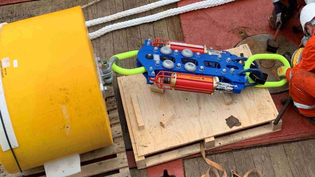 Photo courtesy Mark Hemnell, UK Met Office, Aug 2022
To support the MAWS deployments, each buoy will be fitted with two releases installed in a load amplification frame, providing a working load limit (WLL) of 15 tonnes. This configuration provides both equipment redundancy and the WLL needed to withstand harsh ocean conditions. Operators will command and control their RT 6s using Sonardyne’s newly developed Deck Topside. Rugged and portable, Deck Topside features a high brightness screen, inbuilt GPS receiver for recording deployment locations and a battery life of eight hours. A cabled, over-the-side dunker provides the secure acoustic communication link between the surface and RT 6s.
The Met Office expects the first deployment using their new Sonardyne equipment to be on the ‘K7’ buoy, which will be reinstalled about 150 km west of the Shetland Islands in 700 m water depth by the Northern Lighthouse Board’s lighthouse tender NLV Pharos.
[blockquote author=” Mark Hemnell, Marine Engineering Manager at the Met Office”]Met Office buoy moorings are designed to withstand the worst that the Atlantic can throw at them for deployments of four to six years.[/blockquote]
“The Met Office open ocean buoy network is often where forecast weather systems meet our measurement systems,” says Mark Hemnell, Marine Engineering Manager at the Met Office. “Data from the buoys are used along with observations from many other sources to initiate model runs from which the UK’s weather forecasts are derived.
“Met Office buoy moorings are designed to withstand the worst that the Atlantic can throw at them for deployments of four to six years. They take advantage of the properties of synthetic materials to do this, and it is our intention to remove all these materials from the ocean at the end of a deployment. Tandem release assemblies will ensure that this can be done reliable and safely, reducing our impact on the marine environment.”
“Deployed far from shore in deep water, at significant operational cost, and exposed to some of the severest weather that the North Atlantic can generate, it’s vital that the Met Office’s buoys are moored securely for years at a time. Consequently, the selection of our RT 6 acoustic releases is a significant vote of confidence our technology,” adds Geraint West, Head of Science at Sonardyne.
“Acoustic release transponders have featured in Sonardyne’s product portfolio throughout our 50 years, so we’re delighted that, in our 50th year as a company, the UK’s national weather service has invested in UK technology, manufacturing and through-life support to help deliver their vital services.”
Header photo courtesy of Plymouth Marine Laboratory.
Submarine cable installation and repair specialist Asso Group has chosen underwater vehicle guidance technology from Sonardyne for its expanding trenching fleet.
The company, based in Greece and with operations globally, will install Sonardyne’s subsea Lodestar attitude and heading reference sensors (AHRS) on its trenching machines working across interconnector and offshore wind cable installation, protection and repair.
Asso Subsea specialises in hard soil conditions using its in-house designed fleet of shallow to deepwater trenchers. Its largest system, the nearly 13 m-long AssoTrencher IV, can cut trenches up to 2.3 m deep for burying power and telecommunications cables, including interconnectors and offshore wind inter array and export cables, in down to 800 m water depth.
Using Lodestar’s on its trenchers will allow technicians to complete cable laying and burial operations efficiently, by maintaining a high level of situational awareness of the platform’s dynamics, which is key when to keeping the vehicles on course in geotechnically challenging, zero visibility environments.
In addition to AHRS, some wind farm project specifications can also require the use of an inertial navigation system (INS) on trenchers, in order to ascertain an accurate as laid position of their subsea cables.
[blockquote author=” Michael Chionatos R&D Director of Technical Division, at Asso”]”By choosing Lodestar, we can easily upgrade to Sonardyne’s full INS solution, SPRINT. Indeed, this is something we have been able to do in the past, providing our developer customers assurance, when they require it, by geo-referencing cable laying operations, all without the need to pay for a separate INS system and having to interface additional payloads to their vehicle.”[/blockquote]
“We’re happy to be supporting Asso Group as they see increasing demand for their capabilities in the offshore wind market,” says Mike Ellis, Business Development Manager for renewables at Sonardyne. “With their latest and upgraded trenchers, and the recent addition of the Athena DP-3 trenching support vessel to their fleet, targeting floating offshore wind, they’re ready to support this expanding market, supported by our trusted and time-saving underwater guidance and navigation solutions.”
Last year, Asso won a contract to install the 66 kV export and inter-array cables on Vattenfall’s 350 MW Vesterhav Nord and Syd projects. The company was also awarded a contract, in consortium with Prysmian Group, to install the export cable system for the Gruissan floating offshore windfarm in southern France.
The company’s previous projects include work on Borwin 3, Dolwin 3, Veja Mate, Deutsche Bucht, Global Tech 1, and SeaMade.
The Sonardyne Asia team has news: we’re investing in new premises in Singapore! Jose Puig, our head of sales for Asia, explains why, when and how there’s a lot to be excited about across the wider region.
Six months ago, I moved into my new role as head of sales here in Asia and I’m glad to say I’ve not looked back. One reason for that is how much there is to look forward to across the regions we cover.
It’s a hugely diverse and challenging area; politically, culturally, geographically, economically. Here in Singapore, we serve customers all the way from the Middle East, down to Australia and of course across to the Pacific Islands, and right across the energy, science and defence sectors. That’s anything from growing offshore wind capacity to protecting to coastal communities from environmental threats, through to strengthening national capability in the underwater naval domain.
Which brings me to the second reason I’ve not looked back and that I’m hugely excited to announce; we’re moving our Singapore headquarters into new premises at Loyang Offshore Supply Base in early July.

We’re not moving far. It’s literally a few blocks from the home which we’ve occupied for the past 14 years. Combined with the appointment of a director of operations, Hwee Chin Cheng, and myself as head of sales, both the move and management changes will help us to meet your needs even better.
28 years – and counting
We’ve had an office in Singapore since 1994 – that’s now 28 years ago – and we’ve been in our current premises since 2009. Over the years, it’s become quite a busy place, so we wanted our own standalone facility with plenty of space for our offices, warehouse space, workshop and test tank, as well as visitor, break out and recreation areas. And did I mention the roof terrace?
It’s also going to have space to meet the needs of our sister Covelya Group companies, such as EIVA, who will be able to come and use our offices and the test tank. So, it will be a real hub for us, and you, our customers.

Just now, it’s having a full makeover, bringing a modern touch and amenities, so that it fits all our needs. But we can’t wait to you, from mid-summer, when we expect to officially open our new Sonardyne Asia doors. Look out for an open house event invite in due course! And don’t forget, it’s Sonardyne’s 50th birthday this year so added cause for celebration.

Offshore wind at the forefront
This investment couldn’t come at a better time. Singapore came out of lock down in April and we’re seeing similar across the region. That means everyone is able to start doing more business again and projects that were delayed are now being switched back on. One market is particularly standout: offshore wind.
According to a recent report, Asia Pacific could become the second-biggest offshore wind market, with capacity reaching 78 gigawatts by 2030. We’re expecting to see that especially in Taiwan and then Vietnam, followed by Korea and Japan. Even Australia looks set to be part of this growth.

This activity is driving the use of traditional survey systems, such as our Ranger 2 USBL family. Mini-Ranger 2 has been especially popular in this segment, supporting high elevation, shallow water tracking for site survey and characterisation operations. In this new market, customers want easy to use and reliable systems and that’s what Mini-Ranger 2 delivers.
But that’s not to say they’re not testing new ways of working. For example, they’re integrating these systems into nimbler, lower emission platforms, such as uncrewed surface vessels (USVs), as well as adopting more efficient ways to deploy environmental mitigation measures, such as bubble curtains, when performing piling operations.
Safer, smarter ocean data
Similarly, we also expect to see more demand for environmental monitoring systems, systems that can deliver data direct to desktops via uncrewed platforms and the cloud, instead of requiring sensor retrieval, to make ocean data collection easier, safer and more cost effective. In Europe and North America, we are delivering this capability right now, and we can’t wait to bring you news of the first seabed-to-desktop project in Asia to you in the not-too-distant future. Watch this space.
Defence, right across the Sonardyne Asia region, is also seeing increasing attention, as geopolitical tensions remain high on governmental agendas. A major focus here is in the underwater domain, where our technologies are supporting advances in large diameter uncrewed or unmanned underwater vehicles (LDUUV/XLUUV), but also mine countermeasures (MCM) and secure waveforms for underwater communications.
From asset integrity to coastal protection
Oil and gas, too, still has a role in the region. While activity has been lagging, compared with other regions, we expect to see increasing activity, especially around extension projects and asset inspection, repair and maintenance, where underwater robotics can and are playing an increasing role and decarbonisation is a real focus.
And let’s not forget ocean science, where there’s continued focus on coastal protection. An example of that is continued investment in tsunami detection systems in key coastal regions, while the main research institutes out here continue to invest in the latest technologies to underpin critical research in the deepest depths of the ocean.
Here at Sonardyne Asia we’re excited and we hope you are too. With our new workshop and offices, we’ll be able to serve you even better. We look forward to welcoming you very soon.