Sonardyne
Support Centre

6G modems make the connection between data and decisions

Two years ago Shell Exploration and Production (Shell E&P) approached Metocean organisation RPS Evans Hamilton Inc to expand the capabilities of their service to measure seabed current profile data at the Walker Ridge area in the Gulf of Mexico.

The challenge

Operations in deep and ultra-deep water (6,000 to 10,000 feet) are challenging for drilling, construction and pipeline installation. These challenges can be made safer and more efficient through a good understanding of subsurface current patterns. For this to be effective, wireless transmission of observations to the surface are essential for instant analysis.

This type of data is usually obtained using acoustic Doppler current profilers (ADCPs) mounted near the surface looking down through the water column. As operational depths increase, a second ADCP, placed on the seabed looking-up, provides the additional data.

The most common approach involves deploying the second ADCP for several months at a time. This is set to log bottom currents at intervals from minutes to hours. While this data is extremely useful for site surveys and planning exploration activities, the delay between collection, instrument recovery, download and analysis, means its usefulness is limited. Particularly when needed for supporting on-site decision making during operations (including complying with government directives). A faster way to retrieve the data collected by the ADCP is needed.

The solution

An acoustic modem directly connected to the ADCP provides a cost-effective and increasingly popular option for providing instant access to the data collected. The modem enables access to the data from almost anywhere in the world.

But not all acoustic modems are made equal. It’s vital to make sure when choosing one for use in an application such as offshore drilling, the signal processing and error correction techniques reliably deliver critical data payloads over long distances and, if needed, through acoustically hostile transmission paths.

RPS Ocean Science identified Sonardyne’s 6G (sixth generation) wireless communications platform as the optimum solution. 6G has an enviable reputation across the region. Today it’s the only acoustic technology to have been proven as a successful monitoring solution during a well containment situation.

The seabed component of the monitoring system incorporated a Sonardyne Compatt 6 telemetry transponder interfaced with a Teledyne RDI Workhorse 300 kHz ADCP. These were mounted together in a deployment frame. 10,000 feet above, a Sonardyne HPT modem deployed from the rig acted as the surface receiver. It was enclosed within a rugged cage to protect it during deployment and recovery phases, and weighted to prevent drifting in high surface currents.

The HPT was integrated with the data collection system RPS Ocean Science had previously supplied to the rig, this included a 38 kHz ADCP at the surface and load handling system. The Compatt 6G modems and ADCP were deployed by ROV on the seabed at a depth of 9,970 feet, approximately 150 feet away from the rig’s BOP.

After establishing reliable seabed to surface communications, data collection was initiated. The acquisition system is designed to receive and display data from the surface and bottom ADCPs at 10 minute intervals.

Modem 6

0

m

operating depth

0

bps

acoustic comms

The results

Following initial system deployment, the signal analysis tools built into the Compatt 6 and HPT enabled the bidirectional communications link to be optimised for the local conditions. This resulted in highly reliable and low latency data return rates.

Water velocity profiles were generated from approximately three metres to 100 m off the seabed. The profiles were composed of 50, two metre bins. Data was averaged over 75 seconds at a 1 Hz sample rate. Velocity and direction profiles were processed by the subsurface instrument and transmitted to the rig’s data acquisition system where profiles were displayed, along with the velocity and direction profiles from the surface ADCP, on the platform bridge.

The data has been utilised by the metocean team to support exploration operations in daily advisories as well as providing a unique perspective on potential Topographic Rossby Waves thought to be a common feature in the area. Processed data files were also transmitted to our client’s shore-based server and the National Data Buoy Center (NDBC) in near real-time.

A demonstration of the system’s capability took place during the summer of 2015. Since then, the RPS-Sonardyne solution has proven to offer reliable self-contained operation with long service intervals. The configuration of the upward looking ADCP and Sonardyne 6G digital modem technology perfectly complements conventional near-surface and mid-column current monitoring. It also contributes toward lowering operational risk and increasing the safety of drilling, survey and ROV operations in deep water.

Ranger 2 – it's anything but standard

Carbon Capture and Storage is increasingly seen as one of the key measures to help us reduce greenhouse gas emissions. Capturing it is one thing, storing it and making sure it stays stored is another, which is why the National Oceanography Centre (NOC) and others have been working to understand the nature of potential CO₂ leaks and test sensor capability to detect these.

The challenge

Understanding how carbon dioxide behaves in deep water environments requires specialist equipment and multiple sensors. The various systems need to be able to work together smoothly, fly through the water without drag and reliably stay in contact with above water instrumentation.

One of the NOC’s most recent missions focused on CCS. As part of the European Union Horizon 2020-funded Strategies for Environmental Monitoring of Marine CCS (STEMM-CCS), it focused on CCS in the North Sea.

The solution

The project, involving researchers from Germany, Norway, Austria and the UK, and industry partner Shell, centred on the decommissioned Goldeneye field, about 100 km offshore Scotland in about 120 m water depth. In May 2019, researchers and scientists onboard the RRS James Cook set out for Goldeneye for an intense period of scientific activity.

The aim was to simulate carbon dioxide (CO₂) leaks from the seafloor in order to test various sensors and systems for their ability to detect potential CO₂ leakages. This would help the teams understand how the gas behaves, and discover if seepage from the seabed worked its way up through the water column.

For mapping the area and wide-area chemical sensing, they used a Gavia autonomous underwater vehicle (AUV) called Freya. Because the Gavia had been adapted specifically for the mission – including fitting additional sensors to its body – operators were uncertain about how it would now fly through the water.

Our Ranger 2 system has underpinned the ocean science carried out by the RRS James Cook since it went into NOC service in 2006. It’s helped to track a whole host of vehicles and instruments, including NOC’s Isis ROV to 5,000 m deep. Indeed, on this latest mission, Isis, with a 6G Wideband Mini Transponder (WMT) onboard, was tracked using Ranger 2 during its many trips to the seafloor where it helped to accurately install an array of seabed equipment, sensors and instrumentation.

The Gavia Freya is classed as a low-logistics vehicle – meaning that only two people are required to deploy and recover it. Typically, Gavias measure anywhere between 1.8 m and 4.5 m in length, and just 200 mm in diameter. So when it came to choosing which USBL transponder to equip Freya with, there was really only one option Nano.

It’s our smallest 6G-enabled USBL transponder (just 160 mm tall by 52 mm diameter) and comes with features such as wireless charging, depth sensor and lightweight plastic construction. For this mission, Freya’s mission payload included a GeoSwath system for side scan sonar and bathymetry, mounted externally to the hull, supported by additional buoyancy. This provided a convenient place to the site the Nano. Freya was also used for photographic surveys and chemical sensing for pH using the SeaFET system.

For maximum operational flexibility, the RSS James Cook is permanently fitted with both our HPT 5000 (wide area) and HPT 7000 (deep water optimised) transceivers to separate, through-hull deployment spars. Whilst either of these medium frequency transceivers is capable of tracking a Nano, the shallow water at Goldeneye meant that the Gavia was tracked with the HPT 5000.

The results

“We were able to use the displays from the Ranger 2 to see that the Gavia was getting down to its working depth, usually around 100 m, as we were mapping the seabed,” says Mike Smart, Glider Engineer, Marine Autonomous and Robotic Systems, National Marine Facilities, NOC. “This was very useful as there was quite a lot of uncertainty about how the Gavia would behave given the extra payload it was carrying. Tracking data from Ranger was also shared across our network with survey and science teams elsewhere onboard.

“Being able to track the progress of the mission was another nice feature. With a much longer and heavier configuration of Gavia than we usually deploy, the time it needed to resurface was longer than we had predicted. So, being able to view the vehicle’s precise location, aided by regular depth updates from the Nano, meant we could more accurately predict surface times and not be anxiously waiting for Freya to reappear at the end of her survey run.”

This is just the latest time we’ve been involved in the work towards CCS. Past work demonstrates how our Sentry leak detection sonar and our Solstice side scan sonar are able to detect leaks, as static and dynamic sensors. Our instruments have also been shown to be able to support so-called chemical “sniffers” that can detect CO₂ (see Baselines 12 and 18).

While it’s still an emerging area, the industry is getting closer to making CCS offshore a reality – the first offshore carbon storage license was awarded in the UK in 2018, followed by a new license for a significant storage site in Norway in 2019.

Speak with one of our experts to learn how we can make your CCS project a success.

Micro. For when good is good enough

Describing underwater ecosystems requires detailed information that can be accurately tied to specific locations. The impact of marine pests, litter, marine industries and other issues needs to be tracked over time with confidence. What’s more, the changeable nature of the sea and weather systems in coastal areas means equipment used for the assessment and monitoring of marine life, reef systems and sea fauna must be quick to deploy and simple to set up.

The challenge

Port Phillip Bay is home to a host of unique and iconic marine life and is one of the most diverse places on the planet for seaweeds and reef systems that support a diverse array of sponges and other invertebrates. It’s also shadowed by the city of Melbourne which has a growing population of nearly 5 million people and experiences particularly challenging conditions – the large embayment is exposed to strong winds and has periods of low underwater visibility.

To protect the Bay, the Victorian Department of Environment, Land, Water and Planning (DELWP) is implementing the Port Phillip Bay Environmental Management Plan 2017-2027 (EMP). The team at Fathom Pacific Pty Ltd have been tasked with carrying out studies and surveys in Port Phillip Bay to inform the decisions and recommendations made by the EMP.

To do this they need to create reliable models and maps, along with reports detailing the bay’s marine biotopes – areas that provide habitats for specific species – for the protection of the Bay to be effective. The data gathered has to be quantitative and accurately geo-referenced, and it must be gathered in increasingly cost-efficient ways.

The solution

Firsthand ecological research and environmental monitoring are key building blocks of the models and maps needed for supporting the EMP decisions. The BlueROV2 remotely operated vehicle (ROV) from Blue Robotics and a Micro-Ranger 2 USBL from Sonardyne have enabled Fathom Pacific Ltd to capture incredibly detailed HD imagery from the camera they’ve mounted on it. Importantly, the USBL tells them exactly where it was recorded. If divers and other assets are in the water, it can track them as well.

The Micro-Ranger 2 is extremely portable and easy to mobilise making it the ideal solution for small-boat coastal operations and short-notice surveys.

The MRT – the part of the system that communicates with transponders fitted to underwater targets – is so small and light, it has been mounted to the bottom of the stern diver ladder. The range and coverage of the transponder is impressive. Equally impressive are the Nano transponders, these can be strapped to the frame of the ROV or a diver’s tank without affecting balance or freedom of movement. The rechargeable battery lasts for a full day of operations.

Thanks to the instructional videos available on YouTube, the whole system was simple to install and calibrate. Once the software was set up and tested on the laptop, it was put straight to work supporting surveys throughout last winter and spring. The whole set up was often mobilised at very short notice, due to the unpredictable weather windows experienced in Port Phillip Bay.

The Micro-Ranger 2 system has accurately and consistently tracked the BlueROV2 in the bay’s shallow waters, even when it has been transecting some 50-100 m from the small MRT transceiver. This is important for the assessment of the bay’s biotopes during which images of the key structural and functional components of temperate reef and sediment biotopes are taken using the ROV mounted HD camera.

ROV transects typically operate in two modes. The first is a ‘video inspection mode’, detailing the canopy, sub-canopy, lower strata and turfing components and identifying the associated macrofaunal biodiversity. The second is a ‘still image mosaicking mode’, where fixed-altitude planar stills are taken to create biotope mosaics.

Using Micro-Ranger 2, Fathom Pacific Ltd were also able to place their analyses of reef biodiversity and biotopes into a spatial context by correlating the imagery data with real world coordinates. This means ground-truth data for biotope modelling can be provided, while also establishing biotope conditions and informing ecosystem models. Exactly the same locations can be visited time and again for future surveys.

The results

The investment in Sonardyne’s USBL technology is paying enormous dividends. Better monitoring of the Bay is enabling targeted and faster responses to issues like the spread of marine pests, loss of canopy-forming algae to urchin grazing, biodiversity loss, eutrophication, litter and impacts from marine industries. These are just some of the threats facing Port Phillip Bay’s marine systems that are now being curtailed.

Speak with one of our experts to learn how you can protect coastal environments with Sonardyne’s technology.

Sentinel expeditionary – Intruder detection where it's needed

When we initially developed Sentinel to detect underwater intruders the world was a very different place. At that time, the Cold War was history, and the underwater threat was from rogue state actors and terrorists. Combat divers posed a significant asymmetric challenge: capable of swimming undetected they could cause major damage to our ships and platforms.

The challenge

Detecting divers effectively was no easy feat. Navy labs had been developing and fielding large, heavy sonars that were seeking to protect naval ports. It was quickly apparent that costly mobilisation and maintenance operations made them unsuitable for permanent deployments.

Weighing at approximately 250 kg, they proved difficult to transport and almost impossible to deploy from vessels of opportunity.

Fast forward to today, a new cold war is brewing. Peer adversaries are developing new capabilities and adding to the list of threats. Combat-divers remain a significant threat to assets and sailors. The recent attacks on the port of Fujairah are a clear example of what can happen when the guard is let down. Now, unmanned underwater vehicle (UUV) systems have also evolved alongside this threat. UUVs have a smaller signature than divers and can move faster.

The solution

A new approach was required and so Sentinel was born. Sentinel was the first intruder detection system designed to be portable. It weighs just 35 kg. Design parameters were carefully selected to improve the detection and tracking capabilities in comparison to existing systems.

Typically deployed in shallow waters and with a requirement to detect threats as far as possible, the design carefully considered the challenges from operating in confined areas, such as complex sound velocity profiles, multipath effects and shadow zones. As a result, Sentinel uses a circular transducer configuration to ensure even coverage.

Modern computing and cutting-edge algorithms enable Sentinel to track and analyse a large volume of targets. Improvements were made without compromising performance. Sentinel’s range and detection rates were far superior to that of the larger systems. Its size made it truly expeditionary. The system could be mobilised to set up a protective perimeter for your amphibious forces one day or to monitor a sensitive choke point the next.

As new threats emerge, our navy customers want to ensure that their existing Sentinel systems can meet them. After all, the design parameters were carefully selected to improve the detection and tracking of divers. Can they meet the underwater drone challenge?

Each sonar head was designed to operate at 70 kHz with a 40 ms pulse to improve the signal-to-noise performance and to increase the effective range of the system. The 20 kHz bandwidth provided an effective 3.75 cm range resolution. Sentinel emits a 360° linear-period-modulated (LPM) pulse and uses 256 receive beams equally spaced along its perimeter to discriminate targets in up to 1500 m range even at high velocity.

The results mean Sentinel can detect scuba divers up to 1,000 m range and divers with rebreathers up to 700 m. Sonardyne engineers had the anecdotal experience that the system could detect and track UUVs, but more concrete data was needed to ensure that performance was suitable for the task.

A set of experiments conducted during the Advanced Naval Technology Exercise (ANTX 2019) in collaboration with the US Naval Undersea Warfare Center (NUWC) in Newport, RI demonstrated improved performance using Sentinel against combat divers and a one-man portable Riptide µUUV.

ANTX has become a key naval technology collaboration, development and demonstration event in the US calendar. It brings together more than 1,000 naval, academic and industry attendees at the US Naval Undersea Warfare Center’s (NUWC) Narragansett Bay Test Facility (NBTF) in Newport. The NBTF is a test and evaluation facility designed to support research and development work in advanced underwater weapons and weapons systems, weapon launchers, UUVs and oceanographic equipment.

The Riptide µUUV provided a formidable target. Manufactured by BAE Systems, the Riptide is just 12.4 cm in diameter and weighs under 12kg. The man-portable small, unmanned vehicle is a sophisticated yet simple, efficient, and highly flexible platform.

In the exercise, multiple threat runs using both divers and the µUUV were carried out against Sentinel over two days. In some cases, the runs used threat tactics, such as moving along harbour walls and zig-zagging courses, designed to make tracking as challenging as possible. The results demonstrated that Sentinel continues to be up to the task.

That same year, the Slovenian Armed Forces (SAF) 430th Naval Division put our Sentinel through its paces in their own test. As part of a broader multinational exercise, their Underwater Special Operations Detachment carried out operations alongside a group of divers from the Montenegrin Navy.

The 430th Naval Division of Slovenia’s Armed Forces often use their Sentinel from vessels in port, while at anchor. For the multinational exercises, they deployed it from a pole mount from the patrol boat stern platform. Starting with integration drills, involving underwater and surface inspection of the operational area, they moved on to joint inspection of navigable waterways, followed by a mine hunting and detection exercise around moorings used by allied vessels.

Throughout, the underwater part of the port’s disembarkation area – which is protected by the 430th Naval Division – was monitored using Sentinel. It was then used to steer the force reaction towards the simulated intruders.

Weighs just

0

kg

Operates at

0

kHz

0

ms

pulse

Uses

0

beams

0

metre range

The results

The Sentinel Expeditionary System is perfect for short term operations using Offshore Patrol Vessels (OPVs) and temporary sites onshore. Navies use it as part of naval exercises, to provide protection at specific events such as during the Olympics, or protect their expeditionary forces where they are operating.

Both the ANTX experiments and the 430th Naval Division’s use of Sentinel shows its flexibility – it can be deployed and redeployed from different vessels, quaysides, subsea mount frames or even buoys. In other words, our Expeditionary Sentinel System provides intruder detection where it’s needed.

Our navy customers also want to know how to optimise the system for each new environment. The performance of any sonar system is heavily dependent on the target of interest and the environment the system is being operated in. Fortunately, Sonardyne has developed performance prediction tools. These determine the performance of the system in different environments against different types of threats. The tools consider deployment options and provide effective metrics to your team.

With sufficient time a site survey informs the user where to deploy sonars to improve the performance of Sentinel. These surveys can also be conducted remotely. Our training includes how to operate these tools meaning that our customers can conduct those surveys and remain at arm’s length from our support teams.

Most navies still consider Sentinel to be the intruder detection of choice. They need a system they can count on and that will stand up to emerging threats. These threats exist now. Equipped with a Sentinel Expeditionary System, a two-person team can rapidly mobilise on-site, use the output from the site survey to deploy the Sentinel and keep a constant vigil. Any threats will raise the alarm. This data can be interfaced with a third-party command-and-control system if required.

Improved MCM operations using multi-aperture sonar

The evolving requirements from world navies are challenging innovators to improve mine-hunting capabilities. In the face of declining budgets, navies want to improve percentage clearances, minimise risk by removing more personnel from minefields and get the job done quicker. With growing budget restrictions, it’s easier said than done.

The challenge

Uncrewed systems are the preferred choice for navies in support of mine countermeasure (MCM) operations. The first navy to deploy these operationally was the US in Operation Iraqi Freedom. Here an early version of the Mk 18 Mod 1 “Swordfish” underwater vehicle was used in support of mine clearance operations.

Since then, many navies have acquired small, man-portable systems to conduct operations in very shallow waters and larger systems for operations in deeper waters. The performance of the Royal Australian Navy’s Bluefin-9 and the medium-sized Bluefin-12 unmanned underwater vehicles (UUVs) has demonstrated that ocean robots have a significant role to play in MCM missions.

These kinds of underwater vehicles succeed because they provide a stable platform in which to mount payload sensors and do a great job of surveying the seafloor, at a constant height from the sea bottom. However, while operating, their data is stored within the system until it can be recovered and the data uploaded to a computer. This leads to delays in completing the operation. One way to combat this is to use uncrewed surface vessels (USVs) to complement their underwater cousins. This enables real-time access to data and facilitates a faster tempo for operations. Just like the underwater vehicles, to be successful a USV needs to provide a stable platform for its payloads and get them close to the seafloor.

The solution

Sometimes the solution is already there, all you need to do is piece it together. Equinox uses existing technologies as building blocks to create a new solution for improving MCM operations.

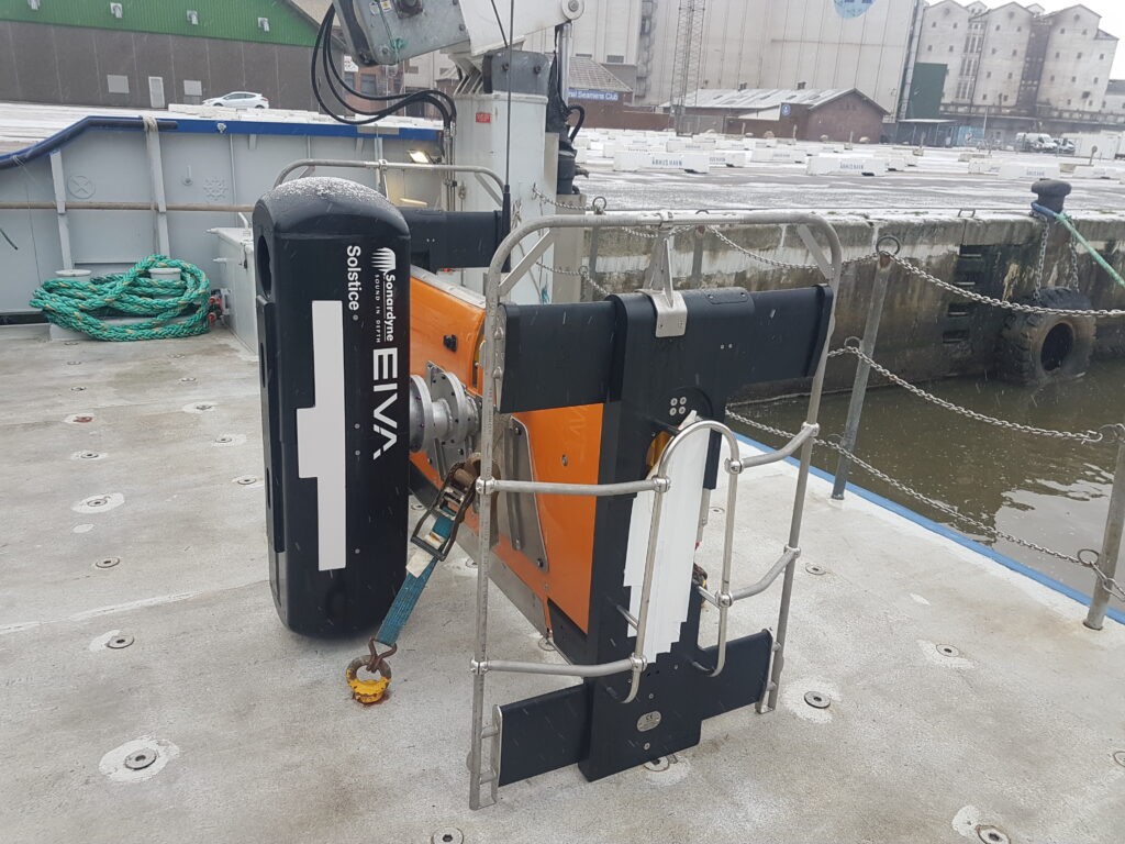
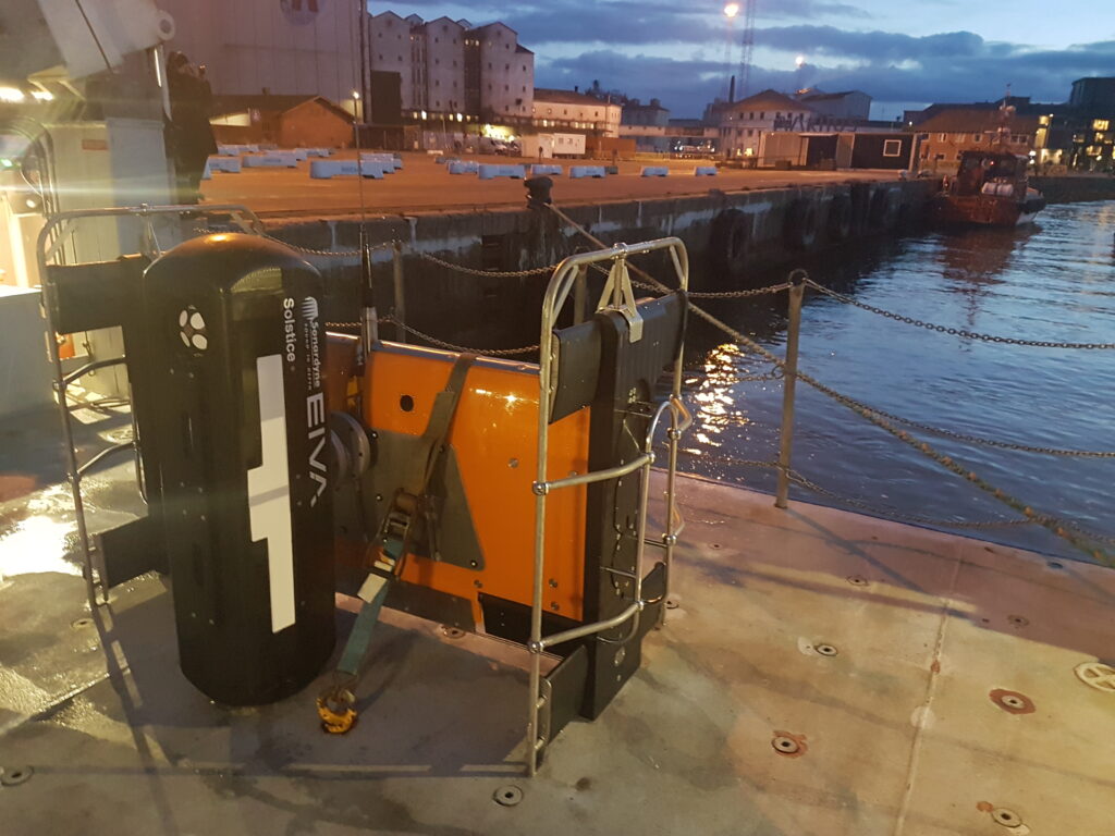
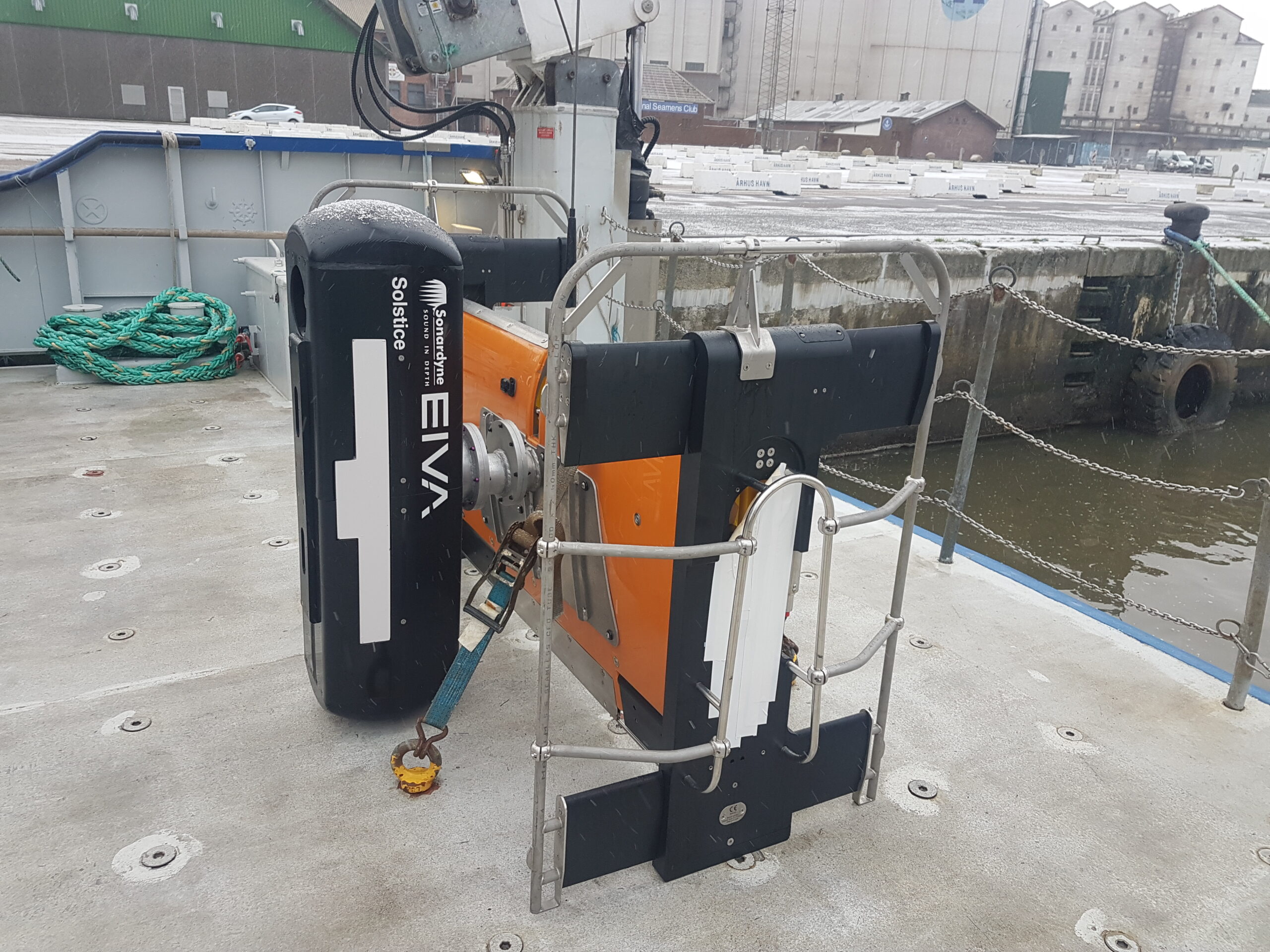
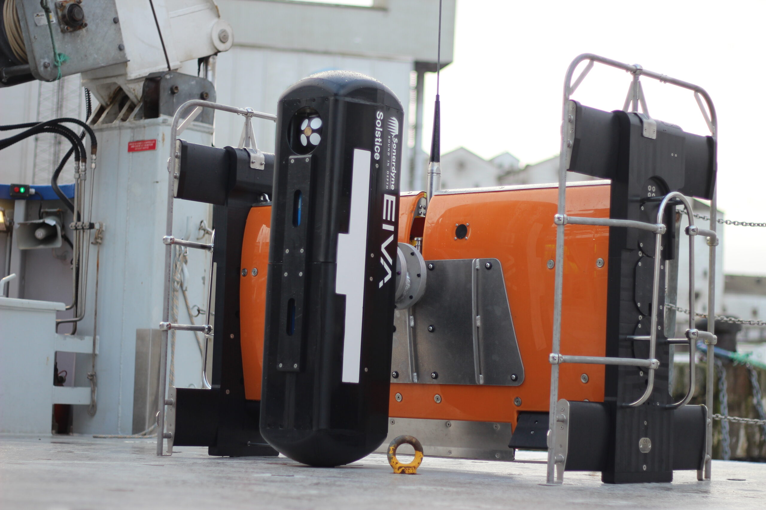
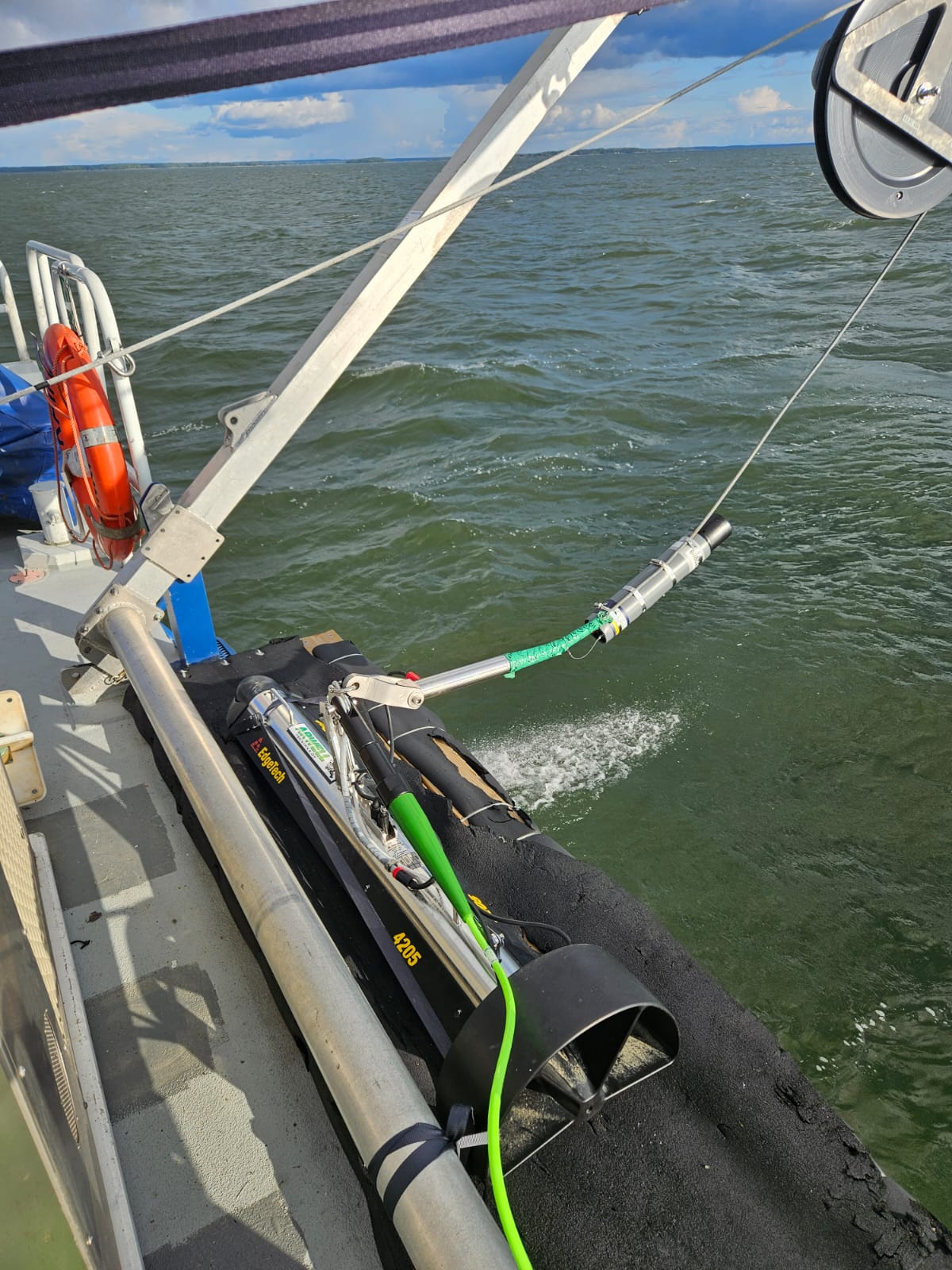
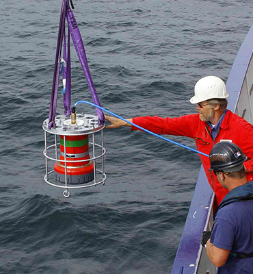
Solstice mine-hunting sonar

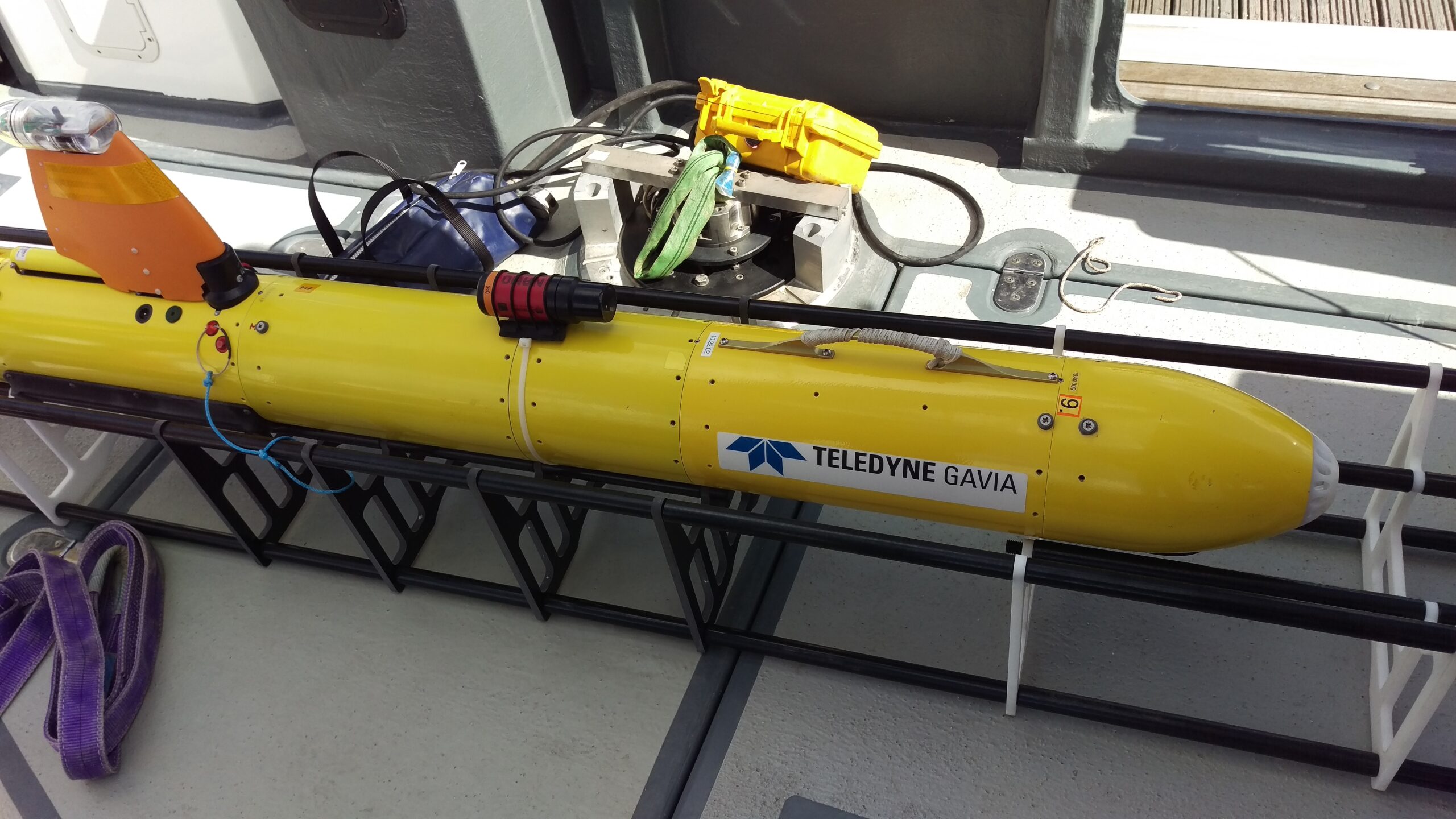
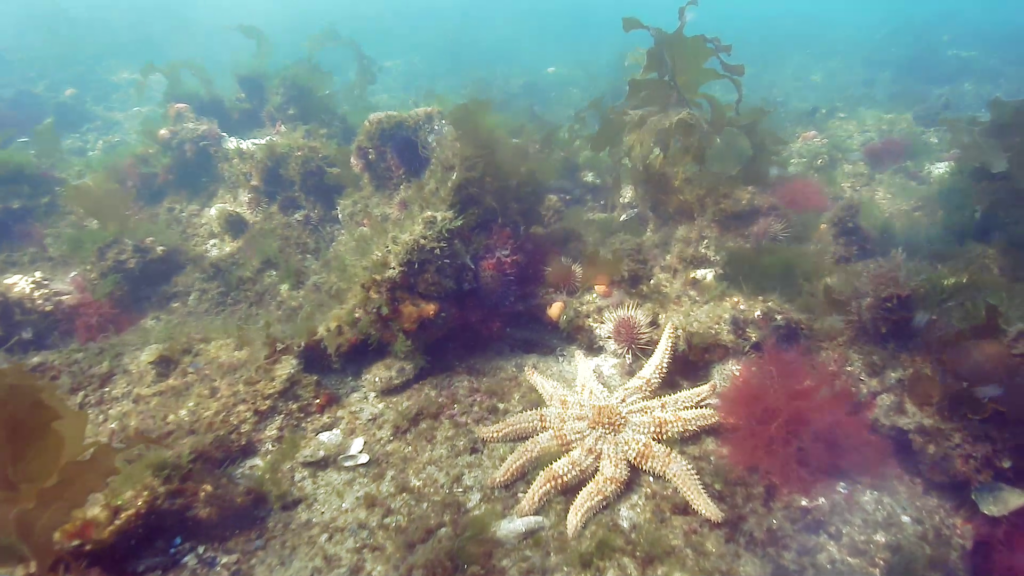
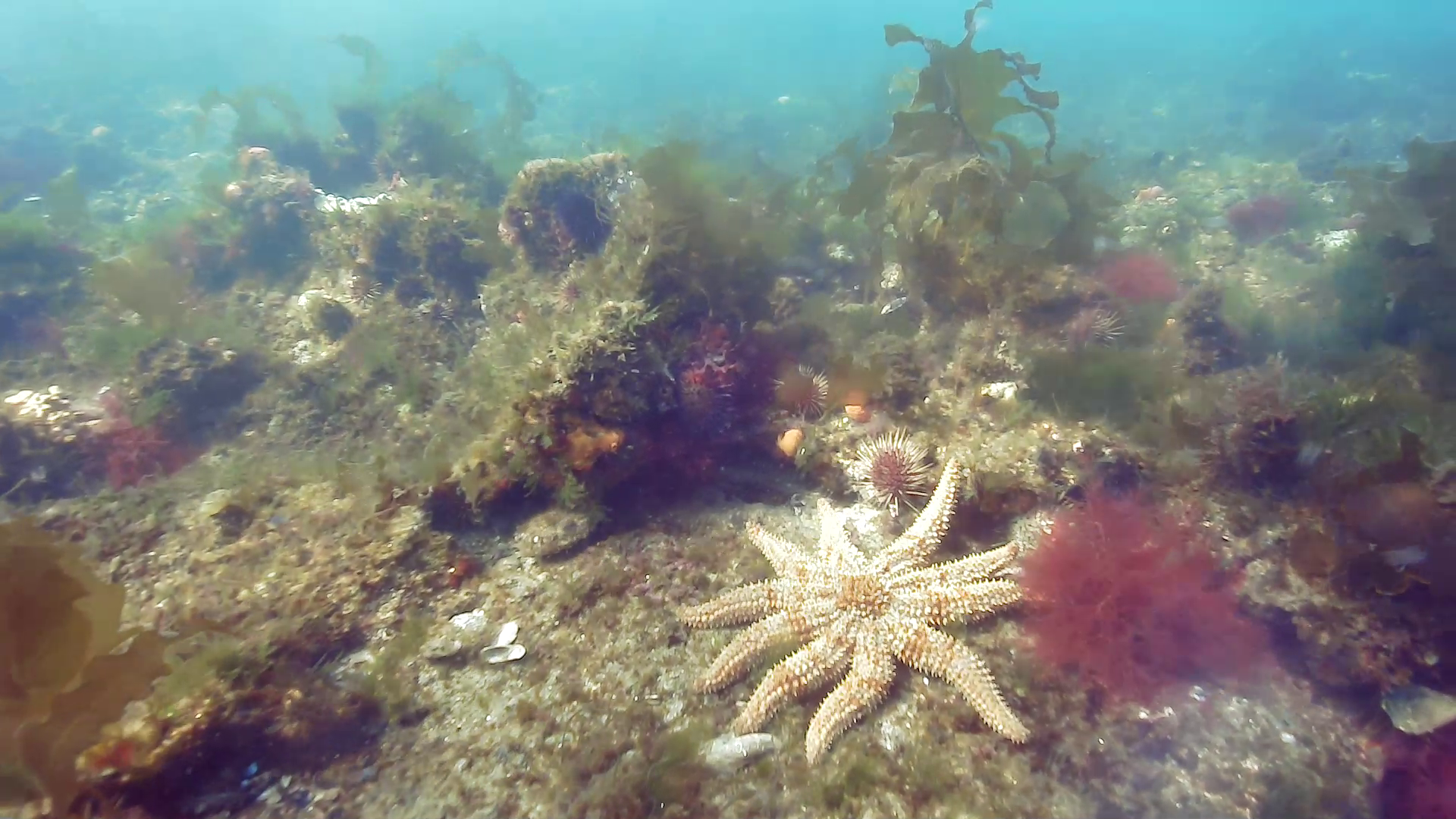
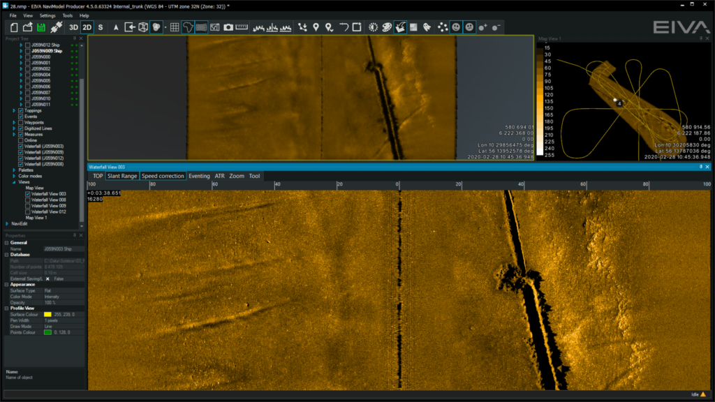
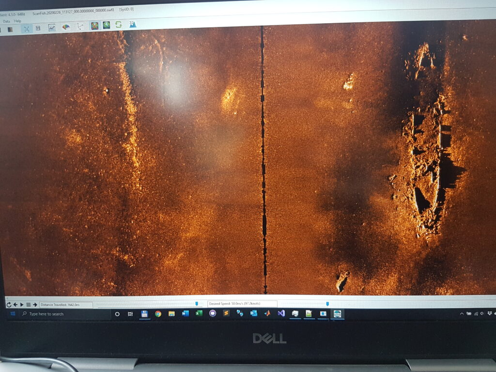
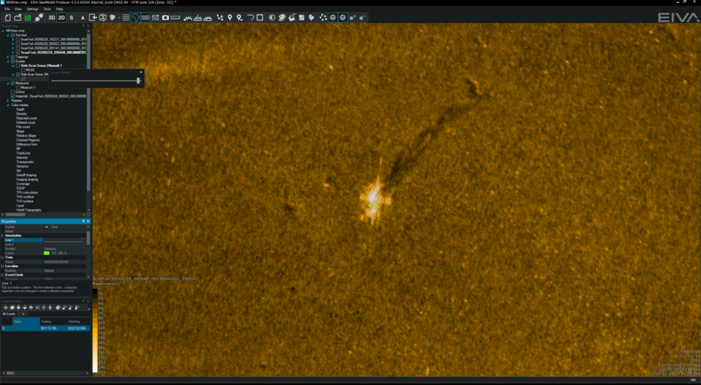
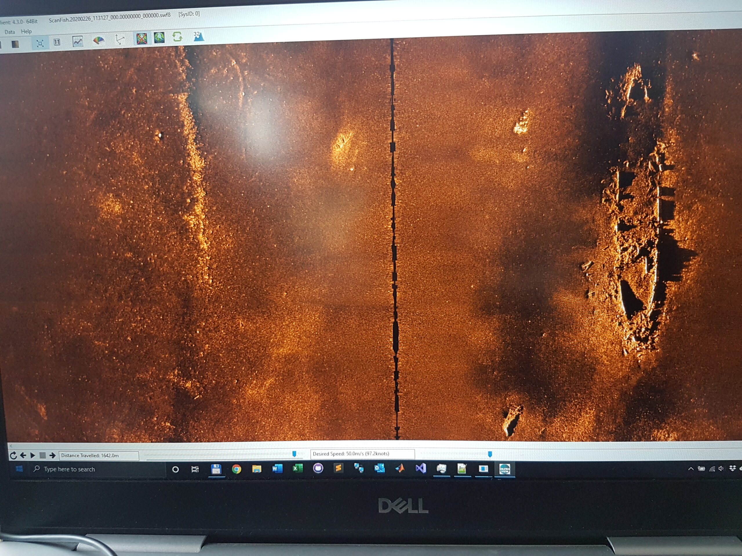
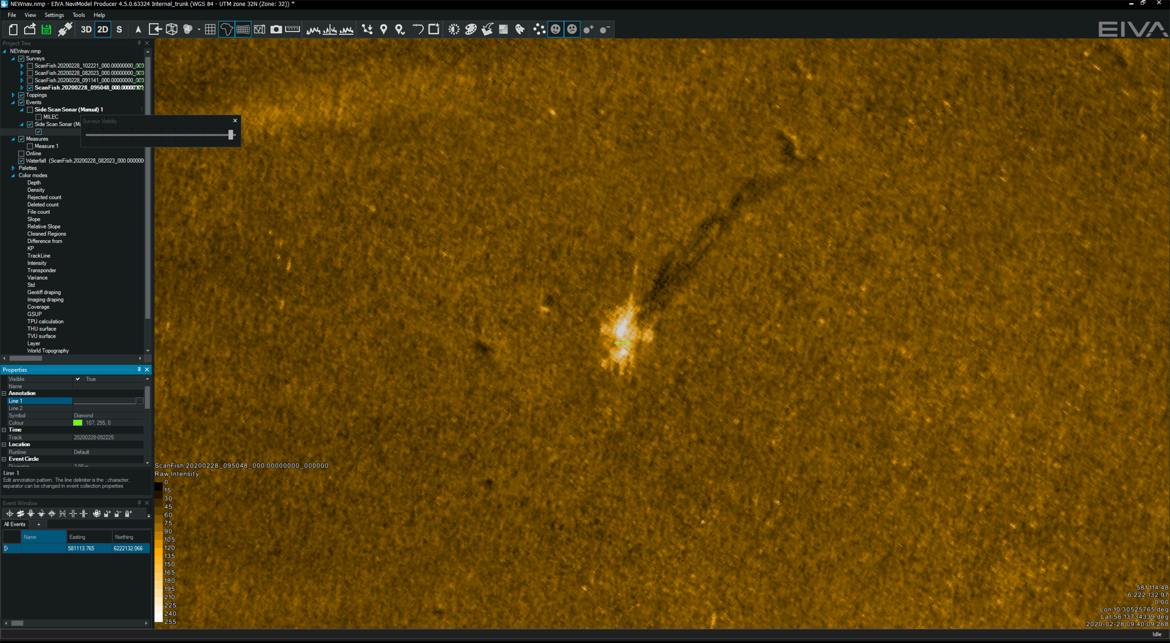
The first building block used to create Equinox is Solstice. Our Solstice was designed by our sister company, Wavefront, to deliver the ultimate mine-hunting side-scan sonar. Solstice uses a proprietary array design and multiple apertures to improve the signal-to-noise ratio performance, capturing stunning imagery at longer ranges than other sonars at the same frequency. Typically operating at 750 kHz it scans a 200 m swath and delivers a brilliant along-track resolution of 0.15°.

One example available in the public domain shows Solstice was able to both detect and identify lobster pots across a 200 m swath. These man-made targets are typically smaller than mines so constitute a great target, illustrating that Soltice is more than capable of the MCM sonar task.

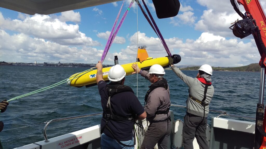
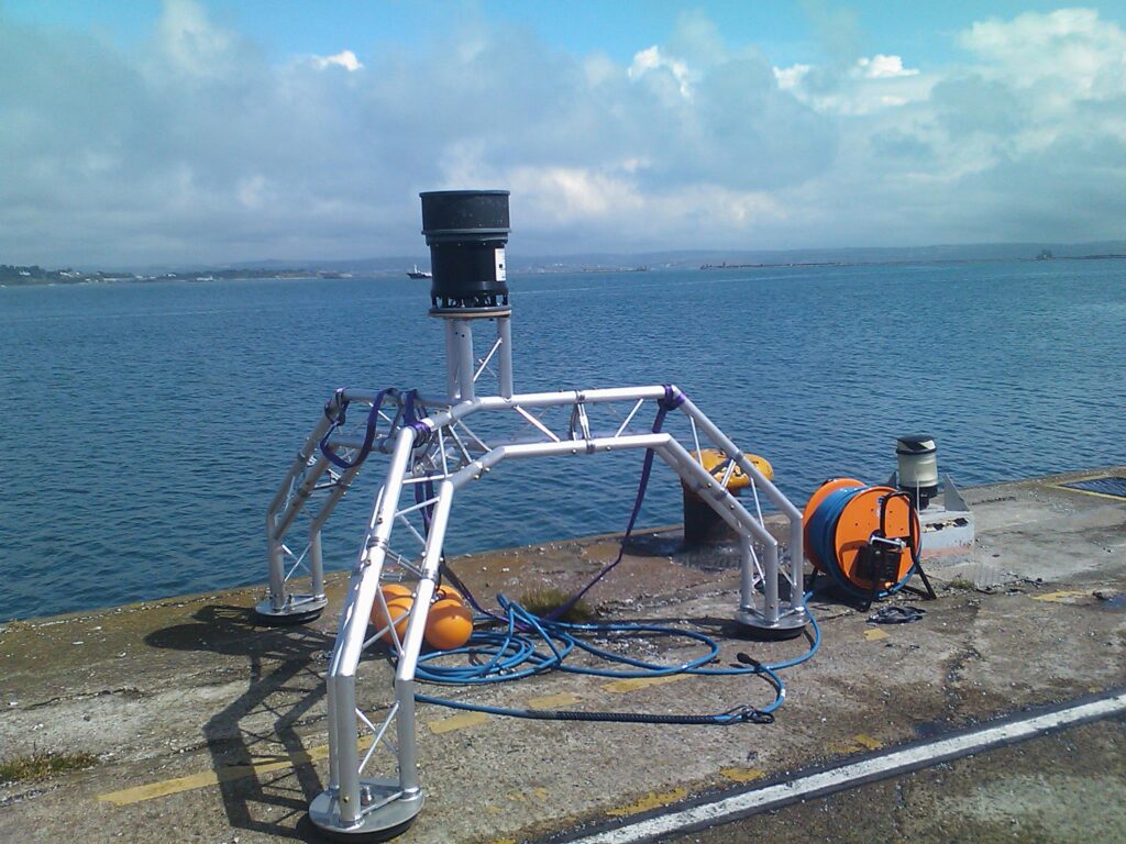
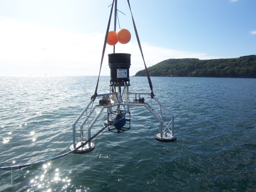
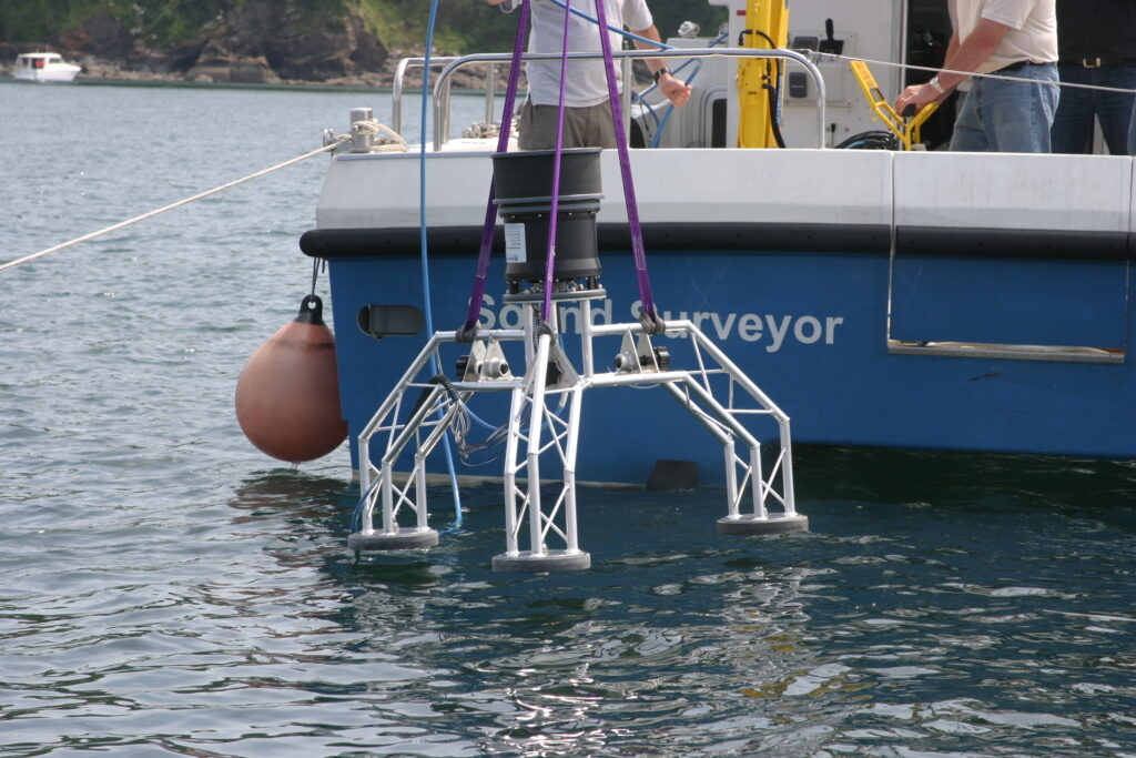
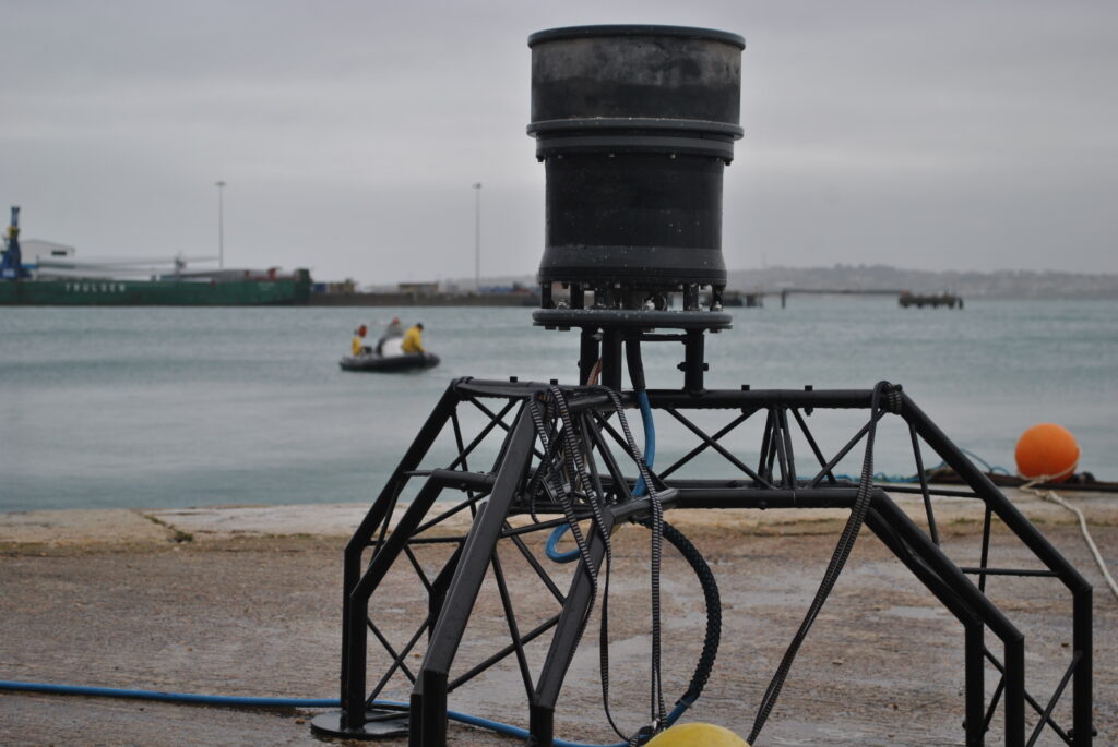
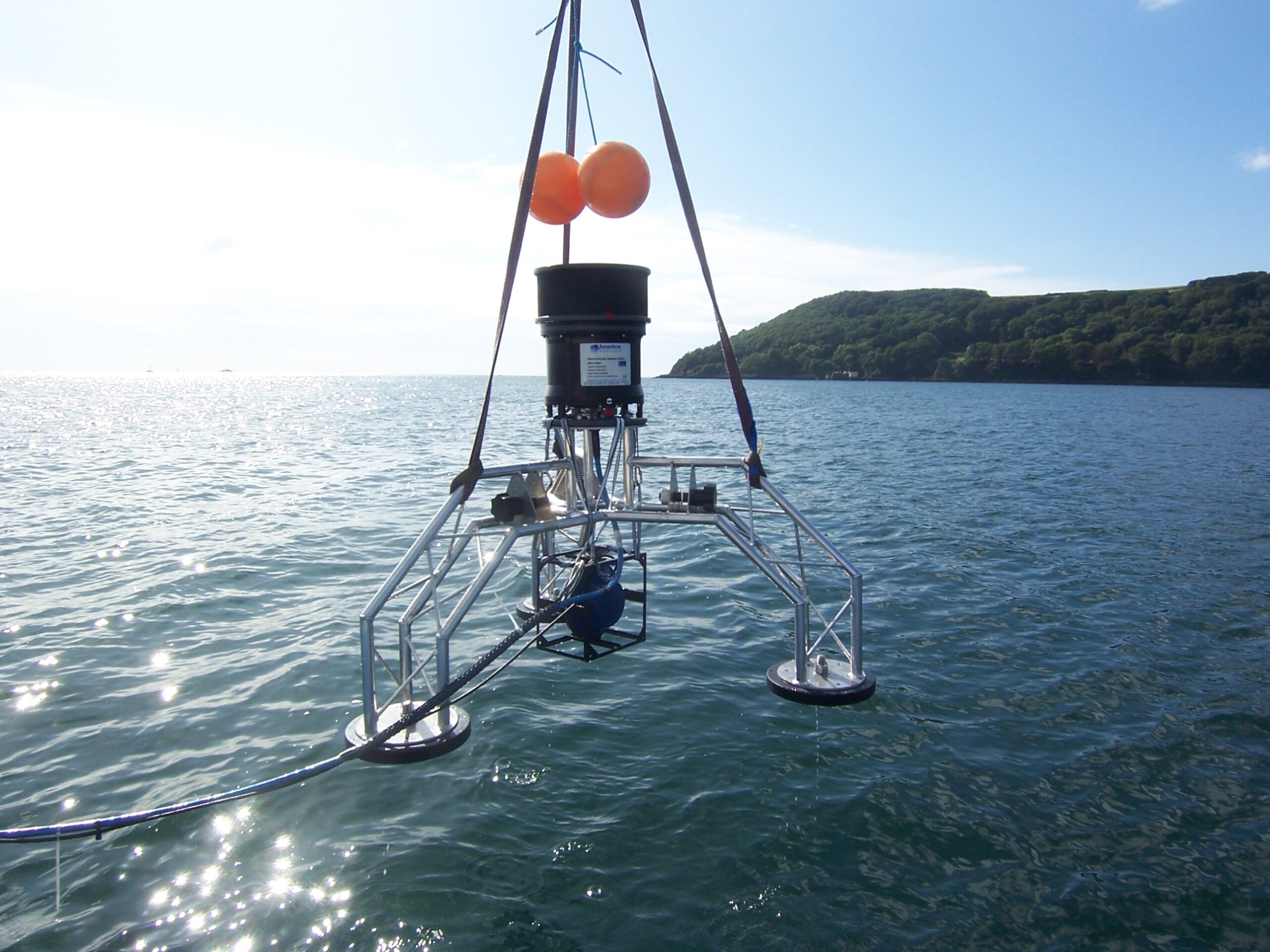
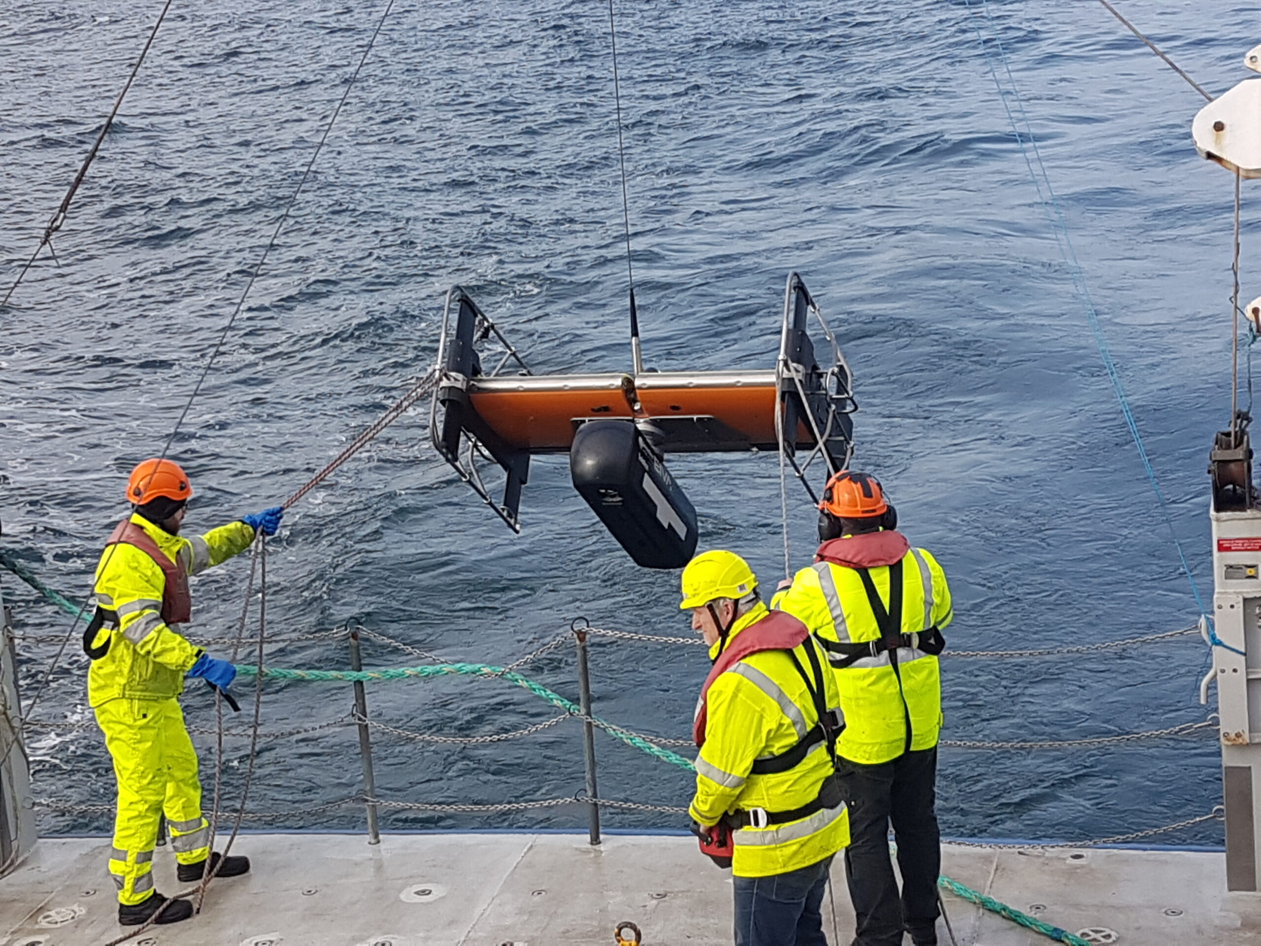
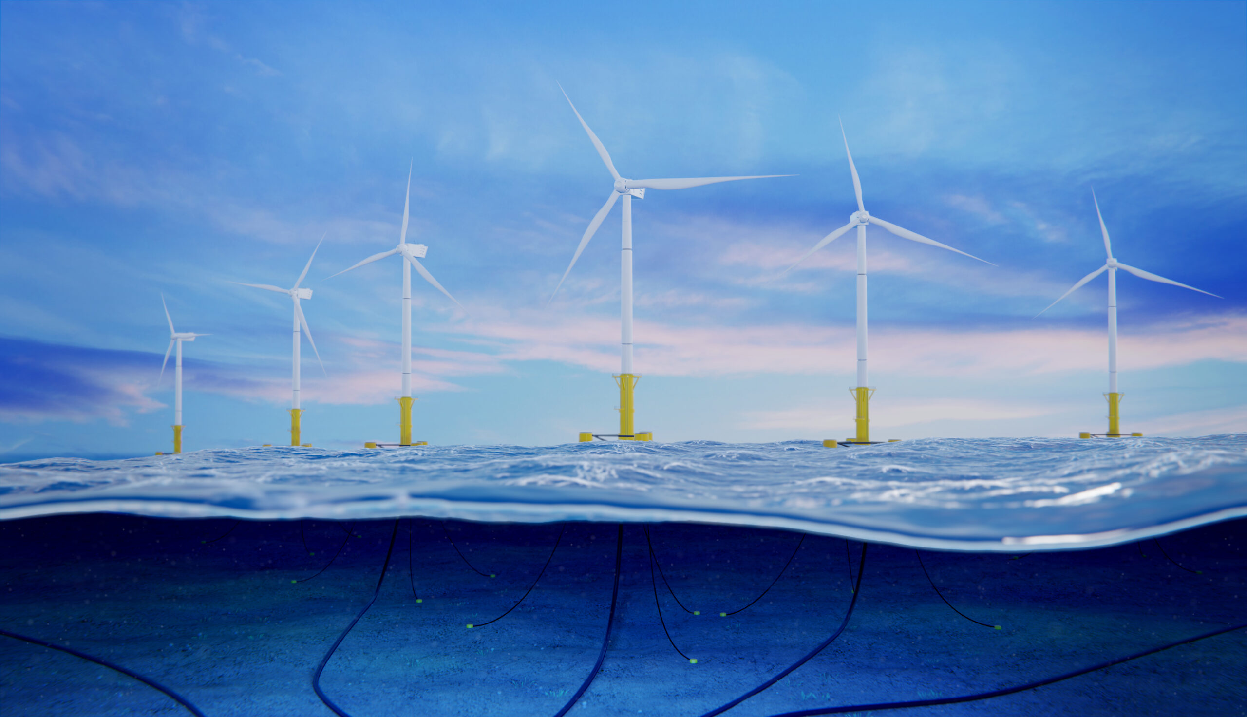
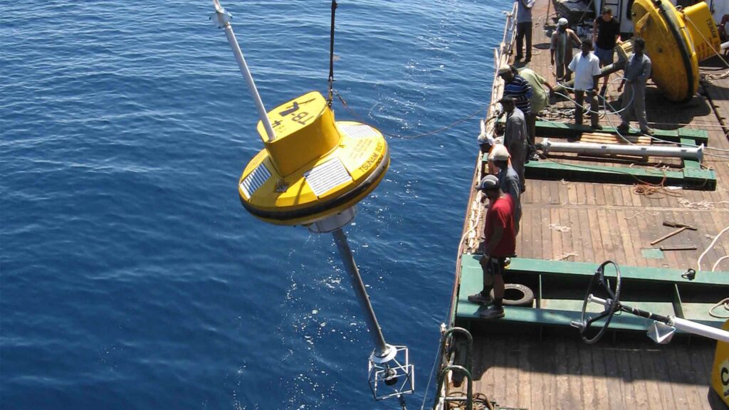
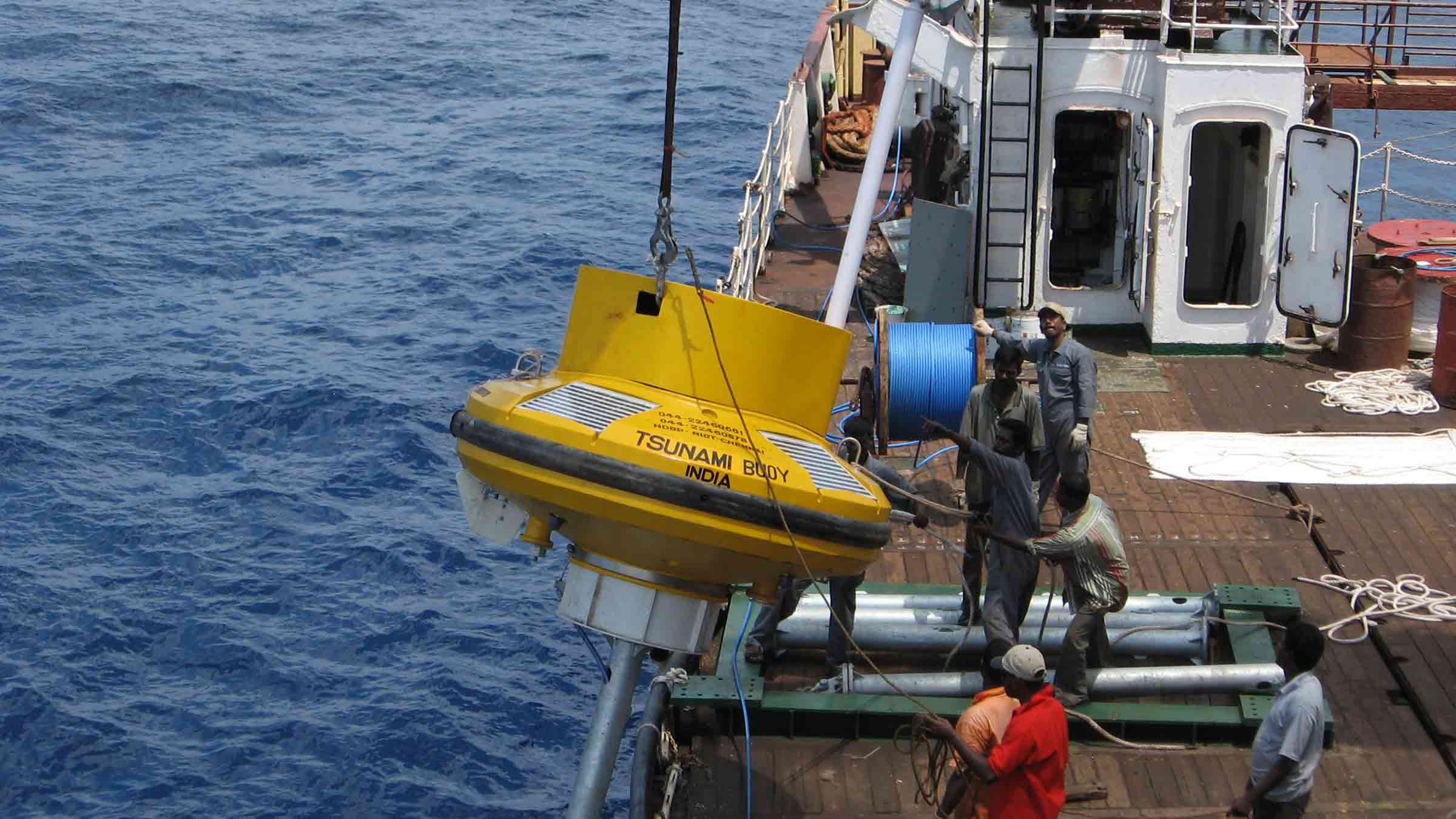
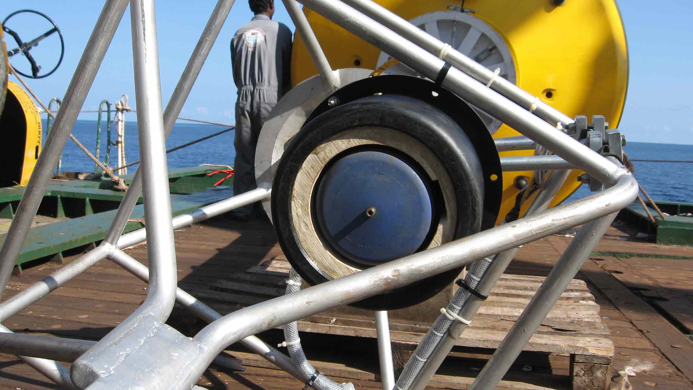
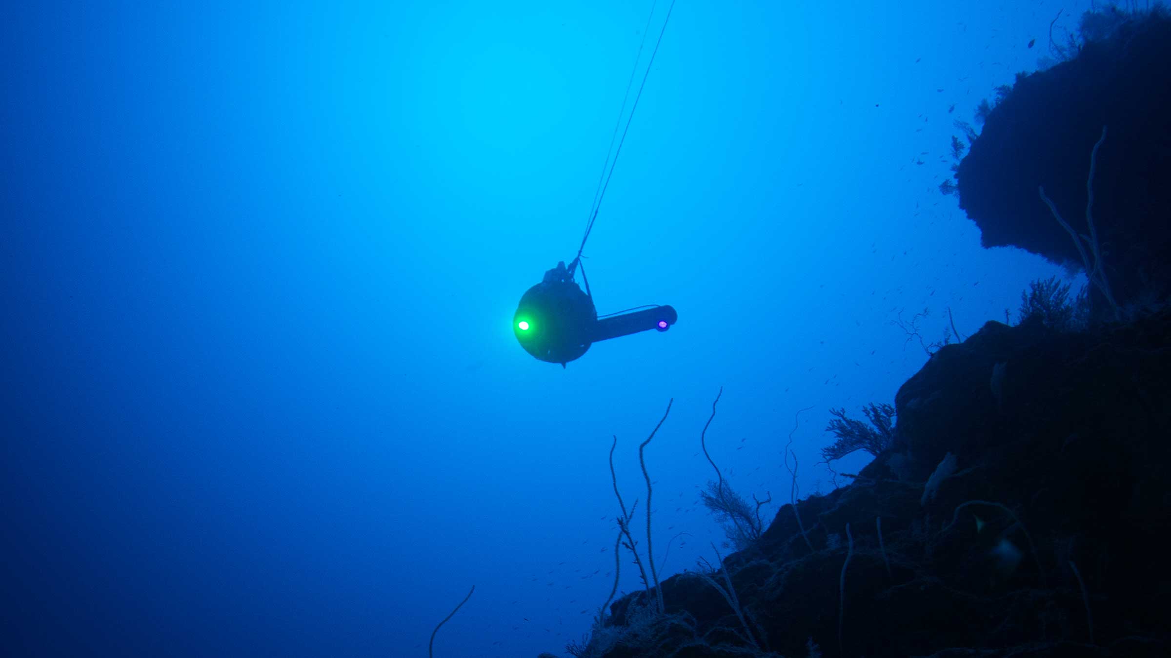
However, to make Solstice work when deployed from a USV several technologies need to come together. First and foremost, it needs a stable platform capable of keeping Solstice at a set height from the seabed as it travels through the water. This is where the next building block, ScanFish 3D, comes in.
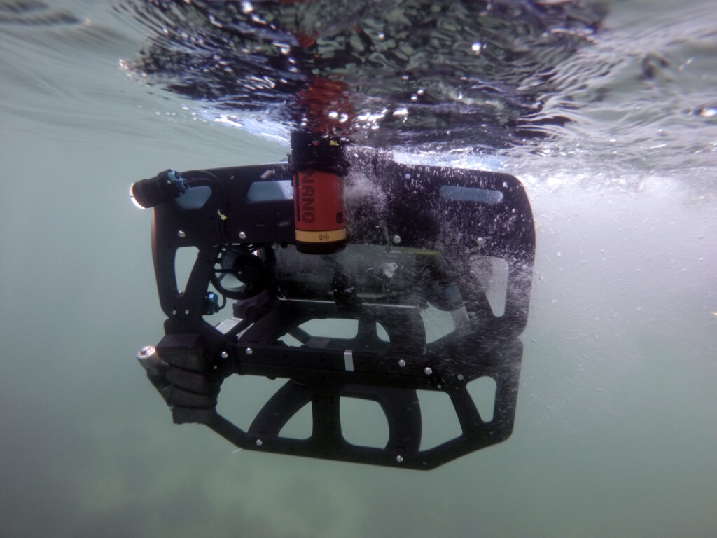
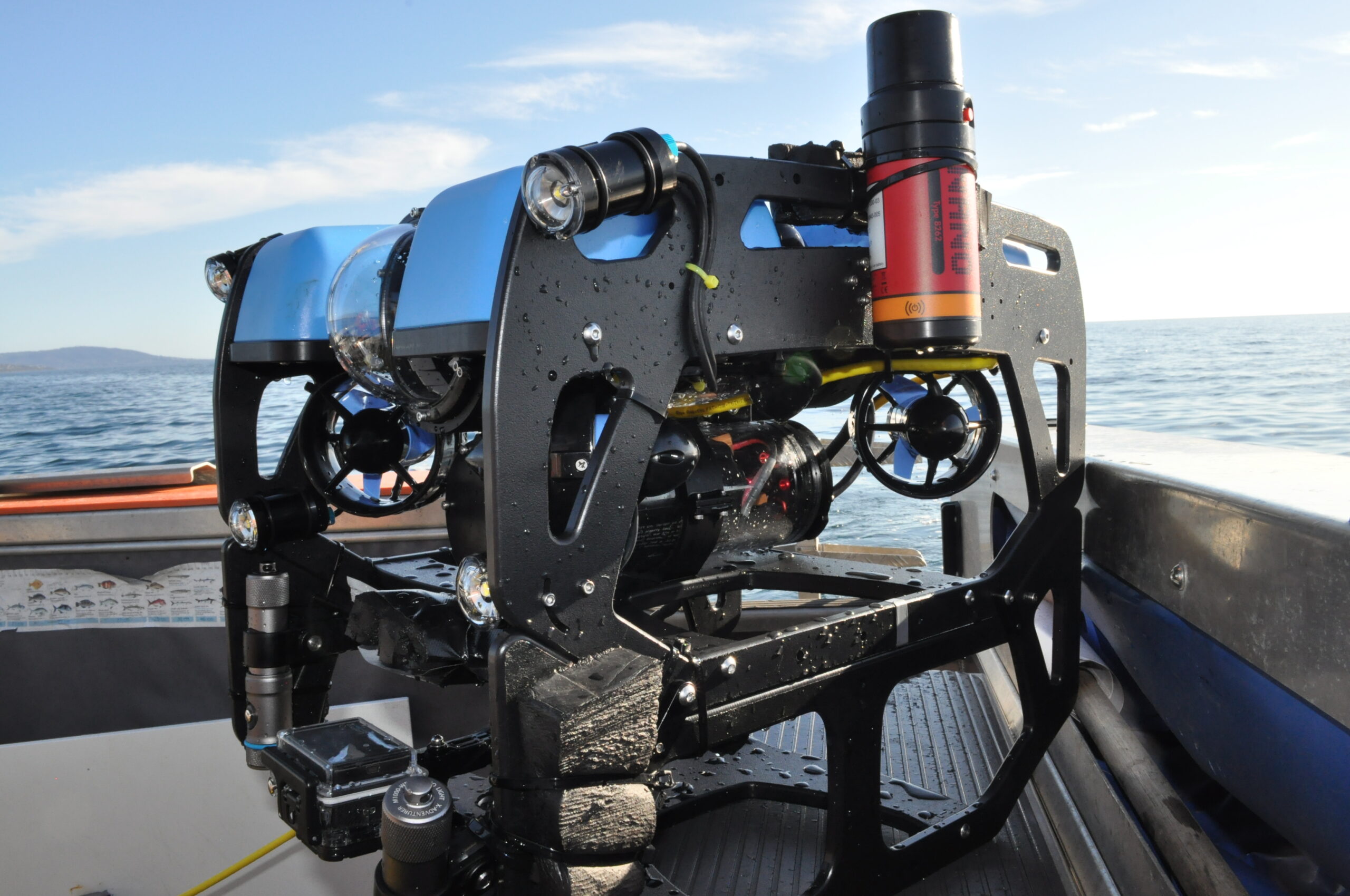
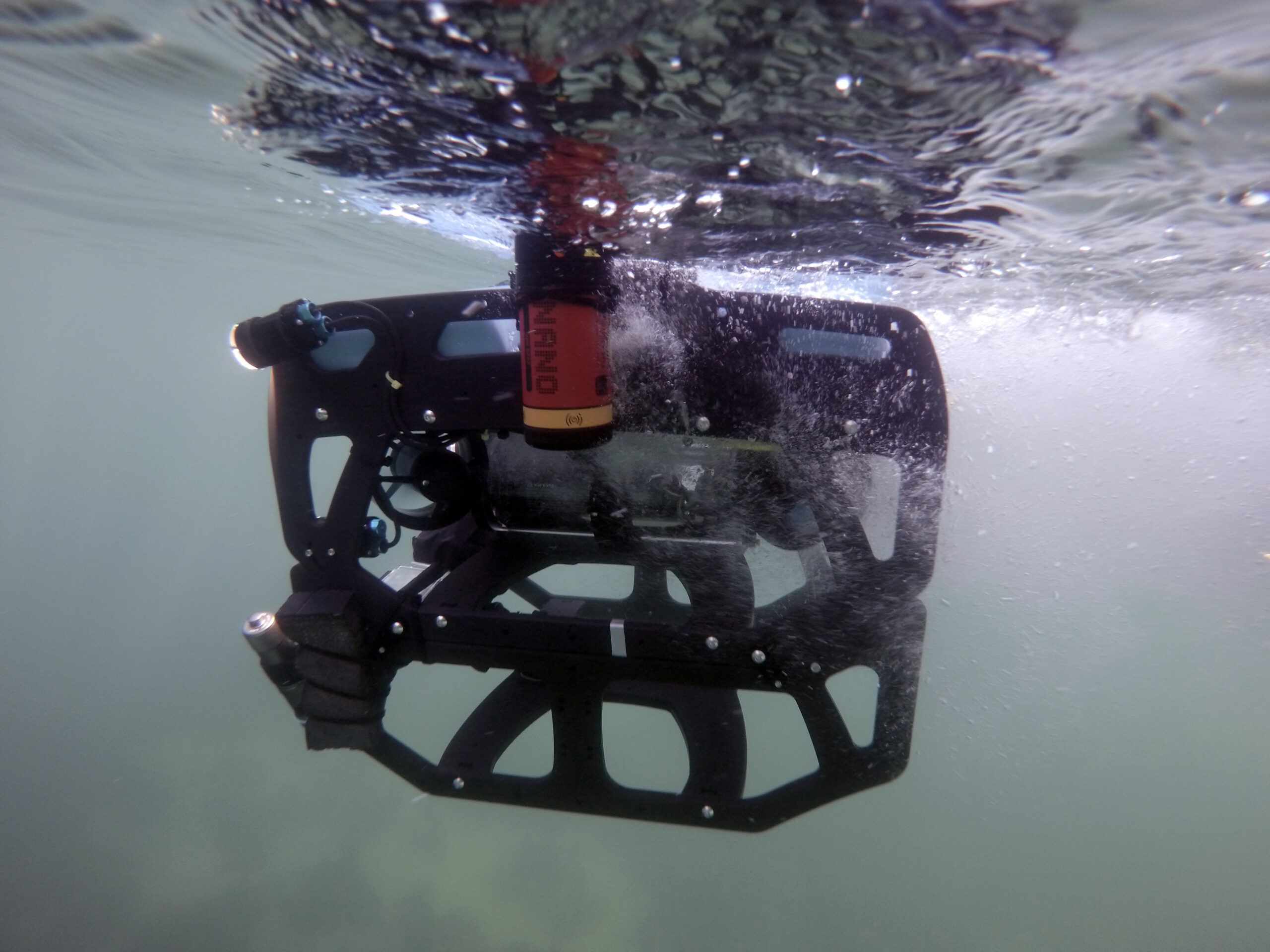
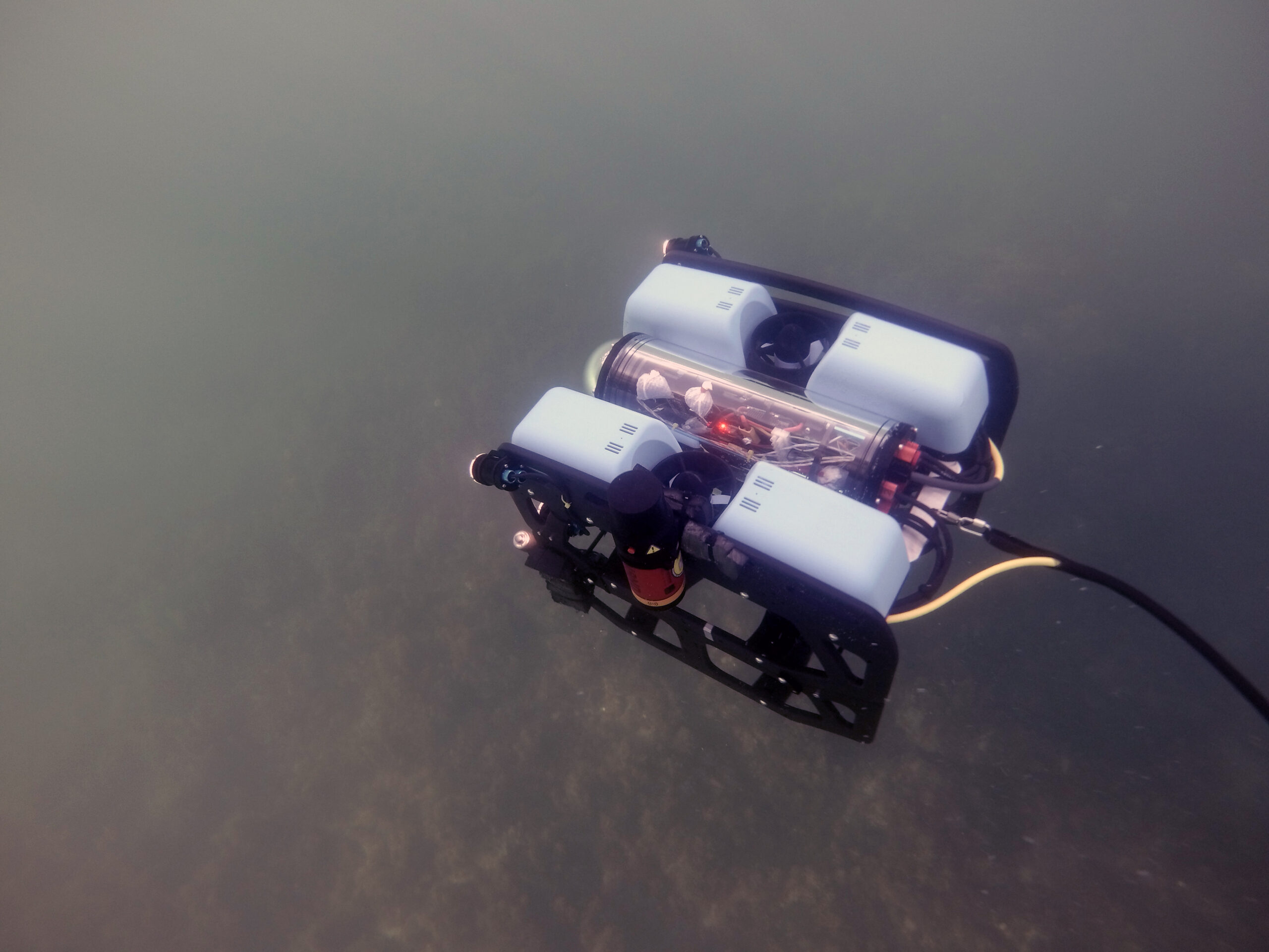
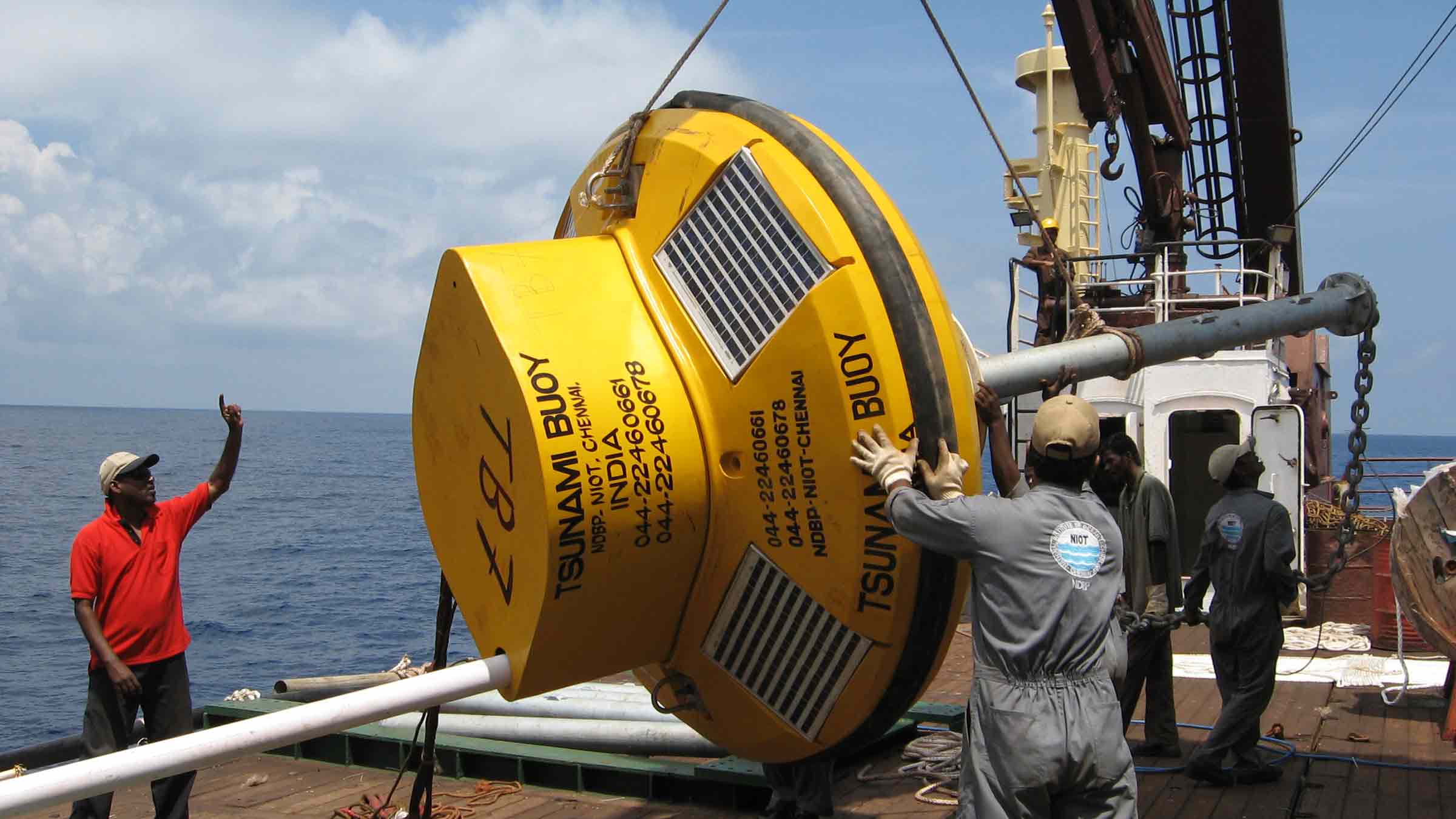
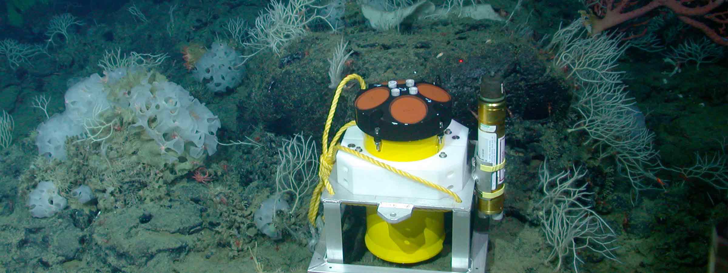
EIVA’s ScanFish 3D

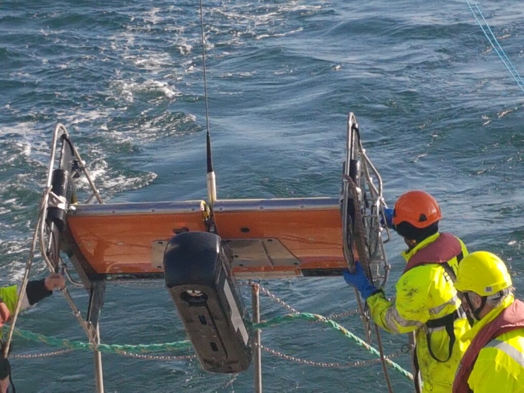
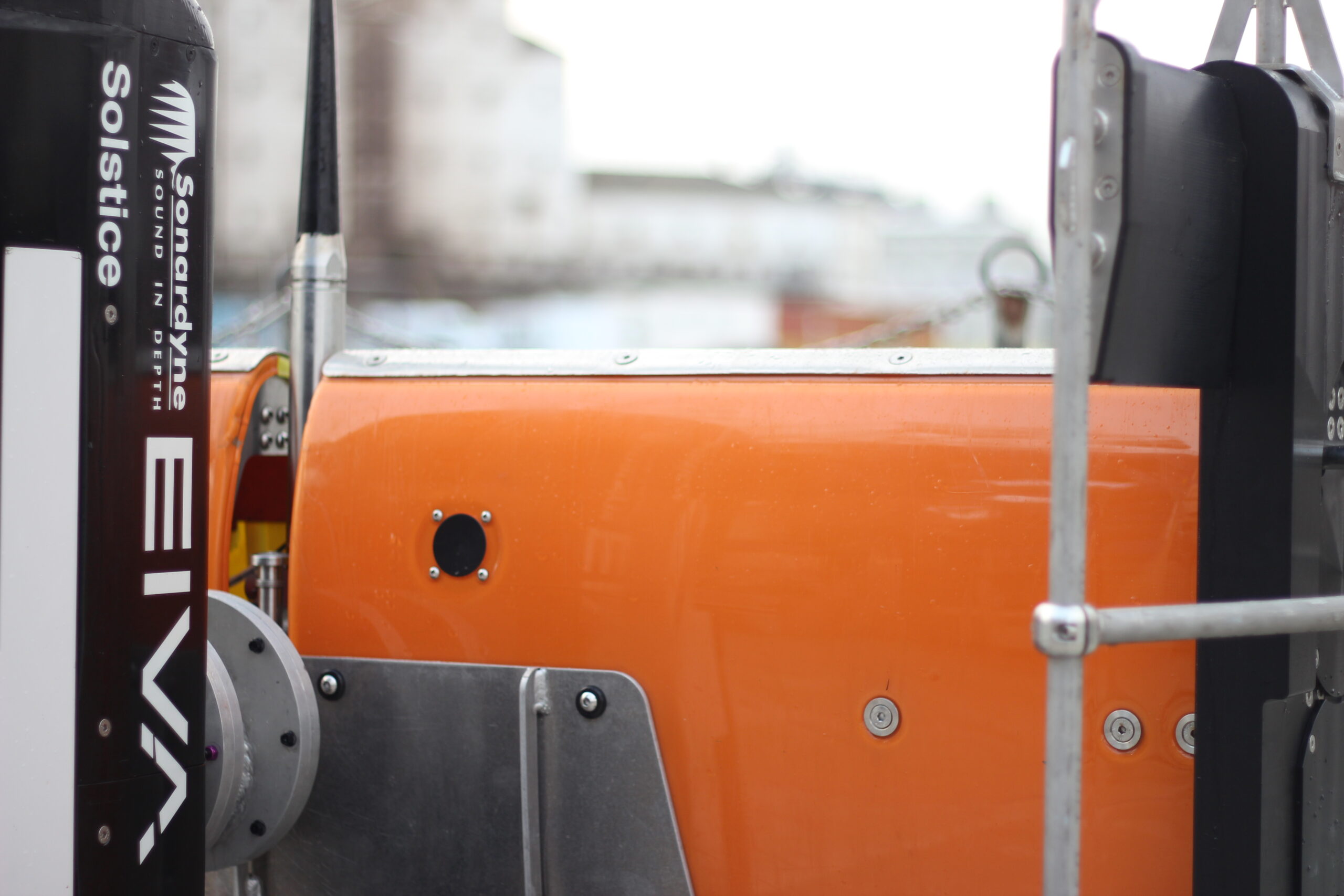
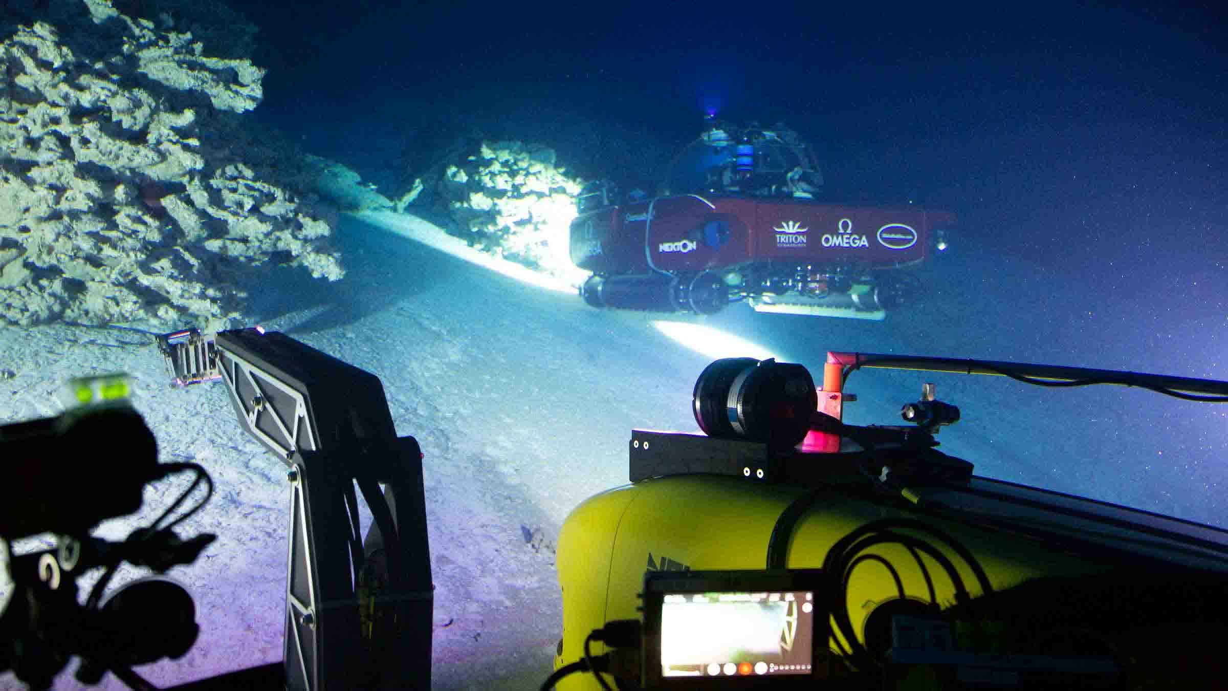
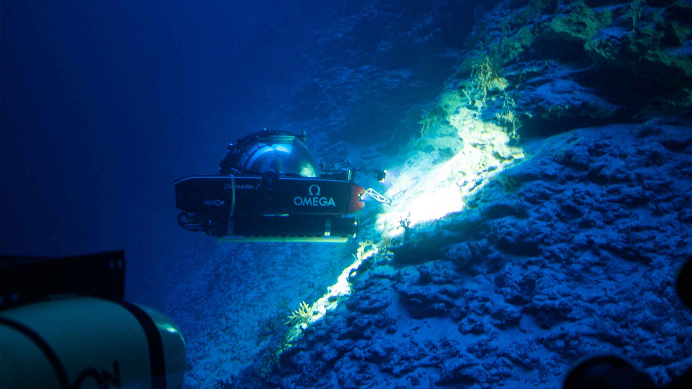
Our other sister company EIVA manufactures ScanFish 3D. The ScanFish 3D is a trusted ROTV platform capable of sailing through the water at a constant height from the seafloor. Designed to be both very stable when surveying and highly dynamic when needing to surface at high speed, there is no need to constantly pay cable in or out to adjust the height.

ScanFish 3D can carry a significant payload and is stable enough for Solstice to excel. Strong enough to be equipped with navigation instruments to accurately geo-reference the data, the platform demonstrates performance similar or better than an AUV, keeping an almost constant heading, pitch and roll as the AUV gathered data.

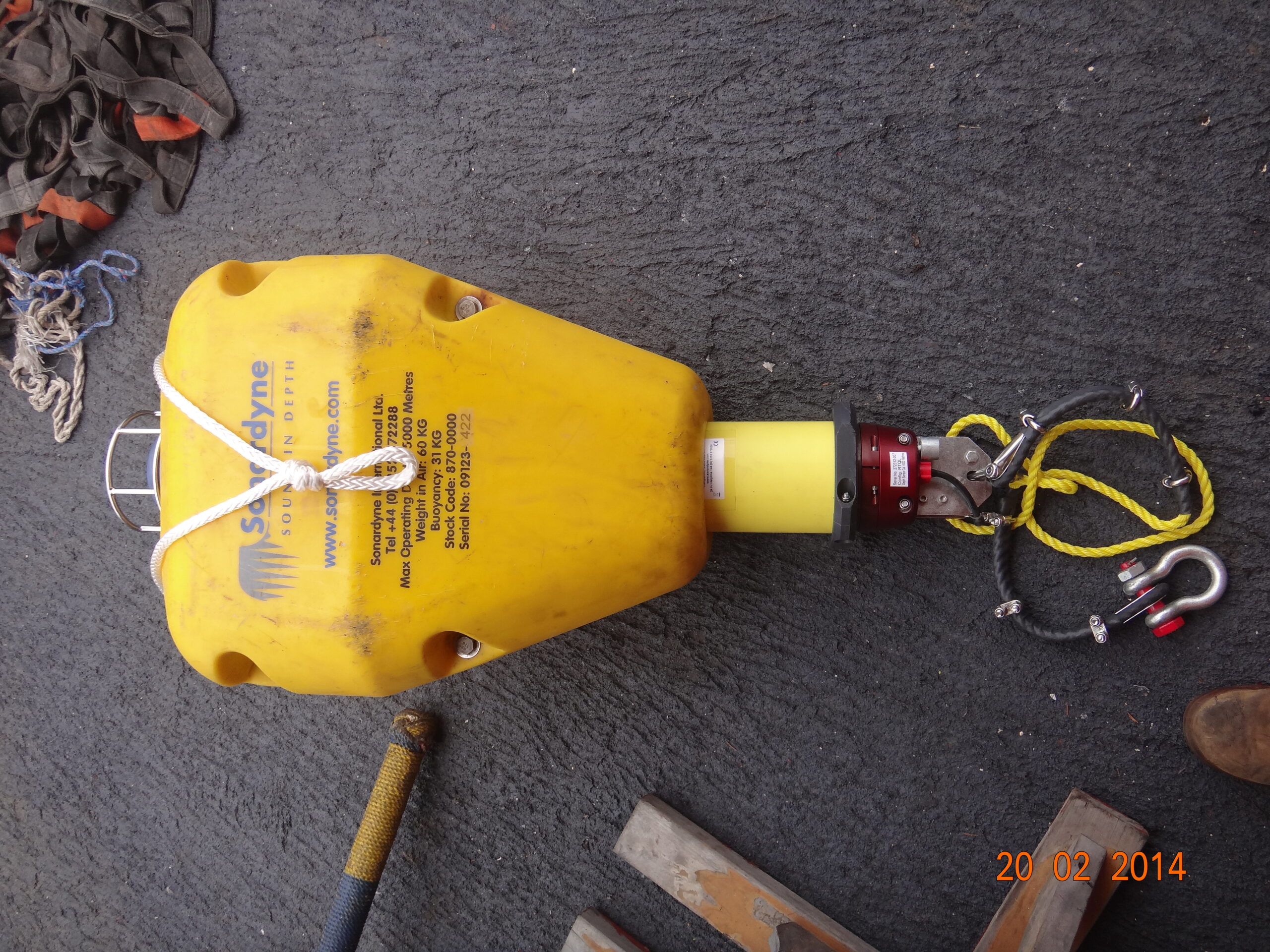
This means that the sonar data can be acquired at the sweet spot for the sensor at 7.5m from the seafloor. Once the data has been gathered, it needs to be georeferenced. This leads us to the next Equinox building block, SPRINT INS.

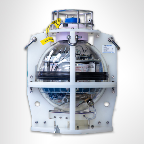
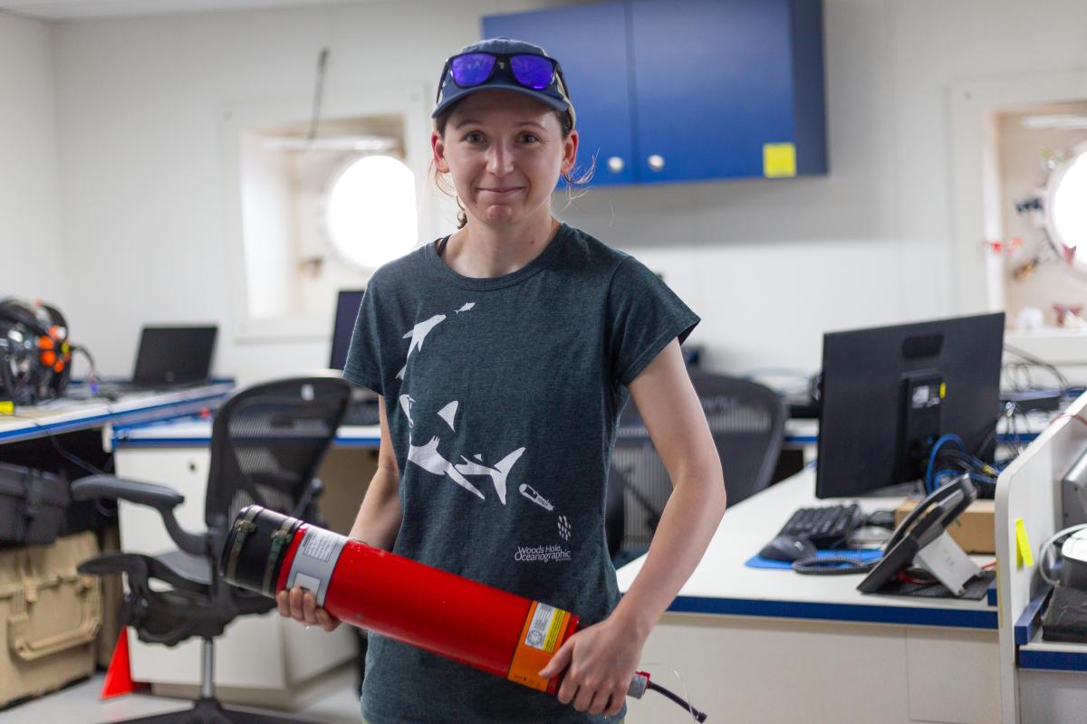
SPRINT INS minimising position errors

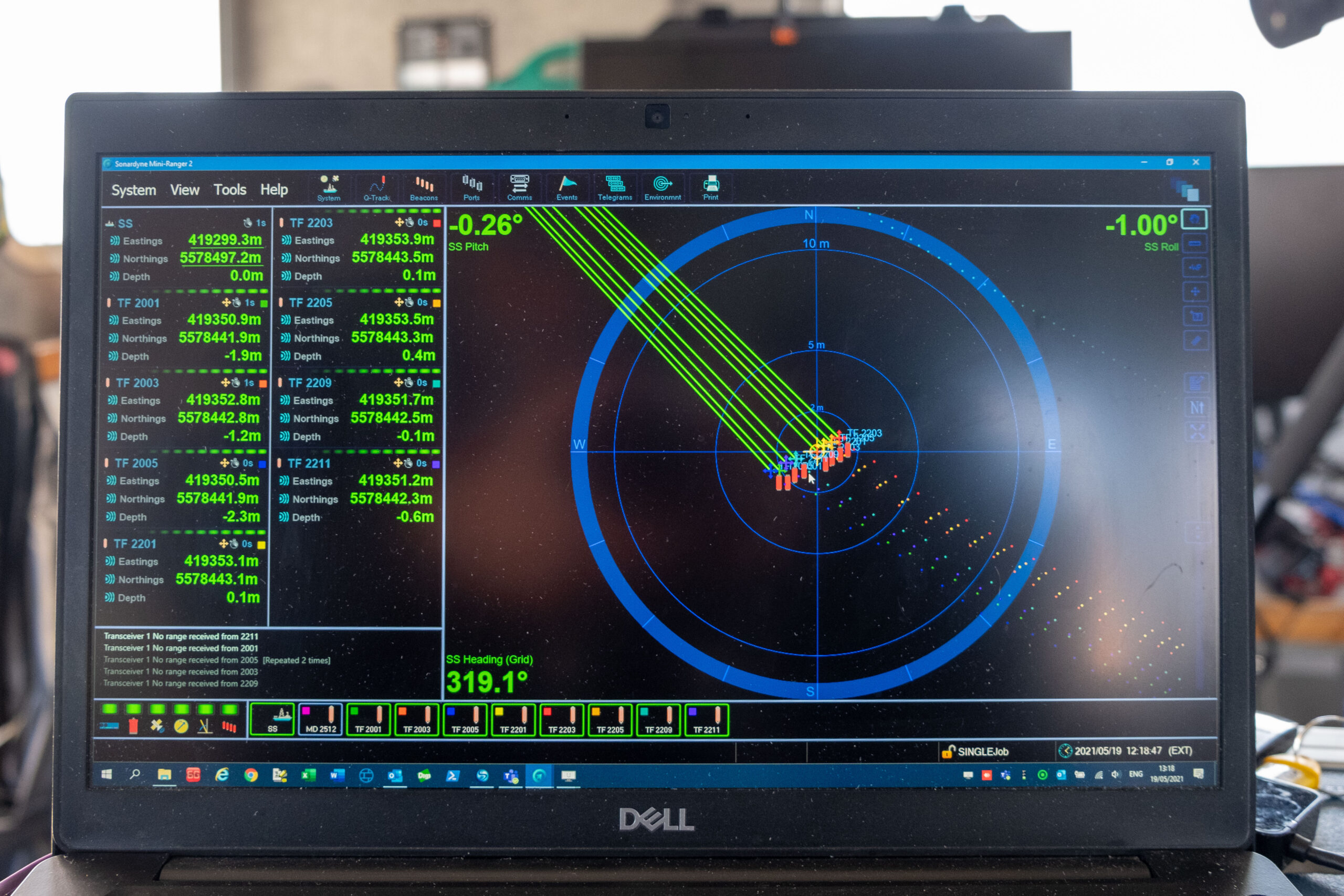
Typically, navies require a 5 m (DRMS) absolute position error for any contact surveyed during mine-hunting operations. The requirement is driven by both the technical limitations of the solutions used to date and the assumption that to re-acquire a target within that position error is achievable. However, in challenging environments, a 5 m error translates as time wasted in the actual process of re-acquiring and identifying the contact.

Commercial-off-the-shelf (COTS) instruments solve this problem effectively at a lower cost. Using a SPRINT INS aided by a Doppler velocity log and a Mini-Ranger 2 ultra-short baseline (USBL) system, Equinox can localise targets within 1 m (DRMS). This decreases uncertainty in MCM missions while improving tactics and the tempo of operations.

Inertial navigation is inherently self-contained, robust and with very good short-term accuracy, but it can drift over time. Therefore, the INS is aided with complementary acoustic positioning, i.e. the DVL and USBL, to provide long-term accuracy and robustness. Conversely, the additional integrity offered by the integration of the INS significantly reduces operational delays during periods of challenging subsea acoustic conditions, such as aeration and noise. In addition, the heading accuracy reported by SPRINT minimises lever-arm effects for targets at the furthest range from the sonar. This is a large source of error in towed sonar systems.

Extensive trials have taken place to test the navigation accuracy achieved by the combination of instruments that form Equinox. In one trial, two bicycles were lowered to the seafloor. They were placed at known positions and were used to establish the navigation accuracy of the system. The results demonstrated the performance to be less than 1 m (1 DRMS), as expected.

With the performance of the combined systems delivering far better than expected results, there is just one last building block needed to complete the solution; the software that stitches it all together.

NaviSuite Kuda

Completing the system is NaviSuite Kuda software, which is used to plan, monitor, and process the data from the Equinox system. NaviSuite Kuda has also been developed by EIVA and is another COTS system used by hydrographers worldwide to run their underwater projects.

To plan a survey, the user defines the sailing route and run lines by simply selecting the area that needs to be surveyed. The software generates a plan that can be fed directly to the USV control software (or to a skipper if using a crewed vessel).

During an MCM mission, NaviSuite Kuda continuously updates the vessel and ScanFish 3D position in real-time. The navigation and Solstice data is processed and displayed on the screen enabling an operator or automatic target recognition (ATR) algorithm to review it as it is being gathered. The information can then be used to inform the next stage of the mission while the survey is taking place.

The results

The critical advantage that Equinox offers over competing systems is that it is made from combining products that retail as COTS. This means its component parts have been deployed in thousands of mobilisations and have been proven, time and again, to meet or reduce error margins.

Equinox selects best of breed COTS to deliver a step up in capability. The result is improved performance compared to standard side-scan sonar systems, improved navigation accuracy several times better than any other system in the public domain, and at a price exceedingly lower than competing products that have been specifically designed to conduct mine-hunting operations.

For a navy this means an enhanced ability to mobilise a capability quickly, using components that can be easily looked after and maintained and feeding into existing training programmes and a community of existing users.

Underpinning the Indian Tsunami early warning system

Sonardyne Bottom Pressure Recorders (BPR) have been at the heart of the Indian Tsunami Early Warning System (ITEWS) since its establishment in 2007. Based on Sonardyne’s workhorse Compatt transponder, our BPR instrument was developed in direct response to the devastating 2004 Indian Ocean Tsunami.

The challenge

30% of India’s population (ca. 420 million) live on its 7,500 km long coast and are consequently highly vulnerable to devastating Tsunamis such as the one that occurred on 26th December 2004. This killed over 230,000 people in the Indian Ocean region, with 10,749 confirmed deaths in India and another 5,640 missing. While seismometers are an important component of Tsunami warning, only Bottom Pressure Recorders can detect the passage of an actual Tsunami. Indeed, Tsunami warnings based purely on seismic data have the potential to produce false alarms, which are costly in wasted evacuations and undermine public confidence.

The essential elements of a Tsunami Detection System (TDS) are:

1. The capability to detect a Tsunami – While a Tsunami may arrive at the coast many metres high, in open ocean they pass almost imperceptibly and may only be a few centimetres in height, although this elevation in sea-level can be maintained for as long as 20 minutes.

2. The functionality to provide this detection ashore with sufficient warning time – A Tsunami travels (in ms-1) at roughly the square root of the depth of the water (in m) multiplied by the acceleration due to gravity (9.81ms-1): In short, it travels faster in deeper water, so for example, in 1,000m of water it will be travelling at over 1,100 kmh-1. In India’s case, the Andaman-Sumatra and Makran subduction zones are located within a few hours Tsunami travel time of the Indian coastline

3. High reliability in delivering the detection information ashore – BPRs, as the name implies are deployed on the seabed, so rely on robust telemetry, which has to operate even in poor weather conditions continuously 24/7/365.

The solution

The catastrophic 2004 Indian Ocean Tsunami led Sonardyne’s founder, John Partridge, to initiate development of a variant of the Compatt 5 seabed transponder to detect a Tsunami passing overhead.

With an extensive track record in the oil and gas industry, this instrument was ideal to form the heart of a TDS requiring very high reliability. Nevertheless, integration of a Digiquartz pressure sensor to enable the Compatt 5 as a BPR, required significant development. This particularly involved reduction of the power required for continuous operation on battery power. Similarly, a new transceiver with low quiescent power, capable of long endurance deployment on a surface telemetry buoy, also had to be developed.

Development was so rapid that when India’s National Institute of Ocean Technology (NIOT) in Chennai, started looking for a TDS in 2005, it was ready for competitive field trial. Sonardyne’s solution was subsequently selected in 2006, leading to deployment of operational systems in the Bay of Bengal and Arabian Sea in 2007.

In normal operation the Digiquartz pressure sensor in the BPR continuously measures water pressure and this data is stored every 15 seconds. The pressure data is then acoustically transmitted every hour to the surface, where an acoustically baffled transceiver, mounted beneath a buoy, receives this data. The buoy is linked to NIOT’s Mission Control Centre (MCC) by satellite communications, so that not only can data be transmitted ashore quickly, but also the health of the BPR is remotely monitored and, if necessary, reconfigured.

Embedded in the BPR is the National Oceanic and Atmospheric Administration’s (NOAA) Tsunami detection algorithm, which compares each measurement to the predicted pressure [Figure]. This predicted pressure uses the previous 3-hour history to take account of tide, weather and temperature variation. Should the difference between the two exceed a programmable default threshold of 3 cm for two consecutive samples, the BPR switches into Tsunami Alert Mode, which then initiates a sequence of data transmissions for the next few hours.

Sonardyne’s Wideband acoustics are central to the functioning of the system, and with the subsequent replacement of the Compatt 5 with Compatt 6, Sonardyne’s latest TDS offering is equipped with the most robust and efficient wideband acoustic telemetry available.

Of India's population

0

%

live on its long coast line

Monitoring

24/7/365

The results

Soon after the first batch of BPRs were deployed, on the 12th September 2007, the system detected its first Tsunami, which was triggered by an 8.2 magnitude event off the coast of Sumatra at 04° 30’ S 101° 18’ E. How the Tsunami generated was tracked across three of the Indian Tsunami Buoys (ITB) is shown in the gallery.

Located between 1,760 – 2,300 km away, all three stations recorded the seismic ground wave arrival between 7 – 12 mins after the event started. Between 2 – 3 hrs later, the wave itself, which was less than 10 cm in height, passed over the three BPRs, indicating that it had travelled at between 740 – 800 km/h over this period.

Today, Sonardyne’s TDS continues to deliver bottom pressure and event data to NIOT, which is responsible for delivering sea-level data to the Indian Tsunami Early Warning Center (ITEWC) at the Indian National Centre for Ocean Information Sciences (INCOIS) in Hyderabad. In 2014, NIOT reported that system data availability had been 98.83%, with a Mean Time Between Failure (MTBF) of 1.62 years, noting that the majority of these failures were due to external impacts, including weather and human interference with the surface buoys, resulting in damage to surface communication and data systems.

Seabed-to-desk data harvesting with HydroSurv

Combining uncrewed surface vessels (USVs) and cloud services can help offshore wind farm developers and operators collect and act on ocean data faster and more efficiently. Learn how we’re using our expertise to make rapid seabed-to-desk metocean data collection happen with USV innovator HydroSurv.

The challenge

Offshore renewable energy projects need data throughout their lifespans to support proper design, installation, operation, and maintenance*.  This includes bathymetry and geotechnical data, but also metocean data, such as current, wave and sea height characteristics.

Water current profiles, for example, are needed to help locate turbine foundations, cables and cable landfalls. During the life of a project, operators need to understand what’s happening in the water column and at the seabed, to prevent downtime, ensure safe and efficient operations and understand fatigue life.

As wind farms start to be built in deeper waters, ocean data becomes even more critical, as conditions become more complex and especially where floating platforms will be deployed. Water current, height and direction are all critical, for planning and operations.

Traditionally, much of this data is gathered using seabed sensors, such as acoustic Doppler current profilers (ADCPs) and pressure sensors, and conventional crewed vessels. However, when accurate spatial and temporal data is required, this isn’t always efficient. The required frequency of site visits to gain sufficient data increase risk and cost, especially when sites are further from shore. Because of this, there is growing demand for remote, lower cost and emissions survey and data harvesting solutions that help reduce downtime and improve yield.

The solution

USVs can visit challenging offshore sites more frequently, at significantly lower cost and with much lower carbon emissions than a crewed vessel.

So, we’ve been working with Exeter-based HydroSurv, an innovator in uncrewed vessel technology, to demonstrate the benefits of USV platforms to provide seabed-to-shore rapid data gathering. This was through a collaborative project, co-funded by Innovate UK through its Robotics for a Safer World: extension project.

HydroSurv’s REAV-40 USV was paired with our intelligent seafloor and vessel-mounted instruments, alongside satellite communications and cloud-based services, to provide an end-to-end seabed-data-to-shore service.

That included our Mini-Ranger 2 Ultra-Short BaseLine (USBL) acoustic positioning system, which is popular for use on mid-size USVs. That’s because it provides USVs with an easy to install and use capability to position, track, communicate with and health check and configure/reconfigure mobile and seafloor-based instruments. It’s the link from the seabed to the surface! Like all Sonardyne hardware, it uses Sonardyne’s 6G Wideband spread-spectrum digital signal processing to communicate, track and position any 6G-enabled instruments.

The REAV-40 also had our SPRINT-Nav hybrid acoustic-INS navigation instrument onboard. SPRINT-Nav provides USVs with navigational redundancy, helping them to ride out drops in GNSS signals, which can be a challenge in wind farms and near built up areas or large structures. This also helps to improve multibeam echosounder data gathering, but it can also support station keeping.

The result

This project demonstrated the application of HydroSurv’s USV and Sonardyne’s acoustic communications technology for rapid environmental data collection to Blue Gem Wind, Simply Blue Group and Offshore Wind Consultants (OWC) focusing on the Valorous floating offshore wind project. The demonstration took place in the Celtic Sea.

Using the REAV-40 and our instruments, HydroSurv streamed a live, online demonstration of data harvesting from underwater instruments, straight to a cloud portal to Blue Gem Wind, Simply Blue Group and OWC audiences in multiple locations.

The integration demonstrated real-world capability of USVs, as platforms for integrated systems and sensors, to execute near-real-time critical data harvesting campaigns safely and cost-efficiently for the offshore sector. With our instruments, combined with cloud-based services, they were able to provide near real-time seabed data-to-desk capability, bringing data and value to the customer.

HydroSurv is now making Mini-Ranger 2 and SPRINT-Nav Mini integration available for customers to specify for turnkey integration into its USV platforms.

*Read DNV’s Metocean Characterization Recommended Practices for U.S. Offshore Wind Energy or IMAREST’s Metocean Procedures Guide for Offshore Renewables.

“This collaborative, seabed-to-desk data collection project provided a fantastic opportunity for us to demonstrate a new integrated survey solution for the offshore wind sector. The project has provided a real-world example of the ability to monitor subsea assets at greater frequency, at lower cost and with a significant reduction in carbon emissions when compared to survey campaigns carried out with traditional, crewed vessels.

We see this integrated solution with HydroSurv’s USV technology and Sonardyne’s subsea communications equipment as a real enabler for the offshore wind sector and others where a win-win reduction in cost and increased visibility of live data and subsea survey asset health provide a new level of service, well suited to the increasingly challenging environments faced by offshore wind farm developers.”

Ian Godfrey Chief Operating Officer, HydroSurv

“The world is increasingly digital. We now routinely use the cloud in our homes and even the high street, for example. We have all the data we need at our fingertips. It’s time we took more of this capability to our offshore and underwater operations. This project is a step towards that vision.

Working with HydroSurv, we’ve shown how we can create intelligent networks of sensors and uncrewed platforms. By doing this we can provide users access to the actionable information they need from seabed sensors, in near real-time, wherever they are in the world. What’s more, they can even configure or reconfigure their remote sensors, all from their desktop.

Put it this way, it’s like having access to your home thermostat from your smart phone, except it’s on the seabed. This is a new digitally enabled way of working, bringing decision-making about operations many kilometres away and hundreds of metres beneath the sea surface, to your fingertips.”

Aidan Thorn Business Development Manager – Marine Robotics, Sonardyne

Pinpointing Precision: Arctia chooses Sonardyne system for subsea surveys

When Finnish state-owned hydrographic services and icebreaking company Arctia need to accurately and reliably position their subsea survey equipment there is only one logical solution.

Arctia provide a wide range of services for Finland’s maritime industry including icebreaking, hydraulic engineering, planning and permit services, fairway maintenance and survey services, hydrographic services and research.

Their services all rely on precise subsea navigation and tracking, especially those using towed survey equipment. This is where Sonardyne come in, Arctia have chosen their Mini-Ranger 2 Ultra Short BaseLine (USBL) system with WSM 6+ transponders for their marine survey services.

Many of their marine surveys are conducted around offshore wind farms where teams of internationally certified hydrographic surveyors and shallow water experts provide tailor-made survey, analysing and planning solutions to meet even the most demanding of customer needs.

Mini-Ranger 2 is one of Sonardyne’s most popular USBL systems, chosen for its small size, value and dependable performance in all underwater environments. It’s the perfect choice for fitting to small survey vessels, moored barges and uncrewed vessels.

For Arctia, it is the perfect partner for towed hydrographic survey equipment such as magnetometers and sidescan sonars used as part of their survey services. With depth ratings of up to 1000 metres and able to operate in temperatures as low as -5 degrees Celsius, it’s ideal for the Baltic Sea and offers the opportunity to upgrade to other versions for depths up to 4,000 metres should Arctia and their customers operate at greater depths in future.

If you have a similar challenge in your subsea navigation and tracking operations, contact us to see how we can help.

Arctia explains why they chose Mini-Ranger 2 for their survey operations

“Sonardyne products give us the competitive edge in marine surveying in the northern Baltic Sea as the accurate positioning of towed and other remote equipment, like ROVs, is increasing requirement from customers. We’ve had experience with many different methods and have had Sonardyne products as rental equipment many times, which eventually led to us purchasing our own Mini-Ranger 2. We expect to serve many customer segments in marine infrastructure projects by offering the best quality seabed data with high accuracy provided by Sonardyne products.”

Juuso Pylkkänen Geologist team lead

Sonardyne adds

“For a company such as Arctia operating in the varied depths of coastal and offshore waters, the Mini-Ranger 2 system with WSM 6+ transponders is an obvious choice. Their surveys of offshore wind farms and other structures require precise, reliable tracking and positioning which Mini-Ranger 2 is proven to deliver time and time again. We look forward to working with Arctia as they continue to grow their maritime services.”

Duncan Rigg Sonardyne Sales Manager
Jump to

Overview

Trusted to protect coastal communities

Developed, supplied and maintained in partnership with MSM Ocean, our Tsunami Early Warning System (TEWS) provides vulnerable coastal communities with early warning of an approaching tsunami wave. TEWS combines our robust acoustic instruments together with MSM Ocean’s IALA compliant buoy and easy to use shore control centre software to provide unrivalled system availability.

Measuring the shortest change, to give the longest warning – how it works

A tsunami wave in deep water creates a small (a little as 3 cm) but measurable change in pressure that can be maintained in excess of 20 minutes.

The sensitive pressure sensor in the BPR detects the small, but continuous change in water pressure, which triggers transmission of a series of warning messages to a surface buoy moored above it. This means that the first message warning of a tsunami, caused by a small variation in water pressure on the seabed thousands of miles from shore, can be in the office of the monitoring organisation within minutes, if not seconds.

The Tsunami Early Warning System (TEWS), developed by MSM Ocean and Sonardyne, centres around a sophisticated Bottom Pressure Recorder (BPR) deployed on the seabed. This modified Compatt 6 transponder works in conjunction with a surface buoy and onshore control centre to create a comprehensive tsunami detection network.

The BPR operates at depths up to 7,000 m and features impressive longevity, running for four years on standard power or up to nine years when housed in a glass sphere configuration. Operating in the LMF band (14-20 kHz), the device samples water pressure every 15 seconds and typically transmits data hourly to the surface. The system is compatible with various surface transceivers, including our Ranger 2 USBL system.

The detection process is both sensitive and precise. The BPR can identify pressure changes as small as 3 centimetres, using the NOAA DART® algorithm to compare measured pressure against predicted values. When two consecutive variations exceed the preset threshold (typically 3cm), the system enters alert mode. Data is then transmitted acoustically to the surface buoy, which relays the information via dual Iridium satellites to the shore. This entire alert process takes only minutes to complete.

System management is streamlined through the NETCOM-TS web application, which provides comprehensive control and monitoring capabilities. The data is shared with NOAA’s National Data Buoy Center, ensuring broad distribution of critical warning information. The system can be configured remotely, and maintenance is straightforward thanks to an acoustic release mechanism that allows for simple recovery and redeployment. Unlike some competing systems, this solution requires no underwater cables, making it particularly reliable and easy to maintain.

This integrated system serves as a crucial link in the chain of tsunami detection and warning, providing coastal communities with vital advance notice of potential threats. By combining robust hardware with sophisticated detection algorithms and seamless communication protocols, the system delivers a dependable early warning solution that can save lives and property in vulnerable coastal areas.

At a glance

  • All-in-one wireless solution for detecting tsunamis; no fixed sea-to-shore infrastructure required
  • Detects height variation on the water surface as small as 1 mm; a change of 3 cm launches a tsunami event (tsunami alert)
  • Generates Deep-ocean Assessment and Reporting of Tsunamis (DART®) warnings which can be received onshore within seconds of a confirmed tsunami event
  • Low cost of ownership; COTS technology with long service intervals
  • IALA compliant buoy for increased safety of the system to guarantee availability
  • Remote monitoring and control for ease of operation
  • Intuitive shore control interface using MSM Ocean’s NETCOM-TS software

Why choose Sonardyne & MSM?

Easy ownership

Our warning system is commercial-off-the-shelf, can be acquired easily, delivered in short timescales and commissioned without any significant national investment in, or construction of, sea-to-shore infrastructure.

It’s integrated

Competing warning systems are often made up of individual sensors, battery packs and modem with vulnerable connectors and cables. Together with MSM Ocean, we provide a one-stop shop solution that’s rugged and robust.

It’s proven

The system’s built using proven, high security wireless seabed to shore monitoring and communications technology, with proven performance in detecting tsunamis.

Seabed to surface communications (Sonardyne)

• Long range for deep water deployment far offshore; 19-34kHz frequency band
• Advanced protocols to minimise data loss and re-sends
• Directional transducer for optimised seafloor-to-surface communications
• 100 – 900 baud user payload, bi-directional
• Powered by 6G and Wideband 2 technology: in use globally within science, energy and defence

Surface to shore communications (MSM Ocean)

• Uses the Iridium low earth orbit (780 km) constellation of polar orbiting satellites
• Incorporates dual modems and antennas for redundancy
• NETCOM-T software web application enables remote management of the tsunami buoy and BPR from Shore Control Centre

BPR Design (Sonardyne)

• Robust all-in-one design; compact, integrated, self-powered, no cables to get damaged
• Easy to deploy; standard depth rating of 5,000 m (option for 7,000 m)
• Integrated release mechanism for simple recovery of seabed BPR for servicing
• 2 year battery life typical; up to 10 years possible with alternative design of BPR
• Simple to integrate surface transceiver on instrumented buoy (solar and communications)

Tsunami Buoy (MSM Ocean)

• Suitable for deployment in depths of up to 4,000 m
• IALA compliant topmark, lighting with 5 NM luminous range
• Aluminium superstructure with a 2.4 m diameter shock-resistant closed-cell polyethylene foam float and stainless-steel tail
• Multiple safety and anti-vandalism measures fitted as standard: GPS out of position alarm, unremovable solar panels, impact sensor, intrusion sensor

A typical TEWS configuration (Per monitoring location)

• Seafloor deployed BPR transponder and floatation, 5,000 m rated, 2 year battery life. Sonardyne iWand back-deck and workshop test and configuration device
• Moored, IALA-compliant communications buoy equipment equipped with sub-surface acoustic transceiver, power, navigation safety aids and redundant satellite communications gateway
• MSM Ocean command and configuration software used to remotely control and monitor the TEWS and issue alerts

Ownership

• Warranty: 1 year return to Sonardyne MSM Ocean service centre
• Training: onsite or remote operator and maintainer training required
• ITAR Controlled: No
• UK Export Licence: Not required

Specifications

Feature Type 8141 Buoy Mounted Transceiver Type 8142-000-02 Buoy Mounted Transceiver
Frequency Band LMF (14–19 kHz) LMF (14–19 kHz)
Transducer Beam Shape Directional Directional
Transmit Source Level (dB re 1 µPa @ 1 m) 196–172 dB (3 levels) 196–172 dB (3 levels)
Receive Sensitivity (dB re 1 µPa) 95–130 dB (6 levels) 95–130 dB (6 levels)
Telemetry (Wideband 2) 100–900 baud, user payload, bi-directional 100–900 baud, user payload, bi-directional
Sonardyne Messaging Service (SMS) data buffer 128 bytes 128 bytes
Command/Control Accessed through communications interface Accessed through communications interface
Error Detection and Correction Advanced protocols to minimise data loss and
re-sends
Advanced protocols to minimise data loss and
re-sends
Communications Interface RS232 (9,600–115,200 baud) RS232 (9,600–115,200 baud)
Dimensions (Length x Diameter) 608 x 260 mm 608 x 260 mm
Weight/Mass 9.75 kg (weight in water)
5.26 kg (weight in air)
9.75 kg (Weight water)
52 N (mass)
External Power Requirement 24–50 V dc, 1 W quiescent,
100 W peak
24–50 V dc, 1 W quiescent,
100 W peak
Armoured Cable to buoy Payload Included (10 m, 8-core, with strain relief) Included (10 m, 8-core, with strain relief)
Feature Type 8303 Bottom Pressure Recorder 6 Type 8303-6226 Bottom Pressure Recorder 6
Depth Rating 5,000 m (4,100 and 7,000 m option) 6,000 m
Frequency Band LMF (14–19 kHz) LMF (14–19 kHz)
Transducer Beam Shape Directional Directional
Transmit Source Level (dB re 1 µPa @ 1 m) 202–169 dB (5 levels) 202–169 dB (5 levels)
Receive Sensitivity (dB re 1 µPa) 80–120 dB (6 levels) 80–120 dB (6 levels)
Telemetry (Wideband 2) 100–900 baud, user payload, bi-directional 100–900 baud, user payload, bi-directional
Battery Life (Monitoring) 725 days standard (1,450 days maximum option) 1,450 days
Working Load Limit (4:1) (Release) 250 kg 250 kg
Dimensions (Length x Diameter) 1,100 x 200 mm 1,667 x 200 mm
Weight/Mass 28.2 kg (weight in air)
14.2 kg (weight in water)
(standard 5,000 m option)
49.5 kg (weight in water)
235 N (mass)
Pressure Sensor 4,100 m (7,000 m option) 6,800 m range
BPR Floatation Collar Included (nett buoyancy
300 N)
n/a
Feature Floatation for Bottom Pressure Recorder 6
Depth Rating n/a 6,000 m
Dimensions (Diameter) n/a 857 mm
Weight/Mass n/a 211 kg (weight in water)
760 N (mass)

Jump to

When you need to transfer large amounts of subsea data over short distances – you need BlueComm 200

Transform your underwater operations with BlueComm 200, our pioneering wireless optical communication system. You’ll experience game-changing data transfer speeds enabling true wireless subsea operations, with rates up to 10 Mbps at distances reaching 150 m – even in bright conditions.

Innovation at work

We’ve engineered BlueComm 200 to push the boundaries of your underwater communication. Using advanced LED technology and sensitive photomultiplier tubes, you’ll achieve communication ranges up to 150 m. Its design houses the emitter separately from the receiver, ensuring optimal performance and reliability.

Fast and flexible – key features to power your mission


  • Lightning-fast data transfer: 2.5 to 10 Mbps at ranges up to 150 m
  • Optimal performance: Perfect for moderate to low turbidity dark water (>200 m depth or at night)
  • Flexible deployment: Connect with your AUV, ROV, USV or surface dunker system
  • Deep-rated capability: Ready for operations up to 4,000 m
  • Speed of light technology: Experience unprecedented data transmission rates

Perfect for your platform

Perfect for your:

  • Autonomous Underwater Vehicles
  • Extra-large uncrewed underwater vehicles (XLUUV)
  • Uncrewed Surface Vehicles
  • Remotely Operated Vehicles
  • Tracking and communications systems


Choose your perfect match:

BlueComm 200

When you need maximum range and performance in dark water conditions, our visible light system delivers up to 150 m range – ideal for video transfer and direct vehicle control. You’ll transfer data up to 10,000 times faster than acoustic systems, although ambient light may affect operating range.

BlueComm 200 UV

Working with lights on? Our UV variant maintains reliable communication even with artificial lighting present. Operating at ranges up to 75 metres, it’s your go-to solution for ROV and AUV applications requiring illumination, such as video recording missions.

Both systems offer incredible energy efficiency – transfer more than nine gigabytes of data using just one Lithium D cell battery.

Specifications table

Feature Type 8361 BlueComm 200 UV
Depth rating Up to 4,000 m operation
Data rate 2.5–10 Mbps
Optical communication range Up to 75 m
Mechanical construction Anodized aluminium or titanium
Supply voltage 24–36 V dc
Communications interface 10/100 Base-T Ethernet (static IP address)
Command interface Graphical user interface or Ethernet UDP command set
Receiver unit
Receive wavelength UV (band pass filter blocking visible light)
Receive angle 180° (omni-directional)
Receiver weight in air/water 7.3/3.1 kg
Power consumption 10 W
Emitter unit
Optical transmit power 6 W (radiated light)
Optical wavelength options 450 nm (royal blue), 400–800 nm (white)
Emitter beam shape 180° (omni-directional)
Emitter weight in air/water 3.6/2.6 kg
power consumption 30 W (bandwidth allocation dependant)
Environmental and dimensions
Operating temperature range -5 to 40°C
Storage temperature -20 to 55°C
Dimensions (length x diameter) Receiver 384 x 136 mm
Emitter 199 x 136 mm


Manuals and quick start guides

Optics

• 450 nm (royal blue), 405 nm (UV) optical wavelength
• 180° (omni-directional) beam pattern
• 10 W / 15 W receiver / transmitter optical transmit power

Design

• Titanium and glass construction
• Subconn connectors
• 5.7 kg weight in water, emitter and receiver

Performance

• 2.5 – 10 Mbps data rate
• 4000 m depth rating
• Up to 150m optical communication range

Ownership

What’s in the box?
• Manual, 2 test cables and 2 sets of one emitter and receiver
• Warranty: 1 year return to Sonardyne service centre
• ITAR Controlled: No
• UK Export Licence: Not required