Sonardyne
Support Centre
Jump to

Overview

Intelligent monitoring for your subsea assets

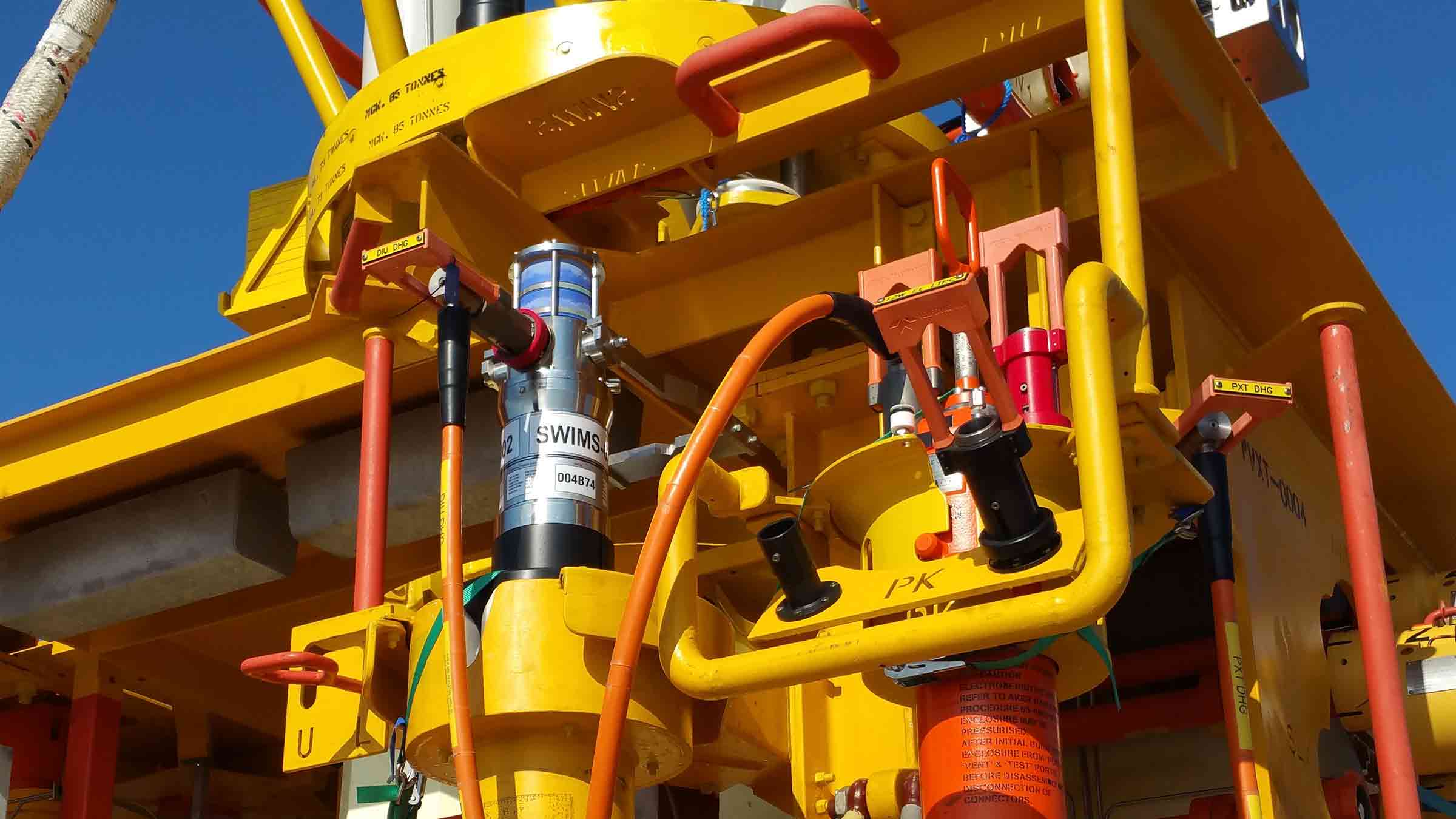
Observer shows you how your subsea assets are really behaving, not how you hope they are. Monitor movement, vibration, load and structural behaviour to reduce risk, prevent unplanned shutdowns and extend asset life.

Onboard processing, extended deployment and wireless data access give you intelligence on demand, keeping operations efficient and assets protected. Subsea asset integrity intelligence delivered. Intervention and cost reduced.

Find out what's possible

We understand that no two subsea asset integrity monitoring challenges are the same

Your underwater infrastructure is subject to constant environmental and process problems, from vortex induced vibration to pressure or temperature cycling, leading to strain and fatigue accumulation. But left unseen, these can lead to unknown risks, downtime or even failure. 

Early detection prevents catastrophic failures and extends asset life. 

Observer delivers the insights you need, when you need them, preventing risk, reducing cost, extending field life. Built on decades of underwater monitoring expertise 

It’s been designed with flexibility of operation in mind; for use on all subsea assets, through the water column, including pipelines, risers, moorings, umbilicals, wellheads and associated infrastructure, helping integrity managers to reduce uncertainty and strengthen decision‑making.  

Enhanced clarity and control through real‑time intelligence

From high or low frequency motion monitoring to a wide range of other sensor data, Observer is designed for maximum flexibility and configurability, putting you in control.  

You can monitor locally or across wider areas, from short-duration campaigns to long-term integrity management. It’s non-intrusive, wireless communications make this possible. 

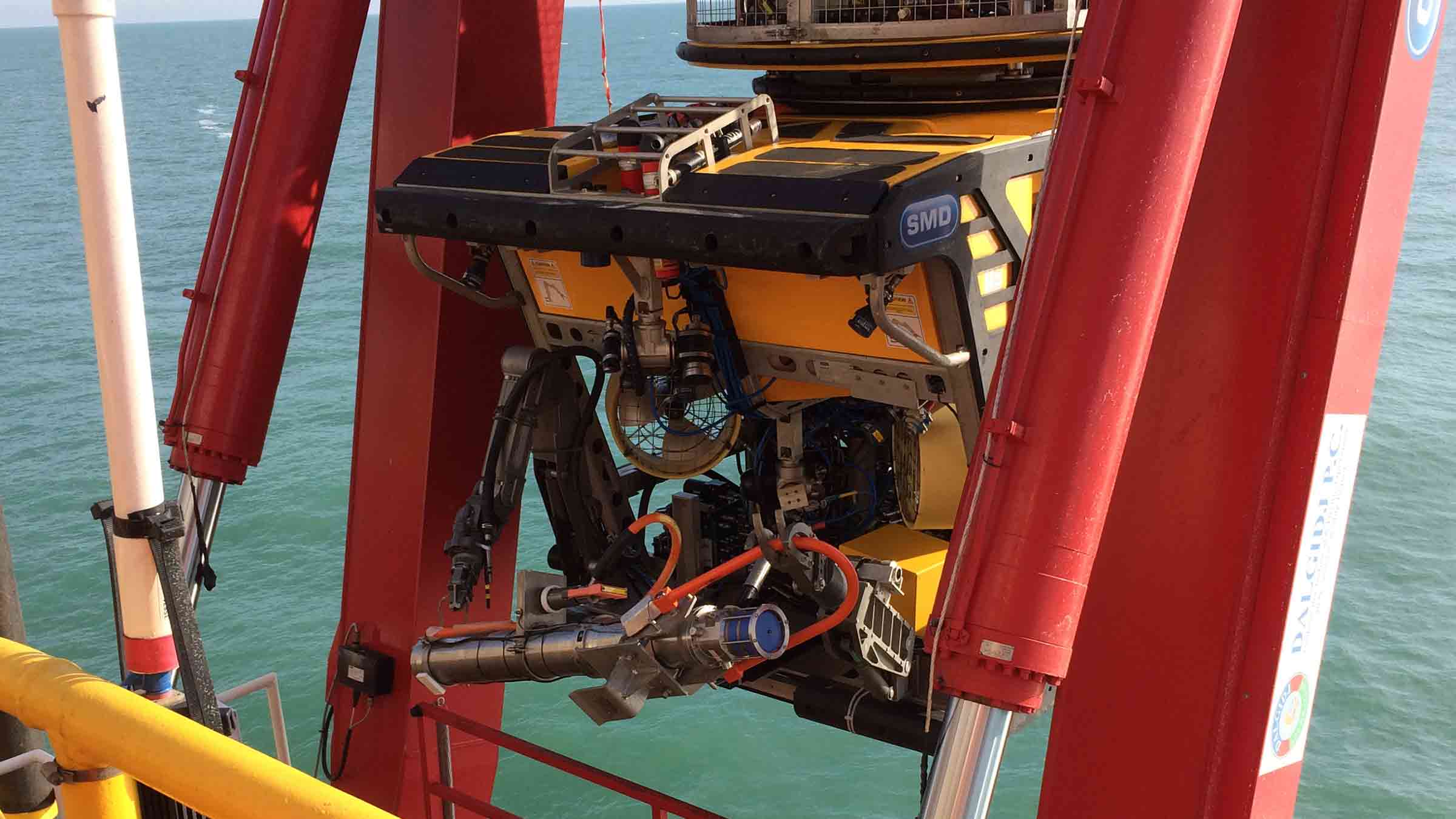
With standardised ROVdeployment options, you can simplify installation and recovery, onboard analytics and wireless data, get you the intelligence you need, on-demand.  

0

m

depth rating

Up to

0

years

life

0

DOF

as standard

Why choose it?

Powerful onboard analytics – you can make decisions based on real behaviour, not assumption 

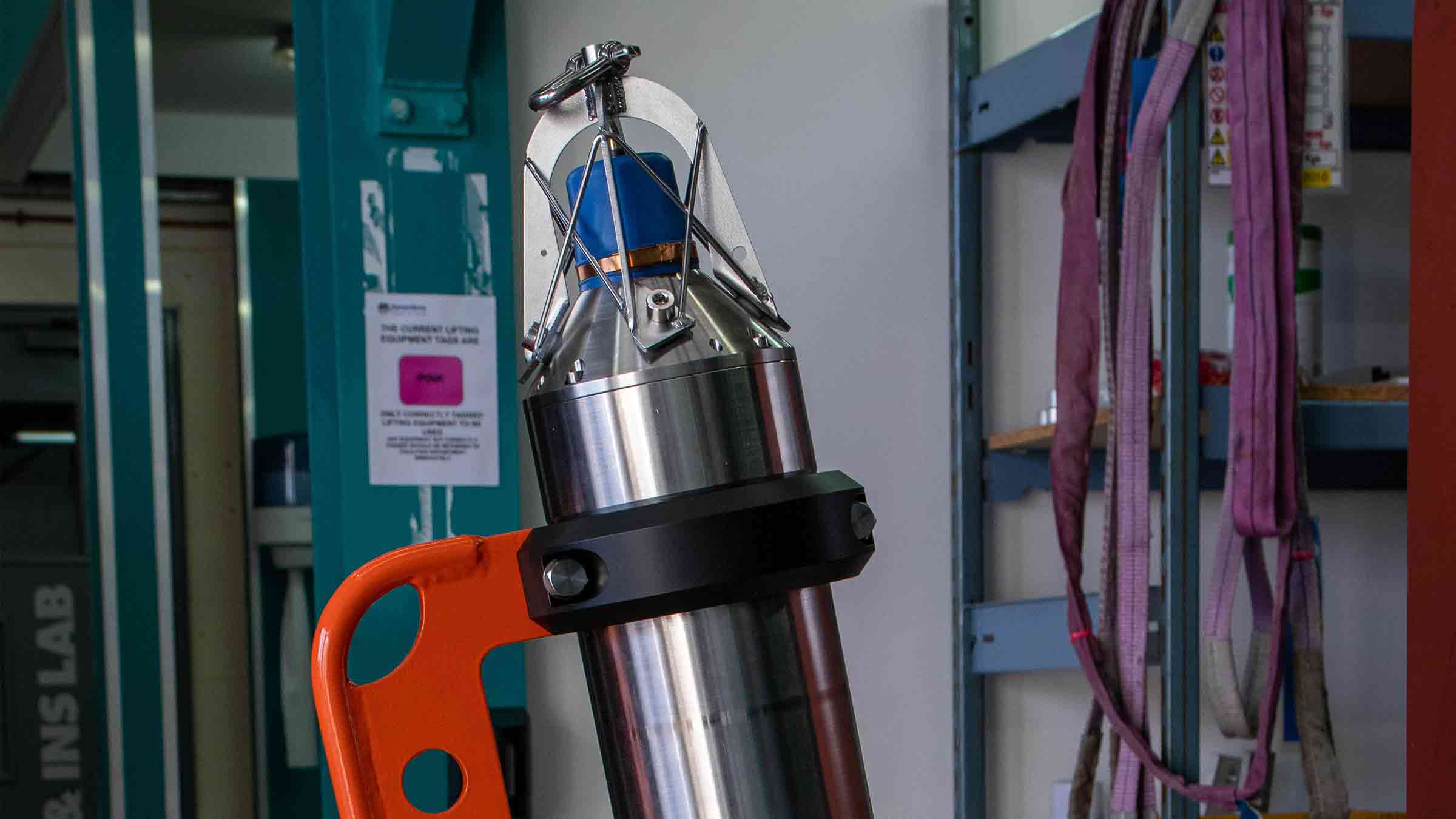
Observer contains SMARTcore, our advanced, modular central processing unit. It’s the system’s brain, delivering low power and high performance that supports deployments of up to 10 years, storing raw and analysed at source. 

Apply your own algorithms or use histograms to support fatigue and damage estimation, putting analysis in your control and powering your digital twin. An intuitive, secure, web-based interface streamlines flexible configuration, driving faster decision making and lower operational costs. 

Low and high frequency measurements in one device – no need for different systems 

In-built sensors capture high-frequency motion for vortex induced vibration (VIV), flow-induced vibration (FIV) and structural behaviour monitoring. This combination simplifies and expands your ability to truly understand the behaviour of your infrastructure. 

Observer can operate as a Long BaseLine (LBL) node for highly precise low-frequency motion monitoring such as pipeline creep and movementIt also supports Ultra-Short BaseLine (USBL) positioning, for measuring assets movements in the water column, like riser and umbilical movement. This capability also enables data retrieval from a vessel or underwater vehicle. 

Always informed. Always in control – flexible data retrieval

Easily setup, check your configuration and QC your sensor data pre-deployment, and also adjust it acoustically post-deployment, using our intuitive web user interface.  

Set and modify data collection and offloading schedules at any time.  

Our trusted acoustic telemetry provides your seafloor-to-surface communications, in all water depths, even in challenging acoustic environments.  

Compatibility with our 6G ecosystem enables data transfer at up to 9,000 bps to topside transceivers and modems, including our HPT 5000, Modem 6+ and Dunker 6 

An Ethernet communication link allows larger quantities of data to be harvested directly from subsea control systems or subsea vehicles. 

Observer at a glance

  • Up to 10-year endurance for fewer interventions  
  • ROVdeployable and recoverable for easy installation 
  • Rated to 3,000 m (7,000 m option) for global operations  
  • Onboard logging and analytics with acoustic offload on demand 
  • High and low-frequency motion monitoring in a single device 
  • Built on our lowpower 6G hardware and Wideband 2 digital signal architecture for trusted subsea communications 

Sensing

• 6 DOF high-performance sensor fitted as standard
• Sampling rate: 5 Hz, 10 Hz, 25 Hz
• Data storage: 64 GB, dual redundant
• Processing capability: Fully programmable including analysis, statistical functions and bespoke options

Design

• 3,000 m depth rating; up to 7,000 m on request
• ROV-friendly design; option for ROV mounted clamps
• Aluminium standard housing material; options for different materials depending on deployment duration and environmental conditions

Acoustics

• Over 500 unique addresses, ideal for large array deployments
• Data transfer rates of 100 to 9,000 bps – user selectable
• Omni-directional transducer for wide area acoustic coverage
• Sonardyne Wideband 2 MF band (19 – 34 kHz); field proven in high-noise subsea environments

Expected battery life (typical/max life/max sampling)

• Up to 10 years (duty cycle logging pressure, temp and motion)
• 4+ years for a typical riser monitoring application (duty cycle logging USBL position, motion, depth, temp and SV)
• 2.5 years continuous logging (motion, depth and temp)

Specifications Table

Features Specification (Type 620-0762)
Acoustic operating frequency MF omni acoustic modem 20-34 kHz (alternative options available on request)
Expected operating range Up to 3000 m slant range
Sampling rates Sensor dependent, configurable decimation
Data storage 64 GB dual redundant
Data processing Min, max, mean, std deviation
Internal sensors Pressure sensor – standard 30 / 300 bar 0.01% FS, additional options available on request
Temperature sensor – standard ± 0.1 °C
IMU – standard 6 degrees of freedom – gyroscope (offsets ± 0.5 deg/sec) and accelerometer (offsets ± 20 mg)
High grade IMU – optional 6 degrees of freedom triple gyroscope (± 0.1 deg/sec) and tri-axis accelerometer (offsets ± 2 mg)
Connectivity 1x 8-way external sensor connector 4-20mA interface
12V external power output
0-12V voltage input
RS232/485 interface
2x 4-way external sensor connectors mV/V (wheatstone bridge type sensor)
1x 8-way connector for power and comms 24V external power input Ethernet
Electrical Standard battery specifications 1872 Wh primary lithium non-rechargeable battery pack (alternative capacities available on request)
Expected battery life (typical/max life/max sampling) Up to 10 years (duty cycle logging pressure, temp, & motion)
4+ years for a typical riser monitoring application (duty cycle logging USBL position, motion, depth, temp & SV)
2.5 years continuous logging (motion, depth, temp)
Mechanical Construction Aluminium (super duplex / titanium on request)
Dimensions (height x diameter) 927.5 x 132 mm
Approx weight in air/water 18 kg / 10.26 kg
Environmental Depth rating 300 / 3000 m (dependent on pressure sensor)
Operational / storage temperature -5 to 55°C / -20 to 55°C

Datasheets

Watch

Jump to

Overview

SMARTen up your operations

SMART brings you low power electronics, data logging, subsea data processing and acoustic telemetry into a single, easily deployed, instrument suitable for a wide range of long duration remote monitoring campaigns across energy and science. SMARTs can be configured to make measurements at specific intervals, intervals which can be adjusted on-demand by you as your campaign progresses. These unique technologies help make SMART; delivering long endurance, intelligent asset monitoring and secure data delivery. Nearly all asset monitoring projects are unique in their requirements. SMART can be engineered to meet your projects exacts needs and budget.

SMART precision monitoring for your offshore assets

Unlock invaluable insights about the health and performance of your critical offshore structures, pipelines, and risers with your SMART monitoring system.

Tailor-made for your needs

We understand that no two offshore missions are the same. With a wide range of configurable sensor options, SMART can be customised to meet the precise monitoring requirements of your offshore mission. Our team will work with you to design and fabricate specialised mounting brackets and clamps to seamlessly integrate SMART into your infrastructure, including ROV-friendly setups for fast, efficient installation and retrieval.

Powerful onboard analytics

SMART’s advanced onboard processor enables sophisticated data analysis and processing right at the source. Advanced algorithms extract meaningful insights from raw sensor data, transforming high-bandwidth inputs into compact, critical updates that keep you informed on the status of your assets. Smart power management ensures long deployment times between maintenance. A low power data logger enables data received from external and internal sources to be securely archived using dual redundant storage.

Flexible data harvesting

Transmit stored data to the surface via industry-leading acoustic telemetry or high-bandwidth optical communication links. SMART integrates with your existing systems and workflows, with configurable software options to suit your needs – from standard diagnostics to custom analysis and visualisation tools.

SMART uses our trusted Wideband 2 acoustic telemetry module for your seafloor to surface communications. Operating in the Medium Frequency (MF) or Low Medium Frequency (LMF) band, there are options for omni-directional and directional transducers with high output powers for use in deep water and in challenging acoustic environments.

By utilising our Wideband 2 advanced spread spectrum coding, SMART can transmit your stored data at rates of up to 9,000 bps to topside transceivers and modems including our HPT 5000, Modem 6 and Dunker 6. An Ethernet connection to a BlueComm high bandwidth optical communication link enables larger quantities of data to be harvested from ROV, AUV or USV.

Dependable performance

SMART is engineered for precision, reliability, and flexibility. Trusted by leading offshore operators, this advanced monitoring system delivers the actionable intelligence you need to make informed decisions and protect your critical investments.

At a glance

  • Battery options to support campaigns in excess of 10 years
  • Can be deployed and recovered using ROV
  • 3,000 m standard depth rating; options for 7,000 m
  • Onboard logging and processing of data; offloaded acoustically on demand
  • Built on our low power 6G hardware platform and Wideband 2 digital signal architecture for reliable acoustic performance in noisy conditions

Ownership

• Warranty: 1 year return to Sonardyne service centre
• ITAR Controlled: No
• UK Export Licence: Not required
• A typical system; multiple structure-mounted SMARTs, vessel-based Modem 6 or Dunker 6 or HPT 5000 / 7000, SIU, SMART software

Sensing

• 6 DOF high performance sensor fitted as standard
• Sampling rate: 5 Hz, 10 Hz, 25 Hz
• Data storage: 32 GB, dual redundant, FAT 32
• Processing capability: Fully programmable including FTT spectral analysis, statistical functions and bespoke options

Design

• 3,000 m depth rating; up to 7,000 m on request
• Lithium battery providing over 500 logging days at typical regimes
• ROV-friendly design; option for integrated acoustic release mechanism
• Super Duplex Stainless Steel standard housing material; options for different materials depending on environmental conditions

Acoustics

• Over 500 unique addresses, ideal for large array deployments
• Data transfer rates of 100 to 9,000 bps – user selectable
• Omni-directional transducer for wide area acoustic coverage
• Sonardyne Wideband 2 MF band (19 – 34 kHz); field proven in high noise subsea environments

Specifications

Instrument Feature Type 8316
Depth Rating 3,000 m (up to
7,000 m on request)
Acoustic Operating Frequency MF (20–34 kHz)
Acoustic Data Rate 100–9,000 bps
Standard Battery Specifications 100 Ah @ 15 V (high capacity options available)
Power Consumption Listening 50 mW
Logging 200 mW
Battery Life (Typical) (Lithium) >500 days @ 25% logging duty, hourly reporting
Mechanical Construction Super duplex stainless steel
Weight in Air/Water 32/22 kg
Operating Temperature -5 to 30°C
Storage Temperature -25 to 70°C
SMART Feature
6 Degrees of Freedom High Performance Motion Sensor Standard
Triaxial Acceleration Measurement Range ±30 ms-2
RMS Noise 6×10⁻⁴ ms-2/√Hz
Instability 5×10⁻⁴ ms-2
Triaxial Angular Rate Measurement Range ±150 deg s-1
RMS Noise 0.002 deg s-1/√Hz
Instability 2.2 deg/hr
Sensor Axial Misalignment 0.02°
Sampling Rate 5 Hz, 10 Hz and 25 Hz
Anti-aliasing Filter (Standard) -3 dB cut-off @ 4 Hz
Data Storage 32 GB dual redundant, FAT32
Processing Capability Fully programmable including FFT spectral analysis, statistical functions and bespoke options
Logging and Reporting Scheme Fully configurable
Connectivity Acoustic Link (for real-time reporting), Ethernet Port (high speed data upload), serial port
Additional Sensors Optional internal and external sensors
Note: The table above shows typical values for a SMART transponder configured for drilling riser fatigue monitoring. As a flexible instrumentation platform, alternative configurations are available including alternative motion sensors if higher sensitivity is required. SMART can be offered with a standard data processing algorithm for fatigue monitoring or can incorporate customer specific requirements on request

Software and firmware

Jump to

Overview

Need to supervise your subsea assets?

Our Sentry integrity monitoring sonar system (IMS) will automatically warn of integrity breaches around your subsea oil and gas assets. The system is capable of automatically monitoring more than one billion cubic feet of seawater, with 360° of coverage from a single sonar sensor location, leaving you free to focus on other parts of your business.

One billion cubic feet of seawater, 360° of coverage, one Sentry.

Key benefits

  • Developed from our field proven detection, localisation and classification sonar technology
  • Provides 360 degree, high volume coverage from a single location; sensitive to small leaks at ranges of over 500 m
  • Low false alarm rate; automated operation – no need for constant supervision
  • Localises integrity breaches at the time of detection
  • ROV deployable and recoverable; perfect for short monitoring projects

Sentry is the answer to your subsea monitoring challenges. It is an active sonar which works by projecting a short-duration high-bandwidth pulse into the water and listening for echoes from any objects such as structures, ROVs or hydrocarbon leaks. The system is fully automated. If a hydrocarbon discharge is detected, it raises the alarm. Data on the leak position is displayed and automatically transmitted to your remote onshore monitoring stations. Multiple users can access and update the system remotely, allowing you to make best use of your time and resources. It is suitable for:


  • Environmental surveys
  • Pipeline and spool piece monitoring
  • Leak detection
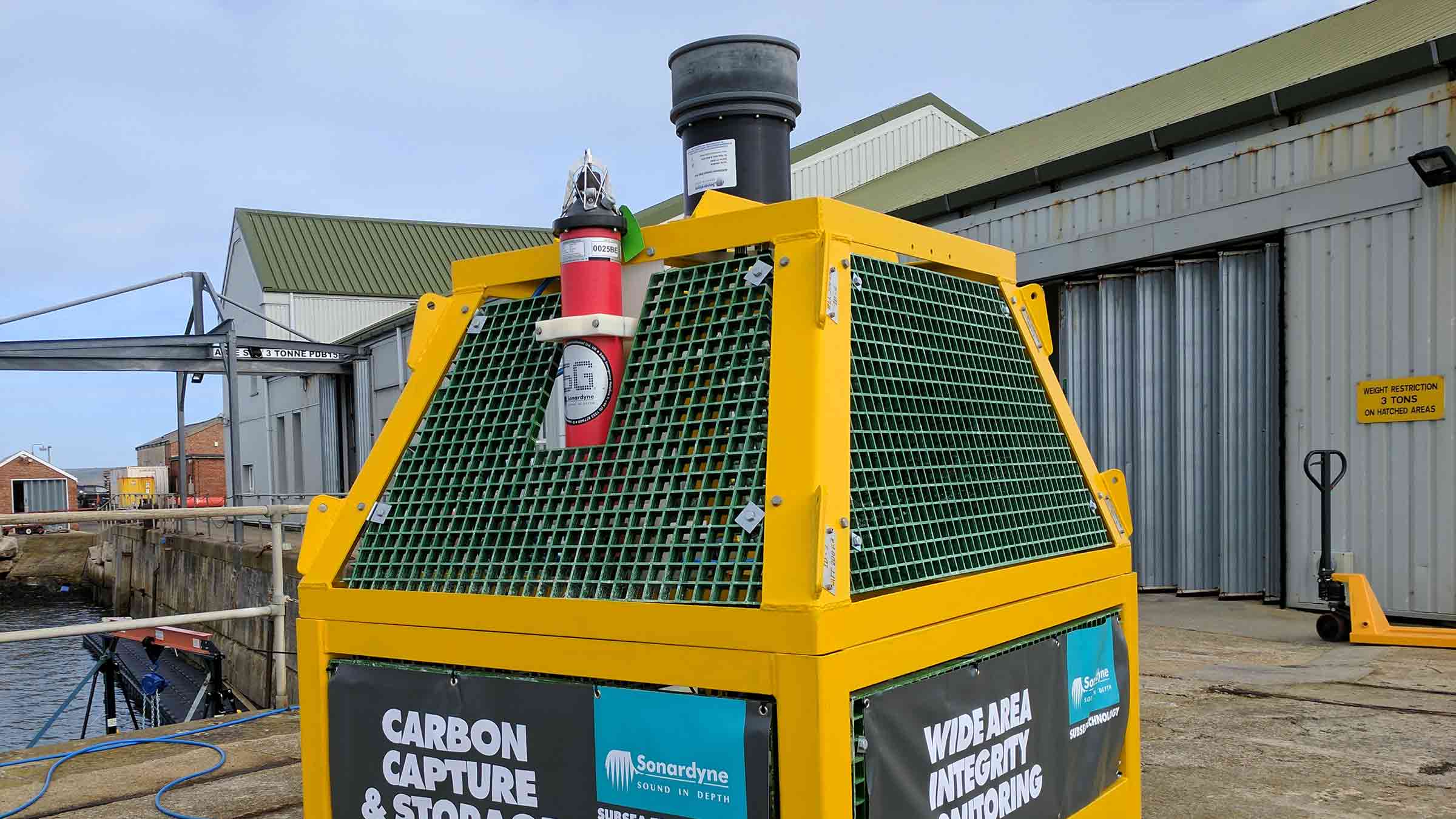
  • Carbon capture and storage
  • Automatic, wide-area leak monitoring

Active, automatic, flexible – Sentry for your asset monitoring operation needs

How it works

Designed by our sister company Wavefront Systems, manufactured and commercialised by Sonardyne, Sentry covers a 360° field of view, with a detection coverage radius up to 1,200 m and is capable of monitoring over one billion cubic feet of seawater. It can detect leaks of monophase gas down to 0.1 litre per minute (equivalent to around 1 barrel of oil per day) or monophase oil to 1 litre per minute (equivalent to 10 barrels of oil per day).

Wired and battery-powered configurations of Sentry IMS provide flexibility in how and when you can use the system. Mounted on a lander, Sentry-W connects into your asset’s existing power and communication seafloor infrastructure. It will run autonomously, providing alerts to your remote operations centre only when its on-board processing has determined a positive detection and classification of a leak.

Where no infrastructure is available, Sentry-B (a standalone battery operated system) can be lander-deployed, complete with subsea data processing, close to your assets. At pre-set intervals, or when a leak event is detected, summary data is transmitted using a 6G acoustic modem to a surface transceiver for onward transmission to your remote operations centre. Surface transceivers and satellite communications systems can be mounted on a moored buoy, integrated into an unmanned surface vehicle (USV), or fitted to any other surface asset.

Common applications

CCS site monitoring

Containment failure at an offshore carbon capture and storage (CCS) site, while highly unlikely, is of significant concern to regulatory bodies, operators and environmental groups. We have developed the capability to detect and monitor any leakage at high risk locations combining Sentry sonar and chemical sensors on a lander to deliver sensitive and reliable automated leak detection capability across wide areas.

Speak to us about your CCS requirements.


Offshore hydrogen production and storage site monitoring

As we transition towards a net zero world, hydrogen is set to play a larger role in our energy system. This includes offshore production and then transport via pipeline to shore. It may also include underground storage, including in sites offshore, similar to how natural gas has been stored. Containment monitoring and asset integrity assurance are just as important here and Sentry provides an ideal solution. Contact us to find out more.


Need mobile, more targeted monitoring over distance?

For inspecting greater lengths of subsea assets, such as your trunk pipelines, our compact yet high-performance Solstice side scan-sonar containing powerful automatic target recognition (ATR) algorithms can be integrated into an AUV to provide detection and location of any containment losses of oil or gas. Find out more here.


Performance

• Monitor 1 billion cubic feet of water with one sonar head
• Depth rated to 4,000 m
• 360 degree coverage from a single point
• Low false alarm rates

Design

• Wired and battery-powered Sentry IMS options
• Active sonar – always listening
• Fully autonomous alarms
• Multiple sonar heads can be interfaced together to increase coverage

Typical system set up

• Sonar or multiple sonar heads
• Sonar processor (SP)
• Command workstation (CWS)
• Sentry software

Support

• Work side-by-side with our projects and applications group from concept to installation
• Systems are manufactured and tested before delivery at our world-class in-house facilities
• Highly experienced field personnel can be on hand to ensure even the most complex systems are commissioned safely
• 24-hour support, whenever and wherever you are in the world

Specifications

Feature Type 8265-000-01
Depth Rating 4,000 m
Operating Frequency 60 to 80 kHz
Source level 206 dB re 1 µPa @ 1m
Pulse length 40 ms
Detection range Selectable up to 1,500 m
Operating Temperature -10 to +40°C
Storage Temperature -10 to +55°C
Dimensions (Height x Diameter) 556 x 330 mm
Weight in air / water 86 kg / 48.5 kg

Frequently asked questions

Jump to

Overview

Trusted to protect coastal communities

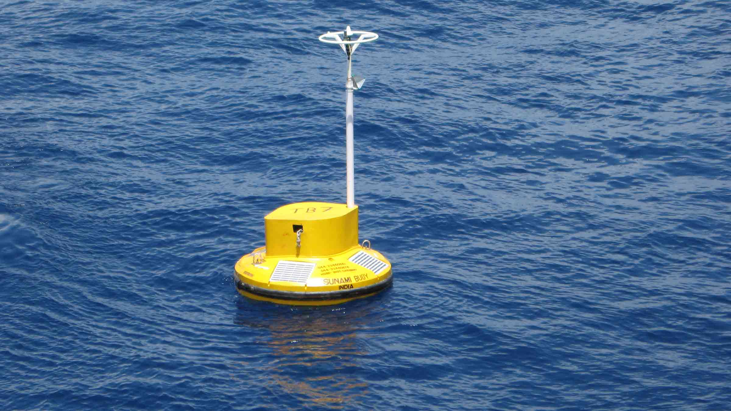
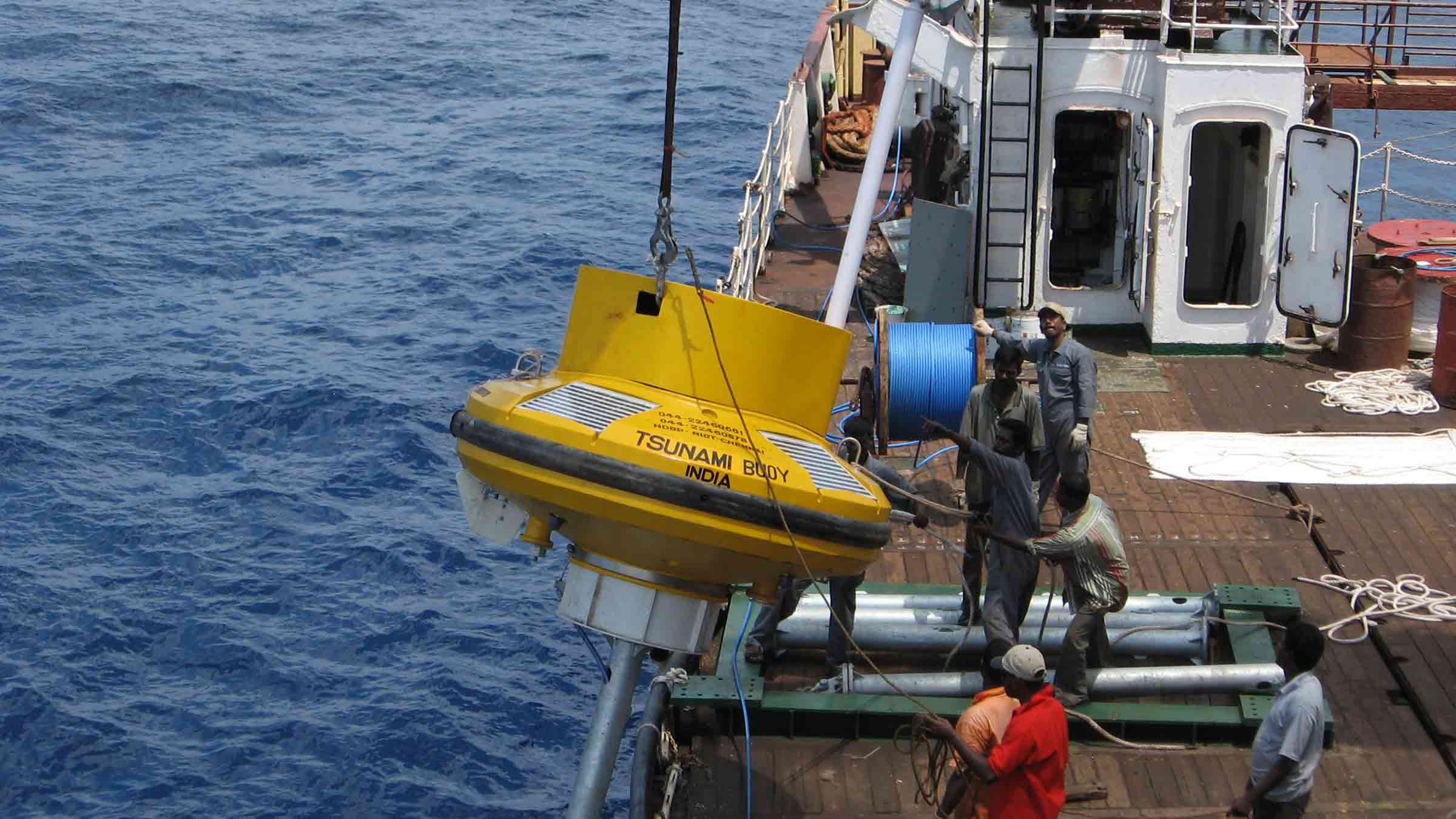
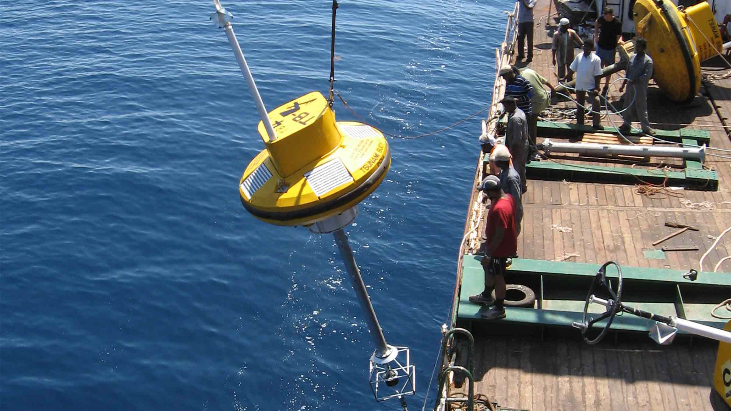
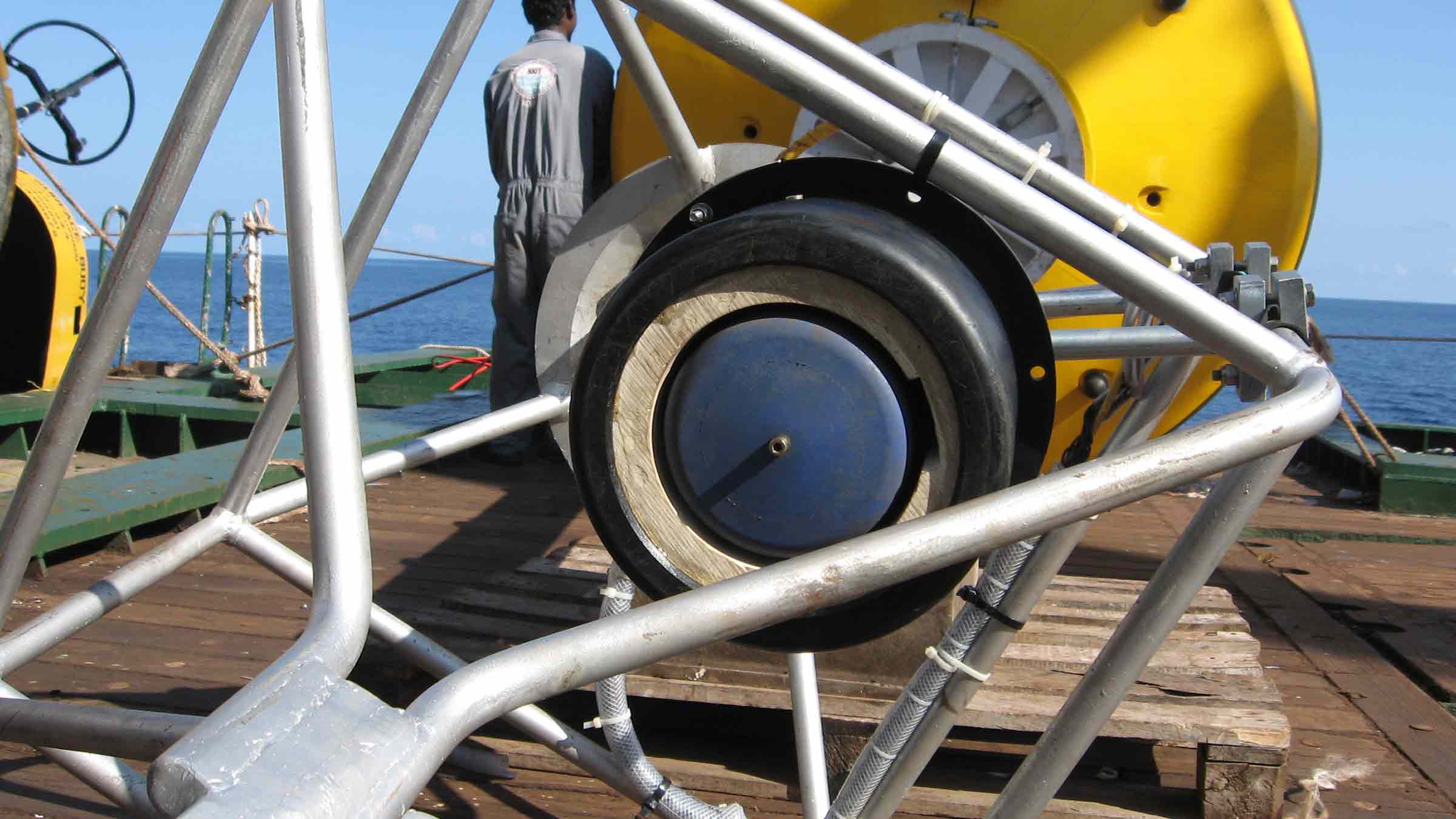
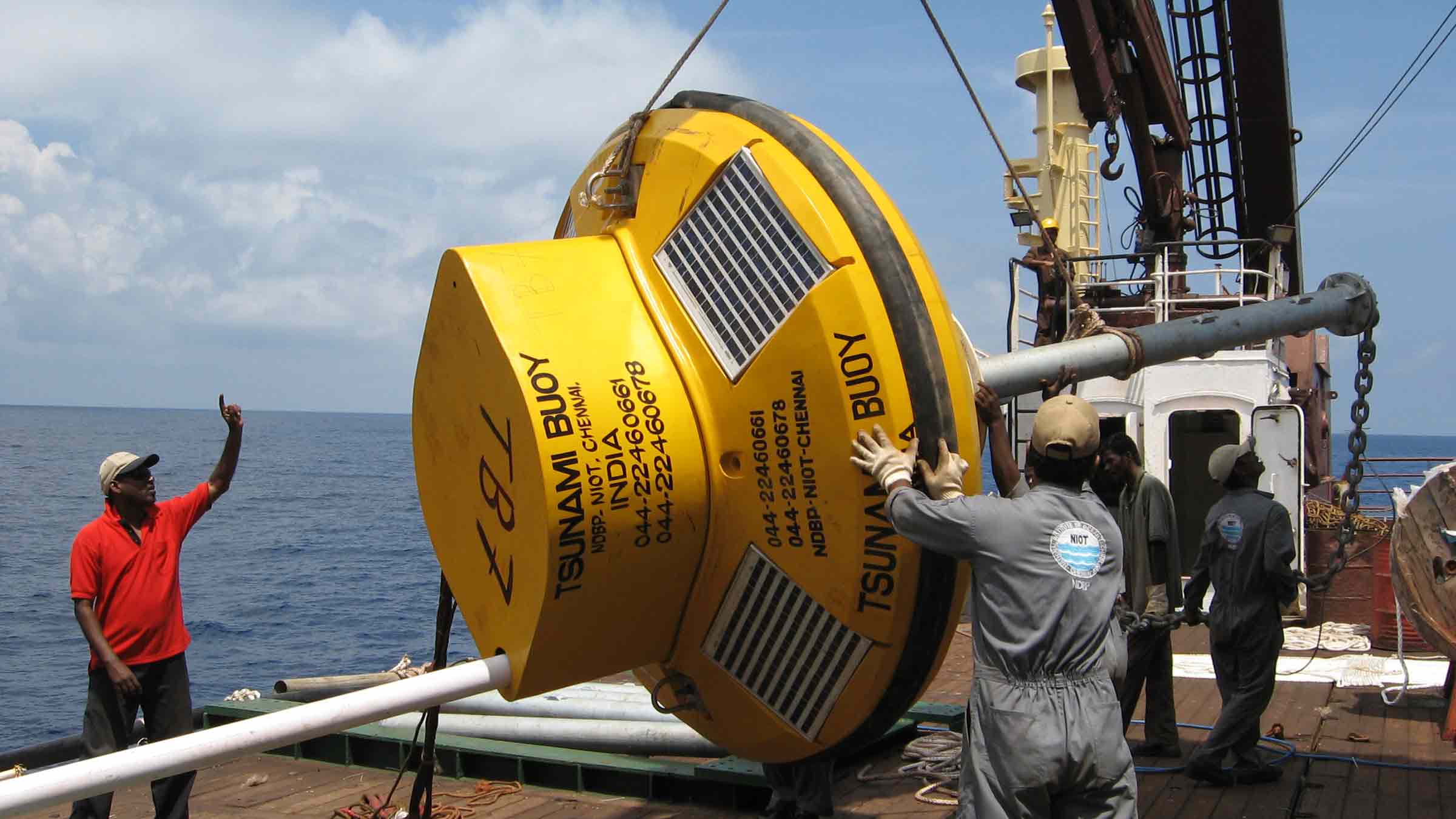
Developed, supplied and maintained in partnership with MSM Ocean, our Tsunami Early Warning System (TEWS) provides vulnerable coastal communities with early warning of an approaching tsunami wave. TEWS combines our robust acoustic instruments together with MSM Ocean’s IALA compliant buoy and easy to use shore control centre software to provide unrivalled system availability.

Measuring the shortest change, to give the longest warning – how it works

A tsunami wave in deep water creates a small (a little as 3 cm) but measurable change in pressure that can be maintained in excess of 20 minutes.

The sensitive pressure sensor in the BPR detects the small, but continuous change in water pressure, which triggers transmission of a series of warning messages to a surface buoy moored above it. This means that the first message warning of a tsunami, caused by a small variation in water pressure on the seabed thousands of miles from shore, can be in the office of the monitoring organisation within minutes, if not seconds.

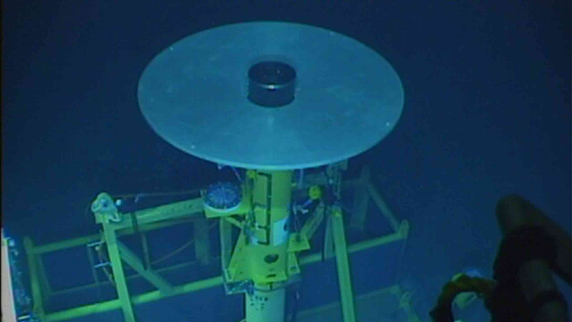
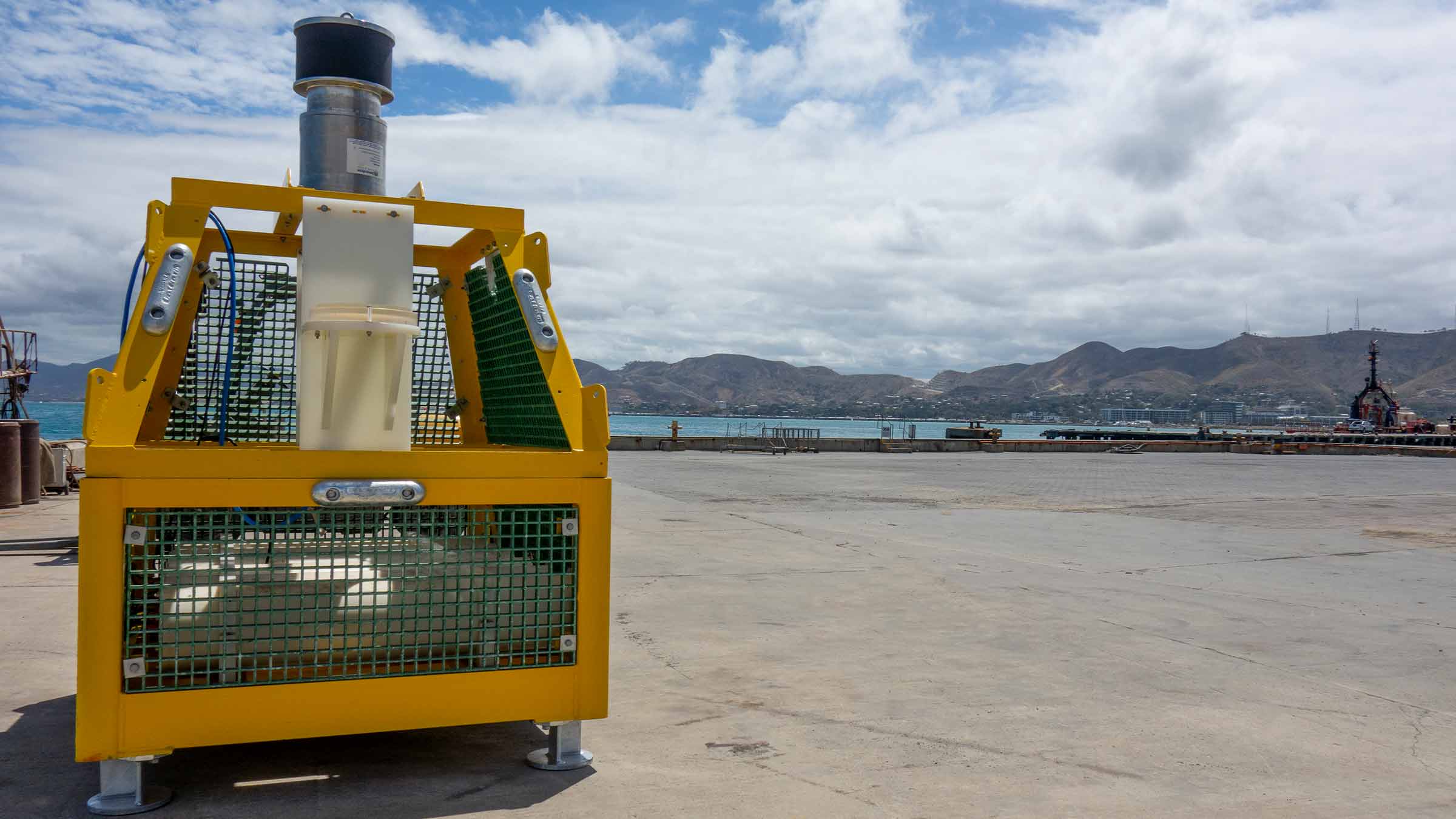
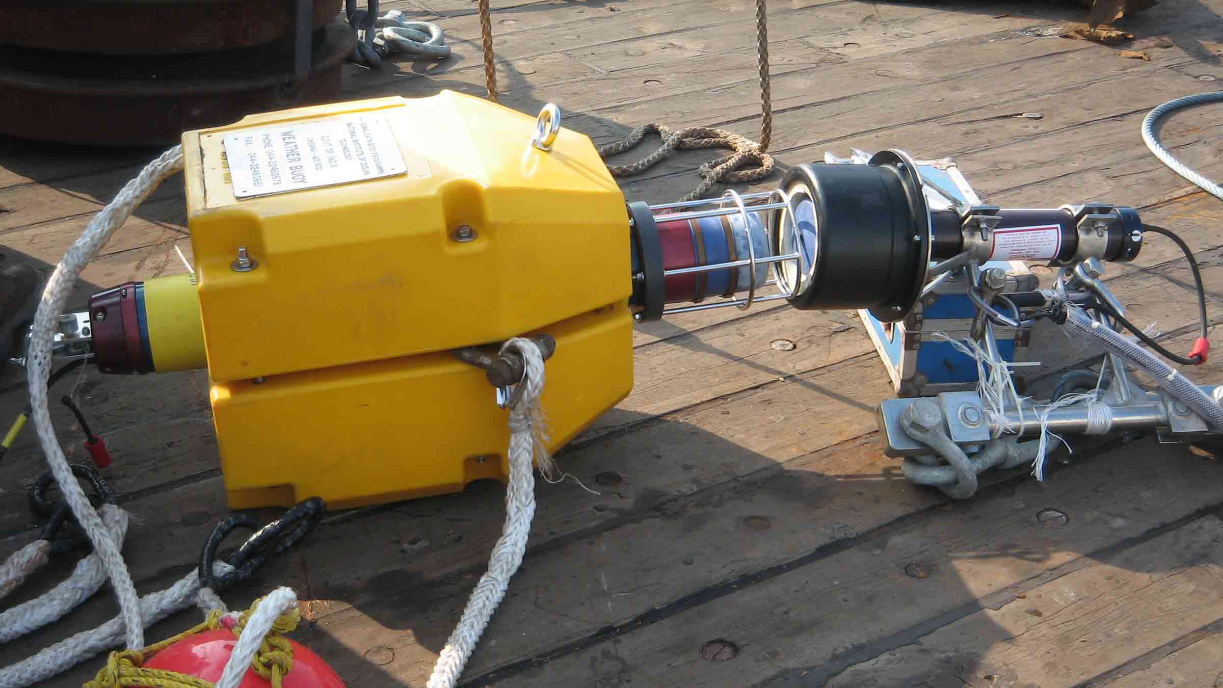
The Tsunami Early Warning System (TEWS), developed by MSM Ocean and Sonardyne, centres around a sophisticated Bottom Pressure Recorder (BPR) deployed on the seabed. This modified Compatt 6 transponder works in conjunction with a surface buoy and onshore control centre to create a comprehensive tsunami detection network.

The BPR operates at depths up to 7,000 m and features impressive longevity, running for four years on standard power or up to nine years when housed in a glass sphere configuration. Operating in the LMF band (14-20 kHz), the device samples water pressure every 15 seconds and typically transmits data hourly to the surface. The system is compatible with various surface transceivers, including our Ranger 2 USBL system.

The detection process is both sensitive and precise. The BPR can identify pressure changes as small as 3 centimetres, using the NOAA DART® algorithm to compare measured pressure against predicted values. When two consecutive variations exceed the preset threshold (typically 3cm), the system enters alert mode. Data is then transmitted acoustically to the surface buoy, which relays the information via dual Iridium satellites to the shore. This entire alert process takes only minutes to complete.

System management is streamlined through the NETCOM-TS web application, which provides comprehensive control and monitoring capabilities. The data is shared with NOAA’s National Data Buoy Center, ensuring broad distribution of critical warning information. The system can be configured remotely, and maintenance is straightforward thanks to an acoustic release mechanism that allows for simple recovery and redeployment. Unlike some competing systems, this solution requires no underwater cables, making it particularly reliable and easy to maintain.

This integrated system serves as a crucial link in the chain of tsunami detection and warning, providing coastal communities with vital advance notice of potential threats. By combining robust hardware with sophisticated detection algorithms and seamless communication protocols, the system delivers a dependable early warning solution that can save lives and property in vulnerable coastal areas.

At a glance

  • All-in-one wireless solution for detecting tsunamis; no fixed sea-to-shore infrastructure required
  • Detects height variation on the water surface as small as 1 mm; a change of 3 cm launches a tsunami event (tsunami alert)
  • Generates Deep-ocean Assessment and Reporting of Tsunamis (DART®) warnings which can be received onshore within seconds of a confirmed tsunami event
  • Low cost of ownership; COTS technology with long service intervals
  • IALA compliant buoy for increased safety of the system to guarantee availability
  • Remote monitoring and control for ease of operation
  • Intuitive shore control interface using MSM Ocean’s NETCOM-TS software

Why choose Sonardyne & MSM?

Easy ownership

Our warning system is commercial-off-the-shelf, can be acquired easily, delivered in short timescales and commissioned without any significant national investment in, or construction of, sea-to-shore infrastructure.

It’s integrated

Competing warning systems are often made up of individual sensors, battery packs and modem with vulnerable connectors and cables. Together with MSM Ocean, we provide a one-stop shop solution that’s rugged and robust.

It’s proven

The system’s built using proven, high security wireless seabed to shore monitoring and communications technology, with proven performance in detecting tsunamis.

Seabed to surface communications (Sonardyne)

• Long range for deep water deployment far offshore; 19-34kHz frequency band
• Advanced protocols to minimise data loss and re-sends
• Directional transducer for optimised seafloor-to-surface communications
• 100 – 900 baud user payload, bi-directional
• Powered by 6G and Wideband 2 technology: in use globally within science, energy and defence

Surface to shore communications (MSM Ocean)

• Uses the Iridium low earth orbit (780 km) constellation of polar orbiting satellites
• Incorporates dual modems and antennas for redundancy
• NETCOM-T software web application enables remote management of the tsunami buoy and BPR from Shore Control Centre

BPR Design (Sonardyne)

• Robust all-in-one design; compact, integrated, self-powered, no cables to get damaged
• Easy to deploy; standard depth rating of 5,000 m (option for 7,000 m)
• Integrated release mechanism for simple recovery of seabed BPR for servicing
• 2 year battery life typical; up to 10 years possible with alternative design of BPR
• Simple to integrate surface transceiver on instrumented buoy (solar and communications)

Tsunami Buoy (MSM Ocean)

• Suitable for deployment in depths of up to 4,000 m
• IALA compliant topmark, lighting with 5 NM luminous range
• Aluminium superstructure with a 2.4 m diameter shock-resistant closed-cell polyethylene foam float and stainless-steel tail
• Multiple safety and anti-vandalism measures fitted as standard: GPS out of position alarm, unremovable solar panels, impact sensor, intrusion sensor

A typical TEWS configuration (Per monitoring location)

• Seafloor deployed BPR transponder and floatation, 5,000 m rated, 2 year battery life. Sonardyne iWand back-deck and workshop test and configuration device
• Moored, IALA-compliant communications buoy equipment equipped with sub-surface acoustic transceiver, power, navigation safety aids and redundant satellite communications gateway
• MSM Ocean command and configuration software used to remotely control and monitor the TEWS and issue alerts

Ownership

• Warranty: 1 year return to Sonardyne MSM Ocean service centre
• Training: onsite or remote operator and maintainer training required
• ITAR Controlled: No
• UK Export Licence: Not required

Specifications

Feature Type 8141 Buoy Mounted Transceiver Type 8142-000-02 Buoy Mounted Transceiver
Frequency Band LMF (14–19 kHz) LMF (14–19 kHz)
Transducer Beam Shape Directional Directional
Transmit Source Level (dB re 1 µPa @ 1 m) 196–172 dB (3 levels) 196–172 dB (3 levels)
Receive Sensitivity (dB re 1 µPa) 95–130 dB (6 levels) 95–130 dB (6 levels)
Telemetry (Wideband 2) 100–900 baud, user payload, bi-directional 100–900 baud, user payload, bi-directional
Sonardyne Messaging Service (SMS) data buffer 128 bytes 128 bytes
Command/Control Accessed through communications interface Accessed through communications interface
Error Detection and Correction Advanced protocols to minimise data loss and
re-sends
Advanced protocols to minimise data loss and
re-sends
Communications Interface RS232 (9,600–115,200 baud) RS232 (9,600–115,200 baud)
Dimensions (Length x Diameter) 608 x 260 mm 608 x 260 mm
Weight/Mass 9.75 kg (weight in water)
5.26 kg (weight in air)
9.75 kg (Weight water)
52 N (mass)
External Power Requirement 24–50 V dc, 1 W quiescent,
100 W peak
24–50 V dc, 1 W quiescent,
100 W peak
Armoured Cable to buoy Payload Included (10 m, 8-core, with strain relief) Included (10 m, 8-core, with strain relief)
Feature Type 8303 Bottom Pressure Recorder 6 Type 8303-6226 Bottom Pressure Recorder 6
Depth Rating 5,000 m (4,100 and 7,000 m option) 6,000 m
Frequency Band LMF (14–19 kHz) LMF (14–19 kHz)
Transducer Beam Shape Directional Directional
Transmit Source Level (dB re 1 µPa @ 1 m) 202–169 dB (5 levels) 202–169 dB (5 levels)
Receive Sensitivity (dB re 1 µPa) 80–120 dB (6 levels) 80–120 dB (6 levels)
Telemetry (Wideband 2) 100–900 baud, user payload, bi-directional 100–900 baud, user payload, bi-directional
Battery Life (Monitoring) 725 days standard (1,450 days maximum option) 1,450 days
Working Load Limit (4:1) (Release) 250 kg 250 kg
Dimensions (Length x Diameter) 1,100 x 200 mm 1,667 x 200 mm
Weight/Mass 28.2 kg (weight in air)
14.2 kg (weight in water)
(standard 5,000 m option)
49.5 kg (weight in water)
235 N (mass)
Pressure Sensor 4,100 m (7,000 m option) 6,800 m range
BPR Floatation Collar Included (nett buoyancy
300 N)
n/a
Feature Floatation for Bottom Pressure Recorder 6
Depth Rating n/a 6,000 m
Dimensions (Diameter) n/a 857 mm
Weight/Mass n/a 211 kg (weight in water)
760 N (mass)

Jump to

Overview

Unleash the power of seamless well monitoring with your Acoustic Data Logger

Experience the power of seamless, long-term well monitoring with our cutting-edge Acoustic Data Logger. Unlock unparalleled insights, optimise your operations, and take your well management to new levels of efficiency and success. Introducing our state-of-the-art Acoustic Data Logger – the ultimate solution for reliable, long-term well monitoring. Engineered to withstand the harshest environments, this versatile device is your key to optimising your operations and unlocking unparalleled insights.

Durable, compatible, configurable, portable

Why Acoustic Data Logger is perfect for your operations

Built on more than 30 years of successful installations, Acoustic Data Loggers provide you with the power to read multiple gauges at predefined intervals, securely store the received information within the unit, then transmit it acoustically through the water column to the surface on-demand.

The current generation includes our 6G and Wideband 2 acoustic technology, allowing large volumes of logged data to be rapidly and accurately retrieved at the surface.

Unmatched longevity for unwavering performance

Say goodbye to frequent maintenance and costly disruptions. Your Acoustic Data Logger can remain deployed for several years without the need for intervention, ensuring your well data is captured with unwavering consistency. They are compatible with Intelligent Well Interface Standardisation (IWIS) and non-IWIS gauge cards from the leading wellbore downhole pressure and temperature gauge manufacturers.

Using normal gauge reading sample rates they can operate for up to three years. Longer deployments or higher sample rates are easily accommodated using external battery packs. All hardware is supplied in corrosion-resistant super duplex stainless steel canisters for very long deployment periods.

ROV portability to a maximum depth of 3,000 m, makes the system ideal for initial well appraisals, where frequent downhole pressure and temperature readings need to be logged over a few weeks. However, the system is equally suitable for long-term deployments where it may remain installed on a wellhead, logging data for several years without intervention.

Suspended or abandoned well monitoring

High-availability acoustic subsea modems are designed for use with third party systems to facilitate the transfer of wellhead or wellbore data to the surface. Our modems can be designed, tested and supplied as part of a third party’s well monitoring solution, including electromagnetic, and through-casing tube technologies to the wellhead or tree-mounted modem.

At a glance

  • Perfect for well appraisal campaigns
  • ROV-deployable, easy to move between wells
  • Can be interfaced to wide range of down hole gauges
  • Depth rated to 3,000 m (10,000 feet)
  • Harvest data using vessel, rig or ASV

Performance

• Standard depth rating of 3,000 m
• Configurable sample rates from 2 minutes to 5 days
• Weight in water 63 kg
• Acoustic data rate 300–9,000 bps

Design

• Super Duplex Stainless Steel construction
• Integrates into all industry-standard gauge cards
• Fully configurable logging and reporting scheme
• 512 gb internal storage

Connectivity

• ROV mate-able connection
• LMF (14–19kHz) acoustic link
• High speed, spread spectrum acoustic data link

Support

• Comprehensive and flexible training for system operators
• 24-hour support, whenever and wherever you are in the world
• Work side-by-side with our Custom Engineering Team from concept to deployment
• Systems are manufactured and tested before delivery at our world-class in-house facilities

Specifications

Feature Type 8195
Acoustic communication
Operating frequency LMF (14–19 kHz)
Transducer beam shape ±30° (directional)
±70° (omni with noise shield)
Transmit source level (dB re 1 µPa @ 1 m) >190 dB
Receiver threshold (dB re 1 µPa) 85–120 dB (7 levels)
Acoustic data Link High speed, spread spectrum
Transmission rates 300–9,000 baud (true payload rate variable by telemetry scheme)
Power
Power Long life lithium primary cell battery pack
Battery capacity Single battery pack 120 Ah @ 14.5 V dc
Dual battery pack 240 Ah @ 14.5 V dc
Battery life Dependant on interface and logging configuration
Interface card Supply voltage 24 V dc ± 4 V
Maximum power 30 W
Communication and interface
Gauge interface card type 1x IWIS DHPT Interface Card (dependant on field requirements)
Interface card serial communication format IWIS RS485 at 9,600 baud, Modbus TCP or Modbus RTU protocol
Interfaces Serial 2x RS485/422 – 2x RS232
Analogue 6x Analogue
Serial communication Direct serial access to data logger & Gauge Interface Card via the external serial port
Logging and data storage
Minimum memory capacity 512 Mb – Industrial SD Card (non-volatile)
Sample rates Standard Configurable from 2 minutes to 5 days (dependant on interface)
Special High sample rate operation for user defined durations from 1 minute to 4 days with configurable rates from 5–60 seconds (dependant on interface)
Mechanical
Mechanical construction Super duplex stainless steel – UNS32550
Mechanical design Sonardyne 6th Generation including inter O-ring test ports
Dimensions (length x diameter) MF single battery configuration 1,086 x 199 mm
LMF dual battery configuration 1,348 x 199 mm
External connectors Gauge interface 1 x ODI or TRONIC (dependant on field requirements)
Serial test port 1x Subconn MCBH8M
1x Subconn MCBH8F
Environmental
Depth rating 3,000 m (dependant on connector)
Operating temperature -10 to +55°C
Storage temperature -25 to +70°C
Design qualification ISO 13628-6 Level Q1 & Q2
Options
ROV handle Type 8195-007 ROV handle assembly (folding), super duplex stainless steel – UNS32550
Battery configuration Single (120 Ah), dual (240 Ah) or triple (360 Ah)
Jump to

Overview

Rediscover your ADCP!

Origin offers resounding resolution on data detail.

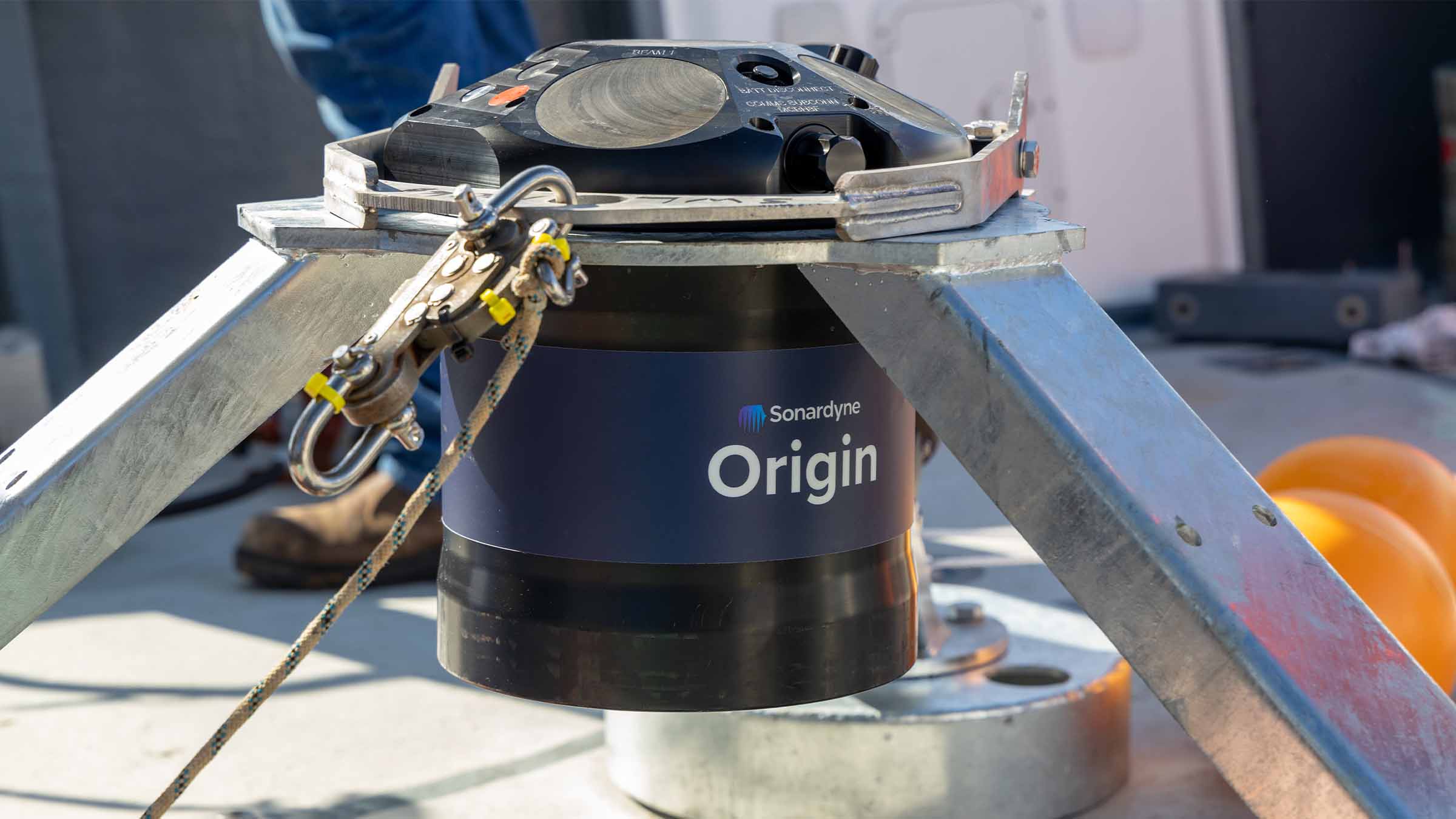
Giving you a choice of either industry standard or up to ten times greater resolution with our exclusive proprietary data formats, Origin 600 delivers you the finest detail ADCP data in near real time.

Reduce your survey costs, risks and time! With a 60-m current profiling range, on-board Edge data processing and an integrated acoustic modem, Origin 600 provides you with in-situ, high resolution measurements and on-demand data retrieval.

Make time-critical decisions with near real-time data delivery

Analyse the structure of your velocity and backscatter intensity data in far finer detail than previously possible with our proprietary formats delivering up to ten times greater spatial resolution. Origin 600 delivers conventional PD0 data as standard, whilst logging the higher resolution data to further enhance your results. All data is recorded to the onboard storage unit with 1 TB capacity.

Reduce your risks and device retrieval costs with power-efficient electronics and a rechargeable internal battery which allows deployments of up to three months on a single charge. A dual battery option allows you to operate longer or more energy demanding deployments. External power can be supplied by PoE, allowing you to program and download data without a separate power supply.

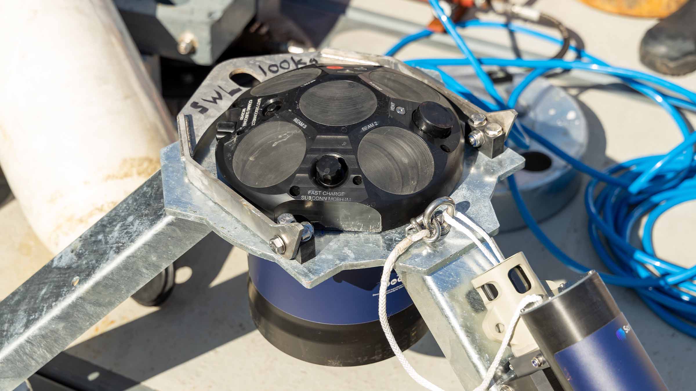
Monitor waves, mean currents and turbulence using Origin 600’s five-beam configuration and sampling frequency of up to 4 Hz on all beams. Your Origin’s built-in acoustic modem enables you to remotely access the unit while it’s deployed using an accompanying topside modem (sold separately) and the Origin Topside PC software. This allows you to check battery and storage, inspect and upload data, reconfigure schedules and run quality control, all whilst your ADCP is on the seabed.

Add external sensors to your ADCP mounting frame, and fuse with your Origin data via the Edge processing software, to really get the most out of every single deployment. You can upload sensor apps via Origin Portal or Topside and the resulting data will be exported over the acoustic modem.

What is Edge?

Discover the key to your customised ADCP data…

A suite of intuitive software tools and the Sonardyne Edge computing environment allows you to get the most out of your Origin 600. The Origin Portal web UI lets you configure your ADCP in operational conditions, including modification of the sampling schedule. Reduce your operational risks by setting your schedules before deployment using the Origin Scheduler PC application. Two schedules can be run together, allowing dual monitoring tasks to be performed with a single device. File data can be inspected using the Origin Viewer software package.

Origin 600 is compatible with your standard mounting infrastructure, reducing your risk and cost for upgrading to this device. For a complete solution, we can provide a dedicated, rugged stand with space for dual redundant releases.

Why choose Origin 600 ADCP?

Origin 600 – Mid-range ADCP

Origin 600 – Mid-range ADCP

Five reasons to LOVE Origin 600 ADCP

Five reasons to LOVE Origin 600 ADCP

Origin 600 for ocean science

Origin 600 for ocean science

Performance

• 625 kHz operating frequency
• 0.6 to 60 m profiling range
• 150 m operational depth rating
• Onboard data storage and processing, 1TB onboard storage as standard

Design

• All-in-one design
• Compact and easy to install from small vessels
• Dual battery and external power options
• Internal rechargeable battery allows for deployments of 3 months

Expanded functionality

ADCP data can be supplemented by and Edge-fused with data from external sensors so you can really get the most out of a single device deployment and the data generated. Optional seabed stand with integrated Sonardyne acoustic release for recovery using Ranger family of USBL systems.

Remote control

The integrated acoustic modem enables actions with the ADCP already in the water, delivering in-field flexibility and data assurance. Deploy and forget; integrated MF frequency modem offers in-situ data recovery, remote re-configuration and survey QC.

Specifications

Features
Type 8382
(-0457 single battery; -0427 dual battery)
ADCP Echosounding
Acoustics Operating frequency 625 kHz
Maximum profiling range 60+ m (depending on water environment)
Minimum cell size 12 mm
Minimum blanking distance 0.6 m 0.04 m
Velocity range
(along beam)
Up to ±2 m/s or
3.75 m/s
n/a
Velocity RMS 0.5% of measured value n/a
Maximum number of cells B-gram 5,000; A-gram 2,500; PD0 255 5,000
Maximum ping rate 4 Hz (5 beams)
Beam width/angle ±1 degrees/
25 degrees
Echosounding dynamic range/
resolution
n/a 79/0.002-2.5 dB
Acoustic modem Operating frequency MF (20–34 kHz)
Typical operating range 500 m
Sensors Temperature -5° to 35°C
Heading accuracy/
resolution
±1°/0.1°
Pitch & roll accuracy/ resolution & range ±1°/0.1° & ±90° (pitch), ±180° (roll)
Pressure ±0.05% full scale
Communication and logging Communications RS232, Ethernet and acoustic modem
Internal logging 1 TB internal memory
Output Output telegrams PD0, A-gram, and
B-gram
Electrical External power 18-48 V power by external cable; PoE+
Power 45 mW (acoustic modem on), 3.5 W (fully active)
Internal battery Li-Ion 800 Wh,
1600 Wh dual version
Internal battery recharge 4 hours fast charge (8 hours for dual battery option)
Full/scheduled/
standby lifespan
1 week/3 months/
2 years
Environmental Depth rating 300 m (survivable), 150 m (operational)
Operating/storage temperature -5 to 40°C/
-20 to 55°C
Mechanical Construction Plastic
Connector type Subconn: 8-way for power and comms; 6-way for fast-charge
Dimensions
(height x max diameter)
308 x 290 mm (dual battery height
388 mm)
Weight in air/ water 19.2/7.2 kg (dual battery option
23.9/ 7.9 kg)
Software Origin Portal Embedded Web UI for control & configuration
Origin Scheduler Schedule planning & configuration tool
Origin Viewer File data inspection
Origin Topside Remote configuration & control over acoustic modem

ADCP in action

Blog: Cable monitoring for floating offshore wind

With worldwide investment in renewable energy continuing to rise, we anticipate a significant increase in floating offshore wind (FLOW) developments over the next ten years. However, investors are concerned about this nascent technology’s performance in deeper, more dynamic environments, particularly risks associated with dynamic cables.

Blog: Moving on from PD0

In this blog, we introduce and explain the core content of the B-gram data format produced by Origin ADCPs.

Case study: Facing the challenge of speeding up consent in offshore renewable energy

Blog: Origin 600 vs. Cyclone Kirrily

A category three cyclone swept through Queensland, Australia during a three-month deployment of two Origin 600 ADCPs in January 2024. This blog looks at the data gathered and how they performed during this unexpected weather event.

Blog: Monitoring waves and currents for floating offshore wind

A trial to understand the dynamics of cable movements in floating offshore wind installations provided the opportunity to also trial real-time measurements (logged every 20 minutes) of waves and currents using an Origin® 600 Acoustic Doppler Current Profiler (ADCP) in the same location. This blog examines the results of the trial and looks at how Origin 600 could be utilised for other similar applications.

Blog: Exploring the benefits of using echosounder mode on Origin 600 ADCP

Origin 600 Acoustic Doppler Current Profiler (ADCP), already established for its advanced data collection capabilities, takes underwater observations to a new level thanks to its recently introduced echosounder mode. From monitoring fish behaviour to examining seaweed growth, its innovative design offers unique insights that can revolutionise aquaculture and marine research.

Case study: How real-time current monitoring can transform port operations

Port of Aberdeen, Scotland’s largest berthage port – previously known as Aberdeen Harbour, was established in 1136 by King David I of Scotland. It is the oldest existing business in Britain, with a history spanning almost 900 years.

Jump to

Overview

Revolutionise what you can do with a deep water ADCP!

Origin 65 combines state-of-the-art acoustics, sensors, and data into one payload – opening up an unprecedented view of the deep.

It’s a versatile, reliable and high performance ADCP with built-in data processing, pressure inverted echosounder (PIES) and an integrated modem for remote access. Depth rated to 4,100 m, Origin 65 can deliver for your operations again and again.

An innovative, robust acoustic design

Its pioneering satellite-dish design allows Origin 65 to match or exceed the acoustic performance of competing instruments. All while reducing your costs, prolonging battery life and increasing robustness to pressure cycling – a long-standing problem with low-frequency ADCPs.

Connect to the subsea world – integrated modem and PIES

Check or reprogramme your Origin 65 acoustically while on the seabed via its integrated acoustic modem. There’s no need to retrieve the device or interrupt your operation.

During your operations, Pressure Inverted Echosounder (PIES) measurements are interleaved with current profiles. This allows time-of-flight (TOF) and average sound velocity (SV) to be determined in-situ alongside the ADCP sampling and the data fused in PD0, delivering all data time-aligned in one place.

At the end of a deployment, the modem can be used to trigger the integrated acoustic release, allowing the device to float to the surface for retrieval.

Don't just settle for standard – introducing A-gram and B-gram data

Your Origin 65 delivers industry standard PD0 data format as default, but why settle for standard when you can have up to ten times greater resolution?

Origin generates our exclusive A-gram and B-gram formats. These offer up to ten times greater spatial resolution than PD0 and expose raw acoustic data which you can them interrogate for your specific operations.

Origin ADCP – Edge enabled

Edge lets you run data processing apps on Origin 65 which are customised to your exact needs. The system will produce the information you are most interested in, rather than bulky raw data that would normally be processed once the device is recovered. You can harvest this data as a file or as a live stream, either through a cabled connection or Origin 65’s integrated acoustic modem.

What is Edge? Discover the key to your customised ADCP data…

Edge computing gives you the ability to write your own apps for Origin via our Software Development Kit (Edge SDK) so that you can focus on the data you need from your operation. To get you started, some of the apps already available to download include simple background currents and quality metrics.

Data gathered by your Origin can also be processed to your requirements within Edge before it is harvested. This minimises both the amount of unnecessary data in each upload and the time taken for each harvest.

Learn more about Origin

Acoustics

• 62.5 kHz operating frequency
• Works with Ranger 2 USBL acoustics
• LMF frequency modem (14-19 kHz)
• Integrated acoustic release

Design

• Innovative acoustic design
• Onboard Edge processing
• Free fall deployment and recovery
• Supports post capture USV data harvesting

Performance

• 800 m profiling range
• Minimum cell size of 120 mm
• Innovative software ecosystem
• 4,100 m operational depth rating

Ownership

• Works with your existing Ranger 2 USBL system
• Warranty: 1 year return to Sonardyne service centre
• UK Export Licence: Yes
• Comes with Origin Scheduler, Viewer, Portal and Topside software as standard

Specifications

Features Type 8323
ADCP Operating frequency 62.5 kHz
Maximum profiling range 800+ m (depending on water environment)
Minimum cell size 120 mm
Minimum blanking distance 12 m
Velocity range (along beam) Up to ±2 m/s or 3.75 m/s user selectable
Velocity RMS 0.5% of measured value
Maximum number of cells 2,500
Maximum ping rate 1 Hz (4 beams)
Beam width/angle ±2 degrees / 20 degrees
Acoustic modem Operating frequency LMF (14–19 kHz)
Sensors Temperature -5° to 35°C
Heading accuracy/resolution ±1°/0.1°
Pitch and roll accuracy/resolution and range ±1°/0.1° & ±90° (pitch), ±180° (roll)
Pressure (high precision) ±0.01%. 6,000 psi (4,100m depth) max. (higher rated options available on request)
Communication and logging Communications RS232, Ethernet and acoustic modem
Internal logging 1 TB internal memory
Output Output telegrams PD0, A gram, B gram; simultaneous output
Electrical External power PoE+, adapter included
Internal battery Lithium primary
Disposable battery capacity 504 Ah dual battery (single and triple battery options available on request)
Full/scheduled lifespan 6 weeks/2 year
Environmental Depth rating 4,100 m depth rating (Deeper
rated options available on request)
Operating/storage temperature -5 to 40°C / -20 to 55°C
Mechanical Construction Glass, steel and plastic
Connector type Subconn: 8-way for power and comms
Dimensions (height x max diameter) 1110 mm x 1306 mm x 1324 mm
Weight in air/water 230/25 kg (excluding stand 170/-21 kg)
Software Origin Portal Embedded Web UI for control and configuration
Origin Scheduler Schedule planning and configuration tool
Origin Viewer File data inspection
Origin Topside Remote configuration and control over acoustic modem

Enabling complex offshore robotics from a next gen USV

Uncrewed surface vessels are cutting cost, emissions and risk in marine operations, but many remain limited in capability. ACUA Ocean is pushing those boundaries with its PIONEER USV, built to perform in tougher environments. Recent trials showed how PIONEER extends operations below the surface, seamlessly linking surface and subsea domains through Sonardyne’s underwater positioning and communications technology.

The challenge

Offshore inspection, monitoring and survey work has long relied on large, crewed vessels, which come with high operating costs, significant carbon emissions and the inherent risk humans face in marine environments.

ACUA Ocean want to challenge the status quo and deliver subsea operations more safely, sustainably and at lower cost, using their PIONEER uncrewed surface vessel (USV).

Developed in Plymouth, PIONEER is a 14-m-long, 25-tonne vessel which uses a small waterplane area twin hull (SWATH) design, providing high stability and allowing operations in up to Sea State 6—conditions that typically restrict smaller vessels and many USVs. .

It also has a hybrid power chain, providing robust operation with long endurance, including the ability to spend 50 days at sea.

ACUA Ocean says these features allow 30% greater operational availability than a traditional 40 m crewed vessel, while reducing emissions by 95% compared with traditional vessels, and removing personnel from harm’s way. It’s also already Maritime and Coastguard Agency (MCA) Workboat Code 3 and hydrogen certified.

ACUA Ocean's PIONEER USV.
ACUA Ocean's PIONEER USV at sea near a coastline.
ACUA Ocean's PIONEER USV.
ACUA Ocean's PIONEER USV at sea near a coastline.

However, ACUA Ocean’s ambition goes beyond surface operations. The company’s strategy is built around a “nested robotics” model. Its moonpool has been designed to be configured for up to 7-tonne payloads, providing high configurability, including remotely operated vehicle (ROV) and autonomous underwater vehicle (AUV) deployments. It’s a “Swiss Army Knife model,” says ACUA Ocean Chairperson Dr Peter Collinson!

PIONEER will act as a mobile offshore hub—launching, tracking and piloting ROVs, AUVs and other subsea sensor packages; operations that would historically require larger crewed ships.

To realise their goals, ACUA Ocean came to us for:


  • Accurate, survey-grade positioning and tracking of tethered and untethered subsea systems
  • Reliable subsea communications to support remote, over-the-horizon operations
  • High data quality while operating in higher sea states
  • Seamless integration with industry-standard subsea assets already used by customers
  • The ability to operate all systems remotely, consistent with a beyond visual line of sight (BVLOS), uncrewed vessel model
A bank of screens with a person working on a laptop.

The solution

To bridge the gap between surface autonomy and subsea operations, ACUA Ocean chose to integrate our Mini-Ranger 2 Ultra-Short Baseline (USBL) positioning and communications system onto PIONEER.

Mini-Ranger 2 is our survey-grade USBL system for tracking, positioning and communicating with subsea assets in coastal and shallow to mid-depth waters. It supports divers and marine robotics operations, with optional command-and-control for multi-vehicle fleets.

During integration trials in Plymouth, ACUA Ocean wanted to prove tracking accuracy, but also demonstrate PIONEER’s ability to function as a remote subsea command hub—deploying sensors, communicating with them and managing operations entirely from shore.

Mini-Ranger 2 was integrated with the vessel, using an HPT 3000 transceiver mounted on a temporary pole and an offboard WSM 6+ to validate end-to-end functionality.

The system was interfaced with PIONEER’s onboard power and network infrastructure and accessed remotely via a wide area network (WAN) and VPN connection.

The results

The trials demonstrated PIONEER’s ability to act as a subsea gateway, using our survey-grade acoustic systems.

This included successful remote operation of subsea positioning and communications over a WAN connection, tracking and communication with in-water assets at sea, data harvesting capability and interaction with subsea nodes, and technical readiness for ROV and AUV operations from PIONEER.

This included:

  • Remote operability: Operators were able to access, configure and control the system from an onshore remote operations centre, without physical intervention onboard.
  • Integration simplicity: Power provision for guest equipment, data connectivity and physical installation were straightforward, supporting the vessel’s modular payload philosophy.
  • Data quality: Survey-grade positioning ensured that increased availability and rough-weather capability did not come at the expense of data accuracy or processing time.
  • Interoperability: The system aligned with subsea technologies already widely deployed across commercial and defence markets, reducing risk for future customers.

“Through these trials, we successfully proved end-to-end functionality remotely over a WAN, establishing reliable communication between the HPT and subsea transponders both alongside and at sea using Mini-Ranger 2,” says James Cowles, Business Development Director at ACUA Ocean.

“The physical integration was remarkably simple, with the system’s intuitive UI and seamless VPN access allowing us to manage survey-grade technology over-the-horizon with zero issues on software or licensing.

“We were also exceptionally well-supported by Sonardyne’s local technical team here in Plymouth and these successful trials confirm our ability to host and manage survey-grade technology for complex, over-the-horizon missions.”

Proving the foundation for nested robotics at sea

“We’re happy to be supporting ACUA Ocean with our subsea positioning and communications technology to make their vision operational,” says Aidan Thorn, Business Development Manager – Robotics, at Sonardyne.

“With reliable, survey-grade tracking and acoustic communications, Mini-Ranger 2 is a key building block to making PIONEER a fully integrated subsea command and control hub. The flexibility of PIONEER’s deployment options, be they AUV, ROV, subsea glider or towed body fits well with our own philosophy with marine robotics to stay platform agnostic and work across the complete marine autonomous system.”

From enabling resilient positioning in GNSS-challenged environments to supporting multi-vehicle subsea operations, Mini-Ranger 2 provides the dependable subsea layer that underpins safe, scalable autonomy.

Together, ACUA Ocean and Sonardyne are demonstrating how proven subsea technology and innovative surface platforms can work in tandem—delivering cleaner, safer and more capable offshore operations from the surface down.

Pioneering new era in deepwater seismic monitoring: OD OBN 

Shell Brasil, Petrobras, Sonardyne, and SENAI CIMATEC are pioneering autonomous technology that transforms how Brazil's challenging pre-salt fields are monitored. Now entering a major pilot array phase, the ground breaking On-Demand Ocean Bottom Node programme promises more efficient, cost-effective 4D seismic surveillance—with fewer people and lower environmental impact. This critical milestone brings us a step closer to a fundamental shift in deepwater reservoir management.

The challenge

Brazil’s pre-salt reservoirs lie in more than 2,000 m water depth, plus another 3,000 m beneath the seabed, making seismic imaging particularly challenging.

Traditional seismic surveys using ocean bottom nodes (OBNs) provide high-quality seismic data, but are often expensive and logistically complex, involving the repeated deployment and recovery of nodes using remotely operated vehicles (ROVs).

These factors can limit the frequency and economic viability of frequent 4D seismic campaigns, which are essential for understanding reservoir dynamics over time.

This is particularly challenging for monitoring large pre-salt carbonate fields where production by alternating water and gas injection (WAG) generates subtle and complex 4D signals that are difficult to measure.

These signals require on-demand monitoring with sufficient fidelity and repeatability to overcome the high levels of survey noise prevalent in conventional node-based surveys.

Saipem's FlatFish

The solution

Launched in 2018, the OD OBN programme is a research and development collaboration between partners Shell, Petrobras, SENAI CIMATEC and Sonardyne, supported under the Research Development and Innovation funding clause of the Brazilian National Agency for Petroleum, Natural Gas and Biofuels (ANP).The On-Demand Ocean Bottom Node (OD OBN) programme marks a pivotal step in addressing these challenges, providing a disruptive approach to time-lapse seismic data acquisition.

It is a pioneering new system for acquiring 4D seismic data, which delivers more efficient and cost-effective surveillance of complex pre-salt fields. At its core is a long-term OBN system that can remain on the seabed for several years, capturing seismic data that can be recorded and harvested “on-demand” using autonomous underwater vehicles (AUVs), without the need for repeated deployment and retrieval cycles.

Vast quantities of seismic data are harvested wirelessly using an AUV such as Saipem’s ‘Flatfish’, that implements the through-water optical interface to interrogate the OD OBNs, as developed under a separate ANP programme sponsored by Shell.

This AUV data harvesting approach eliminates the need for node recovery, dramatically reducing vessel time, operational complexity and associated costs.

Key Sonardyne technologies include wireless acoustic communications, required for long range recording control and node clock time offset measurement, and Sonardyne’s BlueComm extremely high-speed optical communications for short range data harvesting to a nearby AUV or remotely operated vehicle (ROV).

The results

Over 2,000 days of trials of pre-production nodes have been conducted across various pre-salt fields including Sapinhoá, Itapu and Buzios. These have successfully demonstrated acoustic control, high-fidelity data acquisition and optical data harvesting using BlueComm, as well as comparing OD OBN data with that of other commercial nodes.

The final round of tests concluded successfully in 2025, with results presented at the IMAGE ‘25 conference in Houston and SBGf Rio’25 conference in Rio de Janeiro.

Next steps

A pilot array of 660 pre-production nodes is currently being produced at a brand-new manufacturing facility in Camaçari, near Salvador, Brazil. Hundreds of these nodes will soon be deployed at the Mero field operated by Petrobras for extended testing and performance evaluation.

The long-term vision is to use autonomy and state of the art communications technologies to enable operators to conduct more frequent ‘on demand’ seismic surveys, with higher fidelity data, at a fraction of the cost of conventional seismic survey methods.

This capability will provide clearer insights into fluid movements and pressure changes within the reservoir, helping to optimise production strategies, improve decision making and enhance recovery rates in one of the world’s most challenging offshore provinces.

OD OBN is not just an incremental improvement, but a fundamental shift in how the industry approaches deepwater reservoir management.

Your challenges. Our solutions

Learn how our custom engineering team can support your project, no matter how big or small, from the shallows to the deep.

Origin 65 holds the key to help unlock Gulf of Mexico loop current eddy mysteries

The Gulf of Mexico is home to the highly energetic ocean circulation feature known as the Gulf Loop Current System (LCS). This current system influences all ocean processes in the gulf, characterised by highly disruptive Loop Current Eddy (LCE) events. LCEs are rings of warm water which rotate at speeds of up to four knots in a clockwise direction, measuring approximately 100-200 km in diameter, reaching down to depths of 500–1,000 m, and breaking away from the extended Loop Current around every 8-9 months. Loop Current Eddy events have serious implications for a great range of natural and human activities, from ecosystem dynamics and hurricane intensification to fishing operations and oil and gas exploration.

The challenge

The behaviour of the LCS remains difficult to forecast with sufficient accuracy to guide operations beyond a few days, yet its significance for processes and operations in the Gulf of Mexico drives a need to improve and extend forecasts of the LCS and LCEs. The difficulty has arisen partly because interactions of the upper currents with deep eddies have not been detectable in real time to guide numerical models.


Unlocking the Gulf current – a continuance

Sonardyne were introduced to this challenge back in 2018 when the University of Rhode Island launched a multi-year scientific study that included deployment of five Sonardyne Current Pressure Inverted Echo Sounders (CPIES) at depths down to 3,500 m in the area of the extended LCS.


The Sonardyne solution

Sonardyne’s modem-enabled CPIES were a key element in the initial two-year project. These instruments were part of a mass deployment to measure two-way travel time (or tau) over an extended area in order to map the local horizontal velocity and density fields in the extended LCS, as can be read at https://www.sonardyne.com/case-study/unlocking-the-gulf-loop-current/.

Soon after the 2018 deployment, Sonardyne began the development of Origin 65, a combined PIES and ADCP with acoustic modem to enable adaptive data harvesting. The benefit of Origin 65 over CPIES is that it not only supports but augments density/current mapping projects.

Where CPIES use a separate single point current meter to provide a deep reference velocity for calculated geostrophic currents, Origin 65 measures a whole profile of currents over a greater range. Being an all-in-one instrument, Origin 65 also removes the risk and expense of combining separate devices for a single application.

What’s more, by utilising Origin 65’s onboard Edge data processing capability, PIES data is time-synchronised and fused with the ADCP measurements for simpler analysis. After extensive trials, Origin 65 was launched in 2023.


“Pulses of strong currents pose a hazard to industry along steep escarpments in the deep Gulf. Moreover, their unexpected arrival compounds the hazard: satellite and near-surface observations and numerical models do not predict them reliably. We needed a forecast tool grounded in observations with adaptive reporting capability. We had a tall order for the observations: We needed to profile currents from the bottom through hundreds of meters above the bottom and we required fast acoustic telemetry capability. Sonardyne committed the engineering capability to develop a combined PIES and upward-looking low frequency ADCP with a vertical range of 800 m. It was an outstanding match to our needs, and Sonardyne’s fast acoustic telemetry capability was key to being able to harvest the data and report it ashore in near-real time.”

Professor D. Randolph (Randy) Watts, Professor of Oceanography, University of Rhode Island

The 2024 deployment

In 2024, funded by the US National Academies of Science, Engineering, and Medicine Gulf Research Programme and led by a team of scientists from the University of Rhode Island, five Sonardyne Origin 65 units were deployed alongside the original Sonardyne CPIES in the Gulf of Mexico (depth range of 1,800 – 3,200 m) for an initial 18-month measurement campaign.

Both the Origin 65s and CPIES have integrated acoustic modems enabling high-speed (up to 9,000 bps) acoustic telemetry to support wireless retrieval of data by an uncrewed surface vessel (USV) in addition to remote control of the instruments.

Despite similar telemetry capability, the volume of data generated by Origin 65 compared to CPIES is much greater, and therefore limited acoustic bandwidth presents a challenge when looking to transfer this substantial data via acoustic telemetry.

This is where Origin 65’s Edge onboard data processing capability comes into play to condense the bulky raw data into small packets of actionable information, easily exportable via the acoustic modem.

The five Origin 65 units were deployed with an Edge application (app) installed to perform combined onboard processing of the ADCP and PIES data. More specifically, the Edge app implemented a custom algorithm that produced an hourly compact (24 bytes) binary output containing a timestamp, the mean current speed and bearing in six depth-bins above the bottom, plus the mean of the PIES results.

The beauty of the onboard data processing was apparent during planned USV visits, where it took less than 20 minutes to acoustically harvest more than two months’ worth of data

An assessment was conducted whereby the integrated acoustic release on one of the Origin 65 instruments was triggered after 66 days of deployment to allow recovery (Figure 1) of the device and complete data download for a thorough evaluation. This instrument was located in a water depth of 2,142 m.

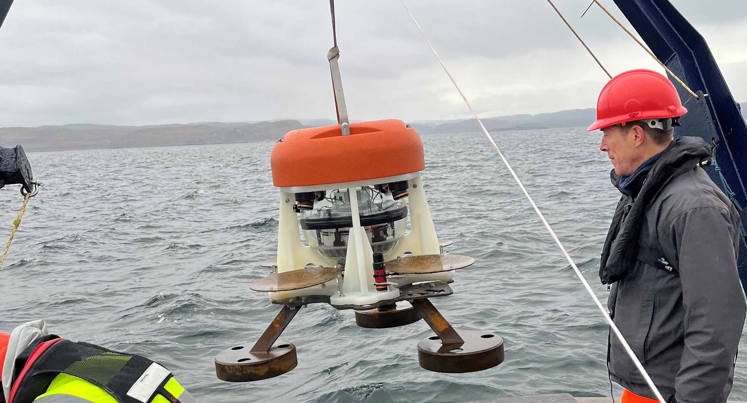
Figure 1: Retrieval of the Origin 65 aboard the R/V Pelican.

Pies

The PIES portion of the Origin 65 performed consistently (Figure 2). Periods of increased scatter in the sound speed measurements are observable, but these are a result of higher ambient noise levels (pretrigger RMS), which correspond to higher sea states (local wave activity is a dominant source of acoustic noise given that in higher sea states the surface return from the PIES chirp is more spread out).

Figure 2: PIES sound speed and ambient noise (pretrigger RMS) measurements for the  deployment. The bottom plot compares ambient noise (pretrigger RMS) to the level of local wave activity using wind speed (as recorded by station Green Canyon 338, 124 km to the WNW of the deployment site) as a proxy for sea state.

ADCP

Velocity data demonstrates expected current behaviour (Figure 3), with velocities much larger in the Eastward and Northward directions than in the upward direction. The lack of significant apparent velocity in the vertical direction indicates that there is no systematic bias in the beam-frame Doppler velocities.

In addition, the observed velocity signals (large blue and red patches) vary on timescales between days and weeks, which is expected.

Of particular interest, it can be seen around 6th June, the prevailing current changed from South-Easterly to North-Westerly over the course of around two days.

This corresponded with a sudden increase in scatter density, thought to be an indication that the seabed was disturbed by the changing current.

Figure 3: Components of the Earth-frame velocities for the 66-day deployment (60-ping ensembles).

Low scatterer concentration in the deep waters (>2000 m) of the Gulf of Mexico reduced the effective profiling range of the Origin 65 from its achieved maximum range of > 800 m. However, with a sufficiently long averaging period it can been seen that the current velocity signal is present for the entire 800 m range of the Origin 65 (Figure 4).

Figure 4: Comparison of 24-hour averages of Eastward current velocity for different altitude bins. Performing increased averaging shows that a consistent current velocity signal is exhibited across the 800 m range of Origin 65.

“Our collaboration with the University of Rhode Island has been instrumental in augmenting our PIES technology in the form of Origin 65, a combined ADCP and PIES, for oceanographic study of geostrophic currents fields like that found in the Gulf of Mexico. We’re delighted to see Origin 65 being applied in this vital study, and by extension, to be able to support research efforts to improve and extend forecasting of the LCS and LCE behaviour with the accuracy desired. We look forward to continuing our relationship with the University of Rhode Island, and to seeing further successful USV data harvests from the Origin 65 units over their deployment period in the Gulf of Mexico.”

Michelle Barnett, Business Development Manager – Ocean Science, Sonardyne


What’s more, evidence of diel plankton migration is apparent with the repeated appearance and disappearance of a scattering layer between 500 m and 800 m height above the bottom. This pattern has a period of roughly 24 hours with the scattering layer clearly visible in daylight hours, as is consistent with the cycle of diel vertical migration observed ubiquitously in aquatic systems throughout the world.

This is nicely demonstrated in cross-correlation data, where values increased to around 80% on a daily cycle in response to the plankton migration (Figure 5). This cross-correlation data helps to indicate the effective maximum range of the system of around 800 m.

Figure 5: An excerpt (4 – 7th June) of unaveraged cross-correlation data for each of the four beams of the Origin 65 demonstrating a clearly observable diel vertical migration pattern. The lower plot represents the local time, with the colour being a function of the local solar altitude.

“This suite of instrumentation and platforms will help refine predictive tools for future applications in the Gulf. Looking ahead, the combination of Sonardyne Origin 65 current profilers and adaptive data-harvesting technology opens the door for long-term deployments in deep water – anywhere in the world. This is very exciting: we could access remote and critically important regions supporting sustained observations and advancing science.”

Professor Kathleen (Kathy) Donohue, Professor of Oceanography, University of Rhode Island


What’s next?

Two successful data harvests by a SeaTrac SP-48 USV equipped with a Sonardyne HPT 7000 L transceiver head have already been conducted. A third data harvest is scheduled for the end of July and the instruments will be recovered in September 2025. Keep an eye on our website and social media for further information about this and the data captured.
If you have an operational challenge for Origin 65, or any other Sonardyne product, please contact us.