Sonardyne
Support Centre
Jump to

Overview

Intelligent monitoring for your subsea assets

Observer shows you how your subsea assets are really behaving, not how you hope they are. Monitor movement, vibration, load and structural behaviour to reduce risk, prevent unplanned shutdowns and extend asset life.

Onboard processing, extended deployment and wireless data access give you intelligence on demand, keeping operations efficient and assets protected. Subsea asset integrity intelligence delivered. Intervention and cost reduced.

Find out what's possible

We understand that no two subsea asset integrity monitoring challenges are the same

Your underwater infrastructure is subject to constant environmental and process problems, from vortex induced vibration to pressure or temperature cycling, leading to strain and fatigue accumulation. But left unseen, these can lead to unknown risks, downtime or even failure. 

Early detection prevents catastrophic failures and extends asset life. 

Observer delivers the insights you need, when you need them, preventing risk, reducing cost, extending field life. Built on decades of underwater monitoring expertise 

It’s been designed with flexibility of operation in mind; for use on all subsea assets, through the water column, including pipelines, risers, moorings, umbilicals, wellheads and associated infrastructure, helping integrity managers to reduce uncertainty and strengthen decision‑making.  

Enhanced clarity and control through real‑time intelligence

From high or low frequency motion monitoring to a wide range of other sensor data, Observer is designed for maximum flexibility and configurability, putting you in control.  

You can monitor locally or across wider areas, from short-duration campaigns to long-term integrity management. It’s non-intrusive, wireless communications make this possible. 

With standardised ROVdeployment options, you can simplify installation and recovery, onboard analytics and wireless data, get you the intelligence you need, on-demand.  

0

m

depth rating

Up to

0

years

life

0

DOF

as standard

Why choose it?

Powerful onboard analytics – you can make decisions based on real behaviour, not assumption 

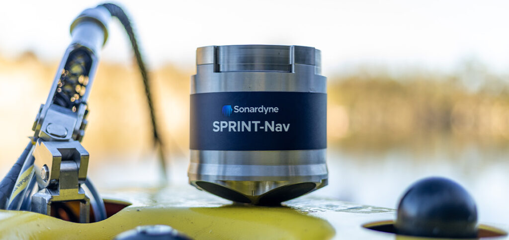
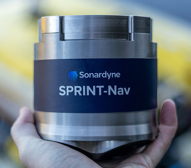
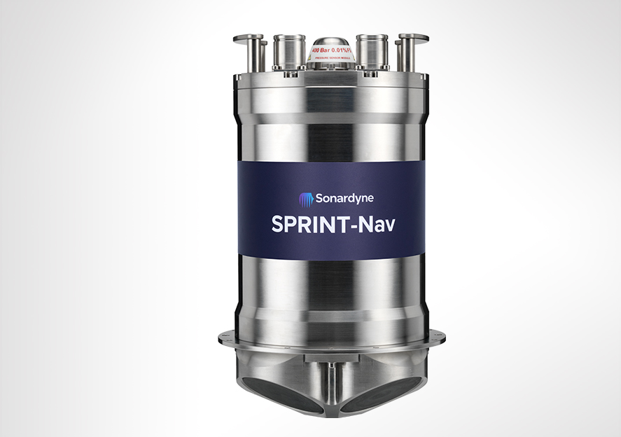
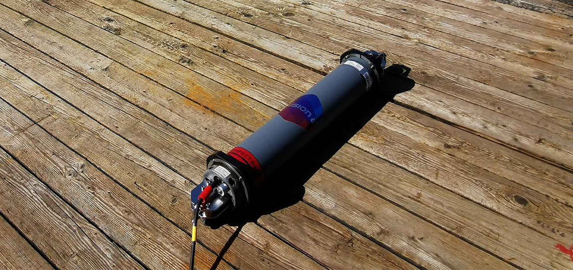
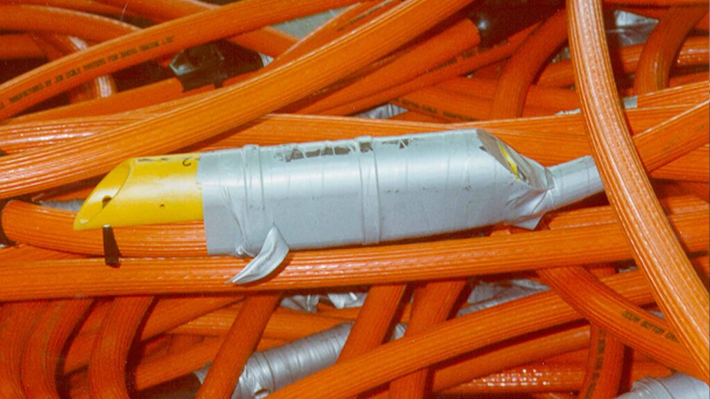
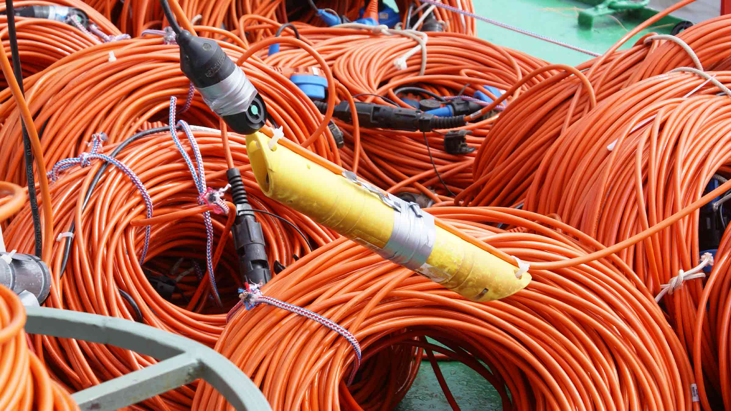
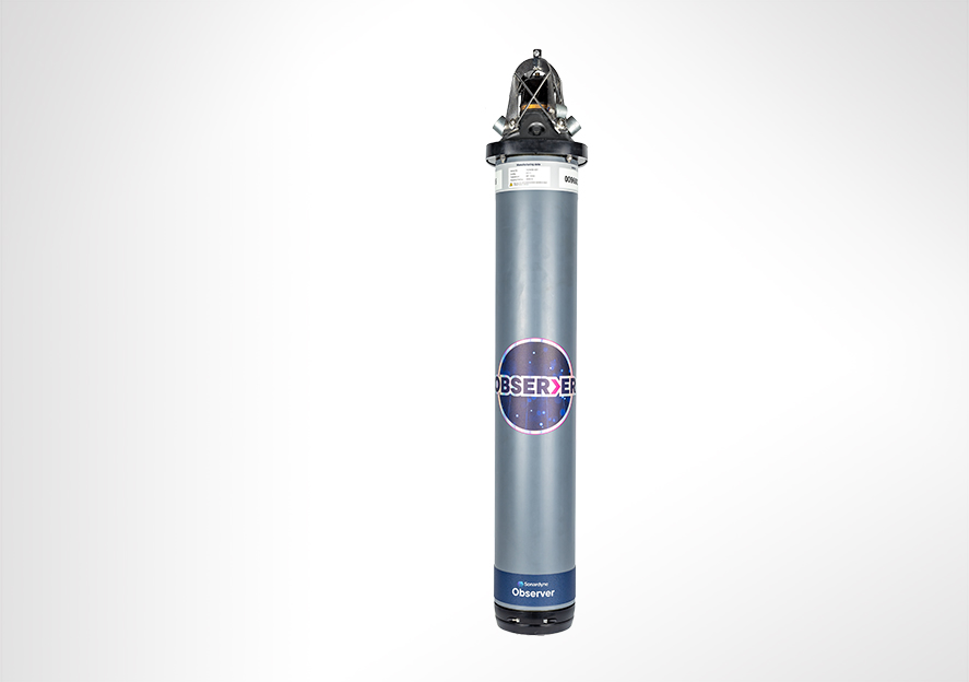
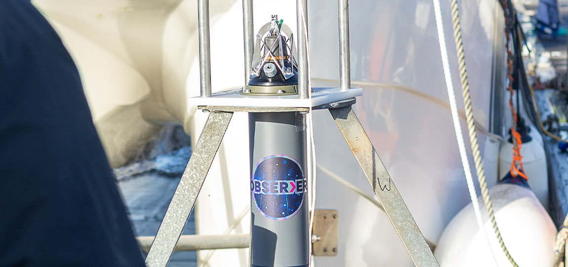
Observer contains SmartCore, our advanced, modular central processing unit. It’s the system’s brain, delivering low power and high performance that supports deployments of up to 10 years, storing raw and analysed at source. 

Apply your own algorithms or use histograms to support fatigue and damage estimation, putting analysis in your control and powering your digital twin. An intuitive, secure, web-based interface streamlines flexible configuration, driving faster decision making and lower operational costs. 

Low and high frequency measurements in one device – no need for different systems 

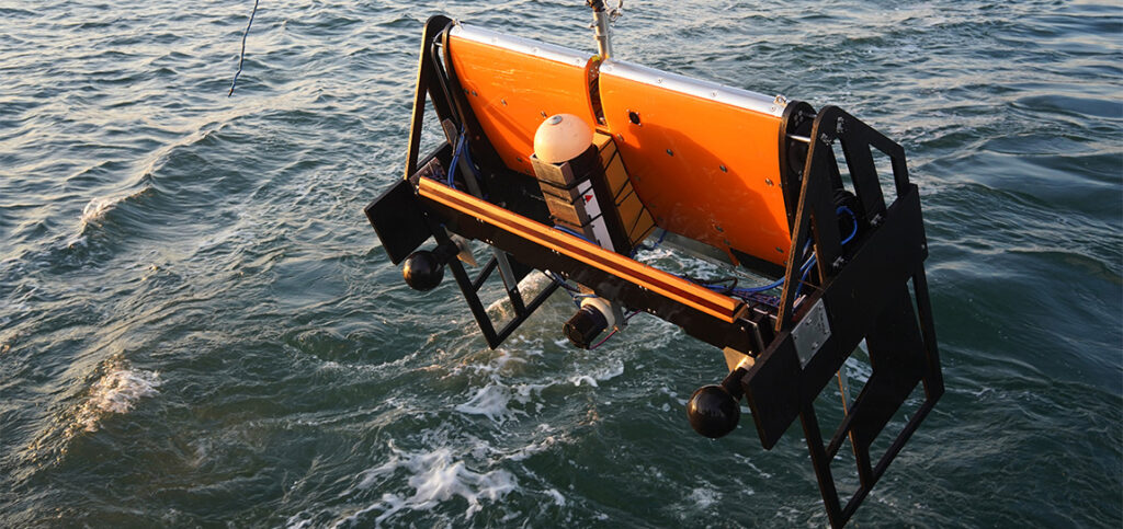
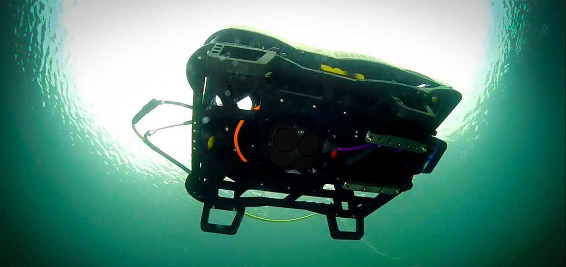
In-built sensors capture high-frequency motion for vortex induced vibration (VIV), flow-induced vibration (FIV) and structural behaviour monitoring. This combination simplifies and expands your ability to truly understand the behaviour of your infrastructure. 

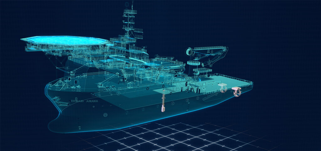
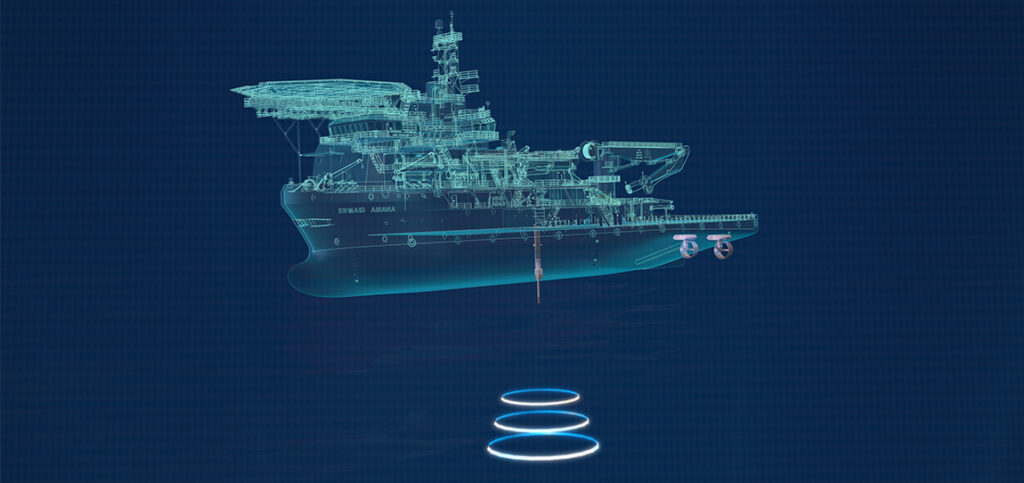
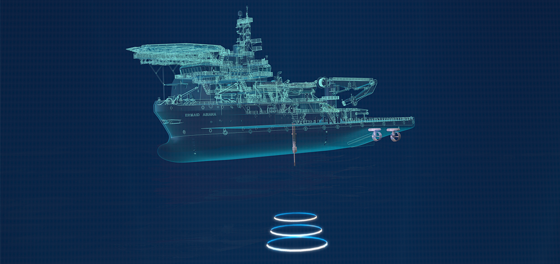
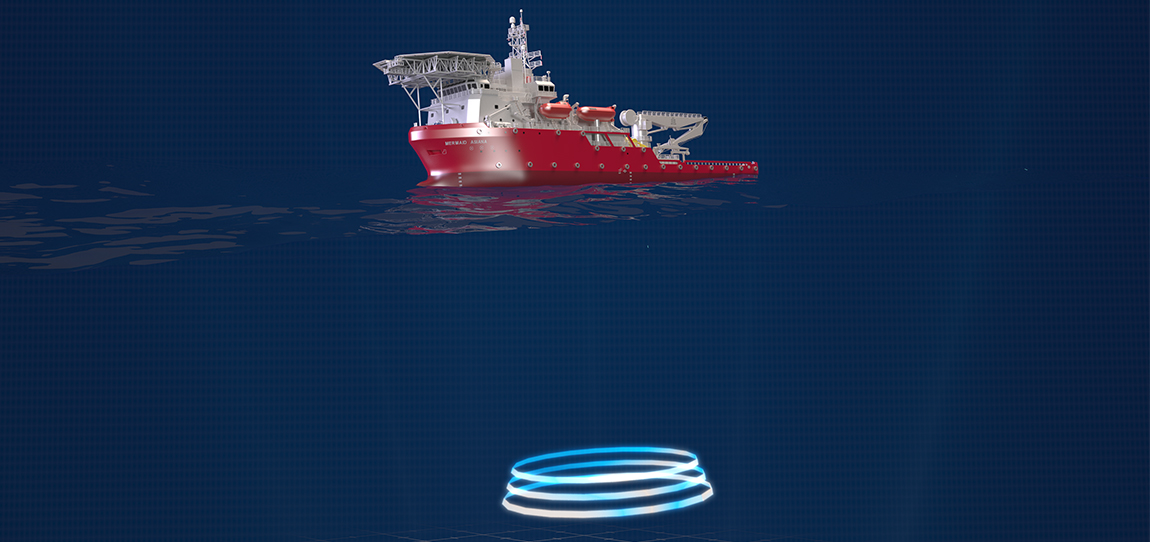
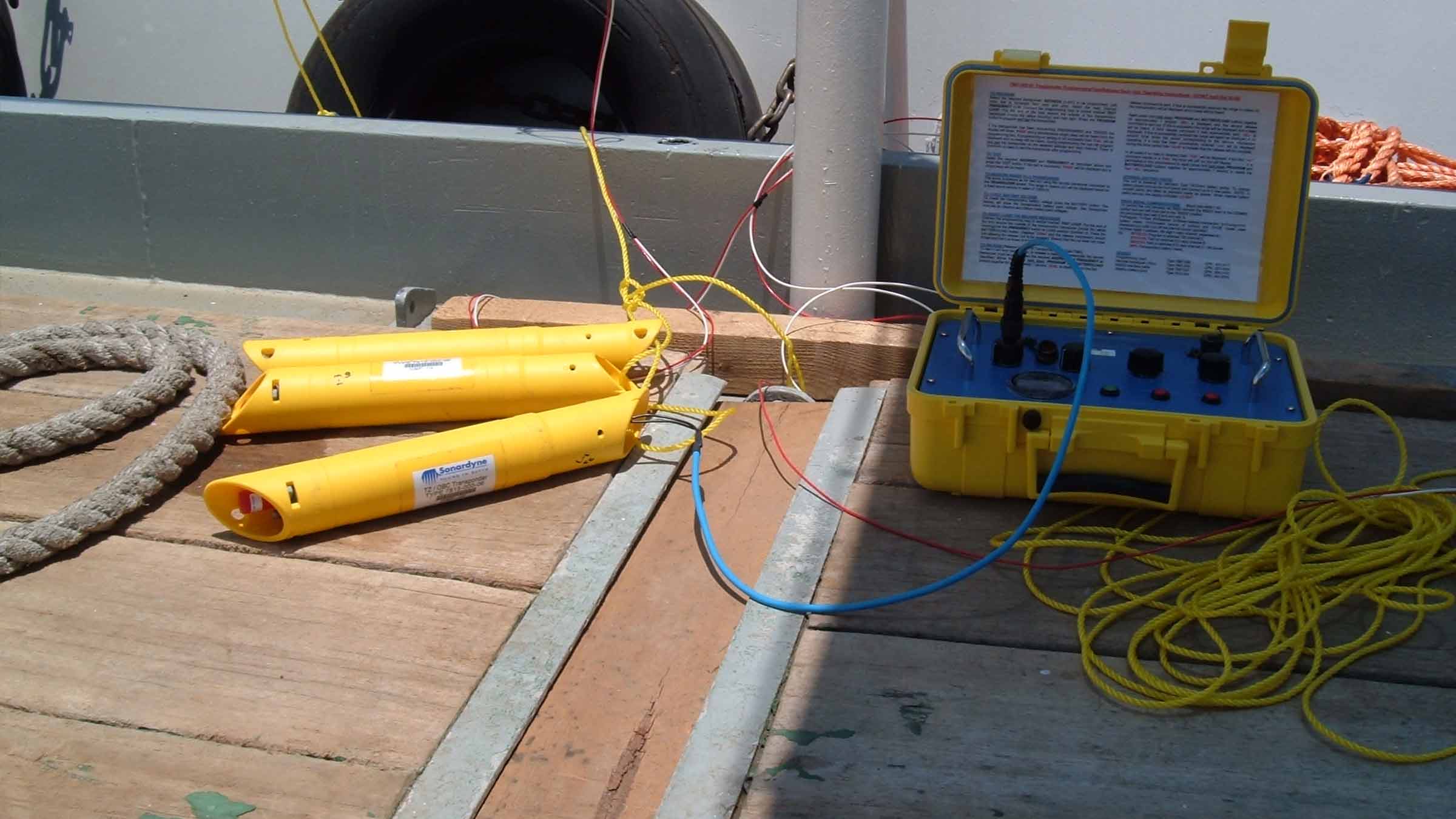
Observer can operate as a Long BaseLine (LBL) node for highly precise low-frequency motion monitoring such as pipeline creep and movementIt also supports Ultra-Short BaseLine (USBL) positioning, for measuring assets movements in the water column, like riser and umbilical movement. Also allowing data retrieval from a vessel or underwater vehicle. 

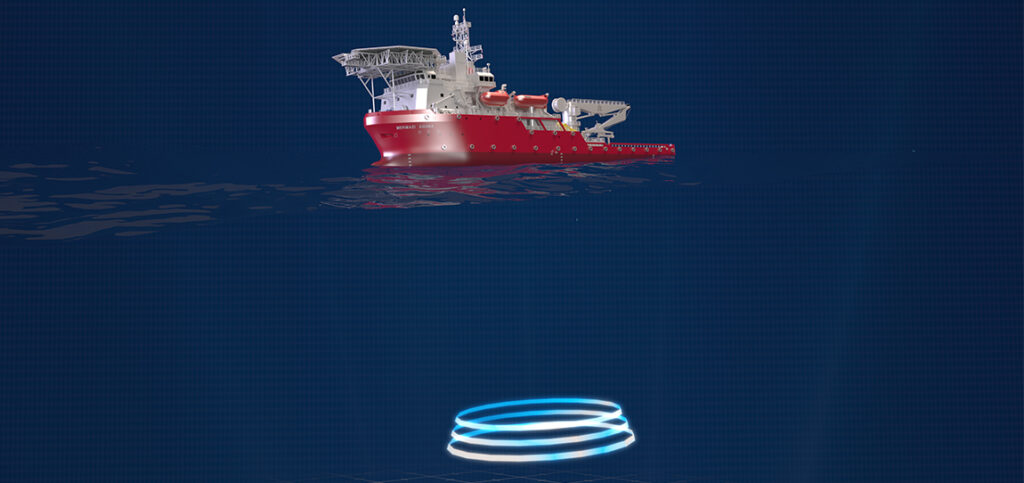
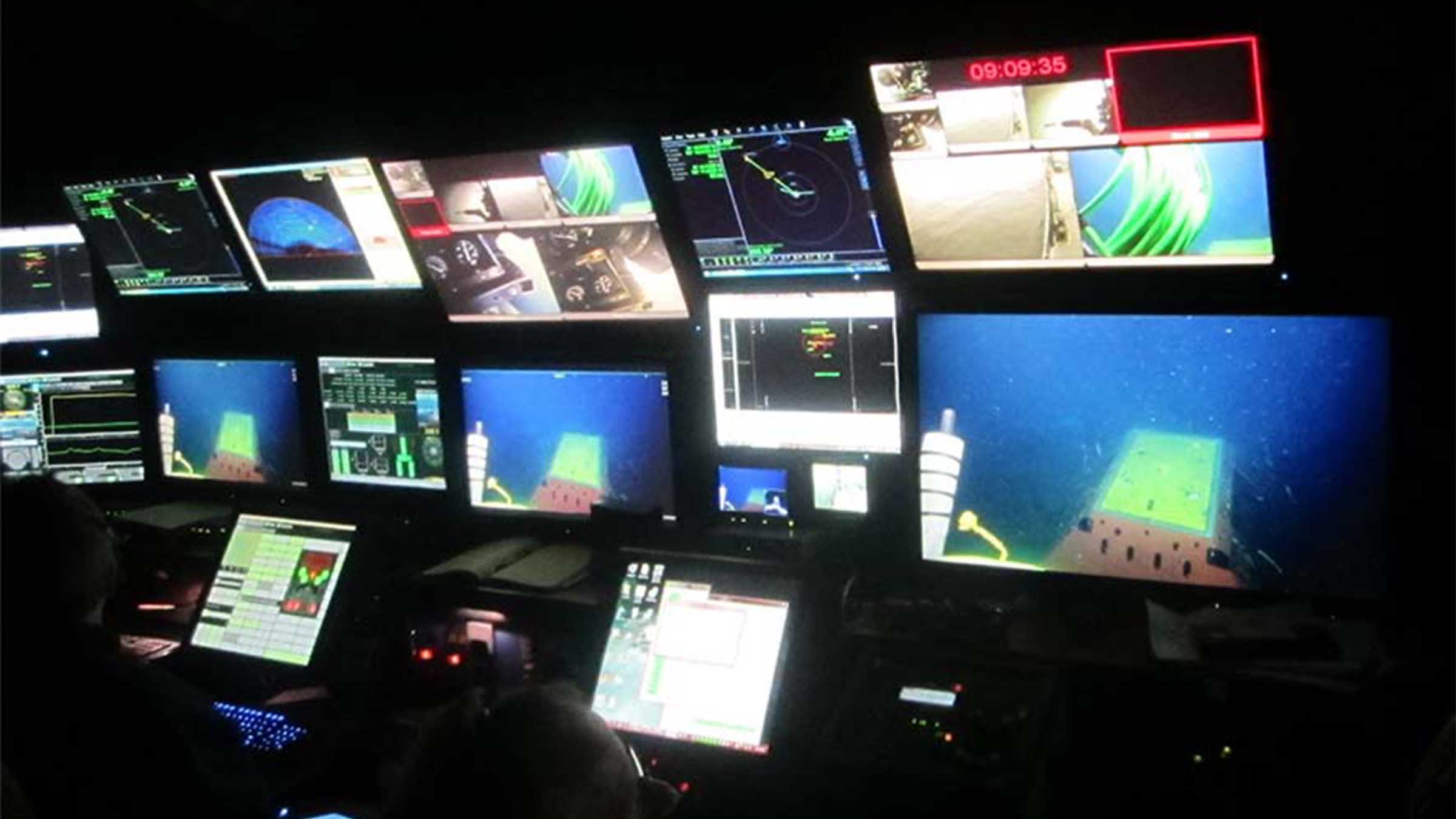
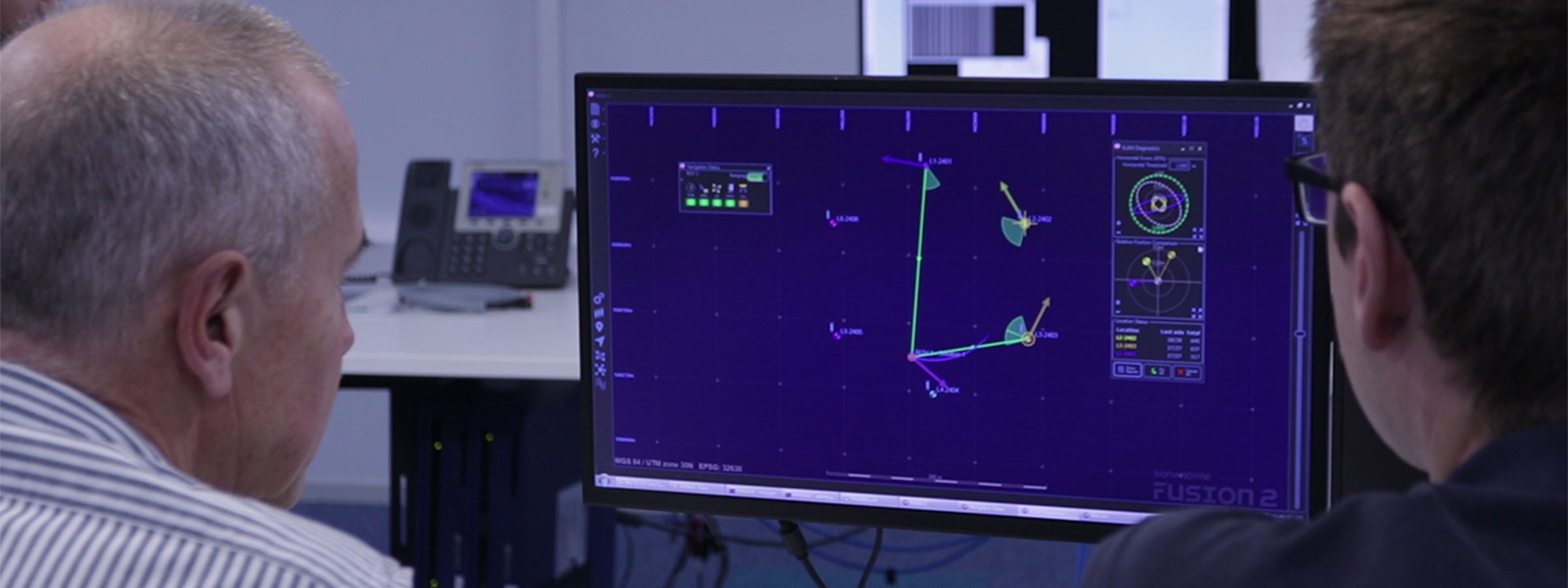
Always informed. Always in control – flexible data retrieval

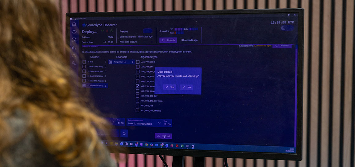
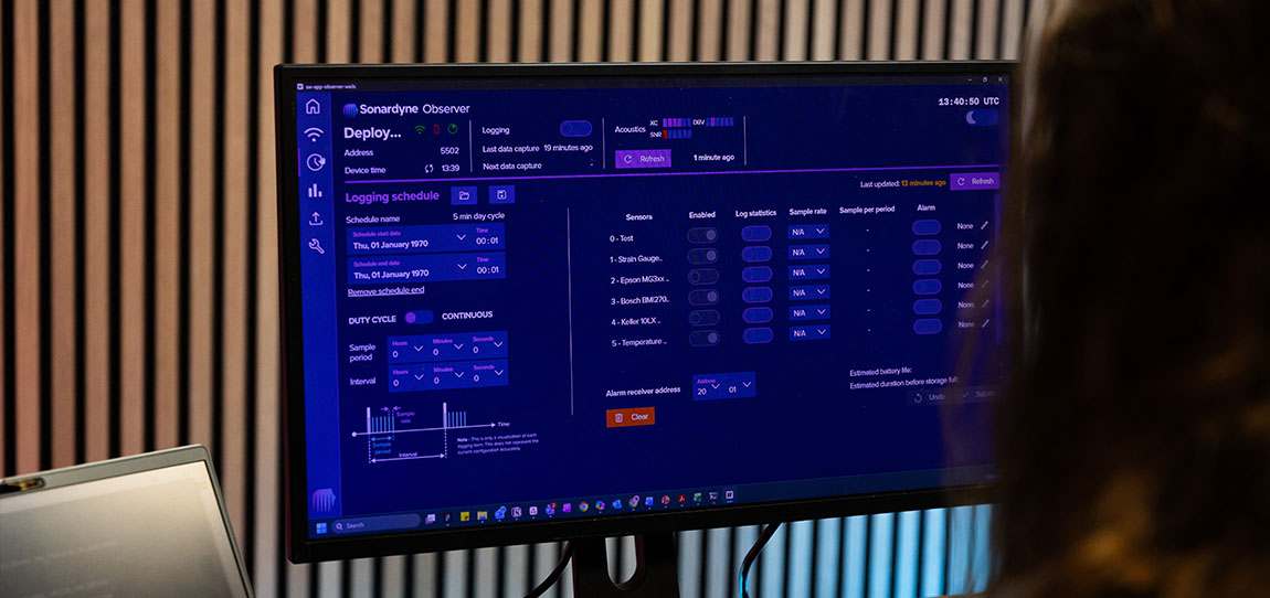
Easily setup, check your configuration and QC your sensor data pre-deployment, and also adjust it acoustically post-deployment, using our intuitive web user interface.  

Set and modify data collection and offloading schedules at any time.  

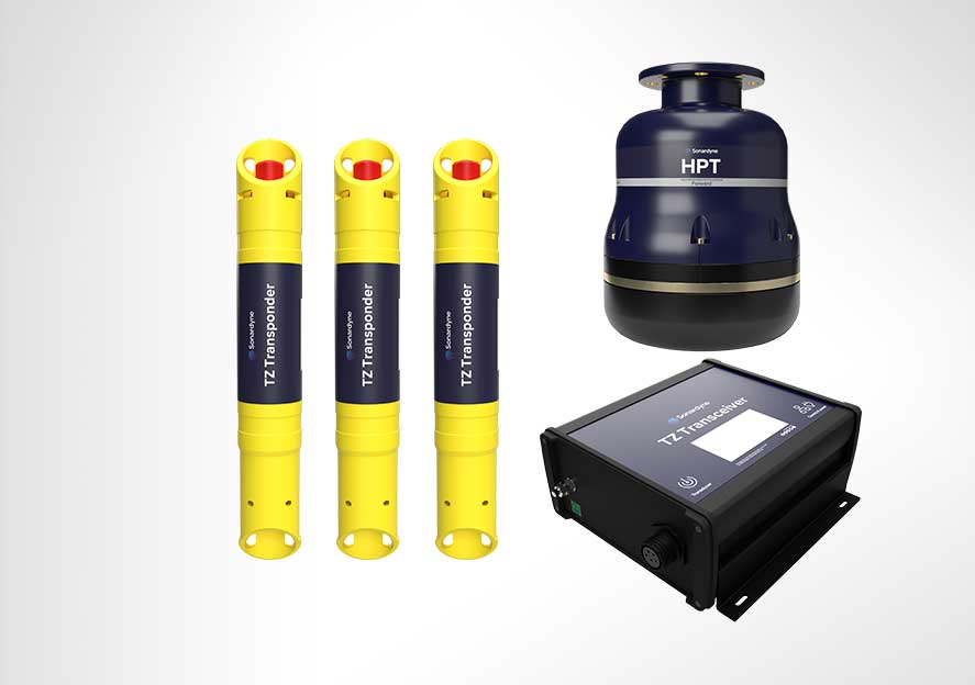
Our trusted acoustic telemetry provides your seafloor-to-surface communications, in all water depths, even in challenging acoustic environments.  

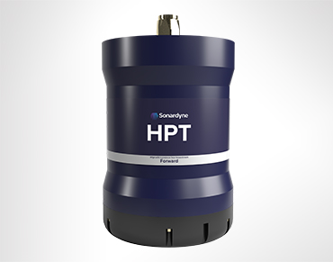
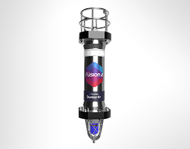
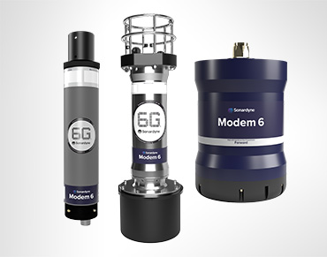
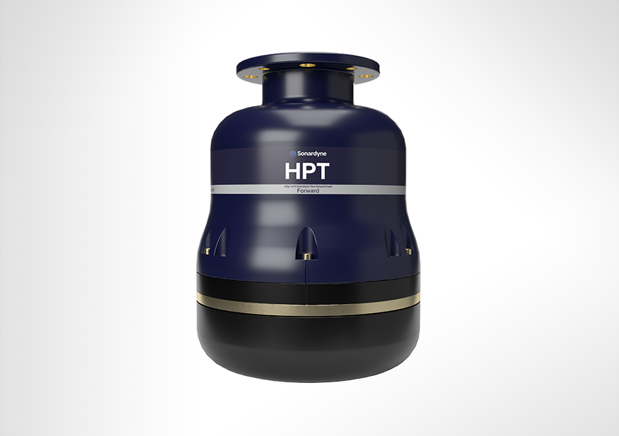
Compatibility with our 6G ecosystem enables data transfer at up to 9,000 bps to topside transceivers and modems, including our HPT 5000, Modem 6+ and Dunker 6 

An Ethernet communication link allows larger quantities of data to be harvested directly from subsea control systems or subsea vehicles. 

Observer at a glance

  • Up to 10-year endurance for fewer interventions  
  • ROVdeployable and recoverable for easy installation 
  • Rated to 3,000 m (7,000 m option) for global operations  
  • Onboard logging and analytics with acoustic offload on demand 
  • High and low-frequency motion monitoring in a single device 
  • Built on our lowpower 6G hardware and Wideband 2 digital signal architecture for trusted subsea communications 

Sensing

• 6 DOF high-performance sensor fitted as standard
• Sampling rate: 5 Hz, 10 Hz, 25 Hz
• Data storage: 64 GB, dual redundant
• Processing capability: Fully programmable including analysis, statistical functions and bespoke options

Design

• 3,000 m depth rating; up to 7,000 m on request
• ROV-friendly design; option for ROV mounted clamps
• Aluminium standard housing material; options for different materials depending on deployment duration and environmental conditions

Acoustics

• Over 500 unique addresses, ideal for large array deployments
• Data transfer rates of 100 to 9,000 bps – user selectable
• Omni-directional transducer for wide area acoustic coverage
• Sonardyne Wideband 2 MF band (19 – 34 kHz); field proven in high-noise subsea environments

Expected battery life (typical/max life/max sampling)

• Up to 10 years (duty cycle logging pressure, temp and motion)
• 4+ years for a typical riser monitoring application (duty cycle logging USBL position, motion, depth, temp and SV)
• 2.5 years continuous logging (motion, depth and temp)

Specifications Table

Features Specification (Type 620-0762)
Acoustic operating frequency MF omni acoustic modem 20-34 kHz (alternative options available on request)
Expected operating range Up to 3000 m slant range
Sampling rates Sensor dependent, configurable decimation
Data storage 64 GB dual redundant
Data processing Min, max, mean, std deviation
Internal sensors Pressure sensor – standard 30 / 300 bar 0.01% FS, additional options available on request
Temperature sensor – standard ± 0.1 °C
IMU – standard 6 degrees of freedom – gyroscope (offsets ± 20 mg) and accelerometer (offsets ± 0.5 deg/sec)
High grade IMU – optional 6 degrees of freedom triple gyroscope (± 0.1 deg/sec) and tri-axis accelerometer (offsets ± 2 mg)
Connectivity 1x 8-way external sensor connector 4-20mA interface
12V external power output
0-12V voltage input
RS232/485 interface
2x 4-way external sensor connectors mV/V (wheatstone bridge type sensor)
1x 8-way connector for power and comms 24V external power input Ethernet
Electrical Standard battery specifications 1872 Wh primary lithium non-rechargeable battery pack (alternative capacities available on request)
Expected battery life (typical/max life/max sampling) Up to 10 years (duty cycle logging pressure, temp, & motion)
4+ years for a typical riser monitoring application (duty cycle logging USBL position, motion, depth, temp & SV)
2.5 years continuous logging (motion, depth, temp)
Mechanical Construction Aluminium (super duplex / titanium on request)
Dimensions (height x diameter) 927.5 x 132 mm
Approx weight in air/water 18 kg / 10.26 kg
Environmental Depth rating 300 / 3000 m (dependent on pressure sensor)
Operational / storage temperature -5 to 55°C / -20 to 55°C

Datasheets

Watch

Jump to

Overview

Small in size, mighty in performance

The class-leading capabilities and performance of SPRINT-Nav navigators are now available for all your marine robotic operations, no matter the size of your platform.

Designed from over a decade’s experience gained across the SPRINT-Nav family of products, SPRINT-Nav U is the world’s smallest hybrid acoustic-inertial navigator. SPRINT-Nav U has been designed to address a clear market need for smaller platforms to provide accurate, precise and robust guidance and navigation.

Find out what's possible

As with all SPRINT-Nav products, SPRINT-Nav U fuses AHRS, DVL, INS and depth data. All of this is now available in a single, ultra-compact and lightweight instrument giving you fast, precise and robust navigation, guidance and control information.

SPRINT-Nav U surpasses expectations in every way. With fast alignment, one unit, one connector, one cable and all the true-north seeking capabilities found across the SPRINT-Nav Family.

Game changing new capabilities for small robotic operations

Measuring just 126 mm in height and 114 (118 at DVL) mm in diameter and weighing a mere 1,000 grams in water, SPRINT-Nav U packs full SPRINT-Nav capability into the space traditionally filled by just a DVL on small subsea robotic platforms. With its compact fibre optic gyro (FOG) Inertial Measurement Unit (IMU) SPRINT-Nav U is a game changer for small vehicle operations.

It’s powered by the same trusted hybrid acoustic-inertial navigation algorithm you’ll find across the whole SPRINT-Nav family. This combines the strengths of all its sensors to provide robust, precise and accurate outputs. SPRINT-Nav U continues to work even in ferrous environments where Micro-Electro-Mechanical Systems (MEMS) based navigation, with its magnetic heading, struggles. This means your operations are provided with a continuous stream of positions, orientation, velocities, depth and altitude even when operating in and around infrastructure.

Ready, set, go

Your SPRINT-Nav U arrives pre-calibrated, meaning there is no need to spend valuable time conducting in-field calibration manoeuvres every time a vehicle is mobilised. It’s the fastest aligning subsea navigator available in the market. Arrive on site, turn it on, give it a position and away you go.

SPRINT-Nav U uses the same, familiar and simple web user interface as the SPRINT-Nav Mini, meaning its already user tested, field proven and has ease of use built in. As is standard for SPRINT-Nav products, the output can be fed directly to your own (or a third party) user interface or vehicle control software.

Need to do an ROV inspection of your offshore energy structures or ports and harbour infrastructure without deploying a large-scale vessel? SPRINT-Nav U will ensure accurate and continuous survey grade navigational data that is unaffected by the materials in such structures.

Conducting a seabed survey with your small AUV, Towfish or USV? No longer worry about the quality of the data you’ll get back as SPRINT-Nav U provides unparalleled navigational inputs for GNSS denied small vehicles and their payload sensors for accurate data collection every time.

Carrying out multiple surveys across a wide area? SPRINT-Nav U’s compact size and weight make it easily man-portable, deployable and retrievable from the back deck of a larger vessel.

SPRINT-Nav U at a glance

  • 126 mm tall by 114 mm in diameter; the industry’s smallest all-in-one hybrid acoustic-inertial subsea navigator
  • Compact hybrid DVL-INS synergies dramatically improve both robustness and performance compared with standalone instruments.
  • Fly higher – 500 kHz DVL maintains bottom lock at up to 100 m altitude
  • Four instruments in one small package; AHRS, DVL, INS and pressure sensor – huge capability at optimised cost, size, weight and power (CSWaP)
  • Easy to integrate, simple to operate, web UI for configuration

General

• Ideally suited for small subsea vehicle guidance, control and navigation
• Size, weight and power optimised
• Powered by our class-leading SPRINT hybrid navigation engine
• More compact and cost effective than the four separate sensors
• Gyrocompass simplicity with hybrid acoustic-inertial navigation performance
• Unaffected by proximity to ferrous objects
• Factory calibrated

Design

• Ultra-compact – 114 (118 at DVL) x 126 mm (excluding penetrator)
• 2.25 kg weight in air, 1.04 kg weight in water
• Water-blocked cable
• Subconn micro circular connector (8-way female)
• Titanium 1,000 m depth-rated housing

Performance

• True north seeking
• Provides 0.1% error for distance travelled (typical survey)
• Heading accuracy 0.15° secant latitude
• 0.02° pitch/roll accuracy
• 0.3/100 m min/max altitude
• Fast alignment

Ownership

• What’s in the box: SPRINT-Nav U
• Warranty: 1 year return to Sonardyne service centre
• ITAR controlled: No
• UK export licence: Yes

Specifications Table

Performance SPRINT-Nav U
DVL aided Typical survey 0.1%
Distance from origin 0.45%
Altitude min/max 0.3/100 m
USBL and DVL aided Precision improvement Up to 4x
Heading (secant latitude) with GNSS or USBL, and DVL 0.15°
Heading (secant latitude) with GNSS or USBL or DVL 0.2°
Roll and pitch 0.02°
Angular rate range ±450°/s
Velocity precision (<2 m/s at 50 m altitude) <1.0 cm/s
Depth accuracy 0.01% FS
Power
Power requirements 24 V dc ±10%, 8 W nominal
Physical/Comms
Data storage 32 GB internal memory
Serial ports/protocol 1 RS232 (available on cable but not Subconn MCIL8F)
Interfaces Ethernet, UDP/TCP, WebUI, 1 x trigger inputs/output (1PPS in/out or DVL trigger), NTP, ZDA out
Mechanical construction Titanium
Dimensions (diameter x height) 114 (118 at DVL endcap) x 126 mm (excluding penetrator)
Weight air/water 2.25/1.04 kg
Environmental
Depth rating 1000 m
Operating temperature -5 to 40 degrees Celsius
Storage temperature -25 to 60 degrees Celcius

Software and firmware

Manuals and quick start guides

Jump to

Overview

Independent. Accurate. Ready to go.

Developed from our SPRINT-Nav family, with its 10 years of proven operational excellence, SPRINT-Nav DP combines INS and DVL technology to provide a robust dynamic positioning (DP) reference alternative in GNSS-denied locations. Perfect for the increasing demand for shallow water DP operations, SPRINT-Nav DP has you covered.

What's possible

GNSS is your trusted DP reference input. But what if that signal vanishes? Don't let a dropped connection halt your operations. Introducing SPRINT-Nav DP – your ultimate second dynamic positioning system.

Forged from a decade of proven excellence with our SPRINT family, this cutting-edge system seamlessly integrates INS and DVL technology, delivering an unshakeable DP reference, especially in GNSS-denied environments. SPRINT-Nav DP is crucial for the growing demands of shallow water operations, ensuring pinpoint accuracy and rock-solid reliability, keeping you on course no matter what. Like all our SPRINT-Nav product family, it’s pre-calibrated, so you can start working right away.

Built for DP class 2 and above operations, its inertial neasurement unit (IMU), featuring Honeywell ring laser gyros and accelerometers, works closely with the Syrinx DVL and the pressure sensor. This integration ensures unparalleled accuracy and reliability when dynamically positioning your vessel.

SPRINT-Nav DP saves time and costs while offering unmatched performance and reliability for a range of applications. With SPRINT-Nav DP, you don’t need to deploy other equipment such as transponders or reflectors as the Syrinx DVL locks onto the seabed for its positioning reference. This also increases the operational footprint of your vessel, which is otherwise limited in range or by weather conditions when using sensors.

Using bottom lock on the seabed, alongside pre-calibration, means that SPRINT-Nav DP is operational and can provide your position references as soon as it arrives on site. This makes it ideal for a wide range of shallow water and nearshore operations where GNSS signals are often spoofed, blocked or distorted by nearby structures such as turbines and risers or coastal geography.

SPRINT-Nav DP – unprecedented performance as standard

“SPRINT-Nav DP represents a leap forward in shallow water vessel positioning. By removing GNSS dependencies, we’re enabling operators to work more efficiently and dependably in challenging environments. Many existing customers had asked about using their SPRINT-Nav’s for dynamic positioning and we are delighted to introduce SPRINT-Nav DP to enhance their operations.”

Duncan Rigg Business Development Manager – Vessel Systems, Sonardyne

Why choose SPRINT-Nav for your DP operations?

Realising the value from tightly integrating high grade INS with other aiding sensors, Sonardyne was the first company to market a hybrid acoustic-inertial family of products for subsea and surface applications – SPRINT-Nav.

The SPRINT-Nav family of instruments has been providing reliable navigation for ROV’s, AUV’s, and USV’s for more than a decade in the harshest of subsea environments, where precision, accuracy and reliability is paramount, and where there is no GNSS signal to depend on.

Renowned for dependable performance, they are the standard fit on hundreds of vehicles operating in the subsea domain. This experience, technology and expertise have led to the development of SPRINT-Nav DP for vessels operating in shallow water where a GNSS signal can’t be relied on.

By law, ships using dynamic positioning must have a number of independent position reference sensors, using different principles, to safely determine and maintain their position. This is known as “meeting class” and the number of independent references required depends on the type of class vessel. Most DP vessels operating in shallow water are class 2.

In shallow water operations, it can be a challenge to meet the requirements for independence and diversity of reference sensors. This can lead to an over reliance on multiple GNSS systems with their common vulnerabilities and failure points.

Removing the need for GNSS to give a DP reference by introducing SPRINT-Nav DP provides you with assurance that your positioning isn’t entirely reliant on a GNSS signal and will therefore still “meet class” in GNSS denied areas. Enabling you to operate safely and within the law.

Performance

• Heading accuracy 0.04° (secant latitude)
• 0.01° Pitch/Roll accuracy
• 0.02% Typical survey accuracy
• Station keeping <2m over 24 hours • Provides bottom lock up to 230 m

Ownership

• What’s in the box: SPRINT-Nav and test lead
• Warranty: 1 year return to Sonardyne service centre
• ITAR Controlled: No
• UK Export Licence: Yes

Design

• 240 x 395 mm, 13.1 kg weight in water (100 m depth rating)
• Titanium housing construction
• Onboard data storage and battery backup to ride through brown outs
• Individually water blocked and replaceable DVL transducers
• In field remote performance upgrades: Yes

Applications

• Subsea structure installation
• Nearshore construction
• Station keeping
• Dynamic positioning in GNSS-denied environments
• Offshore windfarm development
• Coastal and nearshore operations

Specifications table

Performance SPRINT-Nav DP
DVL aided Typical survey 0.04%
Distance from origin 0.12%
High Altitude (HA) option 0.12%
Unaided 1.2 m in 60 s
Altitude min/max Standard 0.4/230 m
GNSS aided Precision improvement Up to 7x better
Station keeping <2 m over 24 hours
INS/AHRS heading (Secant latitude) (1DRMS) 0.05º
Roll and pitch (1DRMS) 0.01º
Pressure sensor 0.01%
ADCP Profiling range 0.4–120 m
Velocity range & RMS (along beam) Up to ±8.4 m/s ±0.4% of measured value
Maximum number of cells 255
Maximum ping rate 1 Hz (ADCP)
Power
Power requirements DVL on and battery fully charged 24 V ± 10% dc, 15 W nominal, 35 W maximum
Internal battery backup Li-ion/5 minutes
Physical/comms
Data storage >1 week of data logging
Ports/protocol 1x RS485 full duplex, Web UI, TCP/UDP
Other ports 2 triggers for PPS from GNSS
Mechanical construction Titanium
Dimensions (diameter x height)
(excluding deployment pole mount)
240 x 395 mm
Weight air/water 23.9/13.1 kg
Environmental and EMC
Depth rating 100 m
Operating temperature -5 to 50°C
Storage temperature -25 to 55°C
Standards EN60945 with General Communications Hub
EN61000 without, CE only

Frequently asked questions

Manuals and quick start guides

Jump to

Unrivalled stability, accuracy and results

Delivering unrivalled stability, position accuracy and results in real-time, Equinox is your integrated, towed multi aperture sonar with improved area coverage rates for mine countermeasures (MCM) and hydrographic operations.
At its core, is Solstice multiple aperture sonar (MAS) delivering imagery of the highest quality possible from side-scan sonar enabling detection and classification of seafloor objects across the whole swath.

Combined excellence

Overview

Equinox is a true example of how Covelya Group technologies combine to provide ground-breaking products. Designed around the Solstice MAS from Wavefront Systems, it is commercialised by Sonardyne and features our state-of-the-art SPRINT INS and Mini-Ranger 2 USBL for state-of-the-art navigation and positioning.

The Sonardyne and Wavefront Systems payloads are all mounted on EIVA’s renowned ScanFish 3D, a steerable remotely operated towed vehicle (ROTV). EIVA’s NaviSuite Kuda user interface is used to plan, autopilot and display the gathered data in real-time.

Producing stunningly accurate pictures, it’s ideal for vessels of opportunity or unmanned surface vessels delivering hydrographic, archaeological, search, salvage, unexploded ordnance, and mine countermeasure missions.

At a glance

  • Mission ready; designed to support search, classify and map (SCM) and hydrographic operations
  • Survey more ground in a single pass; effective area coverage rate (ACR) of up to 1.6 km2/hr
  • Along track resolution of 0.15°; best in class delivering maximum detection rates
  • Co-located side-scan image and bathy improves your situational awareness
  • Real-time motion compensation and positioning accuracies better than 1 m DRMS
  • Automatically follows terrain and avoids obstacles
  • Suitable for site survey and characterisation and high tempo MCM missions

Why Equinox is perfect for your operations

The ScanFish 3D is a trusted ROTV and, thanks to its inherent stability, the ideal platform to operate Solstice from. At a total weight of 220 kg in air, Equinox can be easily mobilised.

Unlike towed Synthetic Aperture Sonar (SAS) systems, Equinox offers you an affordable, lower-logistics alternative still capable of providing high area coverage rates. By combining leading navigation and positioning from Mini-Ranger 2 USBL and SPRINT INS, imaging data is geo-referenced with an accuracy that’s unrivalled for these types of applications at this price.

Planning a mission is easy. Using NaviSuite Kuda software, you can define your sailing route and run-lines by simply selecting the area you would like to cover. During the mission, NaviSuite Kuda continuously updates the vessel and ScanFish 3D position in real-time.

Equinox also provides real-time geo-rectified waterfall, mosaics and DTM maps and the user interface tools that enable an operator to mark and process objects, including automatic target recognition using AI.

That’s not all; ScanFish 3D can carry heavier payloads and there is room in the fibre cable to include additional payload sensors such as gap fillers. Equinox users can count on improved probability of detection and decreased probability of false alarms, improving the efficiency of your mine countermeasures, archaeological, search and salvage missions.

General

• All-in-one, rapidly mobilised solution for MCM, SCM and hydrography
• High stability platform with automatic terrain following
• NaviSuite Kuda software reduces planning times and improves processing times
• Everything supplied, including winch and 1Gbps cable

Performance

• Depth rated to 300 m
• Across track resolution 37.5 mm
• Along-track resolution 0.15°
• Geo-rectified waterfall display
• Image resolution 30 mm x 30 mm
• Co-located 200m swath side-scan and bathy
• Real-time CAD/CAC option

Design (SCANFISH)

• 1210 mm x 1858 mm x 1049 mm, 220 kg in air (73 kg in water)
• Survey speeds 3 to 6 knots
• Pitch and roll stabilised
• Automatic altitude following

Ownership

• What’s in the box: ScanFish 3D, NaviSuite Kuda software, cable and winch, Solstice MAS, Mini-Ranger 2 USBL, WSM 6+, SPRINT 500 INS, DVL
• Warranty: 1 year return to Sonardyne/EIVA service centre
• ITAR Controlled: No
• UK Export License: TBD

Jump to

Overview

Forward looking sonar

Venturing into unchartered waters? Proceed with confidence! Vigilant forward looking sonar transforms your vessel’s underwater situational awareness, alerting you to hidden threats.

Navigating the unknown

Key benefits:

  • Real-time 3D terrain mapping of seabed and water column
  • Extended detection range up to 1.5 km with a 120-degree field of view
  • Automated collision hazard warnings
  • Compatibility with autonomous vessel systems
  • Depth mapping capabilities to 100 metres
  • Two operational modes: 3D mode and Sonar mode

Engineered for versatility, Vigilant offers unrivalled underwater situational awareness with a cutting-edge long-range detection system. This compact, powerful system provides unprecedented underwater detection and mapping capabilities for energy, defence, scientific, and autonomous marine operations. Designed by Wavefront Systems and commercialised by Sonardyne, Vigilant forward-looking sonar revolutionises maritime navigation and safety across multiple sectors. Its compact 31 cm-wide design weighing just 14 kg allows for easy installation on vessels ranging from exploration cruises and private yachts to naval ships and research vessels. The system can be seamlessly retrofitted to existing vessels or integrated into new builds.

How it works

The system consists of a sophisticated sonar projector and receiver array mounted at the vessel’s bow, complemented by advanced bridge software. Its proprietary Altitude Confidence Filter (ACF) generates precise, colour-coded depth imagery, enabling crews to navigate challenging environments with confidence.

Seaborne collision avoidance is also a vital consideration for autonomous ships and an ever-increasing number of unmanned surface and underwater vessels in the offshore energy, ocean science and naval market sectors. Vigilant can be integrated into these autonomous platforms to provide essential information to autopilots and command and control systems, to aid safe navigation and manoeuvres around hazardous obstacles.

Vigilant has two principal operating modes, 3D mode and Sonar mode. 3D mode produces stunning 3D bathymetry and colour coded depth imagery using our proprietary Altitude Confidence Filter (ACF), out to 600 m and down to 100 m. Sonar mode processes the intensity of the acoustic data to extract long-range positional data out to 1.5 km and over a 120 degree field of view. In this mode, the sonar returns are used to generate alerts to the operator (or a third-party system) to the presence of a navigationally relevant obstacle.

For naval and security applications, Vigilant can be combined with Sentinel intruder detection systems, providing comprehensive underwater threat protection. Whether exploring secluded bays, navigating busy shipping lanes, or venturing into polar regions, Vigilant delivers unparalleled maritime intelligence and safety.

Comprehensive engineering support is available to ensure seamless installation and commissioning, making Vigilant your essential tool for modern marine operations.

Jump to

Overview

Intruder Detection System

Close the gap in your situational awareness by specifying the world’s most widely deployed underwater intruder detection sonar, Sentinel, to help safeguard your vessels, oil platforms, waterside facilities and national infrastructure.

Over 2km coverage from one unit

Key benefits

  • Up to 2,400 m diameter protection zone using a single sonar head
  • Detects divers up to 900 m away and UUVs up to 1,200 m away
  • Up 10 targets tracked and classified simultaneously
  • Helps protect ports, harbours, naval bases, private yachts, residences, power stations, offshore platforms
  • Rapidly deployed for instant protection
  • Low false alarm rate
  • In service globally since 2007
  • One of the smallest IDS solutions on the market; take it and deploy it anywhere
  • Commercial-off-the-shelf technology that integrates seamlessly with your existing security systems
  • No specialist sonar experience needed; software automates most of the heavy lifting
  • Can be remotely monitored from anywhere in the world

Discover Sentinel, the cutting-edge maritime security system designed to revolutionise your underwater threat detection and protection. Our innovative technology combines unparalleled flexibility with intelligent threat assessment, offering you comprehensive security solutions for diverse maritime environments. From compact deployments on patrol vessels to extensive networked systems protecting expansive naval bases and container ports, Sentinel adapts seamlessly to your operational requirements. With its lightweight design, advanced algorithmic discrimination, and seamless C2 system integration, Sentinel empowers security personnel to monitor critical areas with unprecedented precision and efficiency, dramatically reducing false alarms while ensuring comprehensive threat detection. It is suitable for:


  • Vessel security
  • Naval ship protection
  • Port and harbour security
  • Naval base protection
  • Protecting your maritime assets from underwater threats

How it works

Sentinel is your cutting-edge underwater security system designed to detect and track potential underwater threats across a wide range of environments. Designed by Wavefront Systems and commercialised by Sonardyne, this innovative technology provides comprehensive protection for your critical infrastructure, naval vessels, ports, and private properties.

With remarkable detection capabilities, Sentinel can identify divers up to 900 metres away and uncrewed underwater vehicles (UUVs) at distances of 1,200 metres. The system is versatile and easy to deploy, whether protecting a commercial harbour, critical national infrastructure, or a private yacht. Its advanced sonar technology can be quickly installed on boats, ports, or coastlines, creating an instant underwater security shield that operates autonomously.

Its user-friendly design sets Sentinel apart. The complex sonar technology is packaged into intuitive software, allowing security personnel without specialised technical expertise to operate the system effectively. For enhanced threat response, an optional accessory called Scylla can broadcast pre-recorded or live audio messages to divers up to 600 metres away, providing an additional layer of deterrence. Whether dealing with busy harbours, shallow waters, or strategic infrastructure sites, Sentinel offers you reliable, real-time monitoring and threat tracking in virtually any marine environment.

Jump to

Overview

Low power, high resolution sonar imaging

Solstice multi-aperture side-scan sonar (MAS) significantly increases the operational envelope of your underwater vehicle by providing wide swath coverage, at high resolution – all while consuming very low power.

Solstice side scan sonar

Capture every feature and every detail in ultra-high resolution.

Key benefits

  • Mission ready; designed to support search, classify and map (SCM) and hydrographic operations
  • Small and compact arrays; optimised for low-logistic AUVs and towed bodies
  • Survey more ground in a single pass; 200 m-wide swath ensures high coverage rates
  • Along track resolution of 0.15°; best in class delivering maximum detection rates
  • Collocated side scan image and bathy improves your situational awareness
  • Consumes only 18 W power: budget friendly and increases your AUV’s endurance
  • Depth rated to 300 or 600 m

Solstice offers enhanced underwater detection capabilities for various missions, including mine countermeasures, archaeological, search, and salvage operations. The system provides high-performance coverage with large 200m swaths on each side, enabling efficient site characterisation without sacrificing detail. Its class-leading imagery allows you to make confident classification decisions more quickly, with the added versatility of deployment on both autonomous underwater vehicles (AUVs) and towfish platforms. By improving probability of detection and decreasing false alarms, Solstice significantly increases the overall efficiency and reliability of underwater exploration and survey missions. It is suitable for:


  • Autonomous underwater vehicles (AUV)
  • Site survey and characterisation
  • Mine countermeasures (MCM)
  • Remotely operated vehicles (ROV)
  • Delivering pixel perfect imaging

Exceptional high-contrast seafloor imagery across diverse water depths

How it works

Solstice, designed by Wavefront Systems and commercialised by Sonardyne, is a world-leading side scan sonar for autonomous underwater vehicles (AUVs) and towed bodies. Its advanced technology delivers exceptional seafloor imagery through multiple aperture arrays with 32 multibeam elements, enabling superior signal-to-noise ratio performance and stunning imagery at extended ranges. The sonar’s unique back-projection beam-forming technique ensures focused imaging for every pixel, eliminating distortions caused by platform motion and guaranteeing 100% ground coverage across diverse water depths.

Designed for a wide range of marine missions including hydrographic, archaeological, search, salvage, and mine countermeasure operations, Solstice stands out through its innovative features. Its real-time array calibration dynamically recalibrates hydrophone elements multiple times per second, compensating for dynamic strains and maintaining linear element alignment. The system produces high-contrast imagery in environments ranging from 600-metre depths to very shallow littoral waters, utilising a specialised array technology that provides wide swath coverage with exceptional shadow contrast.

Jump to

Lift and lower more with your RT 6s

Accessory for RT 6-3000 and RT 6-6000 transponders

Overview

Our range of heavy duty acoustic release frames increase the Working Load Limit (WLL) of RT 6-3000 and RT-6000 acoustic release transponders, enabling you to lift, lower and release heavy loads onto the seabed, including structures and specialist equipment.

The Type 7869-000-01 release frame increases the WLL of a standard RT 6-3000 or RT 6-6000 to 7,500 kg (at 4:1 safety factor) with a breaking load of 30,000 kg. The type 7869-000-05 release frame increases the WLL of a standard RT 6-3000 or RT 6-6000 to 15,000 kg (at a 4:1 safety factor) with a breaking load limit of 60,000 kg.

The Type 7988 release frame has a WLL of 25,000 kg and breaking load of 100,000 kg.

In most cases, both types of release frame can be fitted without any modification to the acoustic release itself and are easily assembled in the field. Manufactured from high-strength steel which is galvanised and powder coated, the releases offer excellent corrosion resistance for long-term deployment.

Applications for which the acoustic releases have been developed include civil engineering, offshore construction, offshore renewables, marine salvage, defence and ocean science.


At a glance

  • Working Load Limit of 7,500, 15,000 or 25,000 kg
  • Breaking load of  up to 100,000 kg
  • Choice of depth rating: 4,000 or 12,000 m
  • Compact size; just over 1 metre long
  • Industry standard lifting rings


Suitable for

  • Subsea structure installation
  • Research vessels

Did you know?

You can use Ranger 2 and Mini-Ranger 2 to release our RT 6 family?

Jump to

Combined LBL transponder and AHRS

Overview

Gyro Compatt 6+ is our combined LBL transponder and AHRS, supporting every stage of your structure installation project. The instrument provides wireless high update rates of attitude, heading, heave, surge, sway, temperature, pressure, SV and acoustic positioning of any subsea object. Deep water structure installation – made easy.

Gyro Compatt 6+ is no longer available for purchase. However, is still available through our hire pool. Contact [email protected] for more information.


At a glance

  • Combined LBL transponder and Lodestar AHRS instrument; rugged, ROV deployable design
  • Calculates motion and position of any subsea object; use it for structure installation and metrology
  • Rechargeable internal battery provides more than a day of continuous use
  • Wideband 3 inside; our latest signal protocols delivering fast, efficient operations
  • LBL and USBL modes; optimised for Fusion 2 and Ranger 2
  • Built to support subsea construction

Gyro Compatt in action

Performance

• Heading accuracy 0.04 to 0.1º Secant latitude
• Ranging precision better than 15mm
• Rechargeable 28 hr internal battery pack
• Simultaneous ranging and sensor data telemetry; requires Fusion 2
• Real time diagnostics on range measurements for quality control
• Autonomous data logging mode

Acoustic, AHRS and Sensors

• MF frequency (19–34 kHz)
• Supports Wideband 3 and Wideband 2 telemetry protocols
• Integrated Sonardyne Lodestar AHRS, factory aligned
• Integrated SV and depth sensors

Design

• Dimensions 918 x 248 mm
• 45/17 kg weight in water/air
• Deploy and recover using ROV
• External AHRS On/Off switch
• Plastic, super duplex stainless steel and anodised aluminium construction. ROHS compliant

Ownership

• What’s in the box: Gyro Compatt 6+, manual
• Warranty: 1 year return to Sonardyne service centre
• ITAR Controlled: No
• UK Export Licence: required; US Export License: covered under de minimis

Specifications table

Feature Type 8084
Depth Rating 3,000 m
Operating Temperature -5 to +40°C
Storage Temperature -20 to +55°C
Operational Shock Rating 22 g, 11 ms half sine
External Battery Pack / ROV Supply 24 V (20–50 V)
Battery Life Acoustic Navigation Standby 3 months
Lodestar Permanently Powered On 28 hours
Acoustic Compatt 6+ Operating Frequency MF (20–34 kHz) Sonardyne Wideband 3
Transmit Source Level
(dB re 1 µPa @ 1m)
185–192 dB (5 Levels)
Ranging Precision Better than 15 mm
Telemetry Protocol Sonardyne SMS and modem
Ranges Tracked 14 simultaneous replies
Lodestar AHRS Heading Range 0–360°
Accuracy 0.04 to 0.1° secant latitude
Settle Time <5 minutes
Follow Up Speed 500° / second
Resolution 0.01°
Roll and Pitch Range ±180° (no physical limit)
Accuracy 0.01°
Resolution 0.01°
Heave Range ±99 m
Accuracy (Real Time) 5 cm or 5% (whichever is the greater)
Bandwidth User selectable
Resolution 0.01 m
Digital Output – Output Telegram (e.g. for ROV LED display) Yes
ROV Switch – Contact Closure Yes
Data Back-up – Data Logger 8 GB (expandable to 32 GB) internal memory to allow post processing
Remote Transducer – For ROV Applications, a Remote Transducer is Available
Sensors Sound Speed Sensor ±0.03 m/s
Pressure – Strain Gauge or Digiquartz 0.01% FS
Physical Size (Diameter x Length) 248 x 918 mm
Weight in Air/Water 45/17 kg
Jump to

Overview

The industry standard for seismic surveys

Positioning rope connected seismic nodes or ocean bottom cables accurately and efficiently is often accomplished in challenging underwater environments. Our shallow and deep water positioning systems are scalable for small or large surveys and have an impressive global track record of use in the offshore seismic industry.

Designed to work in any depth

From less than 1 m in the transition and surf zones to 3000 m for ultra-deep-water seismic applications.

Our shallow and deep rated acoustic positioning systems improve the speed, accuracy and efficiency of positioning seabed marine seismic nodes and cables, enabling the positioning of thousands of transponders in parallel with deployment and shooting operations.

The system uses a network of low cost, rugged transponders that can withstand fast deployment through mechanical ‘squirters’ to provide users with an efficient method of collecting the positions of thousands of seabed nodes in real-time.

A typical system comprises of acoustic positioning transponders attached to the seismic node or cable and a vessel or USV based acoustic range only or full USBL transceiver interfaced to a PC running our HydroPos seismic positioning control software application. Third party software applications that incorporate an acoustic control module can also be used with the system.

Once the nodes are deployed on the seabed, the system precisely measures the acoustic range (distance) or 3D position (USBL) from a surface transceiver on the pinging vessel to each transponder to enable its exact position to be established. The range and USBL positioning processes are more accurate than traditional first break techniques, 1-2 m absolute, and can either be conducted during node or cable deployment operations or later whilst shooting.

Configurations

Shallow water (range only or full USBL)

Uses HF band vessel or USV-mounted TZT or HPT2000 USBL system with Transition Zone Transponders and LRTs attached to seismic nodes or ocean bottom cable receivers. Offers ranging precision of better than 50 mm in up to 500 m water depth.


Deep water (range only or full USBL)

Uses MF band vessel or USV-mounted TZT or HPT 5000 USBL system with SST 6 and RT6-1000 transponders. Offers ranging precision of better than 15 mm in up to 3,000 m water depth.


OEM integration

Get all the benefits of of our deep water system but with an OEM version of our SST 6 integrated in to your seismic node.

At a glance

  • Enables you to position thousands of nodes or cabled seismic receivers in real-time
  • Operational in 1 to 3,000 m of water
  • Uses low cost acoustic transponders and acoustic releases
  • Scalable for both small and large surveys
  • Scalable for both small and large surveys

Transponders

The transponders developed for the system are small and lightweight and are proven to withstand the demanding and varied operational environment of surveys.

Standard features of the popular Type 7815 TZ Transponder include a depth rating of 500 metres, a unique acoustic ‘address’ enabling thousands of units to be laid in a single deployment and battery voltage monitoring to allow users to better plan their maintenance schedules. TZ Transponders operate in the HF band.

The LRT is a release transponder option for this system. It incorporates an acoustic release mechanism and is typically used at rope or cable ends to aid recovery of seabed seismic equipment after shooting is complete.

SST 6 incorporates our Wideband 2 digital acoustic signal processing architecture ensures robust positioning performance with high levels of ranging precision. It can be provided in 1,000m and 3,000m depth rated housings and is fitted with a handy Near Field Communications (NFC) link as standard for programming and battery status checking.

RT 6-1000 is a release transponder option for this system. It incorporates an acoustic release mechanism and is typically used at rope or cable ends to aid recovery of seabed seismic equipment after shooting is complete.

Both SST 6 and RT 6-1000 are MF band transponders, compatible with our family of Ranger USBL acoustic positioning systems.

Transceivers

Two surface transceiver options are available for this system. TZ Transceiver (TZT) is small and lightweight making it perfect for use vessels-of-opportunity and uncrewed surface vessels which are increasingly being used in support of offshore seismic operations. It can operate in the HF or MF frequency band.

TZT is able to interrogate and calculate acoustic ranges to nine TZ Transponders or 95 SST 6 transponders at a time.

HPT 2000 (HF) and HPT 5000 (MF) are USBL transceivers configured to measure range and bearing to TZ Transponders and SST 6 transponders respectively. They are particularly well suited to high elevation tracking scenarios and offers true simultaneous tracking of multiple transponders providing superior position update rates.

Our team is here to advise you which configuration of transponders and transceivers your offshore seismic positioning system should be configured with to meet to operational requirements.

Design

• Incorporates almost three decades of operational and client feedback
• Supports new generation (6G) and legacy hardware transponders inventories – thousands in service globally
• Suitable for small survey vessel or USV operations; safer, greener, lower cost
• Works with all major seismic software platforms
• Optional asset tracking with transponder RFID technology

Performance

• Operate in <1 m to 500 m water depth • Operates in with Sonardyne HF (35-55 kHz) or MF (19-34 kHz) bands • Up to 18 month battery life for TZ/OBC transponders • Position 3,600 transponders in real time • Range-range or range-bearing (USBL) operating configurations available