Sonardyne
Support Centre
Jump to

Unrivalled stability, accuracy and results

Delivering unrivalled stability, position accuracy and results in real-time, Equinox is your integrated, towed multi aperture sonar with improved area coverage rates for mine countermeasures (MCM) and hydrographic operations.
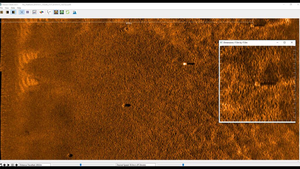
At its core, is Solstice multiple aperture sonar (MAS) delivering imagery of the highest quality possible from side-scan sonar enabling detection and classification of seafloor objects across the whole swath.

Combined excellence

Overview

Equinox is a true example of how Kraken Group company technologies combine to provide ground-breaking products. Designed around the Solstice MAS from Wavefront Systems, it is commercialised by Sonardyne and features our state-of-the-art SPRINT INS and Mini-Ranger 2 USBL for state-of-the-art navigation and positioning.

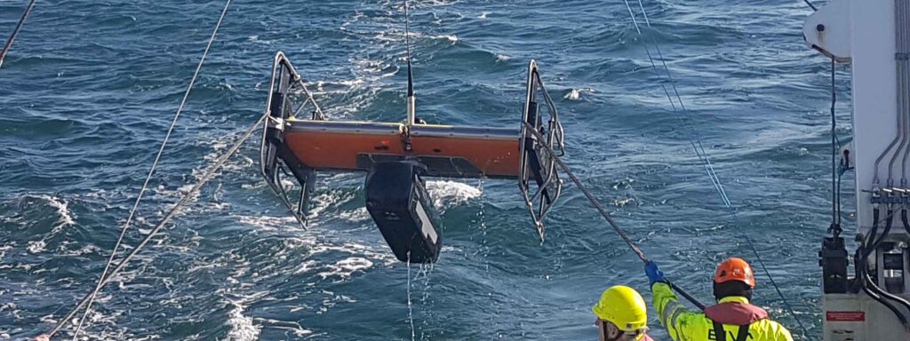
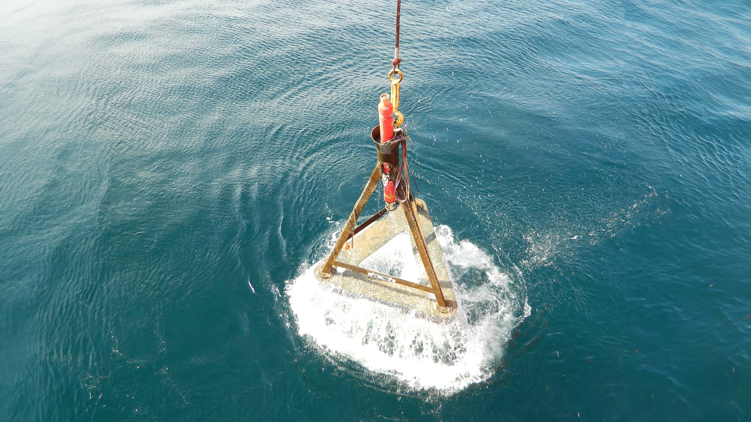
The Sonardyne and Wavefront Systems payloads are all mounted on EIVA’s renowned ScanFish 3D, a steerable remotely operated towed vehicle (ROTV). EIVA’s NaviSuite Kuda user interface is used to plan, autopilot and display the gathered data in real-time.

Producing stunningly accurate pictures, it’s ideal for vessels of opportunity or unmanned surface vessels delivering hydrographic, archaeological, search, salvage, unexploded ordnance, and mine countermeasure missions.

At a glance

  • Mission ready; designed to support search, classify and map (SCM) and hydrographic operations
  • Survey more ground in a single pass; effective area coverage rate (ACR) of up to 1.6 km2/hr
  • Along track resolution of 0.15°; best in class delivering maximum detection rates
  • Co-located side-scan image and bathy improves your situational awareness
  • Real-time motion compensation and positioning accuracies better than 1 m DRMS
  • Automatically follows terrain and avoids obstacles
  • Suitable for site survey and characterisation and high tempo MCM missions

Why Equinox is perfect for your operations

The ScanFish 3D is a trusted ROTV and, thanks to its inherent stability, the ideal platform to operate Solstice from. At a total weight of 220 kg in air, Equinox can be easily mobilised.

Unlike towed Synthetic Aperture Sonar (SAS) systems, Equinox offers you an affordable, lower-logistics alternative still capable of providing high area coverage rates. By combining leading navigation and positioning from Mini-Ranger 2 USBL and SPRINT INS, imaging data is geo-referenced with an accuracy that’s unrivalled for these types of applications at this price.

Planning a mission is easy. Using NaviSuite Kuda software, you can define your sailing route and run-lines by simply selecting the area you would like to cover. During the mission, NaviSuite Kuda continuously updates the vessel and ScanFish 3D position in real-time.

Equinox also provides real-time geo-rectified waterfall, mosaics and DTM maps and the user interface tools that enable an operator to mark and process objects, including automatic target recognition using AI.

That’s not all; ScanFish 3D can carry heavier payloads and there is room in the fibre cable to include additional payload sensors such as gap fillers. Equinox users can count on improved probability of detection and decreased probability of false alarms, improving the efficiency of your mine countermeasures, archaeological, search and salvage missions.

General

• All-in-one, rapidly mobilised solution for MCM, SCM and hydrography
• High stability platform with automatic terrain following
• NaviSuite Kuda software reduces planning times and improves processing times
• Everything supplied, including winch and 1Gbps cable

Performance

• Depth rated to 300 m
• Across track resolution 37.5 mm
• Along-track resolution 0.15°
• Geo-rectified waterfall display
• Image resolution 30 mm x 30 mm
• Co-located 200m swath side-scan and bathy
• Real-time CAD/CAC option

Design (SCANFISH)

• 1210 mm x 1858 mm x 1049 mm, 220 kg in air (73 kg in water)
• Survey speeds 3 to 6 knots
• Pitch and roll stabilised
• Automatic altitude following

Ownership

• What’s in the box: ScanFish 3D, NaviSuite Kuda software, cable and winch, Solstice MAS, Mini-Ranger 2 USBL, WSM 6+, SPRINT 500 INS, DVL
• Warranty: 1 year return to Sonardyne/EIVA service centre
• ITAR Controlled: No
• UK Export License: TBD

Jump to

Overview

Low power, high resolution sonar imaging

Solstice multi-aperture side-scan sonar (MAS) significantly increases the operational envelope of your underwater vehicle by providing wide swath coverage, at high resolution – all while consuming very low power.

Solstice side scan sonar

Capture every feature and every detail in ultra-high resolution.

Key benefits

  • Mission ready; designed to support search, classify and map (SCM) and hydrographic operations
  • Small and compact arrays; optimised for low-logistic AUVs and towed bodies
  • Survey more ground in a single pass; 200 m-wide swath ensures high coverage rates
  • Along track resolution of 0.15°; best in class delivering maximum detection rates
  • Collocated side scan image and bathy improves your situational awareness
  • Consumes only 18 W power: budget friendly and increases your AUV’s endurance
  • Depth rated to 300 or 600 m

Solstice offers enhanced underwater detection capabilities for various missions, including mine countermeasures, archaeological, search, and salvage operations. The system provides high-performance coverage with large 200m swaths on each side, enabling efficient site characterisation without sacrificing detail. Its class-leading imagery allows you to make confident classification decisions more quickly, with the added versatility of deployment on both autonomous underwater vehicles (AUVs) and towfish platforms. By improving probability of detection and decreasing false alarms, Solstice significantly increases the overall efficiency and reliability of underwater exploration and survey missions. It is suitable for:


  • Autonomous underwater vehicles (AUV)
  • Site survey and characterisation
  • Mine countermeasures (MCM)
  • Remotely operated vehicles (ROV)
  • Delivering pixel perfect imaging

Exceptional high-contrast seafloor imagery across diverse water depths

How it works

Solstice, designed by Wavefront Systems and commercialised by Sonardyne, is a world-leading side scan sonar for autonomous underwater vehicles (AUVs) and towed bodies. Its advanced technology delivers exceptional seafloor imagery through multiple aperture arrays with 32 multibeam elements, enabling superior signal-to-noise ratio performance and stunning imagery at extended ranges. The sonar’s unique back-projection beam-forming technique ensures focused imaging for every pixel, eliminating distortions caused by platform motion and guaranteeing 100% ground coverage across diverse water depths.

Designed for a wide range of marine missions including hydrographic, archaeological, search, salvage, and mine countermeasure operations, Solstice stands out through its innovative features. Its real-time array calibration dynamically recalibrates hydrophone elements multiple times per second, compensating for dynamic strains and maintaining linear element alignment. The system produces high-contrast imagery in environments ranging from 600-metre depths to very shallow littoral waters, utilising a specialised array technology that provides wide swath coverage with exceptional shadow contrast.

Enabling complex offshore robotics from a next gen USV

Uncrewed surface vessels are cutting cost, emissions and risk in marine operations, but many remain limited in capability. ACUA Ocean is pushing those boundaries with its PIONEER USV, built to perform in tougher environments. Recent trials showed how PIONEER extends operations below the surface, seamlessly linking surface and subsea domains through Sonardyne’s underwater positioning and communications technology.

The challenge

Offshore inspection, monitoring and survey work has long relied on large, crewed vessels, which come with high operating costs, significant carbon emissions and the inherent risk humans face in marine environments.

ACUA Ocean want to challenge the status quo and deliver subsea operations more safely, sustainably and at lower cost, using their PIONEER uncrewed surface vessel (USV).

Developed in Plymouth, PIONEER is a 14-m-long, 25-tonne vessel which uses a small waterplane area twin hull (SWATH) design, providing high stability and allowing operations in up to Sea State 6—conditions that typically restrict smaller vessels and many USVs. .

It also has a hybrid power chain, providing robust operation with long endurance, including the ability to spend 50 days at sea.

ACUA Ocean says these features allow 30% greater operational availability than a traditional 40 m crewed vessel, while reducing emissions by 95% compared with traditional vessels, and removing personnel from harm’s way. It’s also already Maritime and Coastguard Agency (MCA) Workboat Code 3 and hydrogen certified.

ACUA Ocean's PIONEER USV.
ACUA Ocean's PIONEER USV at sea near a coastline.
ACUA Ocean's PIONEER USV.
ACUA Ocean's PIONEER USV at sea near a coastline.

However, ACUA Ocean’s ambition goes beyond surface operations. The company’s strategy is built around a “nested robotics” model. Its moonpool has been designed to be configured for up to 7-tonne payloads, providing high configurability, including remotely operated vehicle (ROV) and autonomous underwater vehicle (AUV) deployments. It’s a “Swiss Army Knife model,” says ACUA Ocean Chairperson Dr Peter Collinson!

PIONEER will act as a mobile offshore hub—launching, tracking and piloting ROVs, AUVs and other subsea sensor packages; operations that would historically require larger crewed ships.

To realise their goals, ACUA Ocean came to us for:


  • Accurate, survey-grade positioning and tracking of tethered and untethered subsea systems
  • Reliable subsea communications to support remote, over-the-horizon operations
  • High data quality while operating in higher sea states
  • Seamless integration with industry-standard subsea assets already used by customers
  • The ability to operate all systems remotely, consistent with a beyond visual line of sight (BVLOS), uncrewed vessel model
A bank of screens with a person working on a laptop.

The solution

To bridge the gap between surface autonomy and subsea operations, ACUA Ocean chose to integrate our Mini-Ranger 2 Ultra-Short Baseline (USBL) positioning and communications system onto PIONEER.

Mini-Ranger 2 is our survey-grade USBL system for tracking, positioning and communicating with subsea assets in coastal and shallow to mid-depth waters. It supports divers and marine robotics operations, with optional command-and-control for multi-vehicle fleets.

During integration trials in Plymouth, ACUA Ocean wanted to prove tracking accuracy, but also demonstrate PIONEER’s ability to function as a remote subsea command hub—deploying sensors, communicating with them and managing operations entirely from shore.

Mini-Ranger 2 was integrated with the vessel, using an HPT 3000 transceiver mounted on a temporary pole and an offboard WSM 6+ to validate end-to-end functionality.

The system was interfaced with PIONEER’s onboard power and network infrastructure and accessed remotely via a wide area network (WAN) and VPN connection.

The results

The trials demonstrated PIONEER’s ability to act as a subsea gateway, using our survey-grade acoustic systems.

This included successful remote operation of subsea positioning and communications over a WAN connection, tracking and communication with in-water assets at sea, data harvesting capability and interaction with subsea nodes, and technical readiness for ROV and AUV operations from PIONEER.

This included:

  • Remote operability: Operators were able to access, configure and control the system from an onshore remote operations centre, without physical intervention onboard.
  • Integration simplicity: Power provision for guest equipment, data connectivity and physical installation were straightforward, supporting the vessel’s modular payload philosophy.
  • Data quality: Survey-grade positioning ensured that increased availability and rough-weather capability did not come at the expense of data accuracy or processing time.
  • Interoperability: The system aligned with subsea technologies already widely deployed across commercial and defence markets, reducing risk for future customers.

“Through these trials, we successfully proved end-to-end functionality remotely over a WAN, establishing reliable communication between the HPT and subsea transponders both alongside and at sea using Mini-Ranger 2,” says James Cowles, Business Development Director at ACUA Ocean.

“The physical integration was remarkably simple, with the system’s intuitive UI and seamless VPN access allowing us to manage survey-grade technology over-the-horizon with zero issues on software or licensing.

“We were also exceptionally well-supported by Sonardyne’s local technical team here in Plymouth and these successful trials confirm our ability to host and manage survey-grade technology for complex, over-the-horizon missions.”

Proving the foundation for nested robotics at sea

“We’re happy to be supporting ACUA Ocean with our subsea positioning and communications technology to make their vision operational,” says Aidan Thorn, Business Development Manager – Robotics, at Sonardyne.

“With reliable, survey-grade tracking and acoustic communications, Mini-Ranger 2 is a key building block to making PIONEER a fully integrated subsea command and control hub. The flexibility of PIONEER’s deployment options, be they AUV, ROV, subsea glider or towed body fits well with our own philosophy with marine robotics to stay platform agnostic and work across the complete marine autonomous system.”

From enabling resilient positioning in GNSS-challenged environments to supporting multi-vehicle subsea operations, Mini-Ranger 2 provides the dependable subsea layer that underpins safe, scalable autonomy.

Together, ACUA Ocean and Sonardyne are demonstrating how proven subsea technology and innovative surface platforms can work in tandem—delivering cleaner, safer and more capable offshore operations from the surface down.

Monitoring the restless earth for the next “big one”

When the 8.2 magnitude Chignik earthquake hit off the coast of Alaska in 2021, it was a big warning signal.

The largest earthquake in the US since 1965 and one of the largest globally in recent years; it was a reminder of the geohazards lurking, out of sight, off our coastlines.

Offshore events like these could trigger a tsunami, putting major coastal cities and regions at risk.

But, until recently, the geological activity that leads to an earthquake like Chignik was a significant blind spot to scientists, lying hidden and inaccessible beneath the waves.

Now, thanks to ongoing collaboration and development between underwater technology company Sonardyne, Scripps Institution of Oceanography and the U.S. Geological Survey (USGS), the ability to remotely monitor our restless earth is not just possible but also becoming standard practise.

Using a technique called GNSS-A, an increasing amount of coastline most vulnerable to earthquake and tsunami hazards, including the US Pacific Coast, is being monitored.

What is GNSS-A?

GNSS-A works by combining satellite positioning with underwater acoustics to track seafloor movement with centimetre-level accuracy. An uncrewed surface vessel (USV) with Sonardyne’s GNSS-A payload patrols above an array of Sonardyne Fetch transponders on the seabed.

Combining its known surface position with acoustic pulses down to each Fetch transponder allows it to calculate the precise position of each transponder – and therefore the position of the seabed it’s sitting on.

By repeating these measurements over time, scientists can track the movement of tectonic plates across faults to better understand and estimate earthquake and tsunami hazard.

One of the organisations using this technique to monitor subduction zones, where one plate is sliding under another, is the USGS.

They first started exploring its use in 2017, working in collaboration with the University of Hawaii and Scripps, and using a Wave Glider and seabed sensors, in order to measure how friction between two tectonic plates restricts sliding and causes a build-up of stress – essentially measuring “how stuck are the plates”.

Since then, they’ve continued to contribute to the development of GNSS-A using Sonardyne GNSS-A modules and Fetch transponders.

Expanding GNSS-A monitoring along the Cascadia Subduction Zone

A big focus for USGS is the Cascadia Subduction Zone, a 1,000 km long fault off the Pacific Northwest coast that runs from Vancouver Island in Canada to northern California.

Between 2021 and 2025, USGS has installed four monitoring sites on the seabed off the US Pacific coast at the southernmost extent of this zone.

They are part of a wider network along the Cascadia Subduction Zone where subduction involves three plates, the Explorer, Juan de Fuca and the Gorda, sliding beneath the North American Plate, creating the potential for magnitude 9+ earthquakes and large tsunamis.

The USGS GNSS-A sites, each with three Fetch transponders, are on the southernmost Gorda plate where the uncertainty of the Gorda plate motion relative to the North American plate motion has implications on the size and recurrence of earthquakes in the region.

“Before we had this capability, we were only able to use GPS networks on land to estimate, to a sub-millimetre level, the slow movements of the seafloor 50 plus miles offshore,” says Todd Ericksen, Geodetic Engineer at the USGS’ Earthquake Science Center in California.

“But the seafloor was a blind spot; a major missing piece of the global tectonic jigsaw puzzle which meant the true scale of the hazard beneath the ocean was largely unknown. Our instruments stopped at the shoreline.”

“For somewhere like the Cascadia subduction zone, where oceanic plates are being subducted beneath the North American plate, seafloor geodetic sites are filling a major gap, helping us to better understand earthquake and tsunami hazard. If plates ‘lock’ in this zone, building up stress, that whole coastline, and cities like Vancouver, Victoria and Seattle, face significant tsunami risk.”

Critical insights from the Aleutian subduction zone

One of the tectonic sources of large earthquakes that USGS has been monitoring is the Aleutian Subduction Zone. It was here that the Chignik earthquake struck – and USGS was ready for a post-earthquake response mission.

Just a couple of years before, three GNSS-A monitoring sites had been set up on the seafloor off Alaska, in the Aleutian subduction zone, by a team of scientists funded by US National Science Foundation (NSF).

Several Wave Glider surveys had been carried by the USGS and Scripps prior to the M8.2 Chignik earthquake, monitoring the position of the sites in about 1,200 m water depth.

Within weeks of the earthquake, USGS had their Wave Glider back out to measure what movement there had been during and shortly after the earthquake.

Despite challenging weather conditions, the mission collected high-fidelity GNSS and acoustic data with eye-opening results.

“The tsunami was modest, but the seismic event was the largest in the US for nearly six decades,” says Ericksen, “so we expected a large movement. But it was incredible to know exactly how much – and that was 1.4 m.” This was a critical insight into the co- and post-seismic movement, helping to understand subduction zone dynamics.”

The big question was, did the Chignik earthquake increase the state of stress and tsunami potential on the up-dip portion of the fault or not?

“The measurements showed that the fault moved 2 – 3 m horizontally in a shallow part of the fault, less than 20 km below the seabed, helping us to understand how stress builds up along the fault and is released in an earthquake,” he says

“These results suggested that the cumulative slip had relieved stress on the shallow portion of the fault and therefore, the Chignik earthquake likely did not increase tsunami potential of the shallow fault.

“It also showed the effectiveness of the GNSS-A technique and the utility of rapid response GNSS-A measurements to better assess tsunami and earthquake hazards in the region.”

Read more about the Chignik data here.

The origins of GNSS-A

The ability to measure the movement of plates on the seabed is not that new. It’s based on what was originally called the GNSS-A technique, first developed by Scripps, specifically David Chadwell and Fred Spiess.

“Combining GNSS positioning and acoustic measurements to track seabed movement was a clever idea – and it worked,” says Michelle Barnett, Ocean Science Business Development Manager, at Sonardyne.

“But the cost of using crewed ships to do the positioning made it cost prohibitive. It was also technically challenging.”

“So, working with Scripps, in the early 2010s, we developed a combination of our Fetch long-life sensors and an off-the-shelf GNSS-A payload for Wave Gliders that can go out and do the survey work at a much lower cost than using a crewed ship.”

Worth the wait, even when waiting on weather

The technique is not without its challenges, however. After gathering the positions of the Aleutian subduction zone transponders, Ericksen and his team were naturally keen to see the data.

Due to the significant amounts of data involved – we’re talking 25-30 GB per site (comprising three Fetch) – only sub-samples are sent back to shore from the USV, primarily for quality control.

So, they have to wait until the USV comes back – or is brought back – to shore. Low levels of daylight in the Alaskan winter (when the Chignik survey was carried out) meant limited power availability for the USV.

Combined with bad weather, coordinating its recovery proved challenging, resulting in it taking four-months to recover the Wave Glider and offload the data.

Still, the wait was worthwhile and the results are providing greater insights than we’ve ever had before.

Read more

Sonardyne technology chosen for new Canadian seabed observatory.

TL;DR:

Scientists can now monitor underwater earthquake zones using GNSS-A technology—combining satellite positioning with acoustic sensors on the seabed. This breakthrough, developed through collaboration between Sonardyne, Scripps Institution of Oceanography, and the USGS, allows them to track how tectonic plates move and where stress is building up, which was previously a “blind spot” beneath the ocean.

The technology: Sonardyne’s Fetch transponders sit on the seabed in arrays, while Wave Glider robots equipped with Sonardyne’s GNSS-A payload circle above them, using acoustic signals to precisely measure their positions over time. This makes continuous offshore monitoring both feasible and cost-effective for the first time.

Revolutionising small ROV navigation

Operating a small robotic platform in any marine environment is not without its challenges. Reliability and precision with accurate positioning data are key for safe operations and where repeat inspections or surveys are needed.

The size of the platform may present its own limitations, restricting the size and weight of any payload and therefore the extent of its operational capabilities. Environmental or locational factors may also play a part in the reliability of operations. Most navigational and positioning payloads use magnetic compasses to provide heading.

This reliance on magnetic heading makes the platform susceptible to interference from ferrous materials in its surroundings. These could be wind turbine or energy platform monopiles, wreckage or unexploded ordnance (UXO) on the seabed, the presence of vessels / submerged infrastructure in harbours and coastal locations or even just naturally occurring ferrous minerals in the seabed.

These factors introduce heading errors that compromise the supervised autonomous functions of the platform, particularly when following line headings between reciprocal bearings. Even minor heading inaccuracies can cause cumulative deviations over extended missions, leading to imprecise data and potentially requiring time-consuming survey line re-runs.

Any inaccuracies during survey when locating UXOs are particularly unwelcome, by their nature most UXOs are located based on magnetic signature. So, any poor navigation during the wide area or detailed UXO survey can be misleading and potentially dangerous. With repeat inspections of monopiles, for example, ensuring the survey platform returns to the exact same spot on each visit is important to ensure no anomalies or potential problems are missed.

The challenge

Atlantas Marine are a market leader in ROV inspection services. They are regularly called upon to inspect an area for UXO prior to operations or to survey installations at sea. One such example was at the Port of Dover in the UK where Atlantas Marine deployed a VideoRay Defender equipped with an Oculus M750d Multibeam sonar for high-resolution imaging and an ELWAVE TetraPulse system to search for UXOs prior to the deployment of a jack up vessel for remedial work in the port.

At the time of the survey, Atlantas Marine’s VideoRay Defender ROV relied on a magnetic compass for its Attitude and Heading Reference System (AHRS) for navigation and orientation. Richard Stanley, Project Leader at Atlantas Marine explains the mission;

“During the subterranean survey, we utilised a skid-mounted system beneath the ROV equipped with four electrodes to measure electrical impedance up to 2 metres from the vehicle (ELWAVE TetraPulse), targeting both ferrous and non-ferrous UXOs. In the target-rich environment of the port, ferrous objects affected the magnetic compass within the AHRS, resulting in a heading drift of approximately 5-10°.”

Heading accuracy

0.15°

Regardless of the environment

Depth rating

0

m

Weight in water

1.04 kg

The solution

Recognising the need for precise navigation for smaller survey and inspection robotic vessels, Sonardyne set about finding a solution. For over a decade the SPRINT-Nav family of hybrid navigators have combined INS, DVL and pressure sensors with either ring laser gyros (RLGs) or fibre optic gyro compasses (FOG). Unlike most standard fit ROV heading sensors, FOGs don’t rely on magnetic North for positioning and so their operation is not affected by any ferrous objects around them.

Having the technology was one thing, but there was the additional challenge of making it small and light enough to work with vehicles that are often less than a metre in length and only a few kilograms in weight themselves. They also often need to be launched by hand and carried onboard larger vessels, so the size of the payload is imperative.

In response to this challenge facing many small ROV operators like Atlantas Marine, Sonardyne developed SPRINT-Nav U, the world’s smallest hybrid navigator, combining INS, DVL and a pressure sensor in one factory calibrated unit.

“Historically, smaller electric vehicles have been limited in the amount of work they are capable of due to size, power and operational limits presented by weather conditions and surroundings.

Recent iterations of handheld ROVs such as the VideoRay Defender have looked to change what electric ROVs are capable of, while maintaining a platform that is easy to mobilise, operate and maintain. That said, the ROV is only as powerful as the tooling that it holds, so it still requires support from companies such as Sonardyne, to reduce the form factor and weight of their tools and sensors, to enable their integration and deployment offshore.

Atlantas Marine have already been utilising the SPRINT-Nav Mini to great success on our Ocean Modules V8 M500 platform, but Sonardyne’s latest navigator, SPRINT-Nav U, will allow us to go further and integrate it onto our VideoRay Defender ROVs, and provide another service that we can offer our customers – a hand-launched ROV, that can be mobilised in as little as half an hour, transported to site in the back of an car” Mark Salter, Senior Project Manager, Atlantas Marine.

“Like the other hybrid navigators in the SPRINT-Nav family, SPRINT-Nav U’s true north seeking gyrocompass means that it delivers reliable subsea navigation even when in close contact with the types of environmental factors outlined above. With its ultra-compact form factor (126 mm X 114 mm) and a weight in water of just 1.04kg, SPRINT-Nav U gives unrivalled navigation capability to small marine robotic system allowing users to maintain a heading accuracy of 0.15° regardless of environmental factors.

“SPRINT-Nav U has been designed with our customers in mind. We’ve been speaking to them for a number of years about their aspirations for operations with small platforms. With the help of valued customers like Atlantas Marine, our trials have demonstrated a variety of use cases for this new, compact navigator and we’re excited to work on many more innovative uses in future.” Aidan Thorn, Business Development Manager – Marine Robotics, Sonardyne.

“SPRINT-Nav U allows us to offer our customers a level of accuracy and precision that was previously not possible”

Mark Salter Senior Project Manager, Atlantas Marine

Small, light, precise

SPRINT-Nav U is simple to integrate into any marine vehicle along with other payload sensors and uses same field-proven web user interface found on the SPRINT-Nav Mini. Pre-calibration in the factory also means that SPRINT-Nav U is incredibly quick to set up and deploy on site with an alignment time of as little as five minutes, compared to the standard 15-20 minutes of other gyrocompassing inertial navigation systems, making it the world’s fastest aligning hybrid navigator.

“SPRINT-Nav U can turn any marine robot into a survey grade platform. For UXO and asset inspection it drastically improves deliverable data quality. As part of the proven Sonardyne SPRINT-Nav family, customers can be assured of reliable, accurate navigation and positioning every time, no matter the operating environment.” John Houlder, Senior Product Manager, Sonardyne.

The results

Keen to offer their clients a solution for operating in new or challenging locations, Atlantas Marine were happy to put SPRINT-Nav U through its paces as soon as it became available. Vobster Quay in Somerset, UK, provided an excellent proving ground as the flooded former quarry contains the wreck of a plane and many other ferrous objects in up to 36 metres of water.

A combined team from Atlantas Marine and Sonardyne deployed a VideoRay Defender equipped with a SPRINT-Nav U payload manually from quayside in Vobster Quay, and after taking around five minutes to align, the Defender was soon navigating the quarry.

Using Greensea software, the Defender was able to successfully perform precise box and lawn mower survey patterns – with less than 0.1% error as a percentage of distance travelled – over the plane wreck without the ferrous materials affecting the navigation.

What the customers thought

Mark Salter, Senior Project Manager at Atlantas Marine – “Of particular significance to us, is the work we undertake on offshore wind turbines. With a high AC voltage running through the subsea cabling, and the strong magnetic signatures associated with that, plus the ferrous nature of the turbines themselves, the SPRINT-Nav U allows us to offer our customers a level of accuracy and precision that was previously not possible. It allows us to state with much higher confidence the location of any faults and anomalies, and allows us to repeat inspections, year on year, as we document the changing condition of those faults. With the positioning and control managed through Greensea, we can set up autonomous routes and sea patterns with more accuracy and precision than even before, especially in the environments we most commonly find ourselves.”

Richard Stanley, Project Leader at Atlantas Marine – “Providing improved accuracy when operating in ports and areas where large metallic objects are buried on or beneath the seabed, improves not only the reciprocal bearings of the lanes the ROV is flying, but feeds a more accurate heading into the navigation solution which is streamed to the surveyor. Beyond seabed surveys, the ability to maintain a stable heading while piloting a compact inspection-class ROV through culverts with rebar or complex subterranean tunnels is a key advantage. It reduces the need for frequent heading corrections and ensures precise navigation when traversing long distances. This ultimately enhances the quality of deliverables for our clients, providing us with a competitive edge when deploying our equipment.”


Mapping the future for seagrass beds in Plymouth Sound

Seagrass beds are incredibly important ecosystems that offer a range of ecological benefits. Not only do they provide crucial habitats for a diverse array of marine wildlife, especially in coastal areas like Plymouth Sound, they can also store carbon, helping to mitigate the effects of climate change. These underwater meadows serve as nurseries for many species of fish in the early stages of their life, offering them protection and abundant food sources. Additionally, seagrass beds help to stabilise the seabed with their root systems, preventing coastal erosion and maintaining water quality by trapping sediments and nutrients.

Drake seabed
Seagrass
Seagrass seeding
Seagrass map
Drake seabed
Seagrass
Seagrass seeding
Seagrass map

However, despite their importance, locating and monitoring seagrass beds using traditional methods, such as survey boats, presents significant challenges. Seagrass typically grows in shallow waters, which can make it difficult for boats to navigate close enough to the shore to obtain accurate data. Traditional survey boats are often large and cumbersome, making them hard to manoeuvre in shallow or rocky areas. This limitation can result in incomplete or inaccurate assessments of seagrass distribution and health.

Furthermore, the process of using boats for surveying can be time-consuming and labour-intensive. It often requires multiple trips and extensive manual labour to map out the seagrass beds accurately. The visibility in shallow waters can also be poor due to water turbidity, further complicating the survey efforts and leading to potential underestimation of seagrass coverage.

Finding a solution…

This is where Sonardyne and Wavefront Systems come in. The solution, which combines Sonardyne and Wavefront technology, is a survey boat carrying Solstice MAS™ (Multi-Aperture Sonar) as well as a SPRINT-Nav Mini mounted to a pole, deployed over the side of the boat; this maps the chosen area in 200 m wide strips. Once this survey has been completed, the sonar data that has been captured is then processed to create a map of the seagrass in a GIS. A Remotely Operated Vehicle (ROV) is then sent to the same area to ground truth features on the seabed to check that they are how they have been interpreted by Solstice MAS. The ROV is fitted with SPRINT-Nav Mini, allowing us to track its position underwater and guide it, using the map, to the features identified by Solstice; the ROV is also fitted with a camera and the recorded video can be used to create 3D models of the seabed.

Wavefront Systems’ Solstice MAS uses sound signals to produce high-quality images of the seabed, capable of creating images 200 metres wide at high resolution even in shallow water environments, all while consuming very little power. The Solstice family of sonars are built on unique MAS technology and are designed to fill the gap between standard side scan sonars, which are typically simple in design but give low image resolution, and Synthetic Aperture Sonars (SAS), which are expensive, more susceptible to complete data loss due to platform movement and also produce vast amounts of data. In order to execute more detailed mapping, Solstice MAS requires a high quality navigation sensor, which in this case is SPRINT-Nav Mini.

SPRINT-Nav Mini is an all-in-one vehicle guidance and navigation instrument, which combines AHRS data, Doppler Velocity Logger (DVL), Inertial Navigation System (INS) and depth sensor into a single housing. Having SPRINT-Nav Mini fitted onto the ROV provides positioning input, as well as attitude and heading data.

Creates images

0

m

at high resolution

ROV fitted with

0

D

camera

Solstice creates images

0

m

each side of the vessel

Adopting these technologies on such small versatile platforms opens the possibility of high-grade survey data in shallow waters. As a result of the cross Covelya Group collaboration between Sonardyne and Wavefront Systems, a high-definition map of seagrass beds can be created with a greater degree of accuracy than was previously possible with more traditional methods.

A seagrass restoration project conducted by the Ocean Conservation Trust (OCT) in Plymouth Sound, which involves monitoring, conserving and expanding the existing seagrass beds can be enhanced with the use of an ROV which has SPRINT-Nav Mini fitted to it. To help grow the existing seagrass beds, the OCT are placing seagrass mats on the seabed in Plymouth Sound. A survey boat fitted with Solstice and SPRINT-Nav Mini followed by an ROV fitted with SPRINT-Nav Mini can then be used to monitor and create a map of where these mats have been placed so that they have a better understanding of the success of the restoration and expansion project.

“Collaboration is key to our success as a business as we strive to offer integrated solutions to key markets and applications. Our operating companies run independently. However, the overall value when they come together can be significantly more than the sum of their parts. Coupling Wavefront’s Solstice multi-aperture sonar with high performance inertial navigation solutions from Sonardyne and applying it to significant sustainability initiatives such as mapping and monitoring the extent of seagrass beds on the South coast of the UK, makes the effort all the more worthwhile. Great job by the team, continuously innovating to realise increased efficiency and higher value datasets for such worthwhile causes.”

Phil Hart, VP of Integrated Technology, Covelya Group

“We use Wavefront’s Solstice multi-aperture sonar to map seagrass because it provides high-resolution images out to 100m on each side of the vessel even in shallow water. The sonar images give us both a broad and detailed view of marine habitats which is hard to create using other methods. Solstice produces reliable and repeatable results so is ideal for measuring and monitoring changes to the seabed. Solstice also requires very little processing and is compatible with standard side scan processing software, so we find it an efficient solution for habitat mapping over large areas.”

Peter Holt Marine habitat monitoring applications specialist, Sonardyne

Robotic inspections ensure fish nets are securely anchored

With precise positioning a priority in fish farm mooring maintenance, Aquasky Ltd needed a reliable tracking system for their remotely operated inspection vehicle (ROV). Find out how Micro-Ranger 2 proved equal to their challenge.

The challenge

In aquaculture, second only to the welfare of the fish, the maintenance and exact positioning of the nets and their moorings is critical. With specific areas set aside for fish farms, it’s important that the nets don’t drift out of place or into shipping lanes. To maximise production, fish farmers need to moor as many nets as possible within their area whilst ensuring the moorings don’t damage each other. All of this requires careful and precise placement and inspection, which is where Aquasky Ltd excel.

Aquasky Ltd first operated as a small diving company servicing local fish farms along the west coast of Scotland. During 2011/13 it branched out into moorings inspections using a Videoray Pro 5 ROV. They continued to grow and now provide their services to all the major fish farm companies operating in Scotland plus some others abroad.

As the aquaculture industry has grown so has the size and complexity of its subsea equipment. Aquasky Ltd use an ROV to inspect mooring lines and anchors is to verify their integrity and location. The number of anchors can vary from 26 to over 60 for each site depending on the size of the farm.

Accurate identification of anchor positions is essential. Farmers must ensure assets remain within their lease areas as moving outside can lead to suspension of the lease, with significant financial impact.

It is also essential to maintain separation between moorings to prevent any damage. Anchors being incorrectly positioned can result in the following causes of mooring failure: –

  1. Anchor chains rubbing through the mooring ropes.
  2. Mooring ropes contacting rocky reefs and rubbing through.
  3. Moorings being positioned where the anchors cannot locate firmly into the seafloor, for example on clean rock.

In the event of mooring failure, movement of the cages can initially result in the nets coming into contact with the submerged farm grid system. The nets are then squashed, and the fish are forced into a very small area with reduced oxygen available, resulting in them becoming stressed and dying.
In the event of catastrophic failure, cages can break away and drift ashore or out to sea, resulting in the fish escaping into the wild population.

As part of the inspection process, Aquasky provide their clients with detailed reports confirming the location and condition of the moorings.

In order to meet their requirements, Aquasky needed a positioning system that was accurate, compact enough to fit on a small ROV, reliable and portable so that it could be transported to and used in all of their clients’ locations, including those abroad.

Aquasky
Aquasky
Aquasky
Aquasky

The solution

Portable and quick to mobilise, our Micro-Ranger 2 USBL system can be used from any waterside location or vessel to track divers, underwater vehicles and equipment. Ideal for using in lochs and challenging water.

It is our smallest ever underwater tracking system. Everything is engineered to fit in one medium-sized carry case. Apart from a laptop to run the software, nothing else is needed and the size is so small, it can be carried on a plane. Perfect for when Aquasky find work outside of Scotland.

For their anchor and mooring inspections, Aquasky attach a Micro-Ranger 2 Nano transponder to their ROV which then travels around the fish farms. A transceiver is mounted on a vessel nearby and acoustic signals between the transponder and transceiver are used to establish the ROVs, and therefore the anchor/moorings, position. This position can be displayed for in-water tracking and output in real world co-ordinates for interfacing into external chart plotting systems for the clients reports.

“We needed an accurate positioning system that continues to work as mooring lengths increase and in a noisy subsea environment. Having used other cheaper systems, the Micro-Ranger 2 is the only one able to consistently supply reliable positions for anchors at the 300m length currently used by the farms we service.“ Steve Barlow, Founder, Aquasky Ltd.


The results

By adding Micro-Ranger 2 to their subsea inspection tool kit, Aquasky Ltd are able to provide a service that has become the industry standard for fish farm inspections. Their use of an ROV means that inspections are quicker, safer and less expensive than traditional diver inspections. Using Micro-Ranger 2 ensures that the ROV never gets lost and provides accurate data which is vital for the inspection reports.

“We needed an accurate positioning system that continues to work as mooring lengths increase and in a noisy subsea environment. Having used other cheaper systems, the Micro-Ranger 2 is the only one able to consistently supply reliable positions for anchors at the 300m length currently used by the farms we service.”

Steve Barlow, Founder, Aquasky Ltd

“Aquasky’s use of our Micro-Ranger 2 is a great example of its versatility for application in a different marine market sector. Using it for their ROV operations has allowed Aquasky to set the industry standard for fish farm monitoring and inspections. We are delighted to have supported them in doing this and look forward aiding their future operations.”

Alan MacDonald, Head of Sales, UK, Europe and Africa, Sonardyne

Up to

0

%

slant range accuracy

Tracks up to

0

targets sequentially

Maximum

0

m

tracking range

0

Hz

position update rate

Delivering subsea synergy in ORE inspections

There are numerous challenges associated with offshore wind visual inspections, including currents, turbidity, time and cost. Sonardyne, EIVA and Voyis, all part of the Kraken Group, are working together to bring a complete imaging, navigation and autonomy solution to overcome these obstacles and enhance the inspection data product.

With almost a century of combined subsea expertise between them, the companies are ideally placed to offer a solution to the offshore renewable energy (ORE) market that is even greater than the sum of its parts.

Combining great experience to create even greater things.

Bringing together their combined expertise at a technology accelerator event at the ORE Catapult Subsea and Marine testing facility in Blyth, Northumberland, UK, Sonardyne, EIVA and Voyis were able to demonstrate the potential of their ORE inspection solution to industry users, vehicle manufacturers and end clients recently.

Each company brought its own existing technologies which were integrated, on remotely operated vehicles (ROVs) provided by Atlantas Marine , to demonstrate an even more effective solution for underwater surveying.

During the demonstration, NaviSuite VSLAM leveraged the Discovery Stereo system to enable augmented piloting through real-time 3D point cloud images for quality control, while NaviSuite Mobula provided an end-to-end software solution for acquisition, processing and delivery of data.

Sonardyne SPRINT-Nav Mini

Sonardyne’s SPRINT-Nav Mini provides robust, reliable, navigation for piloting and surveying. It is the world’s smallest hybrid acoustic-inertial navigation system and can be used as an all-in-one vessel and marine robot navigation instrument with performance beyond its size. The SPRINT-Nav Mini eliminates the need for separate sensors, such as AHRS, DVL, INS, and depth sensors. This results in no further calibration requirements, fewer cables and connectors to manage and it is more cost-effective than the four sensors it replaces.

It will work in the most challenging environments and remains unaffected by steel structures such as wind turbine foundations and provides a continuous stream of positions, orientation, velocities, depth and altitude at up to 200 updates per second.

Voyis Discovery Stereo camera

Voyis’ Discovery Stereo camera provides a powerful platform for a vehicle’s subsea vision needs, delivering stills images, video, IMU data and 3D data with a data-centric DDS architecture. Through edge computing, it integrates with EIVA’s visual simultaneous localisation and mapping (VSLAM) software technology to provide real-time 3D reconstruction, ensuring area coverage mapping and augmented piloting. Mounted on the front of the ROV, the Discovery Stereo provided 4K video stream and high-resolution images for both navigation and inspection throughout the demonstration.

EIVA NaviSuite Mobula

EIVA’s NaviSuite Mobula software package provides a complete topside software solution for the ROV, enabling efficient acquisition of data with the Voyis Discovery Stereo and Sonardyne SPRINT-Nav Mini. This software offers unique capabilities for automating remotely operated subsea inspection and surveying operations – using tools for a wide variety of tasks, leveraging the software toolbox of NaviSuite.

Demonstrating the difference.

The technology accelerator event at Catapult provided the perfect opportunity to showcase the possibilities in developing this combined subsea inspection solution. The test dock contains a turbine foundation and various other structures, perfect for subsea navigational and photogrammetry demonstrations.

The ROV was fitted with a SPRINT-Nav Mini at the rear, Discovery Stereo camera at the front and utilised the NaviSuite Mobula and VSLAM software packages to control the ROV movements, represent the operation in a real-time 3D visualisation and pilot view, along with monitoring coverage and inspection data quality.

Once the ROV was launched, focus shifted to the control room where the assembled delegates watched the live 4K video stream from the Discovery Stereo camera as the vehicle navigated the dock.

Whilst its primary navigation and positioning was provided by the SPRINT-Nav Mini, as the ROV navigated and surveyed the subsea structures the Discovery Stereo camera and NaviSuite software combined their capabilities to provide millimetric positioning precision and 3D point cloud detail which was fed back to the control room. A video from the demonstration, giving more information about the technology, can be viewed here.

In real-life operations, these actionable insights could then be used to make immediate decisions about state of the asset, the quality of the data and subsequent actions required from the ROV. Having the capability to make real-time operational decisions greatly reduces the risk of collecting inaccurate data and helps to avoid the associated wasted time and cost.

For Sonardyne, EIVA, Voyis and the wider Covelya Group, this demonstration of synergetic working is just the beginning of our ‘Better Together’ approach. The opportunities for delivering smarter, faster, cleaner and more effective subsea technology solutions from within the group of companies are almost endless.

“The benefits of coming to the Covelya Group for an integrated subsea inspection solution is a tight integration of our complementary products in the world of subsea communication, navigation and data acquisition across the group.”

Phillip Hart VP of Integrated Technology, Covelya Group

Over the horizon robotic data harvest aids Shell's net zero ambition

Sonardyne, working with XOCEAN’s uncrewed surface vehicles (USV), deliver a lower cost, lower risk and lower carbon, remote acoustic data harvesting service to Shell from their Ormen Lange gas field in the Norwegian Sea.

Shell’s Ormen Lange gas field is a deep-sea site 120 km / 75 miles off the coast of Norway. As Norway’s second largest gas producer, it plays a key role delivering stable gas supplies to Europe. Built on the site close to Storegga, a major landslide which occurred some 8000 years ago, about 5 million tonnes of rock was used to prepare the seabed for subsea equipment back in 2005. The field has been operational since 2007. Ormen Lange is distinctive in that it doesn’t have conventional surface operation platforms.

Close monitoring of any seabed movement is key to prevent any potential impact to the pipe system. Monitoring of the ocean floor around the well heads is conducted by seabed sensors. The first monitoring array at the site saw 203 Acoustic Monitoring Transponders (AMTs) installed in 2011. These sensors enabled monitoring of changes in pressure and tilt to provide an understanding of seabed movement.

This array was recovered in 2016 due to battery limitations and uncertainty in drift. Today the monitoring is undertaken by an array of 75 Sonardyne seabed Pressure Monitoring Transponders (PMTs). Shell took the decision to install 30 PMTs in 2019 with a further 45 installed in 2020.

The challenge

Without surface platforms, acoustic data from the subsea sensors had to be harvested by crewed vessels in the early years of the field’s operation. This was costly, carbon heavy and posed a risk to personnel in often challenging sea conditions.

With a company ‘Powering Progress’ strategy to achieve net-zero emissions by 2050, Shell was looking for an alternative data harvest method that would reduce cost and risk as well as its carbon footprint.

The solution

Marine robotic platforms provide the opportunity to remove carbon and personnel risk. Working with the customer and XOCEAN as a sub-contractor we developed a solution that would save time, costs. and carbon, while also eliminating the human risk element, using a USV to conduct the data harvest.

The proposal was to use our HPT 3000 transceiver mounted to an XOCEAN USV to remotely harvest data from the 75 seabed PMTs. The HPT 3000 is perfect in terms of size, weight and power for deployment from a USV and can communicate with seabed transponders at depths up to 995 m (or 4,000 m with an extended range version).

XOCEAN USVs are perfect for the data harvesting mission at Ormen Lange. They enable full over-the-horizon 24/7 operations. This means that operators and data analysts can remain safely onshore whilst the operation takes place and data can be sent ashore and verified in near real-time using the USV’s satellite communications.

This satisfied Shell’s commitment to accelerate the transition of their business to net-zero emissions and to integrate sustainability within their business strategy. Following the successful PMT installation in 2019, a five year project was agreed where Sonardyne are responsible for the data delivery to Shell and XOCEAN are responsible for delivering the transceiver to the field for data collection via their USV.

The results

The project began in January 2020 and this was the first time a remote USV data harvest was completed offshore in Norwegian waters by any operator.

Whilst the USV and HPT 3000 were in Norwegian waters surveying the Ormen Lange site, the Sonardyne and XOCEAN personnel never left their bases in England and Ireland.

The data harvest was monitored in real time, 24/7 and the two teams were in contact with each other as well as the remote equipment. This mean that data was being monitored by our team as it was collected and there was no risk of the USV returning with missing or irrelevant data. Had there been any missed or partially collected data the Sonardyne team could ask the XOCEAN team to return to recollect from a particular PMT whilst still in the field, rather than waiting until the vessel returned and having to send it out again.

Successful data harvests have been conducted yearly since 2020 and continue to be a cost effective, low impact operation. This year we collected data from the Ormen Lange site twice, in Spring and Autumn.

If you think you have a similar challenge for us, contact us today.

XOCEAN says

“Through the successful PMT data harvest campaigns at the Ormen Lange Field, XOCEAN has demonstrated reliability by leveraging our cutting-edge USV technology in partnership with Sonardyne. Our uncrewed survey vessel platform offers a safe, reliable and low carbon solution for the delivery of ocean data. As we continue developing our remote operations, we recognize its pivotal role in steering the world towards the realization of the UN Sustainable Development Goals.”

Tomas Frafjord Norway Country Manager, XOCEAN

Sonardyne says

“Transforming how data is harvested at the Ormen Lange site and the on-going success of this project demonstrates the current and future potential of marine robotics in offshore operations. Moving from crewed to uncrewed vessels for such operations enables the drive to reduce carbon emissions in marine industries. Similar remote data collection solutions can be realised in any marine operation that requires long-term data collection. Where Sonardyne communications are built into seabed sensors we can communicate with them using instruments fitted to marine robotic platforms.”

Aidan Thorn Business Development Manager – Marine Robotics, Sonardyne

Norske Shell says

“In Shell we are always looking for new, innovative ways of working that can reduce risk to both people, assets and the environment. Uncrewed surface vessels have proven a highly suitable vessel for downloading PMTs. Carbon emissions are reduced to almost zero, and we don’t need to send people offshore anymore for the downloads. Considering the long distance from shore to field and the often unstable weather conditions in the area, solid planning and vessel management is essential.”

Egil Syre Project Manager, Norske Shell

Autonomous robots prepare to storm the ocean depths

Sonardyne were delighted to be part of the trials of a fleet of marine robots able to tackle complex offshore tasks as part of a ground-breaking project funded by Innovate UK, which is poised to change approaches to ocean exploration. Autonomous marine systems are being developed and deployed in increasing numbers. However, as maritime operations become ever more complex and expensive, and installed energy infrastructure increases in scale and distance from shore, there is a rapidly emerging need for more sophisticated multi-platform capabilities in the offshore renewable energy (ORE) market.

Squads of Adaptive Robots (SoAR) is a two-year collaborative research project, led by the developer of ecoSUB autonomous underwater vehicles (AUVs), Planet Ocean. The project kicked off in September 2021 and culminated this summer with full system testing at Smart Sound Plymouth on England’s south coast.

The SoAR team’s aim was to demonstrate how large-scale survey and exploration missions can be achieved by going beyond the limitations of individual AUVs. We worked alongside industry and academic partners; Planet Ocean, HydroSurv, the National Oceanography Centre (NOC)Royal Holloway University and the Offshore Renewable Energy (ORE) Catapult to develop advanced AI-driven mission planning, communications protocols for fleet coordination and significant improvements in underwater navigation and communications technology.

The trials simulated an offshore windfarm concession survey mission informed by a comprehensive business case analysis by the team at ORE Catapult.

The technology

The fleet-level autonomy engine developed by Royal Holloway, University of London served as the mission’s central nervous system, making real-time decisions and replanning when necessary due to factors such as inaccurate mission execution, vehicle faults, changes in the operating environment or the addition and removal of stations. The division of labour enabled by this approach showed significant promise in productivity gains made possible by robotics and AI.

The SoAR Communications Backbone, developed and released by the team at the NOC, acted as a central messaging system which enabled interoperability between the fleet-level autonomy engine, each vehicle-specific command and control system and any other sub-system requiring bi-directional communication. This was key to allowing the seamless introduction of different platforms and sub-systems in diverse combinations to suit a wide range of mission objectives.

We provided inter-medium communications via our AvTrak 6 Nano acoustic transceivers fitted to each AUV. This enabled simultaneous USBL tracking via a surface vessel and robust telemetry for AUV-to-vessel and AUV-to-AUV communications.

A small swarm of four ecoSUB AUVs, each fitted with an AvTrak 6 Nano acoustic transceiver, played a crucial role in rapidly assessing the underwater environment and conducting preliminary evaluations to identify targets of interest.

An Auto-Hover 1 (AH1) AUV, owned and operated by NOC, capable of exceptional precision in maintaining station and navigating vertically within the water column, and fitted with an AvTrak transceiver, was dedicated to close inspection tasks, enabling intricate and comprehensive examination of identified targets.

Our HydroSurv REAV-60 uncrewed surface vessel ‘Decibel’ assumed a pivotal role, serving as a crucial communications gateway to and from the AUV swarm. It was fitted with an HPT 3000 transceiver and ran our well-established Ranger-2 software on its topside, facilitating inter-medium communication and providing navigation support to the AUVs. Decibel was also equipped with various communications devices including 4G/LTE and Iridium satellite communication systems to enable communications between subsea, surface and the Autonomy Engine.

The deployed SoAR fleet was managed and controlled from HydroSurv’s shore-based Remote Operations Centre in Exeter, using 4G/LTE and Iridium communications.

The results

The open-water trials successfully showcased co-ordinated missions designed, monitored and adapted in real-time by an intelligent “Autonomy Engine”. The trials involved several surface and underwater autonomous systems, with mission management conducted from a remote shore-based command and control facility.

SoAR has led to the introduction of several technological innovations, including advanced AI-driven mission planning, open-source communications protocols for heterogenous fleet coordination and a range of new and enhanced platform capabilities for both surface and sub-surface systems. The variety of small form factor robotic platforms involved in the project represented some of the best innovation in UK ocean robotics to date.

The SoAR concept is adaptable to various applications but strategically tailored to address the specific needs of the offshore wind sector, developing an approach that will offer new operating paradigms and substantial long term cost savings for offshore asset construction and maintenance compared to conventional methods.

SoAR received funding from the ‘Next Generation Subsea Technologies’ competition, a joint initiative supported by Innovate UK, the Net Zero Technology Centre and the Royal Navy.