Oceaneering International Inc. has ordered hybrid navigation systems from underwater technology specialist Sonardyne Inc. for its subsea resident vehicles Freedom and E-ROV.
The two resident vehicle systems are to be fitted with SPRINT-Nav our all-in-one navigational instrument. SPRINT-Nav combines a SPRINT INS sensor, Syrinx 600 kHz DVL (Doppler velocity log) and a high accuracy intelligent pressure sensor in a single unit, making it one of the smallest and highest performing combined inertial navigation instruments on the market.
Oceaneering’s E-ROV has already proven the ability for battery-powered remotely operated vehicles (ROVs) working in the oil and gas industry to be piloted from shore, via 4G mobile broadband transmitted from a buoy, independent of support vessels. The company’s next-generation resident hybrid ROV Freedom builds on the E-ROV concept. Due to debut in offshore trials later this year, Freedom is targeting long, maintenance free-deployments, on autonomous missions and with support from shore-based pilots.
The vehicle will be based out of docking stations on the seabed, enabling it to recharge and download data before and after its subsea inspection, maintenance and repair missions. It will operate in tethered and autonomous tetherless modes, performing both AUV and ROV-related tasks, including survey, inspection, torque tool operation and manipulator-relator activities.
[blockquote author=” Jami Cheramie, Oceaneering”] Both of these systems have been developed to drive a step-change in inspection, repair and maintenance operations in subsea oil and gas fields, to help both increase uptime, operational flexibility and autonomy. A single hybrid instrument for their navigational needs.[/blockquote]
“Tight integration of the separate sensors within SPRINT-Nav as well as the use of high-specification Ring Laser Gyros are behind the high performance our customers are seeing from these units. Combined with their compact form factor, these results are seeing SPRINT-Nav fast becoming the INS instrument of choice for resident vehicles,” said Char Franey, Sales Manager for Survey and Construction at Sonardyne in Houston.
“They’re free from the calibration routines otherwise required and, because they also run on a unique dual engine algorithm, powering the INS and Gyro compass, initialisation is fast and gaps in navigation are few and far between. Thanks to these qualities, SPRINT-Nav is not only ideally suited to subsea resident vehicle applications, but also autonomous and unmanned underwater vehicle (AUV/UUV) navigation.”
A major new seabed observatory that will provide critical information about earthquake and tsunami hazards is to be deployed offshore Vancouver, Canada, using long endurance acoustic sensing technology supplied by Sonardyne International Ltd.
The new Northern Cascadia Subduction Zone Observatory (NCSZO) will use a “seafloor GPS” network to monitor long-term movements of the subducting Juan de Fuca plate and overriding North American tectonic plate. Data gathered by the new observatory will play a critical role in informing assessments of earthquake and tsunami risk to the large populations of the Pacific North-West.
The NCSZO is led by Ocean Networks Canada (ONC)—an initiative of the University of Victoria—and is made possible through cooperation of international partners that include Natural Resources Canada (NRCan) scientists at the Pacific Geoscience Centre and David Chadwell from the Scripps Institution of Oceanography. More than 20 Sonardyne Fetch subsea sensor logging nodes, which will be deployed in depths ranging from 400 to 2,500 metres of water depth for seven years or longer at a time, will comprise the backbone of the NCSZO.
Data will be acquired up to two times a year using a technique called GPS-Acoustic method (GPS-A), the commercial application of which has been pioneered by Sonardyne. GPS-A uses acoustic positioning techniques, inertial navigation, and GPS data to periodically position the Fetch instruments to centimetre-level accuracy, using a Sonardyne transceiver mounted on an unmanned surface vessel.
These measurements will enable the Fetch positions to be related to a corresponding onshore network of geodetic stations operated by NRCan, allowing the subsea plate motion and onshore plate motion to be correlated, which has only recently been made possible.
A number of Fetch units will also be connected to ONC’s existing 900 kilometre-long NEPTUNE cabled ocean observatory to study the potential for continuous measurements. Furthermore, the cabled units will include Sonardyne’s innovative Ambient-Zero-Ambient (AZA) functionality, which enables the instrument’s high quality pressure sensor to be automatically recalibrated in-situ, by periodically measuring the sensor bias against an integrated low pressure sensor.
Geraint West, Global Business Manager – Oceanographic, at Sonardyne, says, “Proven and low-risk, our Fetch instruments are a key tool for the international science community where they are changing the game for seabed tectonic studies. This deployment at the NCSZO, which will be one of the largest studies we have been involved with, further cements its track record.”
Kim Swords, Senior Applications Engineer for Sonardyne in Houston, says, “The data gathered is critical for understanding which areas of the plate interface in the Cascadia Subduction Zone are locked and whether or not part of the energy is being released by slow creep on the fault. Deeper locking that extends further to the coast results in stronger earthquakes in the large population centres of the Pacific North-West, while shallow locking, on the other hand, leads to bigger tsunamis.”
Martin Heesemann, Senior Staff Scientist, Science Services at ONC, says, “Data provided by the NCSZO are certain to enable major breakthroughs in the scientific assessment of earthquake and tsunami risks related to the Cascadia Subduction Zone. Moreover, Sonardyne’s Fetch technology will allow for world-class research in the geodynamics of subduction zones and major technological advances in the rapidly emerging field of seafloor geodesy.”
The project is supported by the Canada Foundation for Innovation, the British Columbia Knowledge Development Fund, and Natural Resources Canada.
The UK’s centre of excellence for oceanographic sciences, the National Oceanography Centre (NOC), has selected high-performance hybrid navigation technology from Sonardyne International Ltd. for the next generation of its Autosub autonomous underwater vehicle (AUV), targeted for under-ice operations.
The NOC, based in Southampton, will incorporate Sonardyne’s highest performing SPRINT-Nav inertial navigation system (INS) into the new 2,000 m depth-rated Autosub, which is being specifically developed for carrying high-performance sensors on the most demanding research missions under polar ice, hence its name Autosub2KUI, or A2KUI.
SPRINT-Nav combines Sonardyne’s SPRINT INS sensor, Syrinx 600 kHz DVL and a high accuracy intelligent pressure sensor into a single housing, making it one of the smallest combined inertial navigation instruments on the market. SPRINT-Nav’s tight integration of all the raw sensor data at a low level provides unprecedented navigational performance and precision for subsea vehicles. Consequently, SPRINT-Nav has consistently outperformed competing systems in trials carried out for a number of customers. The SPRINT-Nav 700, selected by the NOC, is equipped with the highest performance available sensors, including Honeywell ring laser gyros and accelerometers, and has a conservative quoted accuracy of 0.01% distance travelled (Typical Survey).
[blockquote author=” Geraint West, Global Business Manager Oceanographic, Sonardyne”]”NOC selected SPRINT-Nav 700 to meet its requirements for an advanced dead-reckoning system in a single unit as the backbone of the A2KUI’s navigation system. The capability to plug in other navigation sensors to aid the AUV’s position was also critical and a second upward-looking Syrinx DVL is being incorporated to provide tracking on the underside of the ice.”[/blockquote]
“A2KUI will also be equipped for acoustic tracking using Sonardyne’s Ranger 2 Ultra-Short BaseLine (USBL) system, which is fitted to the UK research vessels RRS James Cook, RRS Discovery and the new polar research vessel RRS Sir David Attenborough,” adds Geraint.
Dr Alex Phillips, Head of Marine Autonomous Systems Development, at the NOC, says, “The development of Autosub2KUI by the NOC builds on the successes of previous generations of Autosub, including Autosub3, which has previously penetrated up to 60km under the ice from the ice-edge. Autosub2KUI will provide the UK science community with a next-generation AUV, equipped with state-of-the-art sonars and camera systems to enable scientists to create detailed maps and establish habitat characteristics of the seafloor under the ice-covered polar regions.
“The missions planned for A2KUI are among the most demanding for any AUV in existence and Sonardyne’s SPRINT-Nav will be fundamental to the AUV’s ability to access the hostile under-ice environment in the polar regions. Gaining insights into these regions is critical to answering some of the biggest environmental scientific questions facing mankind, including climate change.”
Sonardyne’s relationship with the NOC extends back over more than two decades, when it started supplying the NOC’s research ships with USBL acoustic tracking technology. More recently, the NOC and Sonardyne have worked together on a number of Innovate UK-funded projects, with the latest being the Precise Positioning for Persistent AUVs (P3AUV) project, which is trialling new advanced navigation techniques on NOC’s ‘Boaty McBoatface’ Autosub Long Range (ALR) and new ALR1500 vehicles. Sonardyne is a partner at the NOC’s Marine Robotics Innovation Centre.
West adds, “Sonardyne is extremely pleased to continue to support the internationally important mission of the NOC. The selection of SPRINT-Nav for A2KUI is the first time that we’ve provided an INS system to the Autosub programme and underlines its current position as the highest performing commercially available hybrid underwater navigation system available.”
Oceanographic equipment developed by underwater technology company Sonardyne International Ltd. will be used as part of a major US$2 million scientific study of disruptive ocean currents in the US Gulf of Mexico.
The multi-year deployment, led by the University of Rhode Island (URI)’s Graduate School of Oceanography, will monitor the Loop Current System (LCS) using Sonardyne’s Pressure Inverted Echo Sounders (PIES).
The LCS is the dominant ocean circulation feature in the Gulf of Mexico. It influences all ocean processes in the Gulf and has implications for a wide range of human and natural activities, from oil exploration to coastal eco-systems, but, knowledge of its underlying dynamics is limited. URI’s initial study aims to improve the understanding and prediction of the LCS by deploying a seabed network of PIES plus near-bottom current meters to monitor the central Gulf’s deep waters.
PIES work by transmitting an acoustic pulse from an instrument on the seabed upwards. The pulse is reflected off the water-air boundary at the sea surface and returns back down to the seabed where it is detected by the PIES. This enables an exact measurement of the two way signal travel time to be calculated. At the same instant, an accurate measurement of depth is made using highly precise internal pressure sensors. Combining data from an array of PIES instruments and near bottom current meters with historic water profile data can be used to calculate currents throughout the full water column.
A total of 25 of Sonardyne’s and URI’s own PIES and current meters will be deployed this summer, in waters down to 3,500 metres depth, with an initial data retrieval using acoustic through-water communications to a surface vessel planned for autumn 2019. Instrument recovery is scheduled for autumn 2020. The results of this study will be used to inform how best to deploy a larger array for a planned 10-year-long research campaign.
URI’s LCS study is being funded by the US National Academies of Sciences, Engineering and Medicine’s Gulf Research Programme, which was founded in 2013, as part of the legal settlements with companies involved in the 2010 Deepwater Horizon oil spill. The long term objective is to improve forecasts of the LCS in order to increase the safety of operations in the Gulf.
[blockquote author=” Professor Kathleen Donohue, URI GSO Program Director”] “Sonardyne’s PIES is a highly capable instrument, with fast seafloor to surface data telemetering capabilities, which will complement URI’s instruments and scientific expertise and will play a key role in this deployment. Sonardyne’s technical expertise in underwater acoustics, signal processing, hardware design and custom engineering are key components of the special instrumentation being deployed in this project, with a particular challenge being the retrieval of data from the seabed in near real-time.”[/blockquote],
Geraint West, Business Development Manager – Oceanographic, at Sonardyne, says “The selection of our PIES by the University of Rhode Island for use in this important project underlines the capability of our instrumentation to gather critical ocean observation data over long periods of time in a demanding environment. We are pleased to be working with URI on this project, which will enable more accurate predictions of the Loop Current, resulting in improved modelling to underpin safer and more efficient operations in the Gulf of Mexico.”
A major US oil company is set to reinforce its deepwater offshore asset integrity assurance in the US Gulf of Mexico with the aid of a sonar-based subsea leak detection system developed and delivered by underwater engineering specialist Sonardyne.
The system, Sonardyne’s wide-area Sentry Integrity Monitoring Sonar (IMS), has been deployed on the seafloor at more than 2,000 metres (6,500 feet) water depth. Sentry IMS, which can be installed short-term or permanently, is able to detect, classify and localise subsea leaks of hydrocarbons from either the seafloor or oil and gas field production infrastructure.
In this latest deployment, Sentry is being deployed under a six-month trial that will demonstrate its ability to provide real-time subsea asset monitoring. The Sentry sonar head, which is mounted on a seafloor lander, is connected into an existing power and communication umbilical to a floating production facility.
During operation, inbuilt intelligence using algorithms developed by Sonardyne continuously assess the sonar data gathered by Sentry and generate near real-time automatic alerts of any hydrocarbon seeps detected in the water column.
As part of the trial deployment, simulations of an oil plume in the water were created, using nitrile-fibre strands, proving fast and accurate detection and classification of the equivalent release of 100 barrels/day of oil out to 244 metres (800 feet), a distance only constrained by the trial environment.
This was achieved within seconds of the simulated leak occurring. Sentry’s capability, however, covers 100 barrels/day mono-phase oil leaks at distances of up to 740 metres (2,427 feet). For mono-phase gas leaks, the system is capable of detecting down to just 1 barrel/day at 500 metres (1,640 feet) or 100 barrels/day (as measured at depth) at 1,000 metres (3,280 feet).
Uniquely, Sentry is able to accurately localise leaks, unlike other systems on the market. Its titanium housing and ROV-deployable design also makes Sentry an ideal choice for deepwater asset integrity monitoring.
This latest deployment follows battery-powered deployments of the Sentry system by other major international and independent operators, in the US Gulf of Mexico and offshore Papua New Guinea. Sentry has also been used in the UK, where it demonstrated its ability to detect carbon dioxide leaks from the seafloor as part of an offshore carbon capture and storage (CCS) demonstration project.
“For deep water, hard to access fields, robust field management philosophies are essential for operators to assure the ongoing integrity of their systems,” says Stephen Auld, Global Business Manager for Asset Integrity Monitoring at Sonardyne.
[blockquote author=”Stephen Auld, Global Business Manager for Asset Integrity Monitoring at Sonardyne”]Having access to reliable near real-time warning systems that are able to identify and locate sources of leak events, should they happen, is a significant benefit to both the environment and offshore exploration and production companies.[/blockquote]
Norwegian energy firm Equinor is to deploy cabled subsea instrumentation from Sonardyne International Ltd. to help increase the accuracy of time-lapse seismic data at the giant Johan Sverdrup oil field.
From first production at the development, Equinor plans to use seafloor based seismic cable permanent reservoir monitoring (PRM) technology to observe what is happening in the reservoir over time to help maximise recovery rates.
While PRM technologies increase the amount and quality of data that operators have about their reservoirs, processing it can sometimes be complicated by changing environmental conditions, such as water velocity and tidal height, at the time each survey is conducted. If those conditions are known, their impact can be readily removed.
To solve this challenge, Equinor has engaged subsea services contractor Subsea 7 to install a Sonardyne Pressure Inverted Echo Sounder (PIES) at 110 – 120 metre water depth at Johan Sverdrup. PIES instruments continuously measure the two-way travel time of sound waves propagated through the water column from the seabed to the sea surface as well as the pressure (depth) at the seabed. This data is then used to calculate a continuous time history of average water velocity and tidal variation throughout the whole water column.
While PIES instruments are already very widely used in marine seismic survey operations, this will be only the second time where PIES units are hardwired into topside power and communication infrastructure, which means Equinor will have instant and continuous access to their data. Conventionally, PIES data is collected acoustically by a passing surface vessel, including unmanned surface vessels.
[blockquote author=” Shaun Dunn, Global Business Manager for Exploration and Surveillance at Sonardyne”]”Time-lapse seismic is a key tool to help operators optimise their recovery rates through improved reservoir visualisation, modelling and eventually also predictive analytics. By using a PIES, Equinor will have higher repeatability in their seismic data which further supports proactive reservoir management.”[/blockquote]
Joint trials by Norwegian research institute SINTEF Ocean and marine resource technology company Sonardyne International Ltd. have proven the ability for an acoustic positioning system to track underwater robots as they move through industrial-scale fish pens.
Being able to accurately track remotely operated vehicles (ROVs) in aquaculture operations, including cage and mooring inspection and removing perished fish, will help operators to increase efficiency and productivity and reduce the need for divers.
Until now, there has been a misperception that acoustic tracking systems do not work in fish farm applications, due to the volume and density of fish within the pens or cages. Fish have an air-filled swim bladder that helps them regulate their buoyancy and this organ can interfere with the transmission and reception of acoustic signals from the surface to an ROV. In a farm with up to 200,000 fish in any one cage, it has been thought that this could pose significant challenges for some acoustic based systems.
In the trials, at the Korsneset SINTEF ACE site near Trondheim, Norway, a Micro-Ranger 2 Ultra-Short BaseLine (USBL) positioning system was used to track an Argus Mini ROV through a pen containing an estimated 150,000-200,000 salmon. Micro-Ranger 2 is Sonardyne’s latest USBL positioning system, designed for users with no previous experience of USBL equipment. It features a small acoustic transceiver deployed from a vessel or pontoon and an acoustic transponder attached to the ROV. Micro-Ranger 2 uses Sonardyne’s Wideband 2 acoustic signals combined with highly sensitive receivers, which can detect the unique acoustic signals, even in challenging acoustic environments.
[blockquote author=”Elizabeth Paull, Business Development Manager at Sonardyne”]“The demonstration, with SINTEF, showed that our systems function to their usual high standards in low to medium fish densities, both inside and outside of the cage, with the ROV being tracked consistently and accurately. When tracking the ROV through the highest density of fish, the frequency of position updates did decrease, but, the positioning of the ROV was still accurate when acoustic paths were available. And, by moving the ROV away from the net, the frequency of updates could be improved.”[/blockquote]
“These positive results mean that those in the aquaculture industry can now use Micro-Ranger 2 for ROV tracking, knowing that the system will track even with high densities of fish,” adds Paull. “This means that items of interest, such as holes or tears in the net, can be located and then relocated quickly and easily, reducing the time needed to make repairs.”
Shell Brasil has agreed a partnership with underwater sensor technology company Sonardyne International Ltd. and Brazilian research institute Senai-Cimatec to develop innovative autonomous technology to make the monitoring of Brazil’s challenging deepwater pre-salt oil fields more efficient.
The new 4D seismic monitoring system, based on so-called On Demand Ocean Bottom Nodes, is being developed under a National Agency of Petroleum, Natural Gas and Biofuels (ANP) promoted programme.
The goal of the project, which Brazilian oil major Petrobras is also a partner in, is to increase the autonomy of ocean bottom nodes, enabling them to be deployed and remain on the seafloor for up to five years, ready to record the seismic and geodetic data on demand. During that period, no interventions, such as connections for data extraction or replacement of batteries, would be required. The nodes would communicate wirelessly with autonomous underwater vehicles (AUV), such as the Shell-funded FlatFish AUV. These capabilities will help to generate operational efficiencies and eliminate the various existing difficulties in deploying current 4D seismic monitoring technology, which is vital to the development and production optimization of oil and gas fields. The new technology will also allow the reduction of both costs and operational safety risks.
[blockquote author=” Jorge Lopez, Shell Research and Development Advisor in Brazil”]”This is a very promising project, fully aligned with the new reality of the oil and gas industry, which seeks to use new technologies to ensure a safer, more efficient operation that has less impact on the environment. For Shell, Brazil is an important centre for attracting partners and technological development, and we are sure that the partnership with Sonardyne and Senai will be very successful.”[/blockquote]
Shaun Dunn, Global Business Manager, Exploration and Surveillance, Sonardyne, says, “We are delighted to be working with Shell Brasil and Senai Cimatec to create this exciting new technology for offshore reservoir surveillance. The project will use our significant expertise in the design of long-endurance battery-powered subsea instrumentation, as well as our wireless through-water acoustic and optical communications technologies. Leveraging these will help to create a unique capability that will greatly enhance the cost effectiveness of on-demand seismic surveys and continuous seafloor deformation monitoring offshore Brazil.”
The project is divided into three main phases: development, including design and initial testing of the new node, including communication with the underwater vehicle; manufacturing of a pilot scale system; and deployment of the pilot system for three years in a pre-salt field.
Petrobras will provide technical advice, aid selection of a pre-salt field for a pilot deployment and support integration of the seismic data into the field’s reservoir management programme.
Subsea Technology and Rentals (STR), a multi-disciplinary technology expert specialising in the design, production, rental and sale of innovative marine survey equipment, has become the first company to invest in Sonardyne International Ltd.’s new Long BaseLine (LBL) and Inertial Navigation System (INS) software, Fusion 2. The announcement was made following Sonardyne’s launch event at OSEA 2018 in Singapore.
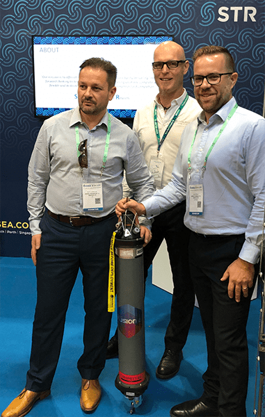
STR will upgrade its existing 6G hardware to Sonardyne’s new 6 ‘plus’ variants, which, combined with Fusion 2, will make marine survey and offshore construction projects faster and easier than ever.
Sonardyne’s new Compatt 6+ and ROVNav 6+ hardware has been designed to get the best performance from Fusion 2, a brand new software package that provides a single system from which surveyors can perform all of their LBL, acoustically-aided INS and Sparse LBL operations, with more functionality and capability than they’ve had before, including real-time SLAM calibration.
This performance is achieved with Wideband 3, which allows, for the first time, sensor telemetry data (e.g. pressure, depth, temperature) to be embedded within navigation (ranging) telemetry data, which means that there are no pauses in tracking when installing subsea structures, allowing operators to know exactly what’s happening at all times and reducing risk.
[blockquote author=” Simon Goldsworthy, Sales Manager, Sonardyne”]”The move to upgrade its 6G hardware to the new ‘plus’ variant will place STR in a prime position to be able to offer its clients the tools required to operate Fusion 2. This single solution means operators can undertake field development projects faster and easier than ever before.[/blockquote]
Speaking at the OSEA 2018 launch event, Scott Johnstone, Group Managing Director of STR said, “We are really impressed with the positive impacts that Sonardyne’s new Compatt 6+ and ROVNav 6+ hardware, combined with Fusion 2, will bring to the survey and construction industry. We know our customers are always looking to improve the efficiency and reliability of their operations and we believe that by upgrading our 6G stock to the newest technology this will definitely do that.”
A new platform bringing a step-change reduction in complexity and overheads for offshore operations has been launched by leading underwater positioning and navigation specialist Sonardyne International Ltd.
Available from today, Sonardyne’s Fusion 2 Long BaseLine (LBL) and Inertial Navigation System (INS) software has been written from the ground up to offer marine survey contractors and offshore construction companies a single solution from which they can undertake field development projects faster and easier than ever.
The integrated acoustic and inertial positioning platform builds on Sonardyne’s four decades’ experience as a trusted leader in precision LBL acoustics, its expertise in inertial and Doppler guidance, and its sensor integration capabilities to reduce system complexity, streamline workflows and increase productivity.
With Fusion 2, the separate software applications, vessel-fit hardware and often complex communication interfaces that have been typically required to support LBL, acoustically-aided INS and Sparse LBL operations, have been replaced with a single, unified solution that is easier and faster to set up and run.
Live in-water preview events held in the run-up to today’s launch in Singapore have provided audiences with the opportunity to experience first-hand how Fusion 2 will positively impact their offshore campaigns during the 2019 season and beyond.
One of the benefits demonstrated is the ability to undertake the real-time SLAM (simultaneous localisation and mapping) calibration of a sparse LBL transponder array while you survey – until now a lengthy offline post-processing activity.
Significantly reducing survey time is central to another key innovation that arrives with Fusion 2. Sonardyne has re-engineered the digital signal processing protocols used by Fusion 2 to command and control seabed arrays of its Compatt LBL transponders and vehicle-mounted ROVNav transceivers to Wideband 3.
Wideband 3 allows, for the first time, sensor data (e.g. pressure, depth and temperature) from a Compatt to be to be embedded with navigation (ranging) telemetry data. This will have a big impact on operations such as structure installation, accelerating update rates by a factor of 10 and eliminating issues operators currently face with latency.
To benefit from Wideband 3, Sonardyne has advanced its sixth-generation subsea hardware platform, with Compatt 6 and ROVNav 6 instruments now designated as ‘plus’ units, supplied as standard. To protect customers’ investments, these are backwardly compatible with existing inventories of Compatt 6s, which can also be upgraded to realise the potential of Fusion 2.
[blockquote author=” Edward Moller, Global Business Manager, Construction Survey, Sonardyne,”]”Today’s release of Fusion 2 marks the culmination of years of engineering development work that builds on the achievements of our original Fusion platform by creating, for the first time, a single system surveyors can use for LBL aided INS operations and with more functionality and capability than they’ve had before. We’re making set up easier and faster, including the ability to do system configuration before mobilisation. We’ve built in the ability to do real-time SLAM calibration and, with our Wideband 3 latest generation signal processing, 1Hz LBL update rates, which include sensor readings. Fusion 2 is also incredibly intuitive to use with a powerful customisable user interface and flexible operating environment, letting surveyors work how they want and see the information they want, when they want”[/blockquote]
Fusion 2 is being rolled out in two releases. The Fusion 2 INS pack, released today, delivers LBL aided operations using Sonardyne’s SPRINT INS technology. The second release, due in Q2 next year, will deliver the full acoustic LBL package. The Fusion 2 system works through Sonardyne’s Navigation Sensor Hub (NSH), which also supports the company’s Ranger 2 USBL system, so users will need fewer systems in their inventory and onboard their vessels.