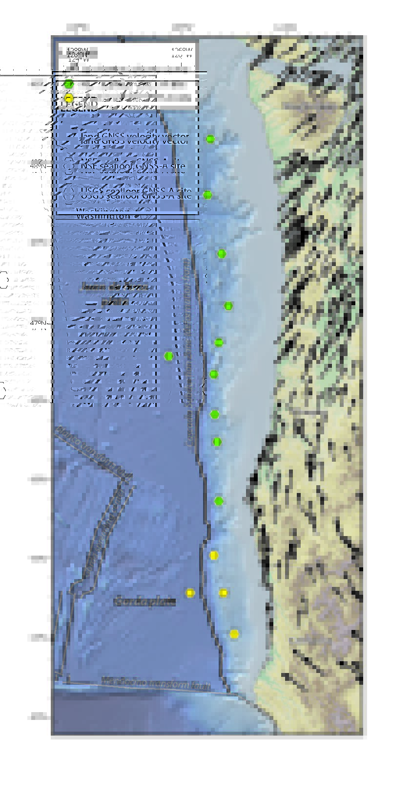
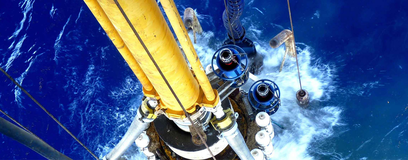
Sonardyne
Support Centre

Monitoring the restless earth for the next “big one”

When the 8.2 magnitude Chignik earthquake hit off the coast of Alaska in 2021, it was a big warning signal.

The largest earthquake in the US since 1965 and one of the largest globally in recent years; it was a reminder of the geohazards lurking, out of sight, off our coastlines.

Offshore events like these could trigger a tsunami, putting major coastal cities and regions at risk.

But, until recently, the geological activity that leads to an earthquake like Chignik was a significant blind spot to scientists, lying hidden and inaccessible beneath the waves.

Now, thanks to ongoing collaboration and development between underwater technology company Sonardyne, Scripps Institution of Oceanography and the U.S. Geological Survey (USGS), the ability to remotely monitor our restless earth is not just possible but also becoming standard practise.

Using a technique called GNSS-A, an increasing amount of coastline most vulnerable to earthquake and tsunami hazards, including the US Pacific Coast, is being monitored.

What is GNSS-A?

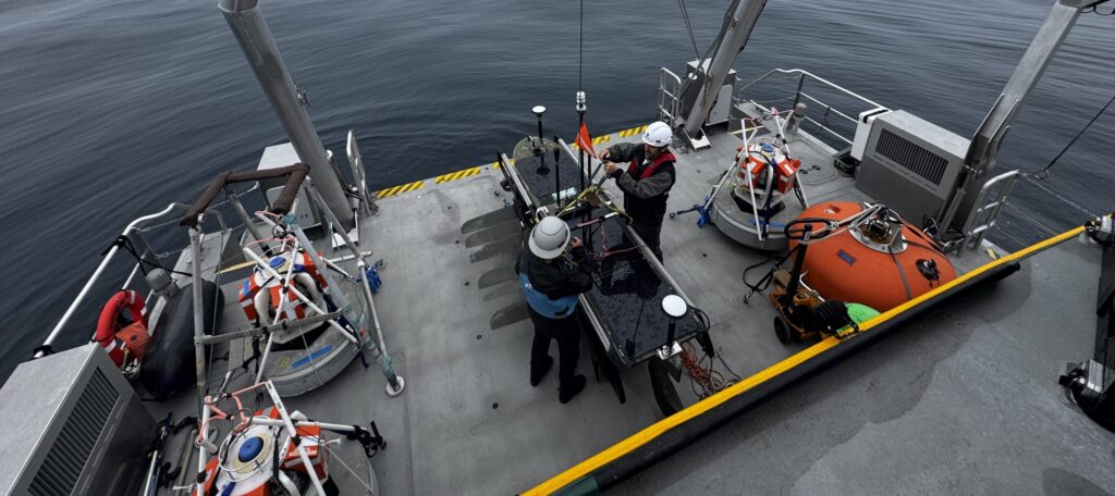
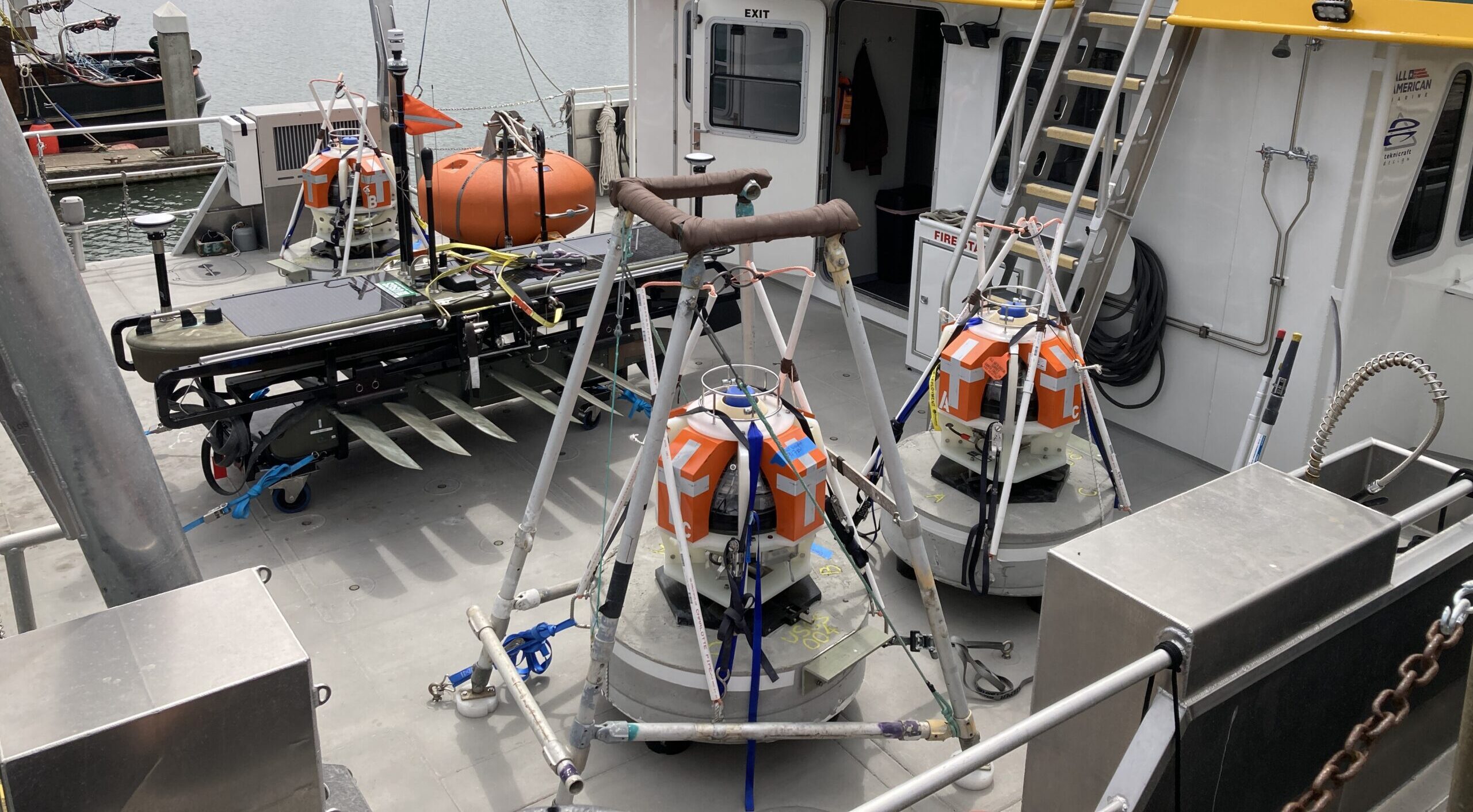
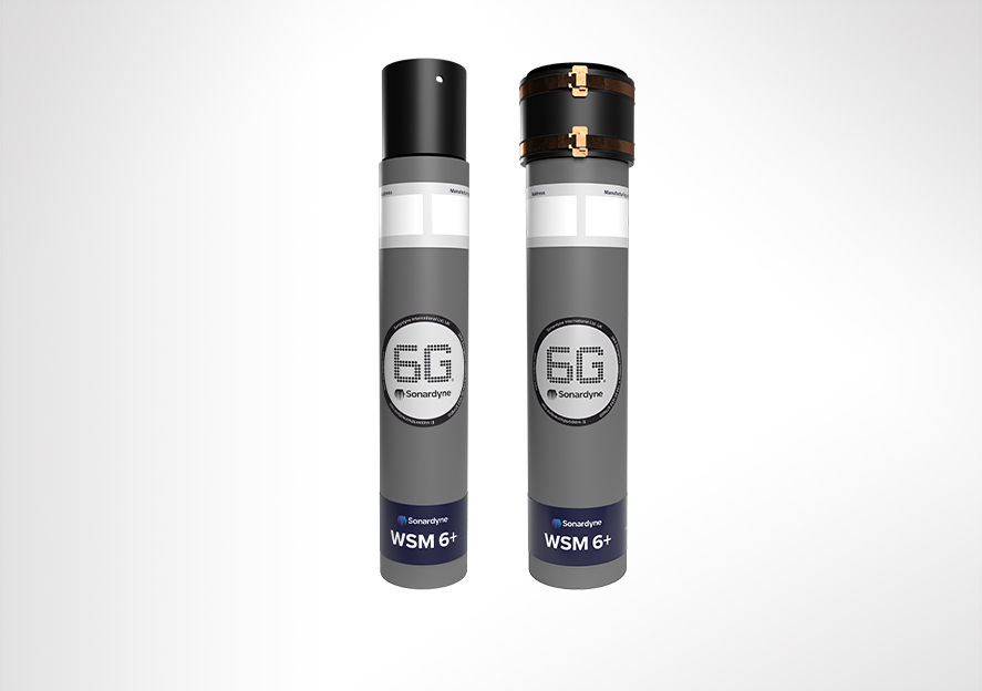
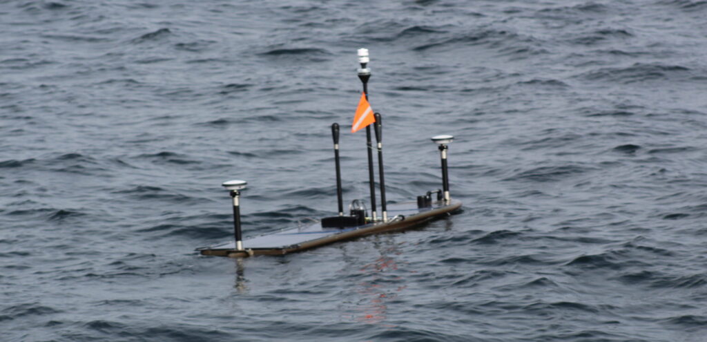
GNSS-A works by combining satellite positioning with underwater acoustics to track seafloor movement with centimetre-level accuracy. An uncrewed surface vessel (USV) with Sonardyne’s GNSS-A payload patrols above an array of Sonardyne Fetch transponders on the seabed.

Combining its known surface position with acoustic pulses down to each Fetch transponder allows it to calculate the precise position of each transponder – and therefore the position of the seabed it’s sitting on.

By repeating these measurements over time, scientists can track the movement of tectonic plates across faults to better understand and estimate earthquake and tsunami hazard.

One of the organisations using this technique to monitor subduction zones, where one plate is sliding under another, is the USGS.

They first started exploring its use in 2017, working in collaboration with the University of Hawaii and Scripps, and using a Wave Glider and seabed sensors, in order to measure how friction between two tectonic plates restricts sliding and causes a build-up of stress – essentially measuring “how stuck are the plates”.

Since then, they’ve continued to contribute to the development of GNSS-A using Sonardyne GNSS-A modules and Fetch transponders.

Expanding GNSS-A monitoring along the Cascadia Subduction Zone

A big focus for USGS is the Cascadia Subduction Zone, a 1,000 km long fault off the Pacific Northwest coast that runs from Vancouver Island in Canada to northern California.

Between 2021 and 2025, USGS has installed four monitoring sites on the seabed off the US Pacific coast at the southernmost extent of this zone.

They are part of a wider network along the Cascadia Subduction Zone where subduction involves three plates, the Explorer, Juan de Fuca and the Gorda, sliding beneath the North American Plate, creating the potential for magnitude 9+ earthquakes and large tsunamis.

The USGS GNSS-A sites, each with three Fetch transponders, are on the southernmost Gorda plate where the uncertainty of the Gorda plate motion relative to the North American plate motion has implications on the size and recurrence of earthquakes in the region.

“Before we had this capability, we were only able to use GPS networks on land to estimate, to a sub-millimetre level, the slow movements of the seafloor 50 plus miles offshore,” says Todd Ericksen, Geodetic Engineer at the USGS’ Earthquake Science Center in California.

“But the seafloor was a blind spot; a major missing piece of the global tectonic jigsaw puzzle which meant the true scale of the hazard beneath the ocean was largely unknown. Our instruments stopped at the shoreline.”

“For somewhere like the Cascadia subduction zone, where oceanic plates are being subducted beneath the North American plate, seafloor geodetic sites are filling a major gap, helping us to better understand earthquake and tsunami hazard. If plates ‘lock’ in this zone, building up stress, that whole coastline, and cities like Vancouver, Victoria and Seattle, face significant tsunami risk.”

Critical insights from the Aleutian subduction zone

One of the tectonic sources of large earthquakes that USGS has been monitoring is the Aleutian Subduction Zone. It was here that the Chignik earthquake struck – and USGS was ready for a post-earthquake response mission.

Just a couple of years before, three GNSS-A monitoring sites had been set up on the seafloor off Alaska, in the Aleutian subduction zone, by a team of scientists funded by US National Science Foundation (NSF).

Several Wave Glider surveys had been carried by the USGS and Scripps prior to the M8.2 Chignik earthquake, monitoring the position of the sites in about 1,200 m water depth.

Within weeks of the earthquake, USGS had their Wave Glider back out to measure what movement there had been during and shortly after the earthquake.

Despite challenging weather conditions, the mission collected high-fidelity GNSS and acoustic data with eye-opening results.

“The tsunami was modest, but the seismic event was the largest in the US for nearly six decades,” says Ericksen, “so we expected a large movement. But it was incredible to know exactly how much – and that was 1.4 m.” This was a critical insight into the co- and post-seismic movement, helping to understand subduction zone dynamics.”

The big question was, did the Chignik earthquake increase the state of stress and tsunami potential on the up-dip portion of the fault or not?

“The measurements showed that the fault moved 2 – 3 m horizontally in a shallow part of the fault, less than 20 km below the seabed, helping us to understand how stress builds up along the fault and is released in an earthquake,” he says

“These results suggested that the cumulative slip had relieved stress on the shallow portion of the fault and therefore, the Chignik earthquake likely did not increase tsunami potential of the shallow fault.

“It also showed the effectiveness of the GNSS-A technique and the utility of rapid response GNSS-A measurements to better assess tsunami and earthquake hazards in the region.”

Read more about the Chignik data here.

The origins of GNSS-A

The ability to measure the movement of plates on the seabed is not that new. It’s based on what was originally called the GNSS-A technique, first developed by Scripps, specifically David Chadwell and Fred Spiess.

“Combining GNSS positioning and acoustic measurements to track seabed movement was a clever idea – and it worked,” says Michelle Barnett, Ocean Science Business Development Manager, at Sonardyne.

“But the cost of using crewed ships to do the positioning made it cost prohibitive. It was also technically challenging.”

“So, working with Scripps, in the early 2010s, we developed a combination of our Fetch long-life sensors and an off-the-shelf GNSS-A payload for Wave Gliders that can go out and do the survey work at a much lower cost than using a crewed ship.”

Worth the wait, even when waiting on weather

The technique is not without its challenges, however. After gathering the positions of the Aleutian subduction zone transponders, Ericksen and his team were naturally keen to see the data.

Due to the significant amounts of data involved – we’re talking 25-30 GB per site (comprising three Fetch) – only sub-samples are sent back to shore from the USV, primarily for quality control.

So, they have to wait until the USV comes back – or is brought back – to shore. Low levels of daylight in the Alaskan winter (when the Chignik survey was carried out) meant limited power availability for the USV.

Combined with bad weather, coordinating its recovery proved challenging, resulting in it taking four-months to recover the Wave Glider and offload the data.

Still, the wait was worthwhile and the results are providing greater insights than we’ve ever had before.

Read more

Sonardyne technology chosen for new Canadian seabed observatory.

TL;DR:

Scientists can now monitor underwater earthquake zones using GNSS-A technology—combining satellite positioning with acoustic sensors on the seabed. This breakthrough, developed through collaboration between Sonardyne, Scripps Institution of Oceanography, and the USGS, allows them to track how tectonic plates move and where stress is building up, which was previously a “blind spot” beneath the ocean.

The technology: Sonardyne’s Fetch transponders sit on the seabed in arrays, while Wave Glider robots equipped with Sonardyne’s GNSS-A payload circle above them, using acoustic signals to precisely measure their positions over time. This makes continuous offshore monitoring both feasible and cost-effective for the first time.

Jump to

Overview

Small, rugged, versatile.

WSM 6+ is a popular choice of transponder for tracking a mobile underwater target such as a towfish, crane wire, ROV or manned submersible. 2-way wideband signals ensure reliable acoustic performance in all conditions. Suitable for a range of applications from environmental surveys to deep water nodal positioning as well as tracking and communications.

Overview

WSM 6+ is one our most popular USBL transponders, selected by customers for its small size, value and dependable performance in all environments, shallow or deep.

It’s the perfect choice for fitting to observation and work-class ROVs, towfish, submersibles and equipment being deployed onto the seabed for short durations.

WSM 6+ is compatible with all of our Ranger 2 USBL systems and we even include one with every Ranger 2 Standard – as standard.

The compact and rugged design is based on the field proven mechanics from previous generation designs and is available with omni-directional or directional transducers. The omni-directional versions are depth rated to 1,000 m and 4,000 m. The directional transducer is depth rated to 4,000 m.

At a glance

  • Rechargeable USBL transponder designed for tracking ROVs, towfish and equipment
  • Choice of 1,000 m and 4,000 m depth ratings
  • Compatible with our family of Ranger 2 USBL systems: Micro, Mini and Standard
  • Transponder or responder operating modes
  • Depth sensor for improved USBL positioning performance
  • External on/off switch for battery saving

All versions support transponder and responder operating mode if an external trigger from your platform is available. Responder mode provides significantly faster position updates than transponder mode.

WSM 6+ supports Wideband 2 acoustic signals and legacy Wideband 1 and HPR 400. The configuration is programmable using supplied software and a serial link or it can be configured acoustically via our back deck handheld test unit – iWand. This allows the WSM 6+ to be configured for use with all of the popular MF frequency acoustic navigation systems.

All WSM 6+ are also fitted with a depth sensor fitted as standard to aid USBL positioning accuracy and an external on/off switch to save battery power when not in use.

WSM 6+ variants are available with acoustically controlled output lines suitable for external motor drive, burnwire or contact closure releases.

Watch our youtube video to learn more

Specifications table

Feature Type 8370-1111 Type 8370-4112 Type 8370-4111
Depth rating 1,000 m 4,000 m 4,000 m
Operational frequency MF (20–34 kHz) MF (20–34 kHz) MF (20–34 kHz)
Transceiver beam shape Omni-Directional Directional Omni-Directional
Transmit source level (dB re. 1 µPa @ 1 m) (external power/battery) 187 dB/
184 dB
196 dB/
193 dB
187 dB/
184 dB
Tone Equivalent Energy (TEE) (external power) 193 dB 202 dB 202 dB
Receive Sensitivity (dB re 1 μPa) <85 dB <80 dB <80 dB
Power supply Rechargeable NiMH battery or 
ext. 24 V via ROV umbilical Rechargeable NiMH battery or ext. 24 V via ROV umbilical Rechargeable NiMH battery or ext. 24 V via ROV umbilical
Operating channels All Sonardyne Wideband 
HPR 400 Channels All Sonardyne Wideband HPR 400 Channels All Sonardyne Wideband HPR 400 Channels
Depth sensor ±0.5% Full Scale (100 Bar) ±0.5% Full Scale (400 Bar) ±0.5% Full Scale (400 Bar)
Operating life
(1 s update rate, max. power, Wideband 2 )
>6 days >3 days >6 days
Update rate (maximum) >2 Hz >2 Hz >2 Hz
Quiescent life (battery) >35 Days >35 Days >35 Days
Connector
(5-Way (standard)
Subconn MCBH5M Subconn MCBH5M Subconn MCBH5M
Operating temperature -5 to 40ºC -5 to 40ºC -5 to 40ºC
Storage temperature -20 to 55ºC -20 to 55ºC -20 to 55ºC
Mechanical construction Anodised aluminium alloy Anodised aluminium alloy Anodised aluminium alloy
Dimensions (length x diameter) 420 x 75 mm 429 x 96.5 mm 419.3 x 87.6 mm
Weight in air/water 3.2/1.3 Kg 5.5/3.2Kg 4.6/2.3Kg
Battery charger 8390-100-01 8390-100-01 8390-100-01

Did you know?

WSM 6+ is compatible with our Ranger 2 family of USBL systems: Micro, Mini and Standard