Sonardyne
Support Centre

You know you need an Ultra-Short BaseLine (USBL) system, but which type of system do you need? It might not seem like an easy choice.

You know you need an Ultra-Short BaseLine (USBL) system, but which type of system do you need? It might not seem like an easy choice. This guide will steer you in the right direction, whether you’re looking to track your dive team, position a deep-rated autonomous underwater vehicle (AUV), or provide a safety critical position refence for Dynamic Positioning (DP).


At a glance

Which is the best USBL system to meet your needs?


  • Diver tracking: → Micro-Ranger 2 USBL
  • UXO survey or inspection ROVs: → Mini-Ranger 2 USBL (+ Gyro USBL if greater accuracy is required)
  • Deep-water survey or DP operations: → Ranger 2 USBL (+ Gyro USBL 7000/7000+)
  • AUV or USV fleets: → Mini-Ranger 2 or Ranger 2 with the Marine Robotics Pack


Understanding your USBL system needs

Identifying your operational category is the first step to help determine which Ranger 2 system is the optimal fit for you. Which is the best fit for you?

Light coastal users

Micro-Ranger 2 is your ideal option if you:

Operate divers, small remotely operated vehicles (ROVs) or towfish
Work in harbours, lakes, rivers or coastal zones
Need a portable, simple system deployable by 1–2 people
Value fast mobilisation over extreme precision

Nearshore operators

Mini-Ranger 2 is your ideal option if you:

Require survey accuracy up to 1,000m water depth
Conduct inspection, unexploded ordnance (UXO) survey, mine counter measures (MCM) or environmental work
Operate from small or mid-sized vessels
Sometimes support AUVs or ROVs and may require acoustic comms

Deep-water / offshore energy / defence users

Ranger 2 is your ideal option if you:

Work in deepwater, for example 1,000–11,000 m water depth
Need survey-grade accuracy with minimal allowable error, supporting deepwater ROV operations
Operate dynamic positioning (DP) vessels or large offshore ships
Track many subsea assets simultaneously
Support construction, drilling or defence operations

AUV / USV / robotic system operators

Micro-Ranger 2, Mini-Ranger 2 or Ranger 2 (with Robotics Pack) is your ideal option if you:

Command or track fleets of AUVs
Need acoustic comms (two-way messaging, mission updates)
Require INS-aiding for long-duration or deep-water missions
Supporting over-the-horizon uncrewed surface vessel (USV)-based data harvesting or robotics operations

Quick comparison: Micro-Ranger 2 vs Mini-Ranger 2 vs Ranger 2

SystemUse case / user typeDepth rangeTracking capabilityAccuracyKey advantages
Micro-Ranger 2 Dive teams, coastal survey, small boats, education/training Shallow water to ~995 m <10 targets sequentially Entry-level 
<5% slant range accuracy 
Extremely portable, rapid deployment, low training burden supports robotics
Mini-Ranger 2 Nearshore operations, UXO survey, inspection teams, mid-range ROV/AUV ~995 m (extendable to 4,000 m) <10 targets, simultaneouslyMid-level 
0.2%–1.3% of slant range accuracy
Excellent balance of capability, portability and price; supports robotics
Ranger 2Offshore energy, deep-water survey, DP vessels, defence, construction ~11,000 m <99 targets, simultaneouslyHighest 
0.04% of slant range accuracy 
Survey-grade precision, DP support, multi-vehicle control, deep-water resilience; supports robotics

Micro-Ranger 2

Best for: Coastal users, diver tracking, training teams, universities

Simple, portable, entry-level “plug-and-play” USBL system
Fast mobilisation; minimal calibration
Ideal for light, irregular or seasonal tasks
Fits in a single case; deployable from a small boat or jetty

Mini-Ranger 2

Best for: UXO survey teams, MCM, nearshore contractors, inspection-class ROVs, small AUV ops

Higher tracking performance than Micro-Ranger 2, but still portable
Tracks multiple vehicles simultaneously improving update rate
Can support AUV command-and-control
Perfect for recurring commercial operations requiring reliability

Ranger 2

Best for: Offshore survey, deep-water construction, DP vessels, energy operators, defence

Ultimate survey-grade precision and range in all water depths
Designed for multi-asset tracking on large vessels
DP reference integration
Supports hundreds of operational scenarios, from construction survey to full ocean depth scientific research and naval defence operations.

Optional add-ons

Gyro USBL transceiver:

Improves accuracy by combining USBL and AHRS/INS in one unit.

Who needs it:

  • Surveyors
    DP operators
    USV operators
    Deep-water specialists

Benefits:

  • No need for a calibration
    Removes alignment and mounting pole-bend errors
    Speeds up vessel mobilisation
    Enhances accuracy in noisy or dynamic environments

Marine Robotics Pack:

Upgrades Micro-Ranger 2, Mini-Ranger 2 and Ranger 2 for advanced robotics.

Who needs it:

  • AUV/USV operators
    Research robotics teams
    Long-range autonomous missions

Benefits:

  • Two-way acoustic messaging
    Vehicle tasking and mission commands
    INS aiding for reduced drift
    Multi-vehicle control (swarming, fleet operations)

Cutting through the jargon!

If you’re not sure what some of the terms mean in our guide, here is a helpful summary.

Term/acronym Full form/meaning Explanation 
USBL Ultra-Short BaseLine An underwater acoustic positioning system that uses a tightly clustered array of hydrophones to calculate range and direction to underwater transponders 
AUV Autonomous underwater vehicle A robot that travels underwater without requiring real-time input from an operator; operates independently 
Hydrophones – Underwater microphones that detect sound waves in water 
Transceiver Transmitter-receiver A device that can both transmit and receive signals 
Transponder Transmitter-responder A device that receives a signal and automatically transmits a response 
ROV Remotely operated vehicle An underwater robot controlled by operators on the surface via a cable 
Towfish – A towed underwater device, typically used for surveying 
UXO Unexploded ordnance Military munitions (bombs, shells, mines) that failed to detonate and remain dangerous 
MCM Mine counter measures Military operations to detect, identify and neutralise naval mines 
DP Dynamic positioning A computer-controlled system that automatically maintains a vessel’s position and heading using thrusters 
USV Uncrewed surface vessel An autonomous or remotely operated boat that operates on the water surface without crew onboard 
INS Inertial navigation system A navigation system that uses motion sensors and rotation sensors to calculate position without external references 
AHRS Attitude and heading reference system A system that provides orientation information (pitch, roll, yaw) for vehicles 
Slant range – The direct line-of-sight distance between two points at different depths (not horizontal distance) 
Acoustic comms Acoustic communications Underwater communication using sound waves rather than radio waves 
INS-aiding – Providing corrections to an inertial navigation system to reduce accumulated position errors (drift) 
Pole-bend errors – Positioning errors caused by flexing or bending of the mounting pole/structure supporting the USBL transceiver 

Which USBL system do I need?

Quick self-assessment:

Choose Micro-Ranger 2 if you:


  • Track divers or small ROVs in shallow water
  • Work in harbours, lakes or coastal areas
  • Need something portable that fits in one case
  • Want simple setup by 1-2 people
  • Don’t need pinpoint accuracy

Choose Mini-Ranger 2 if you:


  • Do inspection work, UXO surveys or environmental monitoring
  • Operate from small/mid-sized boats
  • Need to track multiple vehicles at once
  • Sometimes work with ROVs or AUVs
  • Want better accuracy without breaking the bank

Choose Ranger 2 if you:


  • Work in deep water (2,000+ metres)
  • Need survey-grade precision for your data
  • Operate from large vessels with dynamic positioning
  • Track many subsea assets simultaneously
  • Work on offshore construction, energy or defence projects

Consider adding:


  • Gyro USBL if you need better accuracy or work from moving vessels
  • Marine Robotics Pack if you operate autonomous vehicles and need to send them commands underwater

Bottom line:

Think about your depth, accuracy needs and how portable you need the system to be.

Start with Micro if you’re coastal and casual, Mini if you’re a professional nearshore operator and Ranger if you’re going deep or need the best precision.

The subsea environment is one of the most challenging places to operate critical infrastructure. Pipelines, risers, wellheads and production facilities face constant stress from ocean currents, temperature fluctuations, operational pressures and even tectonic movement.

But how do you know when something is going wrong – before it becomes a costly or dangerous problem?

Subsea integrity monitoring is the continuous or periodic measurement and analysis of your underwater infrastructure to detect potential failures before they occur. It’s about understanding the structural health and performance of your assets in real-time.

How does it work?
Think of it as a health check for your subsea infrastructure. Are your pipelines experiencing fatigue from vibration? Is your wellhead moving due to drilling operations? Are there any leaks developing in your production infrastructure? Subsea integrity monitoring gives you the answers.

The key is detecting changes that indicate potential integrity breaches – whether that’s structural movement, high-frequency vibration causing fatigue or hydrocarbon leaks into the water column.

Effective subsea integrity monitoring involves three critical elements:

  • First, accurate measurement. You need sensors that can precisely detect what’s happening underwater – movement in millimetres, vibrations at high frequencies, or the acoustic signature of a leak.
  • Second, reliable data transmission. Getting that data from the seabed to shore is essential. Acoustic communications allow data to travel through water without the need for expensive umbilicals or frequent ROV visits.
  • Third, intelligent analysis. The data must be processed, visualised and interpreted by specialists who can tell you what it means for your operations and what actions you should take.

Monitoring integrity or assets – what’s the difference?
Now, you might be wondering – what’s the difference between subsea integrity monitoring and subsea asset monitoring? It’s a great question, and the distinction matters.

Subsea integrity monitoring is specifically focused on detecting threats to structural integrity – fatigue, movement, deformation and leaks that could lead to failure. It’s diagnostic and predictive. The goal is to prevent catastrophic events by understanding stress, strain, and potential breach points.

Subsea asset monitoring is a broader term which encompasses integrity monitoring but also includes positioning, tracking, environmental measurements and operational status. For example; monitoring the location of a pipeline during installation, tracking an ROV during inspection or measuring ocean currents around your infrastructure all fall under asset monitoring.

Think of it this way: all integrity monitoring is asset monitoring, but not all asset monitoring is integrity monitoring. Integrity monitoring is specifically concerned with ensuring structural health and failure prevention.

Why use Observer?
Our Observer integrity monitoring transponder is designed to be your go-to integrity monitoring tool. Capable of monitoring both high and low frequency vibrations for detecting fatigue on risers, spool pieces and free spans, as well as pipeline creeping, buckling and seabed settlement.

These intelligent transponders measure, log and process acceleration and angular motion at source. They then acoustically transmit data, which can be processed onboard, through the water using integrated acoustic modems. The ability to process data onboard removes added time and complexity in post-processing data before a decision can be made. You get the answers you need, straight away.

Observer’s long battery life and the ability to interface with external sensors brings unprecedented flexibility to vibration monitoring. It’s designed for real world operations, ROV deployable and compatible with autonomous systems like AUVs and USVs for remote data harvesting capabilities.

From the North Sea to the Gulf of Mexico, from deepwater oil and gas to offshore carbon capture sites, our integrity monitoring solutions are protecting critical infrastructure around the world.

For more information about Observer and how it can aid your subsea monitoring operations click here.

Subsea assets are subject to both low-frequency and high-frequency motions, driven by environmental loading, operational conditions and system dynamics. It is important to understand and to be able to measure both types in order to understand their impact on your subsea assets.

Low and slow…
Low-frequency motions are typically large-amplitude, slow movements caused by factors such as vessel motions, mooring and riser dynamics, thermal expansion and contraction of pipelines, seabed settlement or long-period currents. Examples could include pipeline walking, lateral buckling, slow cyclic riser movement at touchdown zones, wellhead displacement and gradual movement of pipeline end terminations (PLETs) or structures under sustained loading.

These can be measured using either USBL or LBL positioning techniques as the motions are large allowing for time-of-flight measurements. Alternatively, displacement sensors like linear variable differential transformers are designed to be coupled to the structure.

Fast and furious…
High-frequency motions, by contrast, are smaller-amplitude but rapid vibrations caused by turbulent flow, vortex-induced vibration (VIV), wave-induced excitation, rotating equipment. Examples include VIV on pipeline free spans, flow-induced vibration (FIV) in jumpers and short-period dynamic response on risers or jumper connections.

These are typically measured using an inertial measurement unit (IMU) and in some cases a strain measurement to correlate motion data with a stress calculation leading to a fatigue estimation.

The importance of understanding both
Understanding both motion regimes is critical for subsea integrity monitoring, as low-frequency motion is often associated with fatigue accumulation, while high-frequency motion can drive accelerated fatigue damage and localised wear.

You can find out more about subsea integrity monitoring in another of our knowledge base articles here.

Observer delivers an array of on-board analytics, communication and modular sensor hardware which streamlines data acquisition, reduces operational costs and supports data-driven decision making.

But what can its configurable logging, subsea data processing and acoustic telemetry be used for? Here we look at some typical examples of how Observer can be deployed in your subsea operations.

1. Mooring line monitoring

What’s monitored:

  • Line tension
  • Angle and motion
  • USBL position

To determine:

  • A broken line condition
  • Fatigue accumulation
  • Elongation
  • Corrosion / wear
  • Vessel excursion envelope

Why it matters.
Warns in the event of mooring failure on floating production, storage and offloading units (FPSOs), floating wind or other offshore platforms. Real-time tension and fatigue data supports targeted inspection, reduces costs and helps operators extend mooring life safely – maintaining safe operation.

2. Production riser monitoring

What’s monitored:

  • Local motion caused by vortex-induced vibration (VIV) or flow-induced vibration (FIV)
  • Bending and curvature
  • Temperature and pressure

To determine:

  • Stress and fatigue
  • Environmental effects
  • Safe operation envelope

Why it matters.
Dynamic risers are high-risk components. Continuous monitoring estimates damage rate and avoids hydrocarbon release or unplanned shutdowns.

3. Subsea pipeline monitoring

What’s monitored:

  • Expansion and contraction
  • Free spans and seabed interaction from VIV
  • Strain and deformation
  • Corrosion or wall thickness

To determine:

  • Safe operation and potential seabed invention scope
  • Environmental effects and mitigation
  • Corrosion rates

Why it matters.
Pipelines are exposed to seabed movement, trawling, environmental effects and thermal expansion. Monitoring enables management and early intervention before buckling or releases occur. You can find out more about subsea integrity monitoring in another of our knowledge base articles here.

In XML Notepad 2007, open the DJF from the main window:

When loaded it will be seen in the Tree View tab ….

Confirm that the xml-stylesheet is correct as above …. If you’re not loading the DJF in the standard Ranger2 jobs folder location:

C:\Users\Public\Documents\Sonardyne\Ranger2\Jobs\<JobName>\JobName.djf

then it won’t find the denovo.xsl file found at either:

C:\Users\Public\Documents\Sonardyne\Ranger2\Jobs
or
C:\Users\Public\Documents\Sonardyne\Marksman\Jobs

with the link is using a relative path in the href.
Therefore if you’re not loading it in the job folder location, you will need the change the xml-stylesheet value to:-

type=”text/xsl” href=”C:\Users\Public\Documents\Sonardyne\Ranger2\Jobs\denovo.xsl”

so that it can find the xsl file. 

As long as the xsl file is found, then when you select the XSL Output tab, you should see the following:

You can also change the xsl file location, from the XSL Output tab, however you need to select the XSL file found at “C:\Users\Public\Documents\Sonardyne\Ranger2\Jobs\denovo.xsl”, and not the DJF as you’ve tried to do in your screenshot.

Notepad can be downloaded from here

This article explains why GNSS quality is critical to Ranger 2 and GyroUSBL performance, how poor GNSS manifests in results and how to optimise your GNSS performance.

Ranger 2 computes a range and bearing solution to a subsea target relative to the vessel mounted transceiver. To convert this relative acoustic solution into a real-world position suitable for survey and dynamic positioning (DP) systems, Ranger 2 relies on aiding from vessel sensors (GNSS position along with heading, attitude and accurate lever arms).

GNSS acts as the top-level reference for the entire USBL solution. Regardless of acoustic or attitude performance:

  • GNSS defines where the vessel is in global coordinates
  • All subsea positions are referenced back to this GNSS position

If the GNSS solution is unstable or noisy, that behaviour is inherited by the USBL output.

Most subsea workflows assume GNSS is “truth” because it’s the top of the reference chain. However, GNSS can be degraded by:

  • Poor correction service / loss of corrections
  • GPS Spoofing
  • Multipath (cranes, structures, turbine towers, masts)
  • Poor antenna location or installation
  • RF interference
  • Latency, low update rate or timing issue

GNSS installation and configuration best practices

  • Mount the GNSS antenna in a location with a clear, unobstructed view of the sky, minimising the risk of signal masking or multipath from vessel structures.
  • For short-term operations where the USBL transceiver is mounted on an over-the-side pole, consider mounting the GNSS antenna directly above the pole. This helps minimise errors arising from antenna offsets and simplifies lever-arm definition.
  • Accurately measure and record the X, Y, and Z offsets between the GNSS antenna and the USBL transceiver. These lever-arm measurements are critical and will be required when configuring the USBL software.
  • Where possible, provide position data directly from the GNSS receiver to the USBL software to minimise position latency and timing uncertainty that can be introduced by computer-based GNSS solutions.
  • The GNSS accuracy recommendation is RTK Float, DGPS is also acceptable.

GNSS and USBL calibration, CASIUS

USBL calibration relies on clean and stable aiding inputs.

Sonardyne calibration guidance identifies aiding sources and lever arms as major contributors to system error.

A poor GNSS quality while attempting to undertake a CASIUS can result in:

  • Degraded calibration quality
  • Inconsistent calibration results between runs
  • Increased residuals
  • Reduced repeatability

This is particularly noticeable in shallow water operations, where GNSS and MRU errors can be proportionally larger. Calibration should therefore be viewed as a system-level validation, not just an acoustic alignment exercise.

Please contact our service support team if you require any other Ranger 2 or Gyro USBL support. Alternatively, you can browse other knowledge base articles.


    Touchdown monitoring is a fundamental requirement during subsea cable installation. Its primary engineering objective is to ensure the as-laid cable position is within the specified engineering corridor.

    This process demands exceptional positional accuracy to avoid obstacles (such as boulders), prevent damage to seabed ecosystems, and record precise touchdown position data for future cable inspections.

    Navigational challenges specific to touchdown monitoring 

    The environment and the cable itself introduce critical challenges that must be overcome to maintain precision at the seabed interface:


    • Magnetic interference: Subsea cables contain ferrous material (iron/steel) that interferes with instruments relying on magnetic sensors for heading, often rendering them extremely unreliable and ineffective when operating close to the cable.
    • Shallow water acoustics: Achieving accurate positioning is often challenging when using traditional acoustic positioning methods in noisy shallow waters.
    • Positional drift: Maintaining accuracy during extended monitoring missions requires continuous positional refinement to limit drift over time and distance.

    SPRINT-Nav for precision output 

    The SPRINT-Nav family is engineered to provide continuous, high-performance navigation specifically addressing these challenges:


    • Integrated hybrid system: SPRINT-Nav Mini fuses an inertial navigation system (INS), Doppler velocity log (DVL), attitude and heading reference system (AHRS) and depth sensors into a single, compact and lightweight instrument. This hybridization ensures fast, precise, and robust navigation.
    • Magnetic field immunity: To counter the interference from ferrous cable material, the SPRINT-Nav family uses ring laser gyros (RLGs) and fibre-optic gyros (FOGs). These gyrocompasses determine heading by sensing Earth’s rotation, so they do not rely on magnetometers and are immune to magnetic interference. Read more in our case study.
    • Factory calibration: All units are factory-calibrated (ready to go on deployment), eliminating time that would otherwise be spent performing on-site calibration manoeuvres.
    • Depth sensing: An integrated pressure sensor provides depth data.

    Deployment and integration

    SPRINT-Nav provides precise subsea positioning of the cable as it meets the seabed when integrated onto the following platforms:

    Deployment PlatformSPRINT-Nav role/variant Integration
    Remotely operated vehicle (ROV) SPRINT-Nav Used to accurately survey the cable’s touchdown point and surrounding seabed. 
    CableFish inspection tool SPRINT-Nav Mini The system is optimized using a bottom locking SPRINT-Nav to provide uninterrupted pin-point accuracy. This dedicated tool has proven to be a more cost-effective and higher-performance solution than traditional ROVs for touchdown monitoring. 
    • Aiding system integration: The system is often coupled with Sonardyne’s Ranger 2 USBL (Ultra-Short Baseline) positioning system. Ranger 2 provides external acoustic position aiding, which is used to limit positional drift of the SPRINT-Nav’s inertial navigation system (INS) over extended monitoring periods, enhancing the overall accuracy. 

    Operational performance metrics

    The integration of SPRINT-Nav provides the following verified performance benefits for touchdown monitoring:


    • Uninterrupted accuracy: Delivers uninterrupted pin-point accuracy for touchdown position calculation.
    • Data reliability: Provides the necessary accurate heading, attitude, and positional data for reliable calculations of cable touchdown points.
    • Validation: Client operational checks confirmed that the touchdown position provided by the SPRINT-Nav Mini was “spot on!” (find out what they said here).
    • Compliance assurance: Real-time monitoring capability ensures the cable position is accurately known.
    • Size/payload efficiency: The SPRINT-Nav Mini is highly compact (213 mm x 148 mm diameter) and lightweight (0.7 kg in water), minimizing negative impact on the manoeuvrability of dedicated monitoring assets like the CableFish

    Read our SPRINT-Nav for cable lay blog

    Learn how SPRINT-Nav ensures subsea cables are laid within the engineering corridor, avoiding obstacles, protecting seabed ecosystems and enabling accurate future inspections.

    Subsea positioning typically relies on two main acoustic methods: Long Baseline (LBL) and Ultra-Short Baseline (USBL), with Sparse LBL providing a hybrid solution to bridge the limitations of both.

    Comparison of Sparse LBL and traditional LBL accuracy

    Sparse LBL (range-aiding) achieves positioning performance near full LBL levels by tightly coupling acoustic range data with an Inertial Navigation System (INS).

    • Traditional LBL accuracy: Full LBL positioning can achieve up to 3 cm accuracy.
    • Sparse LBL accuracy: Sparse LBL aided by SPRINT INS can also achieve positioning accuracy of up to 3 cm. Fusion 2, the software platform used to manage these operations, enables centimetric subsea positioning in all water depths.

    In practical field comparisons, Sparse LBL shows close agreement with traditional methods:


    • During simultaneous tracking operations, the difference between the Sparse LBL INS solution and the full acoustic LBL solution was shown to be less than 50 cm (with baseline lengths between 300 and 500 m).
    • In one specific case using a single Compatt 6+ transponder for ranging, the horizontal difference between the Sparse LBL INS solution and the full LBL solution was just 12 cm.
    • Comparisons of survey results showed that SLAM-calibrated sparse LBL arrays achieved centimetric agreement when compared against full LBL sections.
    • Experimental figures show that using ranges from one single transponder yields about 50 cm accuracy, while using two transponders yields about 25 cm accuracy. Using three or more transponders yields positioning accuracy around 10 cm, approaching full LBL performance.


    Method Advantages (pros) Disadvantages (cons) 
    Classic Long Baseline (LBL) Provides exceptional accuracy, delivering up to 3 cm LBL positioning accuracy.

    The precision is independent of water depth. It is used when the highest level of subsea positioning accuracy is called for.
    Requires dense arrays of transponders (typically five or more, often six or more).  
     
    Deployment and calibration of these dense arrays demand significant vessel time and cost.  
     
    Requires a minimum of four ranges (ideally five or more) to detect and reject erroneous readings and compute a high integrity position. 
    Ultra-Short Baseline (USBL) Enables rapid mobilisation. Provides speed and flexibility. Accuracy decreases with depth and is calculated as a percentage of slant range.

    It struggles to deliver required accuracy for critical tasks in depths exceeding 1,500 m.

    Performance can be affected by vessel noise and acoustic conditions. Short-term behaviour can be erratic.
    Sparse LBL (range-aiding) Combines USBL’s speed with LBL’s integrity.

    Uses a minimal number of transponders (as few as one or two).

    Significantly reduces vessel time and cost.

    Faster calibration can be performed using real-time SLAM.  
     
    Provides enhanced integrity, particularly when augmenting USBL. 
    Requires an Inertial Navigation System (INS) such as SPRINT or SPRINT-Nav.

    Has less acoustic range redundancy than full LBL.

    Requires careful planning and management of array geometry to achieve optimum performance.

    If only two transponders are used, the precision degrades significantly when moving directly between them, as geometry is lost. 

    What about Sparse LBL navigation during signal loss (masking)?

    Sparse LBL is specifically designed to maintain navigation even if a transponder signal is momentarily lost due to masking, interference or acoustic dropouts.

    This capability is enabled by the tight integration of the acoustic system with the inertial navigation system (INS), such as SPRINT or SPRINT-Nav.


    • Acoustic dropout ride-through: The INS provides high-rate, stable relative positioning. If the acoustic link is lost temporarily (an “acoustic dropout”), the INS can ‘ride-through’ the loss, continuing to output a position using its internal sensors and potentially a Doppler Velocity Log (DVL). This prevents significant degrading of performance over short periods of time.
    • Masking near structures: The INS reduces the line-of-sight dependency to LBL transponders. If the ROV dips behind a subsea structure, the INS will hold the position for that short period.
    • Kalman filter integrity: The core of the system, the Kalman filter running within the INS, handles the range aiding. If a range observation is not received for a few seconds or even a few minutes, the INS and DVL navigation will still run. The system will continue to provide a very good positioning estimate until the acoustic line-of-sight is retrieved, at which point the Kalman filter updates with the new range information.


    Sparse LBL (Long Baseline) is an advanced, hybrid acoustic positioning technique that offers high precision positioning with minimal seabed hardware.

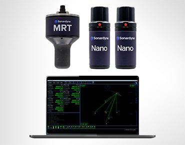
    It is more accurately described as range-aiding, as it functions by tightly integrating acoustic range measurements from a small number of transponders (as few as one, but typically two or three) with an inertial navigation system (INS), such as SPRINT or SPRINT-Nav.

    This combination uses the high-rate, stable relative positioning of the INS to calculate a robust position, using the acoustic ranges to correct the INS drift, thereby achieving high integrity without the large, dense arrays required by traditional LBL.

    Why is Sparse array planning important?


    Planning a Sparse LBL array is crucial to achieving optimal system performance and maximizing the operational and cost benefits of the technique.

    Careful planning is fundamental for Sparse LBL because the system relies on a minimal number of transponders compared to classic LBL, meaning it has less acoustic range redundancy.

    A well-executed plan helps to avoid common pitfalls, such as acoustic interference, and allows teams to configure and check acoustic and INS projects onshore before vessel mobilization, streamlining procedures and de-risking operations

    Planning ensures that the array design maintains high accuracy and efficiency throughout the operation:


    • Geometry management: Planning is necessary to ensure that ranges are collected at a sufficient angle of cut (geometry) to constrain the positioning error ellipse. The precision of position is maintained when ranges are received at angles that best equalize the error ellipse.
    • Cost and time reduction: Strategic placement of transponders, for example, placing Compatts at the top of mounds on the seabed, can lead to fewer Compatts being needed. This, in turn, saves vessel time and reduces costs.
    • Systematic error detection: Sparse LBL has less redundancy than full LBL, which means systematic errors, such as a Sound Velocity (SV) error, can be difficult to detect without careful quality control planning. Accurate sound velocity measurement is a critical element to consider.
    • Preventing acoustic gaps: The array plan includes an SV analysis to define the expected range of the transponders (e.g., Compatt units) at different depths. This analysis is crucial to prevent situations where a needed Compatt is out of acoustic range.
    • Avoiding obstacles: Planners must identify and avoid placing transponders in areas such as overage curves, anchor scour locations, and deployment corridors.

    How to plan a sparse LBL array to avoid gaps and maximise navigable area

    Planning focuses on managed geometry—positioning transponders relative to the anticipated vehicle path (trajectory) to ensure optimal angles of cut across the whole area.

    Trajectory dependence: The sparsity of the array depends heavily on the intended vehicle path. For instance, if an ROV is navigating along a pipeline, the transponders can all be placed on only one side of the pipeline while maintaining sufficient geometry by combining the acoustic ranges with the INS velocity and movement data.

    Avoiding in-line placement: When using only two transponders, positioning precision degrades significantly when the vehicle moves directly between them because the necessary geometry is lost. This must be accounted for in trajectory planning.

    Calibration trajectories: The planning process must define the calibration method:


    • 2D SLAM calibration: This defines the horizontal position and requires the ROV to run a straight-line trajectory that covers an angle of cut greater than 60 degrees relative to the transponder. To reduce the effect of any depth error on the horizontal position estimate, the ROV must maintain a minimum offset (e.g., 150 meters) from the transponder.
    • 3D SLAM calibration: If the transponder’s depth estimate also needs to be refined, a 3D SLAM trajectory is used, often involving an offset circle. This trajectory must be planned to include ranges taken “away from the transponder and over the top” to achieve the big vertical change observable by the Kalman filter.
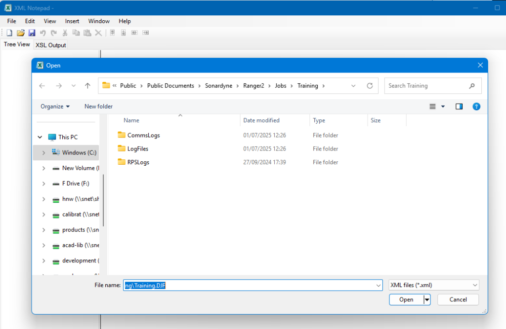
    • DTM and infrastructure: Planning should incorporate a Digital Terrain Model (DTM) of the area and a drawing (e.g., a .dxf drawing) of relevant subsea infrastructure.

    What’s the minimum number of transponders for Sparse LBL to get 10 cm accuracy?

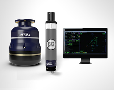
    The number of transponders (e.g., Compatt 6+ units) required depends on the desired accuracy and integrity.

    Minimum for aiding: Sparse LBL can be achieved by using ranges from as little as one single transponder.

    Approaching full LBL accuracy: To achieve positioning accuracy of 10 centimetres (near pure LBL performance), a Sparse LBL array requires three or more transponders.


    Intermediate accuracy benchmarks:

    • ◦ 50 cm Accuracy can be achieved with a ** single transponder** on the seabed.
    • ◦ 20–30 cm accuracy can be achieved by navigating with two transponders.

    Does Sparse LBL need specialist planning software, or can it be done manually?

    Specialist planning software and services are necessary to effectively plan and model a Sparse LBL array due to the critical nature of managing geometry and predicting performance.

    Specialist planning tools: Specialist software is arguably necessary for array planning. Planning software allows users to model the navigation performance before going to sea, inputting bathymetry, sound velocity profiles, transponder placements, and vehicle trajectory to predict the positioning error.

    Fusion 2 software: The Fusion 2 software suite controls LBL, Sparse LBL and SPRINT INS projects from a single interface and is optimised for this workflow. It enables the use of Real-Time SLAM calibration.

    Software licensing: To use the range-aiding/Sparse LBL and SLAM capability within Fusion 2, the user must have the Fusion 2 INS dongle which has been programmed with the SPRINT LBL RANGE AIDING SPARSE UPGRADE.

    In-house/remote services: Sonardyne offers an in-house array planning service and plans to offer a cloud-based planning portal. Additionally, our Remote Operations Access Module (ROAM) enables Sonardyne surveyors to remotely support operations and SLAM calibration onshore.