Unlocking the Gulf Loop Current
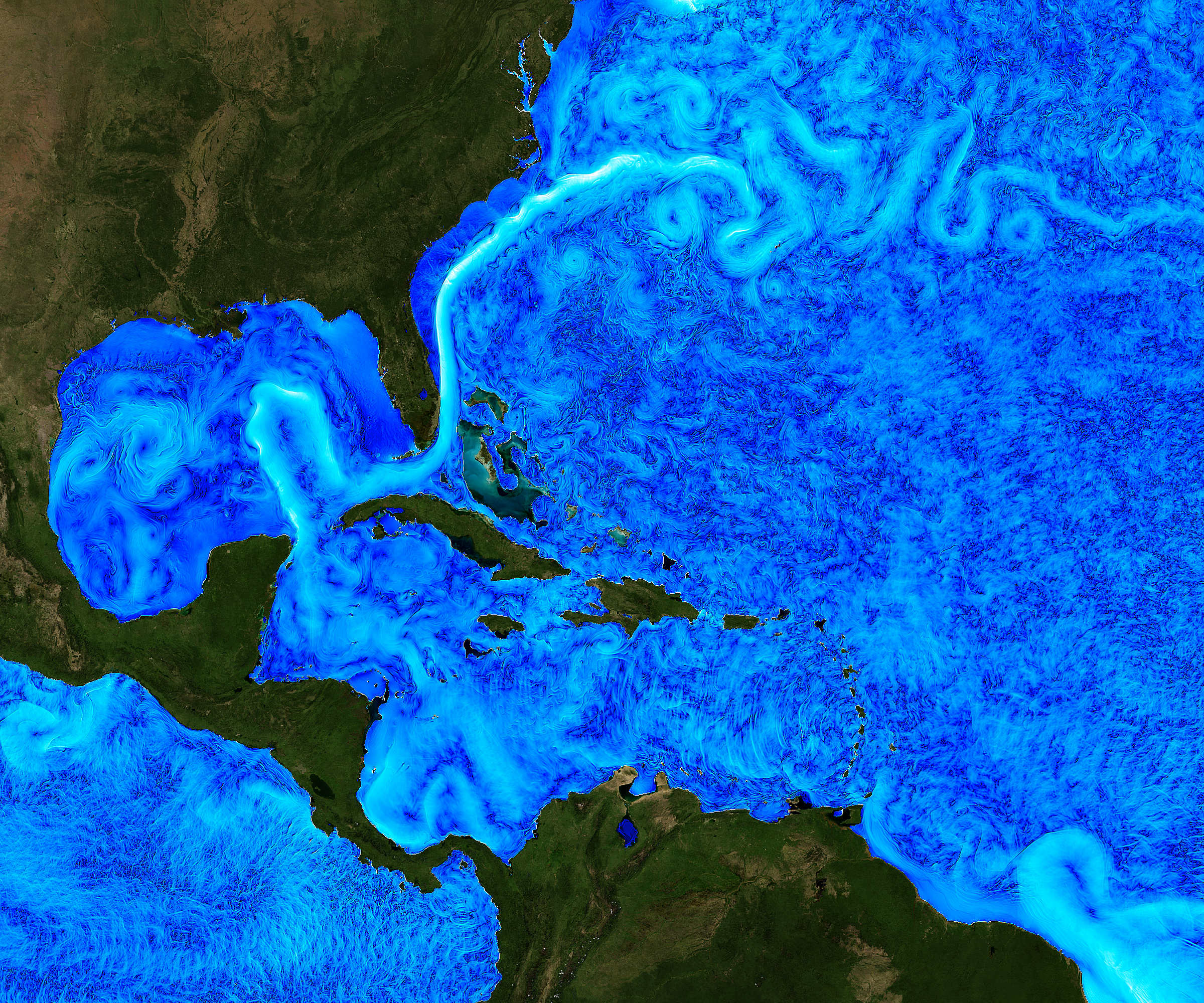
The Gulf of Mexico is home to one of the world’s most energetic oceanographic phenomena – the Gulf of Mexico Loop Current. Reaching intensities of between 2 – 4 knots and measurable down to 1,000 m, the Loop Current System (LCS) also regularly sheds Loop Current Eddies (LCE).
The challenge
LCEs are highly energetic anticyclonic (clockwise) rotating rings of warm water, roughly 300 km across and 500 – 1,000 m deep, with current speeds of up to 4 knots. These break away from the extended Loop Current about every 8-9 months and slowly drift west-southwestward towards Texas or Mexico at about 3-5 km per day.
When an LCE forms at the height of hurricane season, it has the potential to fuel rapid intensification of hurricanes. This is what happened in 2005, just before Hurricane Katrina passed over and “bombed” into a Category 5 hurricane.
Warm circulating eddies can break off the LCS into the western, northern and central Gulf. These eddies are so highly energetic that they regularly disrupt oil and gas operations. But, they’re also critical to the Gulf of Mexico’s oceanographic system, including its nutrient and food cycles and, most importantly, hurricane intensity.
Despite 50 years of effort by the scientific community to understand the processes underlying the LCS, its behaviour remains unpredictable. To some extent, this is because of interactions with the deep eddies, which have been difficult to track from measurements near the sea surface. For this reason, a multi-year scientific study has been launched, led by the University of Rhode Island(URI). It includes a major deployment of Sonardyne’s Pressure Inverted Echo Sounders(PIES).


The solution
Following a recommendation by the US National Academies of Sciences, Engineering, and Medicine a long-term, US$ multi-million research program to plug the gaps in understanding and predicting the LCS is now underway.
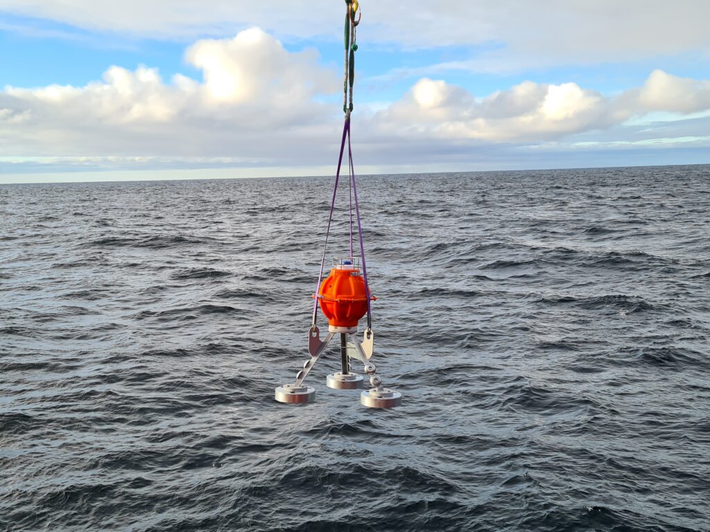
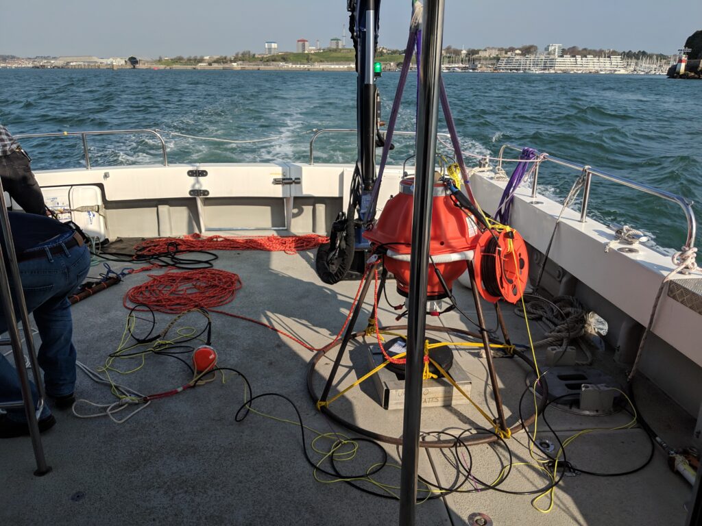
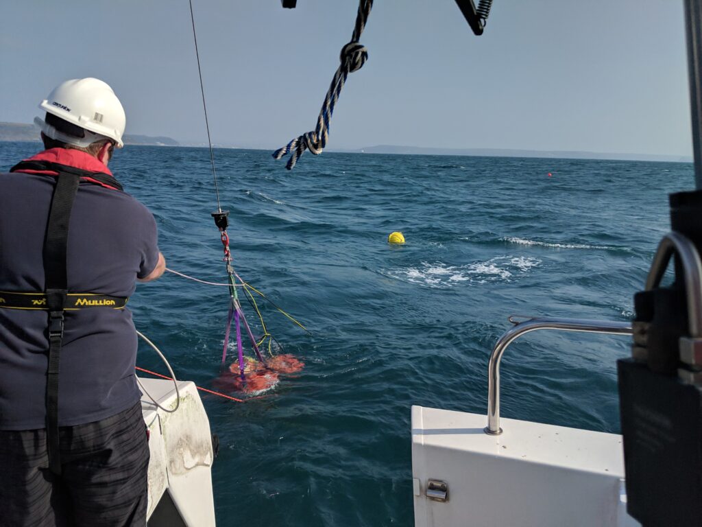
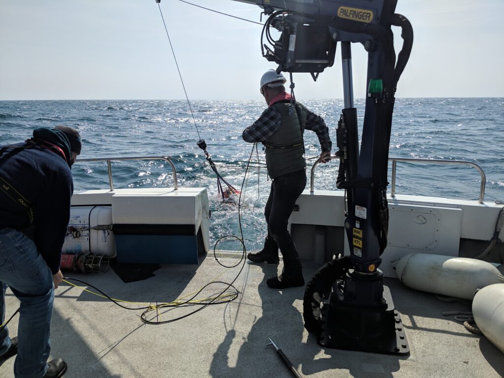
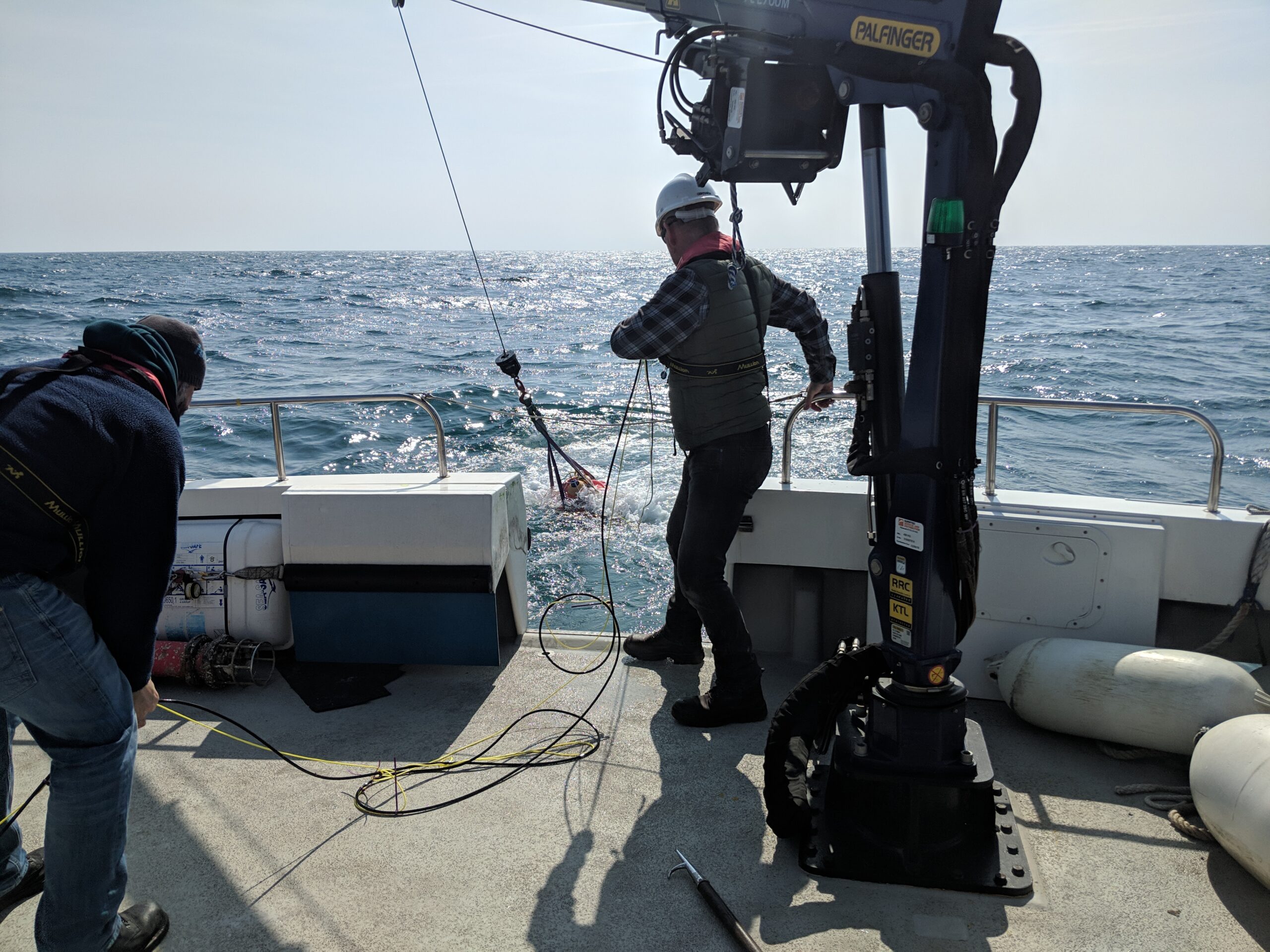
The initial two-year project comprises an array of 15 URI CPIES, five Sonardyne CPIES and five Bureau of Ocean Management PIES. These are in an array, spaced 60 km apart, at depths down to 3,500 m in the area of the extended LCS. Initially deployed in June 2018, for a nominal two-year study, the units are fitted with batteries that can keep them powered for up to 36 months. This will allow for data gathering continuity in the event of a subsequent expansion of the program.
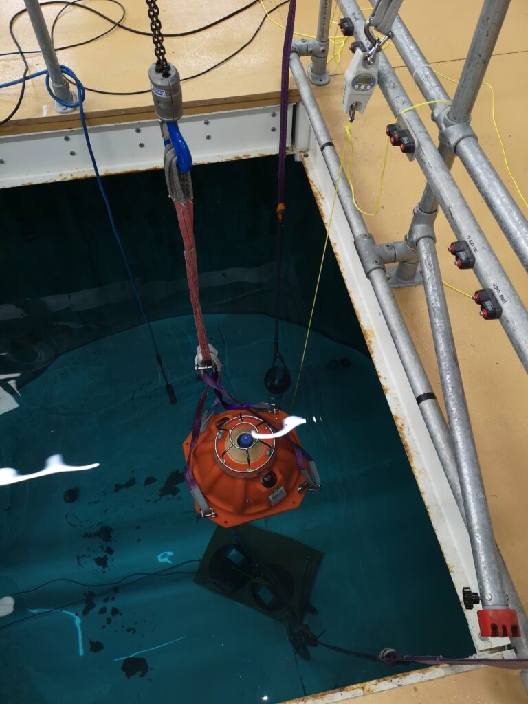
A core element of this scientific study is the array of seabed-mounted sensors, including Sonardyne’s PIES. PIES were originally developed for the marine seismic industry to measure average sound velocity in the water column. They do this by transmitting a wideband acoustic pulse from their position on the seabed. This pulse is reflected off the sea surface and returns to the seabed where it is detected by the PIES.
Oceanographers, however, use PIES differently. Their goal is to derive important physical data, including the strength and direction of currents. This is based on the principle that there’s a strong correlation between two-way travel time (usually known as tau) and vertical profiles of temperature, salinity and density. As a consequence, where this profile has been derived from historical data, an empirical relationship can be derived, which enables the density profile to be inferred from tau.
At a basic level, a laterally separated pair of PIES will, therefore, provide a vertical profile of velocity, and by deploying an array of PIES, local horizontal velocity and density fields can be mapped over the period of deployment.
URI has pioneered and refined the use of PIES for this purpose. While URI has a long history of developing its own PIES instruments, it decided to use Sonardyne’s PIES, as well as its own. This was primarily because a comparison study off the coast of Oregon* indicated that the Sonardyne PIES could generate similar accuracy data efficiently, potentially enabling longer deployments – and because of their telemetry capability.
Sonardyne’s integrated high-speed (up to 9,000 bps) acoustic telemetry capability also enables remote reconfiguration of the instruments and wireless retrieval of data to surface vessels, without interrupting the bottom pressure record.
These capabilities are based on Sonardyne’s extensive expertise in underwater acoustics, signal processing, hardware design and custom engineering, which URI recognises, have the potential to reinforce future PIES development.
Sonardyne’s expertise was central to reconfiguring a standard PIES as a CPIES (Current PIES) which was needed for this project to allow for near-seabed current data to be harvested alongside the PIES pressure and tau measurements. It also delivers important data on deep eddy currents above the seabed/water interface.
The reconfiguration involved connecting an Aanderaa Doppler current sensor to the PIES, which then served as a battery pack and data logger for the current sensor, deployed 50 m above the PIES on a float. Combining the deep current observations with the deep pressure observations enable data from the array to be referred to a common reference surface.
The results
An interim data retrieval campaign, using acoustic telemetry, was successfully completed in September. While the principal purpose of this was to recover an initial three-month-long data set, one notable feature found in the data was echoes, thought to be from fish, shrimp or squid.
This has been seen in other studies carried out by URI. We believe it is related to the transport of nutrients by deep currents crossing from the deeper to shallower thermocline side around the periphery of the Loop Current or a passing LCE.
The present array will inform planning for a longer-term, 10-year campaign. This could see a substantially expanded array of PIES deployed into Cuban, as well as Mexican and US waters. The aim of this larger array would be to provide near real-time data as input for LCS forecasting models.
Loop Current and LCE forecasts have the potential to benefit a wide range of users, from oil and gas operations and hurricane forecasters to fishing and tourism. Furthermore, improving ocean modelling in the Gulf of Mexico has the potential to provide a standard for improving prediction efforts in other ocean basins also.