Across the marine robotics sector, operators face ongoing challenges in achieving precise underwater localisation and robust coordination for autonomous vehicles. Addressing these obstacles is critical for advancing multi-vehicle operations, whether it’s for environmental monitoring, streamlined surveys or a military mission.
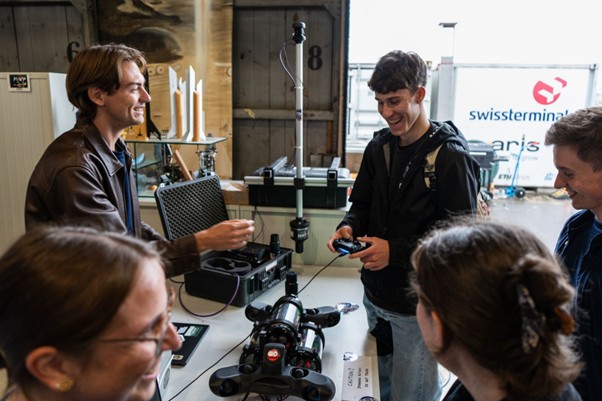
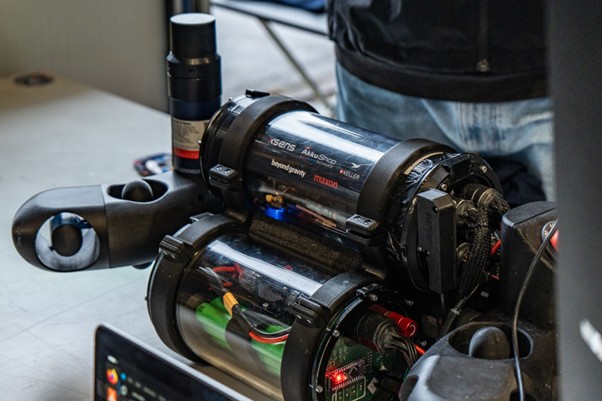
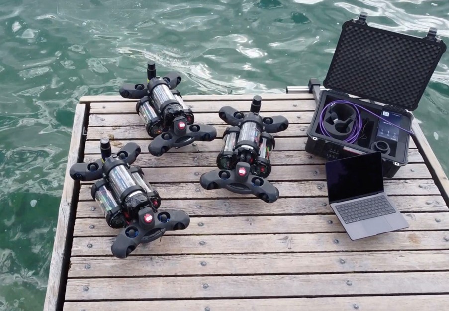
We recently sponsored a team of engineering students at ETH Zürich who are developing underwater swarm capability for 3D environmental sampling in Swiss Lakes. They used our Micro-Ranger 2 with Robotics Pack to develop and demonstrate their robotics.
The challenge
Monitoring environmental pollution in dynamic waters can be challenging, especially using traditional sampling methods from a vessel. This typically involves point sampling, resulting in a limited number of data points, each gathered at a different point in time, hindering spatial and temporal coverage.
The Swiss Federal Institute of Technology’s (ETH Zürich) SWARM team set out to develop a better solution, using underwater robotics. Specifically, they wanted to show how a swarm of drones could gather data simultaneously, across multiple locations, and also move towards where pollutant levels are increasing (gradient tracking) to find the source.
Working in partnership with the ARIS student association and the Swiss aquatic research institute Eawag, their goal was an autonomous underwater vehicle (AUV) swarm capability. This would include synchronised sampling in up to 30 m water depth to create high-resolution 3D pollutant maps with spatial precision below 10 m.
The mission is environmental sampling to support research around the proliferation of antibiotic-resistant bacteria and their effects on the environment in Lake Geneva. Achieving this mission meant finding a solution for real-time, reliable positioning and robust inter-vehicle communication.
The solution
We supported their project providing use of a our Micro-Ranger 2 Ultra-Short BaseLine (USBL) positioning system with Robotics Pack.
Micro-Ranger 2 is designed for shallow water tracking of divers and small remotely operated vehicles (ROVs) and AUVs out to 995 m range. It’s a one-box solution with everything you need, delivering positioning accuracy of less than 5 m and supporting tracking of up to 10 vehicles or targets simultaneously, with updates up to twice per second.
“We first deployed our Micro-Ranger 2 topside and transceiver poolside, enabling testing of our AUVs in a safe environment. After validating proper operations, we then took the plunge and deployed our AUVs in Lake Zurich, with Micro-Ranger 2 topside and transceiver deployed from a pontoon,” says Henrik Eberhardt from team SWARM.
Three AUVs were deployed, each fitted with AvTrak 6 Nano transceivers, our smallest multifunction acoustic transceiver, providing navigation aiding, simultaneous USBL tracking, telemetry and robust communications.
A concern was that noise in the lake, caused by their own vessel motors motors, would interfere with the acoustics.
The approach demonstrated the potential to dramatically increase spatial and temporal environmental data resolution, as well as faster, safer and more repeatable data acquisition.
“Sonardyne’s Micro-Ranger 2 and AvTrak 6 Nano provided the accurate underwater localisation essential for our robots’ autonomous navigation and coordinated swarm behaviour,” says SWARM Team Lead and Project Manager Alexander Sheridan. “Their technology enabled real-time position updates, transforming underwater autonomy from concept to reality.”
Next steps – the Polaris project
SWARM left impacts at ETH Zürich and ARIS that go beyond the project conclusion. Following the success of the original team, a successor project was launched and tasked with exploring safety and climate research by venturing beneath the ice of lake St. Moritz, a touristic and economic hub in the Swiss Alps.
A new autonomous vehicle is currently being developed specifically for this mission, combining both previous experiences and novel innovations in order to competently achieve its mission.
The mission is to measure the ice layer thickness in a vast and accurate grid – without compromising personnel safety in any way.
Find out more at the project website.