The growth of the offshore renewable energy (ORE) market has increased the need for subsea cable laying to link turbines and shore-based operations. Accuracy when laying cables is paramount to avoid obstacles such as boulders, to prevent damage to seabed ecosystems and to provide precise touchdown position data for future cable inspections.
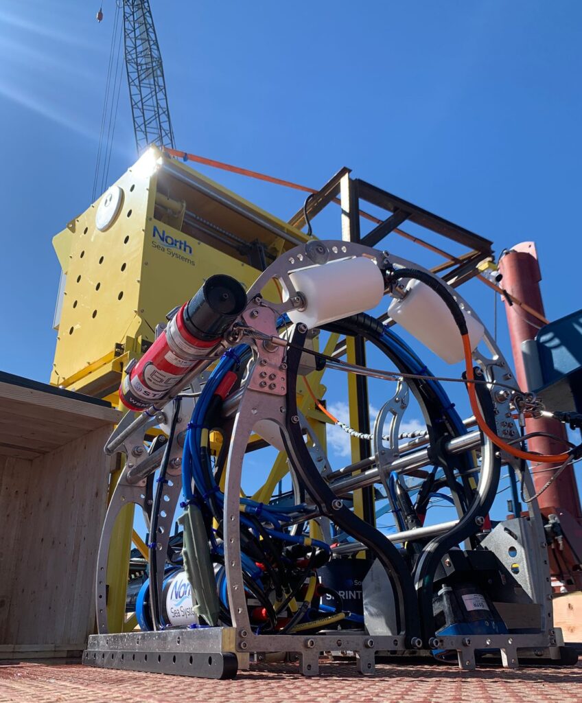
UK-based company North Sea Systems provides innovative design solutions to support the marine renewables industry. They have 15 years’ experience in designing electro-mechanical systems for the marine environment and developing patented products to help bring down the cost of offshore construction work, including CableFish® a tool dedicated to touchdown monitoring of subsea cables.
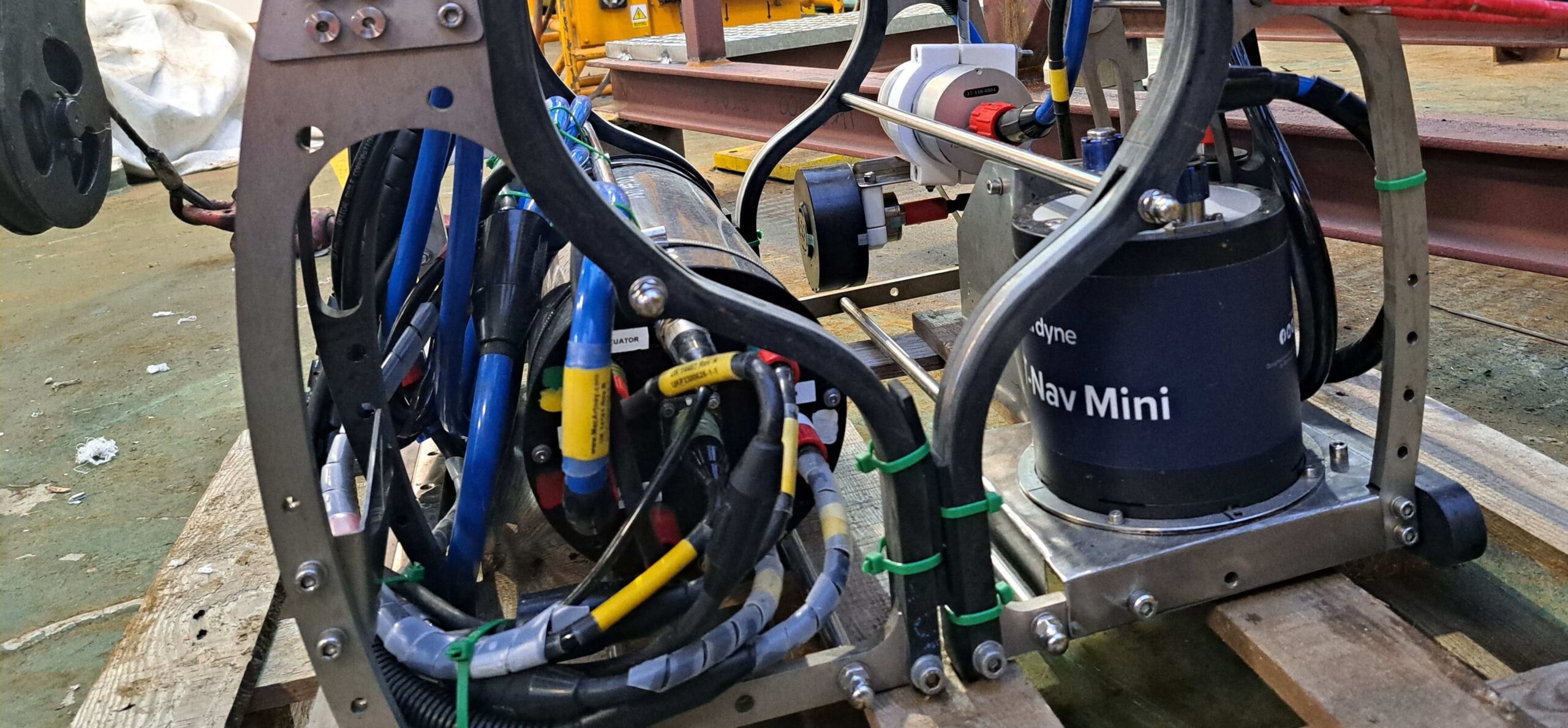
During operations, it is crucial for North Sea Systems to accurately monitor the cable’s heading and touchdown position as it’s being laid onto the seabed. This can be challenging when using acoustic positioning in noisy shallow waters. Additionally, the ferrous material in the cables interferes with instruments that rely on magnetic sensors for heading, rendering them extremely unreliable and often ineffective.
In comparison to an ROV, CableFish® has proven to be a more cost-effective and higher-performance solution for touchdown monitoring. However, in order to improve their product further, North Sea Systems sought a solution that would increase the accuracy of their touchdown position calculation.

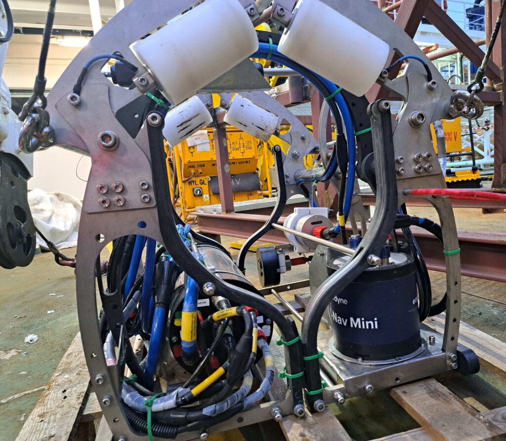
A CableFish fitted with a SPRINT-Nav Mini
Their search led them to Sonardyne’s SPRINT-Nav Mini. SPRINT-Nav Mini is one of the world’s smallest hybrid acoustic-inertial navigators. It fuses attitude and heading reference system (AHRS), doppler velocity log (DVL), inertial navigation system (INS) and depth sensors into a single, lightweight instrument, giving fast, precise and robust navigation, guidance and control information.
“We are thrilled to support Dave and his team with one of our hybrid navigation systems for this innovative technology. The SPRINT-Nav mini has equipped North Sea Systems with the ability to meet and validate crucial measurement requirements in the offshore wind sector. A prime example of how a member of the SPRINT-Nav family can effectively address challenges in less apparent applications.” Mike Ellis, Business Development Manager – Renewables, Sonardyne.
Factory calibration means that it’s ready to go on deployment, saving time spent performing on-site calibration manoeuvres. Not only is it simpler to mobilise, but it also presents a more economical alternative to the four sensors it replaces. Crucially, it uses fibre-optic gyrocompasses (FOGs) for its bearings which seek out true North without using magnetic sensors.
At just 213 mm tall by 148 mm in diameter, SPRINT-Nav Mini fitted easily on the 700 mm long, 600 mm high and 600 mm wide CableFish®. Weighing just 0.7kg in water, it didn’t negatively impact its operation or bearings calculations. The CableFish with its SPRINT-Nav Mini payload was then deployed on a cable laying operation in the Baltic Sea.
“The main advantage for our client is that SPRINT-Nav Mini enabled us to provide an accurate touchdown position throughout the job, with far less hassle and far less cost than an ROV or hull-mounted sonar. On a recent cable lay, the client wanted to check our calculated position and so launched an ROV. The position provided by the SPRINT-Nav Mini was always spot on!” Dave Rigg, Managing Director, North Sea Systems
The integration of the SPRINT – Nav Mini with the CableFish system proved effective in overcoming key operational challenges in an environment where traditional instruments face limitations. The system’s ability to provide accurate heading, attitude, and positional data ensured reliable calculations for cable touchdown points. This ability can be utilised across a variety of similar operations in the offshore wind sector and beyond.

A CableFish, ready to deploy, fitted with a SPRINT-Nav Mini and a Sonardyne WSM USBL transponder.
Whether it’s used to provide primary navigation and positioning data or valuable redundancy capacity when used alongside other systems, its accuracy and reliability even in challenging environments is second to none.